
Blow's Down
Good walks are even better shared.
Overview
Blow's Down: An Overview
Blow's Down is a delightful Marilyn nestled in the South Downs region of the UK, boasting an elevation of 109 meters. While it may not climb as high as some of its more illustrious neighbours, its unique charm and stunning views make it a worthy destination for hikers.
Geology
This little gem is carved from lush chalk landscape, offering varied terrain and amazing biodiversity. The chalk we see today has been around for millions of years, providing a resilient foundation for the vibrant flora and fauna that call this place home.
Routes
The most popular route up Blow's Down is the "Blow's Down Circular Walk." This moderate loop is roughly 5 km long and takes about 1.5 hours to complete. Starting from the village of Northwood, it meanders through open fields and woodland, allowing you to soak in the natural beauty that surrounds you. Bring a picnic, and you might just not want to leave!
Summit Features
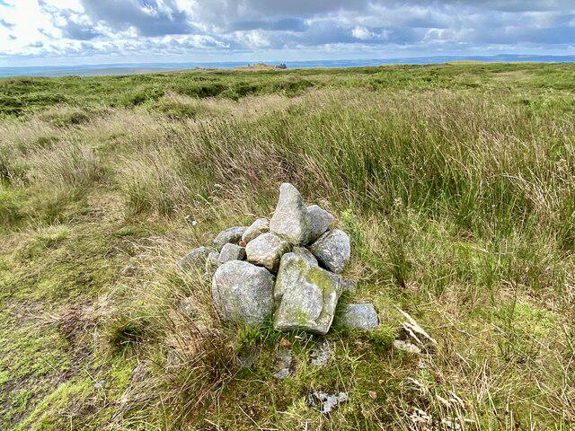
The summit is marked by a trig point that stands proudly, inviting all adventurous souls to pose for a photo with a sense of achievement. Quick pro tip: that’s the perfect spot for a little rest and a nibble!
Views
Once at the top, you’ll be greeted by stunning panoramas that stretch for miles. On a clear day, you can see the coastline in the distance, while the rolling hills of the South Downs create a postcard-perfect backdrop.
Hazards
Like any mountainous area, be prepared for sudden weather changes—today’s sunshine can quickly turn into a sudden downpour! Also, keep an eye out for wildlife when wandering through the fields, especially in spring when the lambs are skipping about.
Access
Getting to Blow's Down is a breeze; the nearest parking is at Northwood village, which can fill up quickly during pleasant weekends. Public transport lovers can catch a bus or taxi from Petersfield station straight to the trailhead.
Facilities
For facilities, you might need to head into Petersfield for a proper meal or drink after your hike as Northwood offers limited options.
History
The name 'Blow's Down' derives from old English, reflecting its breezy weather. The area is rich in historical significance, with connections to ancient grazing, trackways, and burial sites hidden in the hills.
In summary, Blow's Down may not be the highest climb, but what it lacks in elevation, it makes up in charm, views, and the joy of exploration. Grab your walking boots, a buddy, and venture up for an unforgettable day out in the countryside. Just don’t forget your camera!
Explore routes near Blow's Down
Walks starting near this hill. Open a route to check its map, distance and full itinerary.
Dunstable Downs: ridge views and Five Knolls
View route
People’s Park guided walk
View route
Bradgers Hill guided walk
View route
Ashridge Duncombe Terrace and Clipper Down Walk
View route
Route planning notes
These notes describe possible approaches. Check a route's map and access information when planning your walk.
Blow's Down Circular Walk
A scenic circular route that starts from the village of Northwood, providing a blend of open countryside and woodland paths.
Make a day of it, together
Find someone to share the walk with, or organise a day out along a route you like.
Hill facts and local notes
Classifications
Elevation
212m
696 ft
Prominence
48m
Coordinates
51.8816, -0.4985
TL034213
OS Map
166
Explorer: 193
At the Summit
The summit features a prominent trig point, which provides a perfect spot for a celebratory selfie after the climb. Or a cheeky snooze if you’re not in a hurry!
Terrain & Geology
Blow's Down is predominantly composed of chalk, which forms the characteristic rolling hills of the South Downs National Park. The area also showcases a variety of grassland flora, making it a biodiverse hotspot.
Views & Scenery
From the top, you can enjoy sweeping views of the surrounding countryside, with the distant coastline and the rolling hills of the South Downs stretching out before you.
History & Heritage
Name Origin
The name 'Blow's Down' is thought to be derived from the Old English word 'blowe,' meaning to blow, possibly referencing the winds that sweep across the downs.
Historical Significance
The area has been used for grazing since prehistoric times and is steeped in history, showcasing ancient trackways and burial sites.
Getting There & Facilities
Parking
There is a small car park at the entrance to Northwood village, which provides easy access to the route. Be aware that it can fill up quickly during sunny weekends!
Public Transport
The nearest railway station is in Petersfield, from where you can catch a bus or taxi to Northwood.
Nearby Facilities
There are limited facilities in Northwood, but Petersfield boasts a variety of cafes, pubs, and shops for post-walk refreshments.
Safety Information
Known Hazards
- Watch out for sudden weather changes; conditions can shift quickly in the hills. Also, be cautious of wildlife, especially during lambing season.
General Safety Tips
- Check weather conditions before setting out
- Carry appropriate clothing and equipment
- Let someone know your planned route
- Take a map, compass, and GPS device
- Carry emergency supplies: food, water, first aid kit, torch
Hills
Some common questions about the hills answered
Are there group walks up Blow's Down?
Many walkers use Walkmates to join or organise walks with others. You can check for group walks around Blow's Down through the maps
Are there other walkers around Blow's Down?
Activity varies by location and time, but Walkmates lets you see whether others have shared walks or shown interest in this area. Find other people through the walking friends search walking friends for Blow's Down search or of course create your own walk for Blow's Down
Can I organise a walk to Blow's Down?
Yes. If there aren’t any walks listed already, you can create a walk and make it available for others to join.
If you're signed up to Walkmates, you can create a walk to Blow's Down.
How do I find a walk up this hill?
There are often multiple ways to walk this hill, depending on experience and route preference. Walkmates helps you explore walks and routes that others have shared.
Can I suggest a new route up Blow's Down?
Yes. You can suggest or create routes to share with others. Walkmates focuses on the social side of walking, so routes are used to help people organise walks and explore areas together, rather than as detailed navigation tools or route libraries.
Other uses really appreciate knowledgeable walkers sharing their routes. Share your favourite route to Blow's Down here
The is an error or something incorrect about this hill. How do I let you know?
We always strive to keep the information on Walkmates as accurate as possible. If you find an error, please let us know through the contact form and we'll aim to correct it as quickly as possible
Community Discussion
Comments
Location
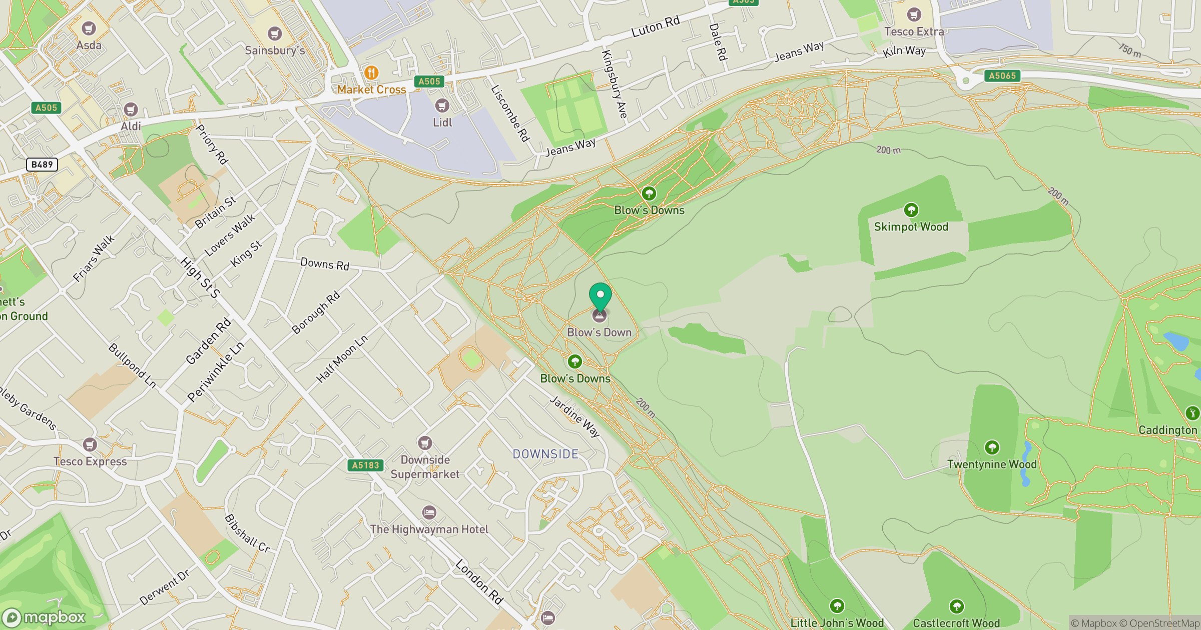
Grid reference: TL034213
View on OpenStreetMapOpens a map in a new tab, centred on the hill.
No comments yet. Be the first.