

Clipper Down
Good walks are even better shared.
Overview
Clipper Down
Overview
Clipper Down, nestled in the picturesque South Downs, stands at a modest elevation of 135 meters. Despite its stature, this Marilyn offers captivating views and diverse terrain that attract both seasoned hikers and casual stroll enthusiasts.
Geology
The region's fascinating chalk and flint geology underpins the rolling hills that characterise the South Downs. Expect soft yet resilient paths that meander through this beautiful landscape, with flashes of rocky outcrops to keep you on your toes.
Routes
There are a variety of routes to reach Clipper Down, ranging from leisurely loops to challenging ascents:
- Clipper Down Circular Route: A gentle 6.5 km loop around the base that showcases the eye-catching wildflowers and serene landscape.
- Direct Ascent from Truleigh Hill: For those with a bit of a challenge on their minds, this steep 2 km route ensures big rewards, just don’t forget to bring breath mints!
Summit Features
At the summit, you’ll find a charming rusting trig point, a relic of surveying from yesteryear. This is the perfect backdrop for your summit selfie, and while you're at it, don't forget to look around and absorb the breathtaking views!
Terrain
Expect a mix of grassy slopes and chalky paths, with a sprinkle of rocky outcrops to keep things interesting. Just make sure your boots have decent grip, especially after rain where chalk paths can get a bit slippery.
Views
The summit boasts sweeping vistas of the South Downs and beyond. Look carefully to catch a glimpse of the Isle of Wight on a clear day, a hidden gem waiting to be discovered. Best enjoyed in spring for the vibrant wildflowers, or during autumn for the crisp air and breathtaking colours.
Hazards
Keep an eye on sudden weather changes as you enjoy your hike. The paths can become quite slippery after rain, so tread carefully if the weather has turned soggy.
Nearby Summits
While you’re in the area, consider hiking to:
- Truleigh Hill (245 m)
- Devil's Dyke (225 m)
Both offer stunning views and they’re worth a visit!
Access
Parking is available approximately 1 km away from the hill, but be wary—it fills up fast! For those using public transport, regular buses to the village of Pyecombe are available.
Facilities
Don't worry about facilities; a quaint café and public loos can be found back in Pyecombe. Perfect for when you need a bit of refreshment after your adventure!
History
The name 'Clipper Down' derives from the Old English word for climbing, a nod to the hill’s character and history. The area is rich with archaeological finds and is a crucial part of the South Downs National Park, making it significant not only for hikers but also for history buffs.
So, lace up your hiking boots and head out to experience the beauty of Clipper Down!
Explore routes near Clipper Down
Public walks starting within 80 km of this hill. Nearby does not mean a route reaches the summit; check its map and access before setting out.
Ashridge Estate Boundary Trail South
View route
Ashridge Duncombe Terrace and Clipper Down Walk
View route
College Lake geology walk and talk
View route
College Lake geology walk and talk
View route
Route planning notes
These notes describe possible approaches, not verified navigable routes or permission to cross land. Check current paths, local access rules and conditions before setting out.
Clipper Down Circular Route
A picturesque loop that takes you around the base of Clipper Down, offering splendid views and a chance to soak in the scenic wildflowers.
Direct Ascent from Truleigh Hill
A more direct ascent that rewards you with panoramic vistas at the summit, albeit with a steeper climb.
Make a day of it, together
Find someone to share the walk with, or organise a day out along a route you like.
Photo Gallery
View all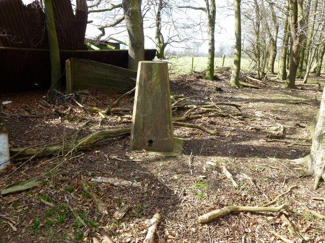 Photo could not load
SP9615 : Clipper Down
Rude Health
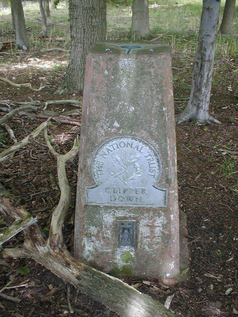 Photo could not load
SP9615 : Trig Point at Clipper Down
David Sands
Hill facts and local notes
Classifications
Elevation
249m
817 ft
Prominence
123m
Coordinates
51.8261, -0.6007
SP965150
OS Map
165
Explorer: 181
At the Summit
The summit is marked by a small rusting trig point, offering an unfettered view across the chalk hills and the sprawling South Downs. A perfect place for a quick selfie or to just take a few minutes to marvel at the vistas.
Terrain & Geology
The underlying geology of Clipper Down features chalk and flint, characteristic of the South Downs. This soft yet resilient rock formation creates the rolling landscapes typical of the area, making it a delightful spot for hikers and nature lovers alike.
Views & Scenery
From the summit, hikers can enjoy views of the sprawling South Downs, the distant coast of England, and on a clear day, the Isle of Wight can be spotted lurking in the horizon like a shy friend at a party.
History & Heritage
Name Origin
The name 'Clipper Down' is thought to derive from the Old English word 'clipian', meaning to climb or steep, aptly describing the hill's nature.
Historical Significance
Clipper Down has been a part of the South Downs National Park, which is rich in archaeological features and natural history, making it a notable spot for both hikers and historians.
Getting There & Facilities
Check current local access restrictions, parking rules and transport timetables before travelling. These notes do not confirm public access to the summit.
Parking
There is a small car park located approximately 1 km from the base of the hill. It fills up quickly, so arrive early to secure your spot!
Public Transport
Regular buses run from Brighton to the nearby village of Pyecombe. The last leg to the starting point may require a bit of a walk.
Nearby Facilities
While there are no facilities on the hill itself, head back down towards Pyecombe for the nearest amenities including a café and public toilets.
Safety Information
Known Hazards
- Be cautious of sudden weather changes, as well as the chalk paths that can become slippery after rain.
General Safety Tips
- Check weather conditions before setting out
- Carry appropriate clothing and equipment
- Let someone know your planned route
- Take a map, compass, and GPS device
- Carry emergency supplies: food, water, first aid kit, torch
Hills
Some common questions about the hills answered
Are there group walks up Clipper Down?
Many walkers use Walkmates to join or organise walks with others. You can check for group walks around Clipper Down through the maps
Are there other walkers around Clipper Down?
Activity varies by location and time, but Walkmates lets you see whether others have shared walks or shown interest in this area. Find other people through the walking friends search walking friends for Clipper Down search or of course create your own walk for Clipper Down
Can I organise a walk to Clipper Down?
Yes. If there aren’t any walks listed already, you can create a walk and make it available for others to join.
If you're signed up to Walkmates, you can create a walk to Clipper Down.
How do I find a walk up this hill?
There are often multiple ways to walk this hill, depending on experience and route preference. Walkmates helps you explore walks and routes that others have shared.
Can I suggest a new route up Clipper Down?
Yes. You can suggest or create routes to share with others. Walkmates focuses on the social side of walking, so routes are used to help people organise walks and explore areas together, rather than as detailed navigation tools or route libraries.
Other uses really appreciate knowledgeable walkers sharing their routes. Share your favourite route to Clipper Down here
The is an error or something incorrect about this hill. How do I let you know?
We always strive to keep the information on Walkmates as accurate as possible. If you find an error, please let us know through the contact form and we'll aim to correct it as quickly as possible
Community Discussion
Comments
Location
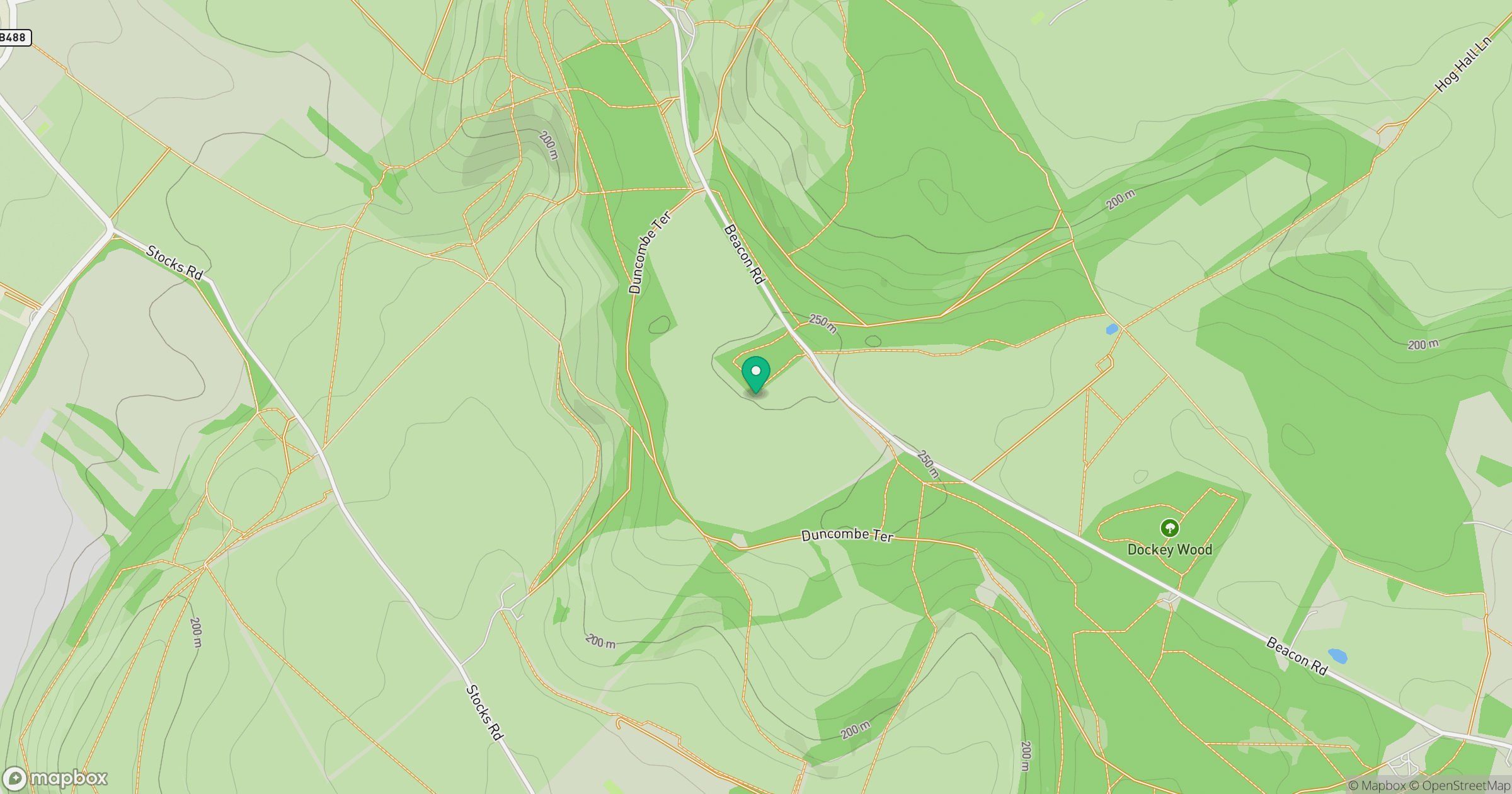
Grid reference: SP965150
View on OpenStreetMapOpens a map in a new tab, centred on the hill.
Hills within 30 km
Straight-line distance, not a walking route or confirmation of access.
No comments yet. Be the first.