

Black Brows
Good walks are even better shared.
Overview
Black Brows: A Hiker's Gem in the North Pennines
Introduction
Nestled in the scenic North Pennines, Black Brows stands as a beacon for hikers seeking the open countryside and spectacular views. At an elevation of 580 meters, it may not be the tallest, but it certainly offers one of the most enjoyable hikes in the area. As they say, it’s not about the height of the mountain, but the depth of your enthusiasm!
Geology
Black Brows is primarily composed of sandstone, a rock that has weathered beautifully over the ages. The geological compositions tell the tales of ancient landscapes and provide unique formations that attract geology enthusiasts.
Routes
There are a couple of popular routes to take, notably:
- The Pennine Way: This historic trail runs past Black Brows and allows for a moderate hike exploring the natural beauty of the North Pennines.
- Lune Valley Trail: A gentler route suited for those looking for a bit less exertion while still providing splendid views.
Summit Features
On reaching the summit, hikers are welcomed by a rocky outcrop and a modest stone cairn. It’s the perfect spot to catch your breath and take some memorable photos (make sure you capture your best angle!).
Terrain Type
The terrain is predominantly grassy with rocky patches. Expect a bit of tussocky grass as you get closer to the top, which can add an extra challenge—just think of it as nature’s way of testing your balance!
Views
The summit offers breathtaking views of the Howgill Fells to the northwest. The best seasons for optimal views are late spring and early autumn when nature is at its most vibrant.
Hazards
While the trails are manageable, be cautious of uneven terrain and slippery bog areas, especially after rain. Sturdy footwear is highly recommended to avoid embarrassing tumbles!
Nearby Summits
Consider exploring nearby greats like Great Coughey (600m) and Harter Fell (612m) if you've still got energy to burn.
Access
Nearest Parking
A handy parking area is located near Ravenstonedale, about 2km from the base of Black Brows.
Public Transport
Public transport options include the Cumbria Connect bus service, making it easier for those without a car to reach this outdoor haven.
Nearest Town
The quaint town of Sedbergh, filled with charming shops, is the closest urban centre.
Facilities
After an invigorating hike, take some time to unwind in one of Sedbergh's delightful cafes or pubs. They have public toilets available, which your bladder will undoubtedly appreciate!
History
Name Meaning
The name Black Brows hints at the raised land of the hill, ‘brōw’ indicating height and ‘black’ referring to the moorland vegetation.
Significance
The Black Brows area has historical significance as a local passage for farmers and has become a popular choice for hikers looking for tranquility.
Conclusion
Whether you're a seasoned hiker or just out for a pleasant stroll, Black Brows promises an exhilarating experience. So grab your walking boots, pack a hearty lunch, and get ready to embrace the beauty of the North Pennines!
Explore routes near Black Brows
Public walks starting within 80 km of this hill. Nearby does not mean a route reaches the summit; check its map and access before setting out.
Grizedale: Silurian Way walking trail
View route
Windermere west shore: Ash Landing to Wray and back
View route
Coniston to Tarn Hows: Monk Coniston Gardens and Woodland Circuit
View route
Tarn Hows Fast Route
View route
Route planning notes
These notes describe possible approaches, not verified navigable routes or permission to cross land. Check current paths, local access rules and conditions before setting out.
The Pennine Way
This iconic long-distance path takes you past Black Brows, offering a straightforward ascent with stunning views.
Lune Valley Trail
Starting from the nearby Lune Valley, this route provides a scenic journey towards the summit with a gradual incline.
Make a day of it, together
Find someone to share the walk with, or organise a day out along a route you like.
Photo Gallery
View all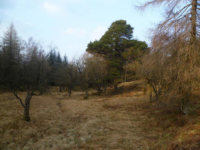 Photo could not load
SD3692 : On Black Brows
Michael Graham
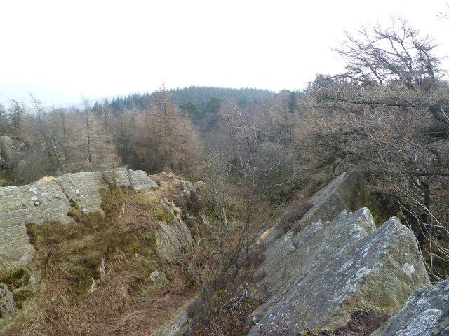 Photo could not load
SD3692 : Black Brows Summit
Michael Graham
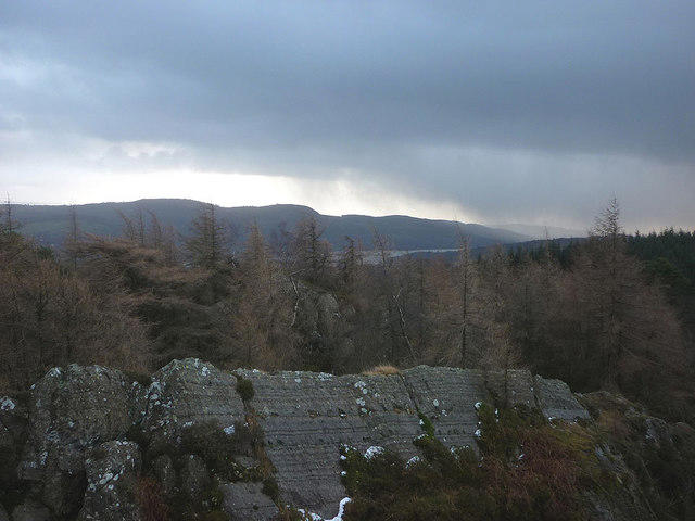 Photo could not load
SD3692 : Summit view, Black Brows (268m)
Karl and Ali
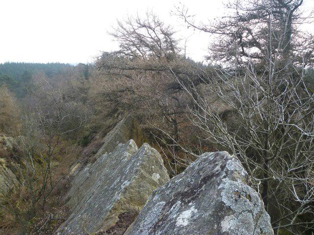 Photo could not load
SD3692 : Black Brows Summit
Michael Graham
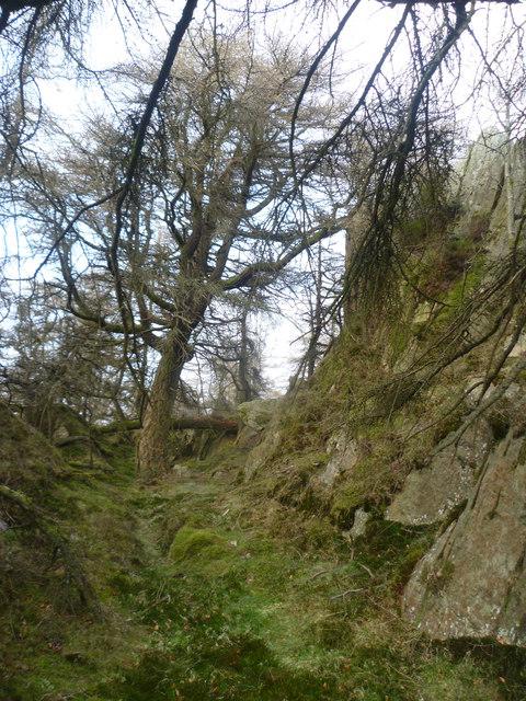 Photo could not load
SD3692 : On Black Brows
Michael Graham
Hill facts and local notes
Classifications
Elevation
268m
879 ft
Prominence
129m
Coordinates
54.3252, -2.9816
SD362926
OS Map
96 97
Explorer: OL7N
At the Summit
The summit is marked by a rocky outcrop and offers a modest stone cairn where hikers can take a well-earned rest and snap a few photos.
Terrain & Geology
Black Brows is primarily composed of sandstone, which has weathered into spectacular shapes over time. The area features distinctive formations that tell tales of ancient landscapes.
Views & Scenery
From the top, you can catch sight of the Howgill Fells to the northwest and the vast expanse of the North Pennines.
History & Heritage
Name Origin
Black Brows derives its name from the Old English word 'brōw', indicating a raised land or hill, while 'black' likely refers to the dark, moorland vegetation.
Historical Significance
The area around Black Brows has been an important passage for local farmers and a favourite amongst hikers seeking the quieter routes of the Pennines.
Getting There & Facilities
Check current local access restrictions, parking rules and transport timetables before travelling. These notes do not confirm public access to the summit.
Parking
There is a designated parking area near the village of Ravenstonedale, approximately 2km from the base of Black Brows.
Public Transport
The Cumbria Connect bus service operates routes that come close to Ravenstonedale, offering a convenient option for visitors.
Nearby Facilities
In Sedbergh, you'll find several cafes and pubs where you can refuel after your hike. Public toilets are also available.
Safety Information
Known Hazards
- Uneven terrain, particularly in inclement weather, and areas of bog that can be slippery. Be sure to wear sturdy footwear.
General Safety Tips
- Check weather conditions before setting out
- Carry appropriate clothing and equipment
- Let someone know your planned route
- Take a map, compass, and GPS device
- Carry emergency supplies: food, water, first aid kit, torch
Hills
Some common questions about the hills answered
Are there group walks up Black Brows?
Many walkers use Walkmates to join or organise walks with others. You can check for group walks around Black Brows through the maps
Are there other walkers around Black Brows?
Activity varies by location and time, but Walkmates lets you see whether others have shared walks or shown interest in this area. Find other people through the walking friends search walking friends for Black Brows search or of course create your own walk for Black Brows
Can I organise a walk to Black Brows?
Yes. If there aren’t any walks listed already, you can create a walk and make it available for others to join.
If you're signed up to Walkmates, you can create a walk to Black Brows.
How do I find a walk up this hill?
There are often multiple ways to walk this hill, depending on experience and route preference. Walkmates helps you explore walks and routes that others have shared.
Can I suggest a new route up Black Brows?
Yes. You can suggest or create routes to share with others. Walkmates focuses on the social side of walking, so routes are used to help people organise walks and explore areas together, rather than as detailed navigation tools or route libraries.
Other uses really appreciate knowledgeable walkers sharing their routes. Share your favourite route to Black Brows here
The is an error or something incorrect about this hill. How do I let you know?
We always strive to keep the information on Walkmates as accurate as possible. If you find an error, please let us know through the contact form and we'll aim to correct it as quickly as possible
Community Discussion
Comments
Location
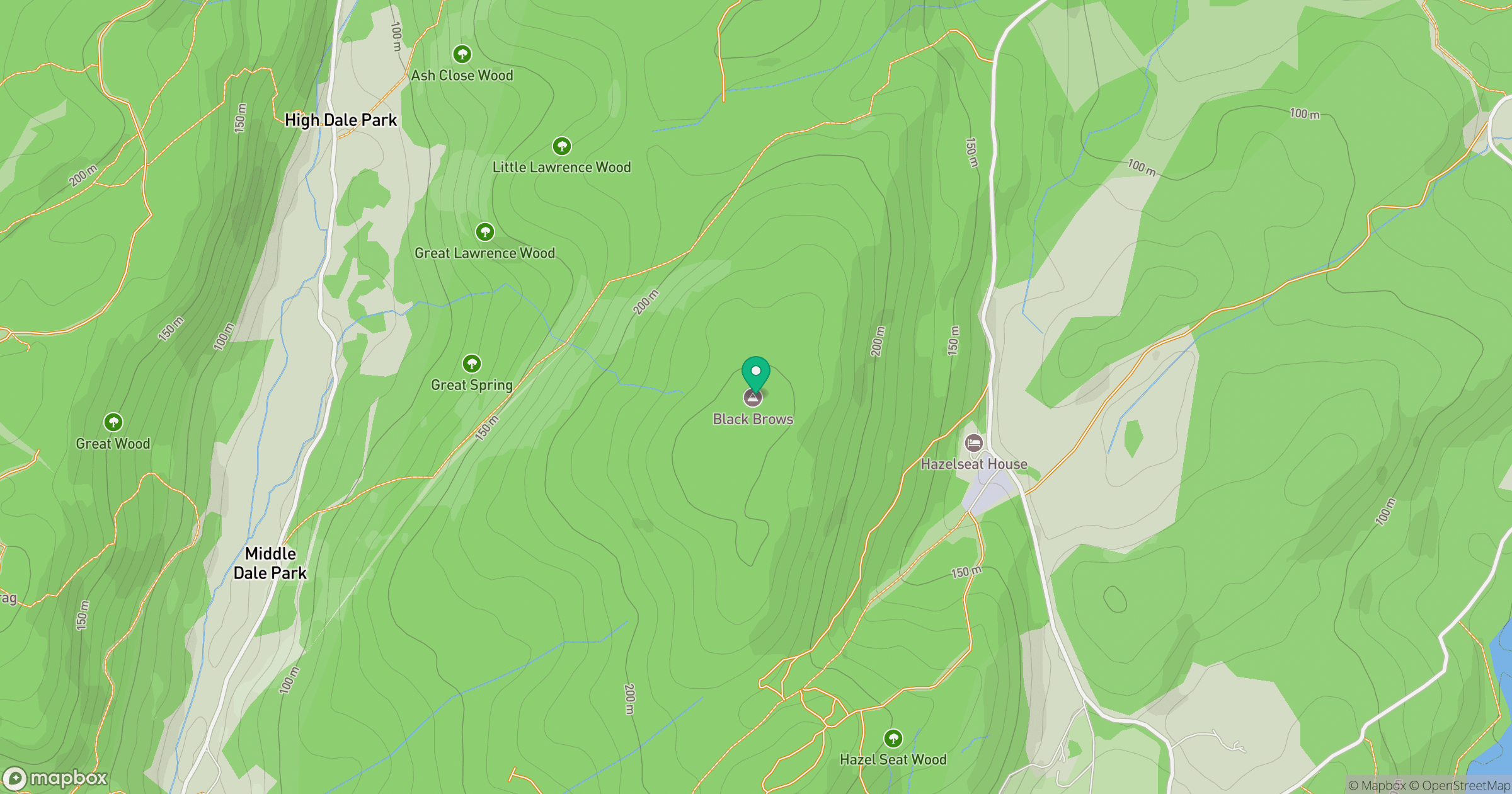
Grid reference: SD362926
View on OpenStreetMapOpens a map in a new tab, centred on the hill.
Hills within 30 km
Straight-line distance, not a walking route or confirmation of access.
Loughrigg Fell
335m
Wetherlam
763m

The Old Man of Coniston [Coniston Old Man]
802m
Red Screes
779m
Dow Crag
778m
No comments yet. Be the first.