
Birkenside
Good walks are even better shared.
Overview
Birkenside: A Hidden Gem in the North Pennines
Nestled within the rugged beauty of the North Pennines, Birkenside offers hikers a delightful mix of challenge and charm. With an elevation of 344 meters, this Marilyn might not be the tallest of peaks, but it holds its own with breathtaking scenery and a variety of walking routes.
Geology
Birkenside's terrain is primarily sandstone topped with some shale layers, creating a unique geological profile that's both interesting to inspect and pleasant to walk upon. The changing stones tell a story of eons gone by, a true natural book for those who appreciate geology.
Routes
One of the most popular routes is the Birkenside Trail, starting from the quaint village of Stanhope. This loop is about 8.5 km long and generally takes around 3.5 hours to complete. It’s rated as moderate in difficulty—perfect for families or those looking for a reasonable challenge that won’t leave you gasping for breath but will still send you home with a sense of accomplishment.
Summit Features
At the summit, you'll find a humble stone cairn and a wooden post marking the peak, where you can pause and catch your breath, enjoy your packed lunch, or contemplate life’s mysteries (like why socks disappear in the wash).
Terrain
Expect a mixture of grassy slopes and occasional rocky outcrops. The terrain is varied enough to keep it interesting but not so treacherous that you need a full climbing team.
Views
On a clear day, the views from Birkenside are nothing short of spectacular! From its summit, you can gaze into Weardale, appreciate the majesty of the Lake District, and breathe in the tranquillity of the North Pennines. Spring and autumn are the best times to take all this in when the air is crisp and visibility is at its peak.
Hazards
Be mindful of the occasional slippery grass and uneven rocky terrain, particularly after rain. And always keep an eye on the weather—like a cat on a laser dot, because, just like that red dot, conditions can change in an instant!
Access
You can find free parking in Stanhope, only a stone’s throw from the trailhead. If you’re relying on public transport, a bus service operates from Bishop Auckland to Stanhope, making it easy to ditch the car if you prefer.
Nearby Summits
Don’t forget to check out Birkenside’s nearby peaks—Mickle Fell at 788 meters and Great Knoutberry Hill at 674 meters—for an extended adventure in the North Pennines.
Facilities
After your hike, reward yourself with a well-earned pint or a slice of cake in one of the local pubs or cafes in Stanhope. Restrooms are also available if you need to freshen up!
History
The name Birkenside is thought to stem from 'Birch-side', harkening back to a time when birch trees were more abundant. This mountain may not be steeped in legendary tales, but its significance as a local hiking destination keeps it woven into the fabric of the community.
So lace up your boots, pack a hearty lunch, and get out to explore Birkenside—it's a little lump of joy just waiting to be discovered!
Explore routes near Birkenside
Walks starting near this hill. Open a route to check its map, distance and full itinerary.
Pennymuir to Whitton Edge: Dere Street track return
View route
Harestanes Peniel Heugh and Waterloo Monument
View route
Hownam and Heatherhope Valley: The Street circuit from Greenhill
View route
Hownam to Belford via Seefew: green road return from Greenhill
View route
Route planning notes
These notes describe possible approaches. Check a route's map and access information when planning your walk.
Birkenside Trail
A scenic loop starting from the village of Stanhope, taking you through wooded areas and up to the summit with stunning views of the surrounding countryside.
Make a day of it, together
Find someone to share the walk with, or organise a day out along a route you like.
Hill facts and local notes
Classifications
Elevation
235m
770 ft
Prominence
32m
Coordinates
55.4387, -2.5142
NT675162
OS Map
80
Explorer: OL16W
At the Summit
The summit features a small stone cairn and a wooden post with a sign identifying the peak, offering a fine spot for a well-deserved snack.
Terrain & Geology
Birkenside is primarily composed of sandstone with some layers of shale, making it an interesting site for geology enthusiasts who appreciate the layers of history embedded in the rock.
Views & Scenery
From the summit, one can enjoy views of Weardale, the Lake District in the distance, and on a clear day, even the North Pennines.
History & Heritage
Name Origin
The name 'Birkenside' is believed to derive from 'Birch-side', referring to the birch trees that were once prevalent in the area.
Historical Significance
Birkenside, while not the highest peak, offers a significant local hiking destination, cherished by the community for its accessibility.
Getting There & Facilities
Parking
There is free parking available in Stanhope, just a few minutes' walk from the trailhead.
Public Transport
The nearest bus service operates from Bishop Auckland, which connects to Stanhope.
Nearby Facilities
Stanhope offers a few pubs, cafes, and toilets, making it a handy spot for refreshments before or after your trek.
Safety Information
Known Hazards
- Occasional slippery grass and uneven rocky terrain; be wary of sudden changes in weather conditions.
General Safety Tips
- Check weather conditions before setting out
- Carry appropriate clothing and equipment
- Let someone know your planned route
- Take a map, compass, and GPS device
- Carry emergency supplies: food, water, first aid kit, torch
Hills
Some common questions about the hills answered
Are there group walks up Birkenside?
Many walkers use Walkmates to join or organise walks with others. You can check for group walks around Birkenside through the maps
Are there other walkers around Birkenside?
Activity varies by location and time, but Walkmates lets you see whether others have shared walks or shown interest in this area. Find other people through the walking friends search walking friends for Birkenside search or of course create your own walk for Birkenside
Can I organise a walk to Birkenside?
Yes. If there aren’t any walks listed already, you can create a walk and make it available for others to join.
If you're signed up to Walkmates, you can create a walk to Birkenside.
How do I find a walk up this hill?
There are often multiple ways to walk this hill, depending on experience and route preference. Walkmates helps you explore walks and routes that others have shared.
Can I suggest a new route up Birkenside?
Yes. You can suggest or create routes to share with others. Walkmates focuses on the social side of walking, so routes are used to help people organise walks and explore areas together, rather than as detailed navigation tools or route libraries.
Other uses really appreciate knowledgeable walkers sharing their routes. Share your favourite route to Birkenside here
The is an error or something incorrect about this hill. How do I let you know?
We always strive to keep the information on Walkmates as accurate as possible. If you find an error, please let us know through the contact form and we'll aim to correct it as quickly as possible
Community Discussion
Comments
Location
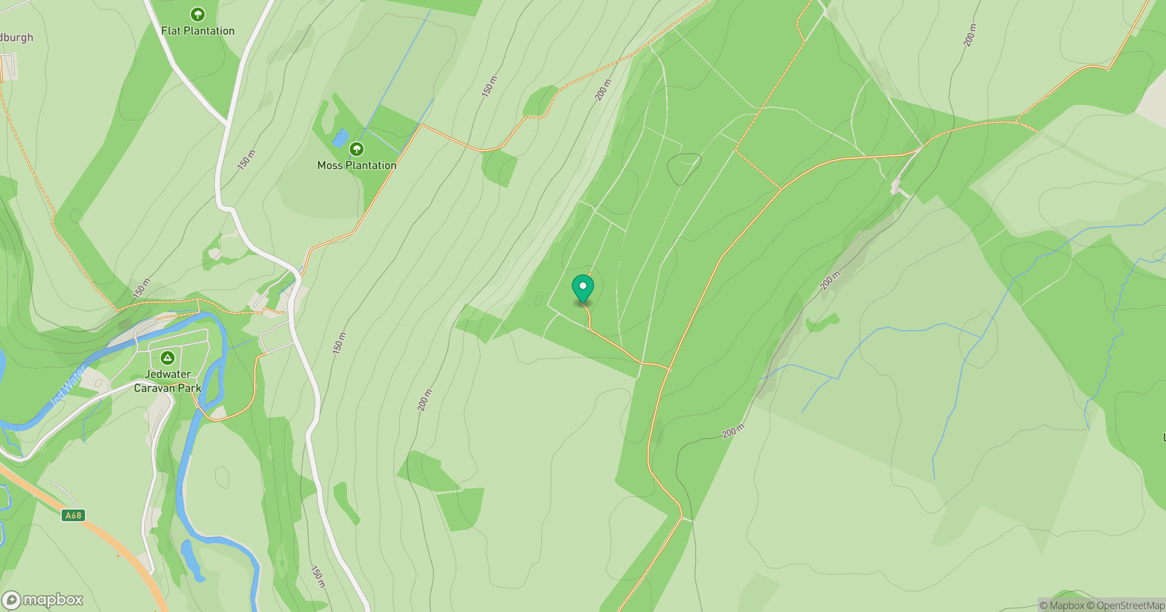
Grid reference: NT675162
View on OpenStreetMapOpens a map in a new tab, centred on the hill.





No comments yet. Be the first.