

Benson Knott
Good walks are even better shared.
Overview
Benson Knott
Introduction
Nestled in the heart of the stunning Lake District, Benson Knott stands as a delightful Marilyn waiting to be explored. At 522 meters above sea level, this peak offers a perfect mix of challenge and reward for hikers of all abilities—so grab your boots and let’s get moving!
Geology
Benson Knott is largely composed of skiddaw slate, a robust and ancient rock formation that tells the tale of geological eruptions and formations from over 500 million years ago. This gives the mountain its distinctive rugged individuality, a feature that will make geology buffs weak at the knees (but do try to keep your footing).
Routes
Benson Knott Circular
- Distance: 9 km
- Estimated Time: 3.5 hours
- Difficulty: Moderate
This circular route begins from the quaint village of Threlkeld and offers hikers a chance to soak in the rich natural surroundings while gradually ascending towards the summit. The trail is well-marked, so you won’t be wandering round like a lost sheep.
Summit Features
As you reach the summit, you’ll be greeted by a small stone cairn—a perfect little spot for celebrating your triumph. Don’t forget to pause for breath and take in the magnificent views; after all, that Instagram post won’t take itself!
Terrain Type
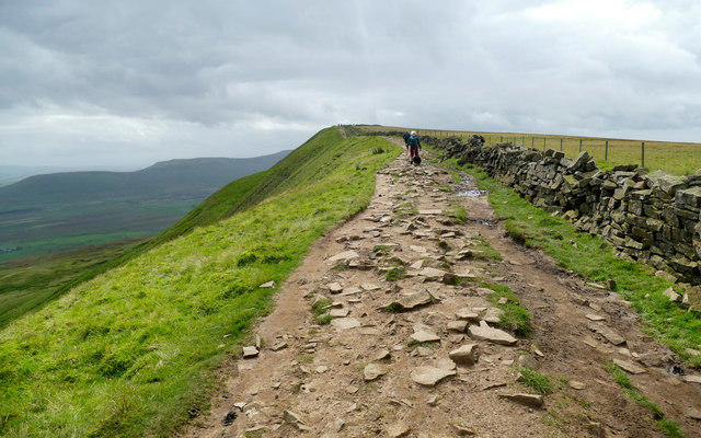
Expect a delightful medley of grassy slopes interspersed with rocky outcrops and the occasional boggy patch. Traverse carefully, and you’ll be glad you brought those trusty walking poles—you might just need them!
Views
From the summit, the panoramas extend to the neighbouring giants of the Lake District. You’ll see majestic views of Skiddaw and Blencathra, amongst others. Remember, spring and autumn are particularly kind for sight-seeing, providing clear skies and vibrant colours that will make your heart sing.
Hazards
While the views are to die for, keep vigilance for quickly changing weather conditions, as well as slippery rocks and sudden fog, especially in the springtime. Pack layers, just in case you end up in a fable rather than a fairy tale about your hike!
Nearby Summits
- Blencathra (868 meters)
- Skiddaw (931 meters)
Take the opportunity to plan a more extensive expedition by tackling these nearby giants!
Access
Nearest Parking: Parking is available at Threlkeld Village Hall, so you can start your adventure without breaking the bank!
Public Transport: Following the scenic bus route from Keswick to Threlkeld will get you there with ease—that cup of tea will wait!
Nearest Town: Keswick, where you’ll find a variety of shops and the perfect post-hike pint.
Facilities
Being in Threlkeld means you can recharge before the trek with a café offering drinks & snacks. You can also return to local pubs for a hearty meal after you’ve taken on the summit; well deserved, we’d say!
History
Name Meaning
The mountain's name is a nod to its historical Viking roots, meaning 'Benda's hill.’
Significance
Benson Knott is part of the majestic Cumbrian mountains that attract hikers year-round, a cornerstone of outdoor adventure in the Lake District.
In conclusion, Benson Knott is not just a mountain, it’s an experience. Prepare properly, respect the conditions, and you’ll enjoy a day of fresh air, stunning panoramas and, let’s face it, a bit of leg stretching. Happy hiking!
Explore routes near Benson Knott
Public walks starting within 80 km of this hill. Nearby does not mean a route reaches the summit; check its map and access before setting out.
Kendal family night walk and stargaze
View route
Kendal dark skies lighting walk and stargaze
View route
Sizergh: Park End Moss and Brigsteer Park Wood Circuit
View route
Windermere west shore: Ash Landing to Wray and back
View route
Route planning notes
These notes describe possible approaches, not verified navigable routes or permission to cross land. Check current paths, local access rules and conditions before setting out.
Benson Knott Circular
A scenic circular route starting from the village of Threlkeld, offering stunning views and moderate ascent.
Make a day of it, together
Find someone to share the walk with, or organise a day out along a route you like.
Photo Gallery
View all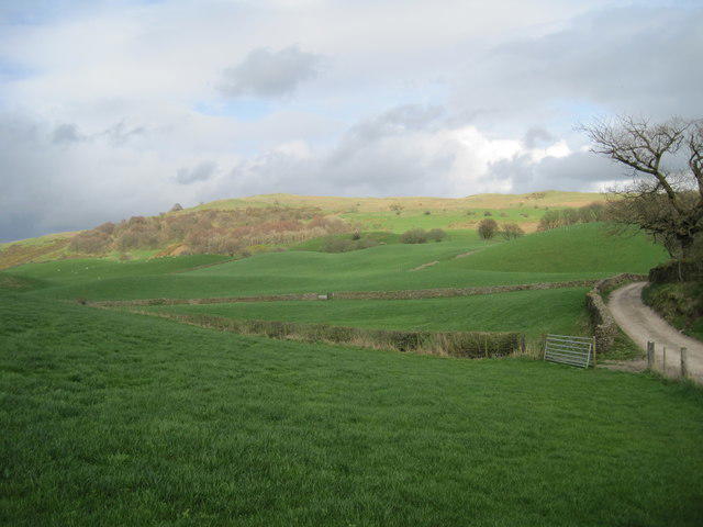 Photo could not load
SD5494 : Benson Knott from Fowl Ing Lane
Sue Adair
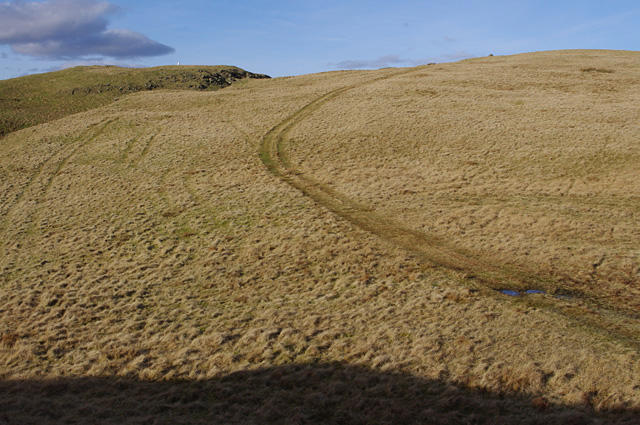 Photo could not load
SD5493 : Hay Fell
Ian Taylor
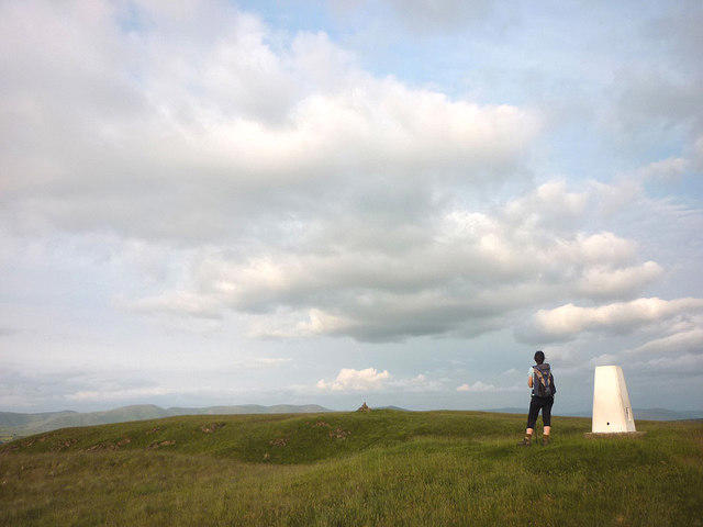 Photo could not load
SD5494 : Benson Knott, west summit (317m)
Karl and Ali
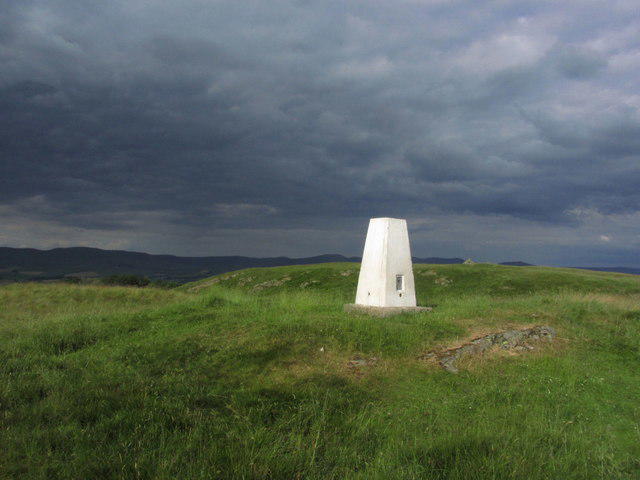 Photo could not load
SD5494 : Trig point on Benson Knott near Kendal
Colin Park
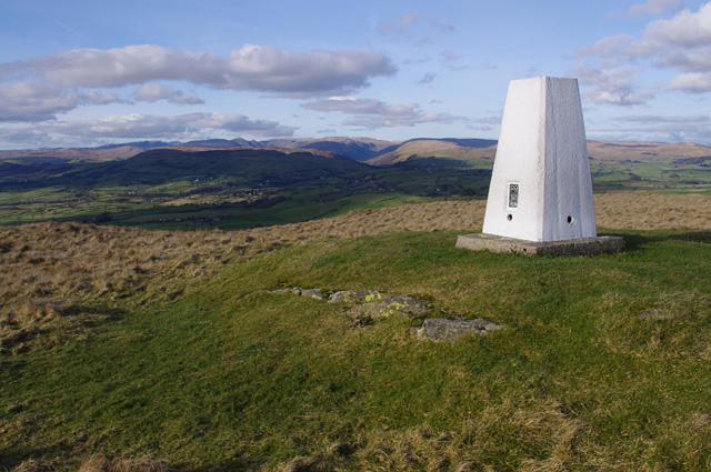 Photo could not load
SD5494 : Trig point, Benson Knott
Ian Taylor
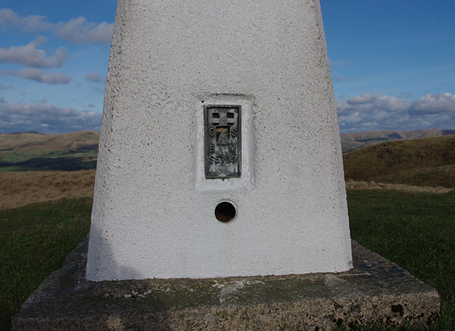 Photo could not load
SD5494 : Flush bracket S5733
Ian Taylor
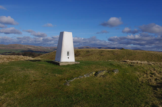 Photo could not load
SD5494 : Trig point, Benson Knott
Ian Taylor
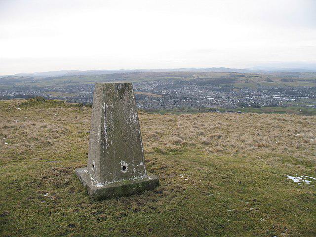 Photo could not load
SD5494 : Triangulation pillar, Benson Knott
Richard Webb
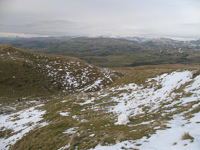 Photo could not load
SD5494 : Benson Knott
Richard Webb
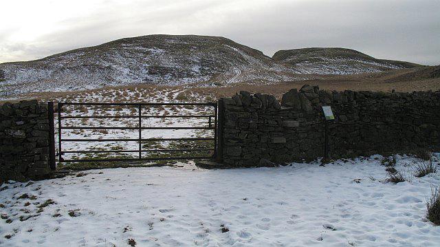
SD5494 : Hay Fell
Richard Webb
Hill facts and local notes
Classifications
Elevation
319m
1,047 ft
Prominence
133m
Coordinates
54.3408, -2.6961
SD548941
OS Map
97
Explorer: OL7N
At the Summit
The summit boasts a small stone cairn, offering a perfect spot for a well-deserved rest and scenic photos. The views are breathtaking, so don't forget your camera (and your snacks)!
Terrain & Geology
The terrain primarily consists of skiddaw slate, a type of dark, metamorphic rock formed around 500 million years ago. This sturdy geological foundation contributes to the rugged appearance of Benson Knott and its surrounding peaks.
Views & Scenery
From the summit, you'll catch sights of Skiddaw, Blencathra, and the sprawling Lorton Valley. On clear days, the vistas are simply spellbinding.
History & Heritage
Name Origin
The name 'Benson' is derived from the Old Norse elements meaning 'Benda's hill', highlighting the historical ties to the Viking settlers of the area.
Historical Significance
Part of the Cumbrian mountains, Benson Knott has been a beloved destination for walkers and adventure enthusiasts for generations.
Getting There & Facilities
Check current local access restrictions, parking rules and transport timetables before travelling. These notes do not confirm public access to the summit.
Parking
There is ample parking at Threlkeld Village Hall, with a small fee—better than a ticket for parking in a city!
Public Transport
Regular buses run from Keswick to Threlkeld, making it accessible for those without four wheels.
Nearby Facilities
The village of Threlkeld has a charming café for pre-hike fuel and a pub for post-hike recovery—you’ve earned it!
Safety Information
Known Hazards
- Watch out for sudden changes in weather, slippery rocks, and disorienting fog, especially in springtime!
General Safety Tips
- Check weather conditions before setting out
- Carry appropriate clothing and equipment
- Let someone know your planned route
- Take a map, compass, and GPS device
- Carry emergency supplies: food, water, first aid kit, torch
Hills
Some common questions about the hills answered
Are there group walks up Benson Knott?
Many walkers use Walkmates to join or organise walks with others. You can check for group walks around Benson Knott through the maps
Are there other walkers around Benson Knott?
Activity varies by location and time, but Walkmates lets you see whether others have shared walks or shown interest in this area. Find other people through the walking friends search walking friends for Benson Knott search or of course create your own walk for Benson Knott
Can I organise a walk to Benson Knott?
Yes. If there aren’t any walks listed already, you can create a walk and make it available for others to join.
If you're signed up to Walkmates, you can create a walk to Benson Knott.
How do I find a walk up this hill?
There are often multiple ways to walk this hill, depending on experience and route preference. Walkmates helps you explore walks and routes that others have shared.
Can I suggest a new route up Benson Knott?
Yes. You can suggest or create routes to share with others. Walkmates focuses on the social side of walking, so routes are used to help people organise walks and explore areas together, rather than as detailed navigation tools or route libraries.
Other uses really appreciate knowledgeable walkers sharing their routes. Share your favourite route to Benson Knott here
The is an error or something incorrect about this hill. How do I let you know?
We always strive to keep the information on Walkmates as accurate as possible. If you find an error, please let us know through the contact form and we'll aim to correct it as quickly as possible
Community Discussion
Comments
Location
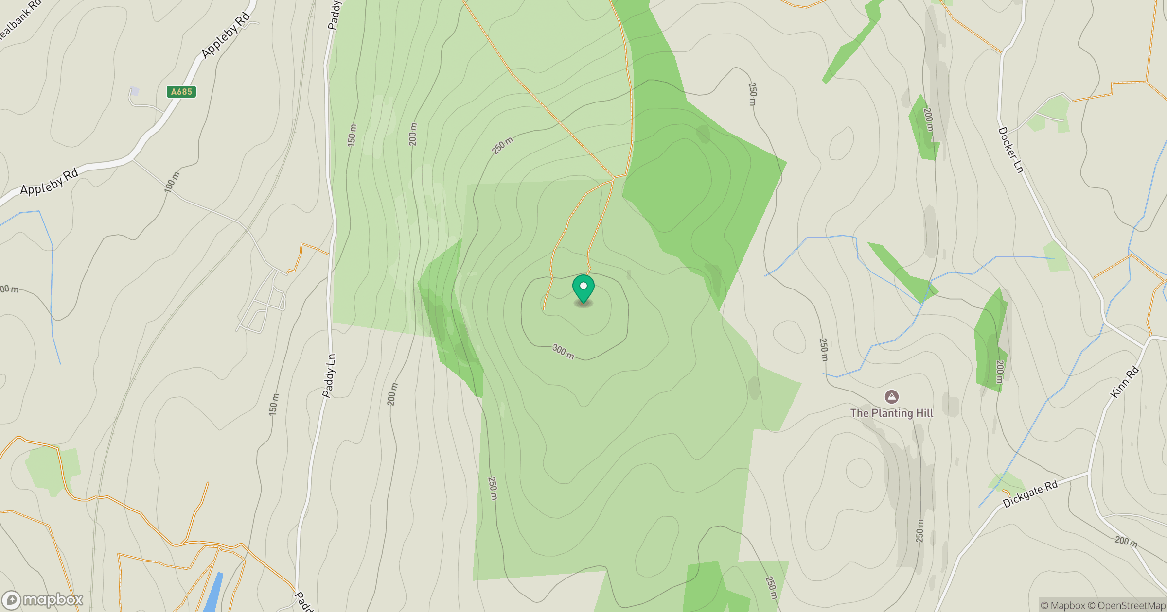
Grid reference: SD548941
View on OpenStreetMapOpens a map in a new tab, centred on the hill.
Hills within 30 km
Straight-line distance, not a walking route or confirmation of access.
No comments yet. Be the first.