

Beinn Trilleachan
Good walks are even better shared.
NN0843 : Summit of Beinn Trilleachan (839m.)
Alan O'Dowd Photo source
Overview
Beinn Trilleachan: The Hidden Gem of the Highlands
If you’re looking for a slice of Scottish wilderness that’s a little less crowded, Beinn Trilleachan might just be your ticket to tranquillity. Towering majestically at 884 meters, this Munro offers both challenge and reward without the throngs of tourists that flock to more well-known heights.
Geology
As you make your way up, take a moment to admire the local geology. The granite that forms the backbone of Beinn Trilleachan is as stubborn as a Scotsman refusing to wear shorts in summer. With its rugged outcrops and rocky terrain, the mountain presents an intriguing landscape that can make hikers feel like they’re treading on a giant’s playground.
Access
Starting your adventure is straightforward. Park your car near the A85 where clear paths beckon invitingly. Just remember, it’s not a good idea to block any farm gates—farmers have a way of making their annoyance very clear! A bus runs regularly from nearby Oban; it’s always advisable to consult the latest timetables so you don’t miss your ride.
The Ascent
The route from the A85 is well worn and fairly direct, taking you through a picturesque mix of forest trails and open moorland. It’s a moderate trek, so pack a hearty lunch but leave room for a few snacks—after all, that summit snack tastes so much better after a good climb!
Summit Features
Upon reaching the top, a sizeable cairn greets you like a mountain-sized high-five. Here, you can kick back, refuel, and take in the breathtaking panoramas stretching out before you. Whether you're gazing towards the glistening waters of Loch Awe or the jagged peaks of Rannoch Moor, there’s plenty to feast your eyes upon.
Hazards
As with any Scottish hill-faring, keep an eye on the weather—especially in the Highlands where it can change faster than a cat on a hot tin roof. Paths can become treacherously slippery in the rain, and the visibility can take a nosedive. Always be prepared and don’t let a little rain dampen your spirit!
Conclusion
For those who appreciate a quieter ascent without compromising on stunning views or delightful terrain, Beinn Trilleachan is a breath of fresh Highland air. Pick the right season, pack a good picnic, and enjoy a day in one of Scotland's less trodden paths!
Happy hiking!
Explore routes near Beinn Trilleachan
Walks starting near this hill. Open a route to check its map, distance and full itinerary.
Ben Nevis via Mountain Path
View route
Banavie to Glen Loy Aqueduct: Neptune’s Staircase Canal Towpath
View route
Beinn Ime from Succoth
View route
The Cobbler from Succoth Carpark
View route
Route planning notes
These notes describe possible approaches. Check a route's map and access information when planning your walk.
From the A85
A direct ascent starting from the A85 road, traversing through scenic forest trails leading to the summit.
Make a day of it, together
Find someone to share the walk with, or organise a day out along a route you like.
Photo Gallery
View all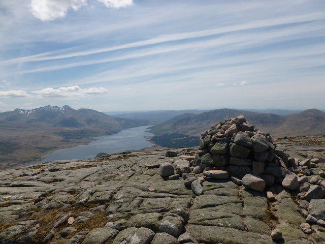 Photo could not load
NN0843 : Summit of Beinn Trilleachan (839m.)
Alan O'Dowd
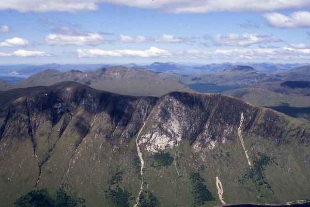 Photo could not load
NN0843 : Beinn Trilleachan with Beinn Sgulaird beyond from Ben Starav
Colin Park
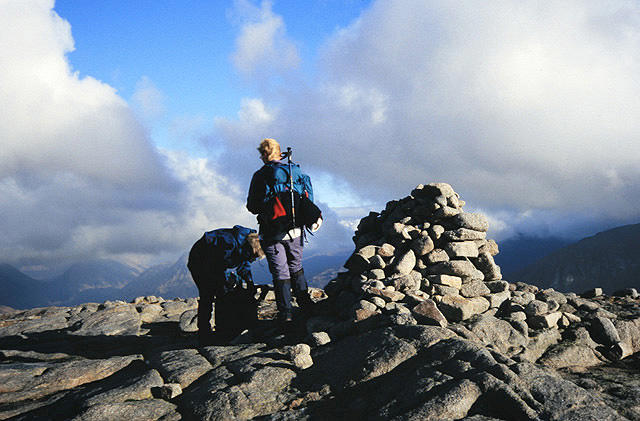 Photo could not load
NN0843 : The summit of Beinn Trilleachan
Walter Baxter
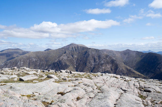 Photo could not load
NN0843 : Rocks at summit of Beinn Trilleachan
Trevor Littlewood
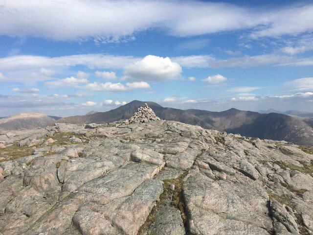 Photo could not load
NN0843 : Cairn on the summit of Beinn Trilleachan
Steven Brown
Hill facts and local notes
Classifications
Elevation
840m
2,756 ft
Prominence
478m
Coordinates
56.5480, -5.1144
NN086439
OS Map
50
Explorer: 377W
At the Summit
The summit boasts a sizable cairn, providing a perfect spot for weary hikers to catch their breath and enjoy the sweeping views.
Terrain & Geology
Beinn Trilleachan is primarily composed of granite, which is typical of the Highland region. The rocky outcrops give the mountain its rugged profile, making for some interesting scrambling opportunities.
Views & Scenery
From the summit, you can see the stunning landscape of Glen Etive, Loch Awe, and the distant peaks of Rannoch Moor.
History & Heritage
Name Origin
The name Beinn Trilleachan derives from Gaelic, with 'Beinn' meaning mountain. The exact meaning of 'Trilleachan' is subject to interpretation, but it may refer to the area's historical significance.
Historical Significance
Locally, Beinn Trilleachan is considered a hidden gem, drawing fewer crowds than its more famous neighbours.
Getting There & Facilities
Parking
Parking is available near the A85 at the start of the route. Ensure you're not blocking farm access.
Public Transport
Regular buses run from Oban to the A85. Check timetables to ensure a smooth journey.
Nearby Facilities
Cafes and toilets can be found in the nearby town of Taynuilt, ideal for a pre-hike coffee or a celebratory post-hike cake.
Safety Information
Known Hazards
- In wet conditions, the paths can be slippery, and visibility may reduce. Watch for sudden weather changes typical of the Highlands.
General Safety Tips
- Check weather conditions before setting out
- Carry appropriate clothing and equipment
- Let someone know your planned route
- Take a map, compass, and GPS device
- Carry emergency supplies: food, water, first aid kit, torch
Hills
Some common questions about the hills answered
Are there group walks up Beinn Trilleachan?
Many walkers use Walkmates to join or organise walks with others. You can check for group walks around Beinn Trilleachan through the maps
Are there other walkers around Beinn Trilleachan?
Activity varies by location and time, but Walkmates lets you see whether others have shared walks or shown interest in this area. Find other people through the walking friends search walking friends for Beinn Trilleachan search or of course create your own walk for Beinn Trilleachan
Can I organise a walk to Beinn Trilleachan?
Yes. If there aren’t any walks listed already, you can create a walk and make it available for others to join.
If you're signed up to Walkmates, you can create a walk to Beinn Trilleachan.
How do I find a walk up this hill?
There are often multiple ways to walk this hill, depending on experience and route preference. Walkmates helps you explore walks and routes that others have shared.
Can I suggest a new route up Beinn Trilleachan?
Yes. You can suggest or create routes to share with others. Walkmates focuses on the social side of walking, so routes are used to help people organise walks and explore areas together, rather than as detailed navigation tools or route libraries.
Other uses really appreciate knowledgeable walkers sharing their routes. Share your favourite route to Beinn Trilleachan here
The is an error or something incorrect about this hill. How do I let you know?
We always strive to keep the information on Walkmates as accurate as possible. If you find an error, please let us know through the contact form and we'll aim to correct it as quickly as possible
Community Discussion
Comments
Location
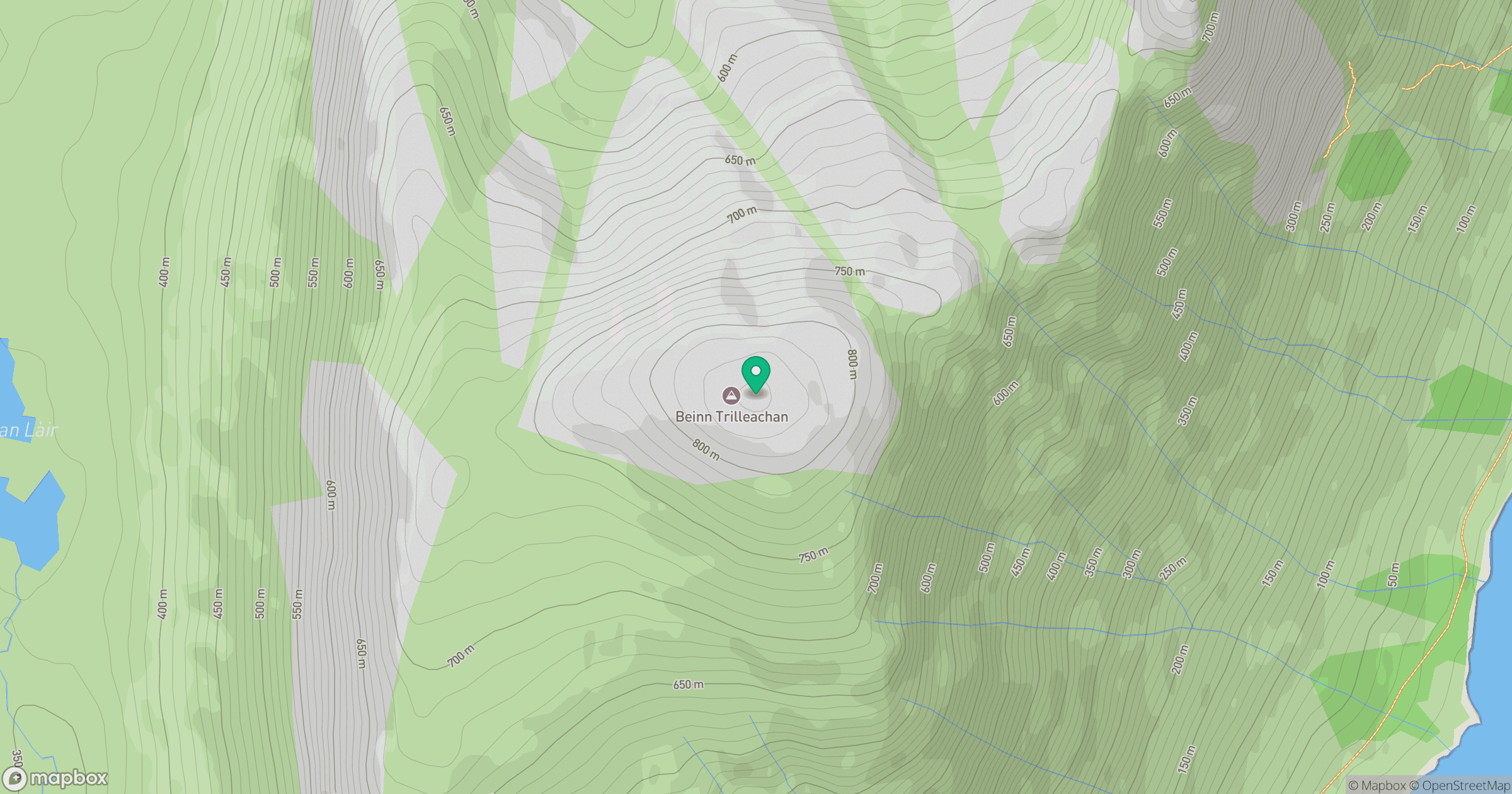
Grid reference: NN086439
View on OpenStreetMapOpens a map in a new tab, centred on the hill.
No comments yet. Be the first.