

Beinn Charsaig
Good walks are even better shared.
Overview
Beinn Charsaig: A Highland Gem
Introduction
Nestled in the stunning Scottish Highlands, Beinn Charsaig beckons hikers with its rugged charm and panoramic vistas. Standing tall at 665 meters, this delightful mountain is perfect for both seasoned adventurers and casual walkers looking to escape into nature.
Geology
Beinn Charsaig’s rocky crags tell a story that’s nearly as old as time itself. The dominant schist and gneiss formations provide an insight into the region's volcanic past, showcasing the natural forces that shaped this majestic landscape.
Routes
East Ridge Route
This route offers a leisurely climb along the eastern ridge, allowing ample time to drink in the views and catch your breath. Covering 6.5 km in about 3.5 hours, it’s perfect for family outings or casual hikers.
North Face Route
For those looking for a bit more excitement, the North Face route poses a steeper challenge. Clocking in at 4.5 km, this path will get your heart racing and your legs burning—ideally in about 4 hours.
Summit Features
At the top, you're greeted by a stout stone cairn. It’s a humble landmark that declares victory to all who made the ascent. From here, the views open up in a glorious 360-degree panorama that will make your heart race (in a good way!).
Terrain
Expect rocky terrain interspersed with stretches of grassy patches. Be wary of the infamous Scottish bogs, as stepping into one means you might become an unwilling participant in an adventure straight out of a comedy sketch!
Views
Notable landmarks you can spot from the summit include the stunning Paps of Jura and numerous other peaks of the Highlands.
Best Seasons
Late spring and autumn are prime times to capture the beauty of Beinn Charsaig. Not only will you be treated to blossoming wildflowers, but also the rich colours of fall foliage, as nature dons its finest attire.
Hazards
Be cautious of slippery surfaces, particularly when the weather decides to play a prank with rain. Bring reliable footwear to keep those socks from becoming a soggy mess!
Access
You’ll find a small car park at NM546220, just a few steps away from adventure. If you’re relying on public transport, the nearest bus service stops at the B844, about 5 km from where your climb begins.
Facilities
Once off the mountain, Taynuilt welcomes you with cafés and public toilets, ensuring you're well-fed and ready for your next wander.
History
The name Beinn Charsaig resonates with deep cultural roots, with interpretations ranging from dear mountain to precious peak. It embodies the historical significance this stunning locale holds not only in maps but also in the hearts of locals.
In conclusion, Beinn Charsaig isn’t just a hike; it’s a delightful romp through nature, peppered with rich history and stunning views. So lace up those boots and let the adventure begin!
Explore routes near Beinn Charsaig
Public walks starting within 80 km of this hill. Nearby does not mean a route reaches the summit; check its map and access before setting out.
Crinan Canal: Bellanoch and Dunardry towpath return
View route
Glen Kin group walk
View route
Ben Nevis via Mountain Path
View route
Bishop’s Glen group walk
View route
Route planning notes
These notes describe possible approaches, not verified navigable routes or permission to cross land. Check current paths, local access rules and conditions before setting out.
East Ridge Route
A gradual ascent that takes you along the eastern ridge, offering panoramic views as you climb. Ideal for those looking for a more relaxed hike.
North Face Route
A steeper, more challenging climb that tests your stamina as you tackle the rugged terrain of the northern face. Rewarding views await at the summit!
Make a day of it, together
Find someone to share the walk with, or organise a day out along a route you like.
Photo Gallery
View all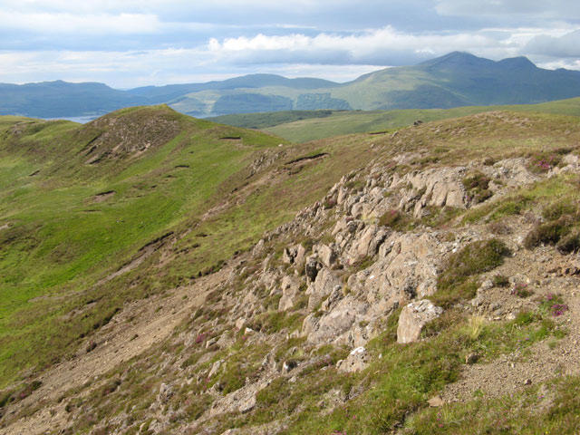 Photo could not load
NM5522 : Basalt outcrop and Ben More
Jonathan Wilkins
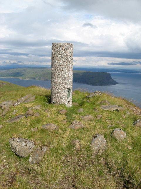 Photo could not load
NM5522 : Triangulation pillar, Beinn Charsaig
Jonathan Wilkins
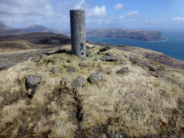 Photo could not load
NM5522 : Beinn Charsaig Trig Point
Rude Health
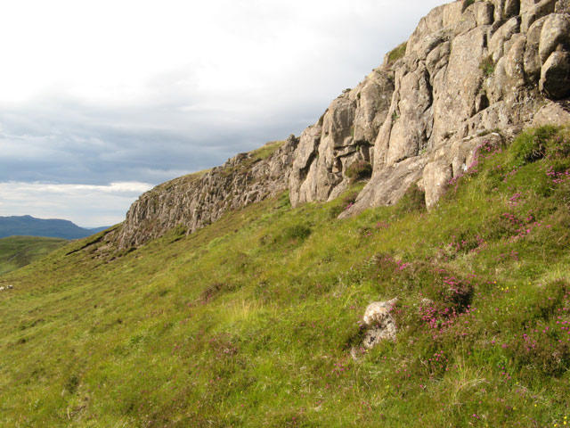 Photo could not load
NM5522 : Summit rise
Jonathan Wilkins
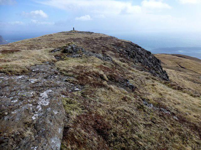 Photo could not load
NM5522 : Beinn Charsaig
Rude Health
Hill facts and local notes
Classifications
Elevation
449m
1,473 ft
Prominence
126m
Coordinates
56.3318, -5.9634
NM550225
OS Map
48
Explorer: 375W
At the Summit
The summit is crowned with a stout stone cairn and offers a breathtaking 360-degree view of the surrounding hills.
Terrain & Geology
The rocky crags of Beinn Charsaig are primarily composed of ancient schist and gneiss, giving the mountain its rugged appearance and stability. The geological formations offer insight into the area's extensive volcanic activity millions of years ago.
Views & Scenery
On a clear day, you can see the rugged peaks of Jura, the Paps of Jura, and the sprawling landscape of the Hebrides.
History & Heritage
Name Origin
The name 'Beinn Charsaig' is derived from the Gaelic 'Beinn' meaning mountain, and 'Charsaig' possibly relates to 'chara', meaning dear or precious.
Historical Significance
A significant peak in local lore, Beinn Charsaig has been a cherished landmark for generations, often featured in local storytelling.
Getting There & Facilities
Check current local access restrictions, parking rules and transport timetables before travelling. These notes do not confirm public access to the summit.
Parking
There is a small car park at NM546220, which serves as a convenient starting point for all routes.
Public Transport
The nearest bus service operates from Oban to Crinan, with stop at the B844, approximately 5 km from the car park.
Nearby Facilities
While there are no facilities directly on the mountain, Taynuilt offers cafes, restaurants, and public toilets for hikers’ convenience.
Safety Information
Known Hazards
- Watch for slippery rocks, especially in wet conditions. Some areas can be boggy; proper footwear is essential to avoid soggy socks!
General Safety Tips
- Check weather conditions before setting out
- Carry appropriate clothing and equipment
- Let someone know your planned route
- Take a map, compass, and GPS device
- Carry emergency supplies: food, water, first aid kit, torch
Hills
Some common questions about the hills answered
Are there group walks up Beinn Charsaig?
Many walkers use Walkmates to join or organise walks with others. You can check for group walks around Beinn Charsaig through the maps
Are there other walkers around Beinn Charsaig?
Activity varies by location and time, but Walkmates lets you see whether others have shared walks or shown interest in this area. Find other people through the walking friends search walking friends for Beinn Charsaig search or of course create your own walk for Beinn Charsaig
Can I organise a walk to Beinn Charsaig?
Yes. If there aren’t any walks listed already, you can create a walk and make it available for others to join.
If you're signed up to Walkmates, you can create a walk to Beinn Charsaig.
How do I find a walk up this hill?
There are often multiple ways to walk this hill, depending on experience and route preference. Walkmates helps you explore walks and routes that others have shared.
Can I suggest a new route up Beinn Charsaig?
Yes. You can suggest or create routes to share with others. Walkmates focuses on the social side of walking, so routes are used to help people organise walks and explore areas together, rather than as detailed navigation tools or route libraries.
Other uses really appreciate knowledgeable walkers sharing their routes. Share your favourite route to Beinn Charsaig here
The is an error or something incorrect about this hill. How do I let you know?
We always strive to keep the information on Walkmates as accurate as possible. If you find an error, please let us know through the contact form and we'll aim to correct it as quickly as possible
Community Discussion
Comments
Location
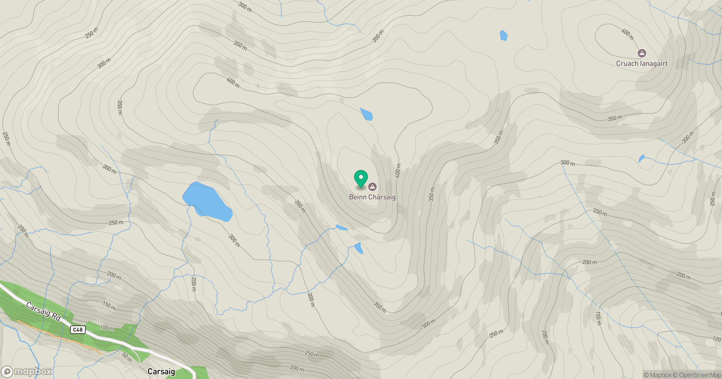
Grid reference: NM550225
View on OpenStreetMapOpens a map in a new tab, centred on the hill.
Hills within 30 km
Straight-line distance, not a walking route or confirmation of access.
No comments yet. Be the first.