
Beinn Bhreac
Good walks are even better shared.
Overview
Beinn Bhreac: An Invitation to the Highlands
Beinn Bhreac, a proud Munro standing at 810 meters, invites adventurous souls to explore its rugged beauty and take in some of the best views the Scottish Highlands have to offer.
Geology
The geological composition of Beinn Bhreac features stunning metamorphic rocks, including schists and gneisses, which tell tales of ancient environments transformed through intense heat and pressure. This mountain has weathered the test of time, shaped by glacial movements that have carved the surrounding valleys. Look closer, and you might just find a rock that looks like a face. But don’t go talking to it; people might already think you’re a bit strange!
How to Get There
Starting from the Derry Lodge car park (grid reference NN 913 922), this route leads you into the wild heart of the Cairngorms. The journey to Beinn Bhreac is often a scenic delight, with dense woodland giving way to striking open moorland as you gain elevation. Bring plenty of snacks—it's a long trek, and nobody likes a hangry hiker!
Route Overview
The trek to Beinn Bhreac from Derry Lodge spans approximately 12.5 km and takes around five hours (depending on your pace and how often you stop for photos). The terrain can be rocky and uneven, but that only adds to the adventure! A moderate level of fitness is recommended, and brace yourself for the possibility of boggy patches that could lead to unexpected surprises—wet socks, anyone?
Features of the Summit
Upon reaching the summit, you'll be greeted by a substantial cairn, providing the perfect backdrop for that all-important selfie. The breathtaking panorama extends across countless peaks and valleys, showcasing the sheer magnificence of the Cairngorms.
Safety First
Always keep an eye on the weather, as it can turn as quickly as a Scotsman’s mood during a rugby match. Be prepared for sudden showers, and make sure to wear waterproofs. The path can become slick and treacherous after rain, so do take care to avoid an unplanned slip and slide.
Final Thoughts
Not only does Beinn Bhreac offer a gratifying hike, but it also beckons with a rich cultural history steeped in myth and natural beauty. Whether you're a seasoned mountaineer or just looking for a good day out, this mountain is one for the memory books!
Happy hiking!
Explore routes near Beinn Bhreac
Walks starting near this hill. Open a route to check its map, distance and full itinerary.
Glen Banvie Trail with the Bruar viewpoint
View route
Rothiemurchus: Beaver Trail and Lochan Mor
View route
Aviemore: Loch an Eilein and the Croft Track from Rothiemurchus
View route
Aberfeldy: Glassie Woodland and River Tay Circular
View route
Route planning notes
These notes describe possible approaches. Check a route's map and access information when planning your walk.
Derry Lodge Approach
A popular route starting from Derry Lodge along the Lairig Ghru, leading to a gradual ascent towards the summit of Beinn Bhreac.
Make a day of it, together
Find someone to share the walk with, or organise a day out along a route you like.
Hill facts and local notes
Classifications
Elevation
912m
2,994 ft
Prominence
171m
Coordinates
56.9161, -3.8603
NN868820
OS Map
43
Explorer: OL51E 394E
At the Summit
The summit of Beinn Bhreac features a prominent cairn, offering a fantastic place for a well-deserved rest after the climb. The views are as good as they get, so don’t forget your camera.
Terrain & Geology
Beinn Bhreac is primarily composed of metamorphic rocks, including schists and gneisses, which tell the story of intense geological forces over millions of years. The ridge showcases striking formations that have been shaped by glacial activity.
Views & Scenery
From the summit, hikers can enjoy panoramic views of the surrounding mountains including the mighty Braeriach and Ben Macdui. Loch Etchachan glimmers in the distance like a sapphire amidst the rugged landscape.
History & Heritage
Name Origin
The name 'Beinn Bhreac' translates to 'speckled mountain' in Gaelic, possibly referring to the patchy vegetation and the rock formations.
Historical Significance
Beinn Bhreac is part of the Cairngorms National Park, an area of significant natural beauty and a haven for wildlife. The mountain's remote location has a rich folklore connected to local legends.
Getting There & Facilities
Parking
Derry Lodge car park (grid reference NN 913 922), which can accommodate several vehicles but gets busy during peak times. Arrive early to secure a spot!
Public Transport
Public transport options are limited; the nearest bus services run to Aviemore, from where you can arrange taxis or take a long cycle ride to Derry Lodge.
Nearby Facilities
The nearest facilities are found in Aviemore, where you'll discover cafes, restaurants, and public toilets to fuel up before your hike.
Safety Information
Known Hazards
- Be cautious of rapidly changing weather conditions typical of mountainous areas. The path can become slippery, especially after rain, so watch your step!
General Safety Tips
- Check weather conditions before setting out
- Carry appropriate clothing and equipment
- Let someone know your planned route
- Take a map, compass, and GPS device
- Carry emergency supplies: food, water, first aid kit, torch
Hills
Some common questions about the hills answered
Are there group walks up Beinn Bhreac?
Many walkers use Walkmates to join or organise walks with others. You can check for group walks around Beinn Bhreac through the maps
Are there other walkers around Beinn Bhreac?
Activity varies by location and time, but Walkmates lets you see whether others have shared walks or shown interest in this area. Find other people through the walking friends search walking friends for Beinn Bhreac search or of course create your own walk for Beinn Bhreac
Can I organise a walk to Beinn Bhreac?
Yes. If there aren’t any walks listed already, you can create a walk and make it available for others to join.
If you're signed up to Walkmates, you can create a walk to Beinn Bhreac.
How do I find a walk up this hill?
There are often multiple ways to walk this hill, depending on experience and route preference. Walkmates helps you explore walks and routes that others have shared.
Can I suggest a new route up Beinn Bhreac?
Yes. You can suggest or create routes to share with others. Walkmates focuses on the social side of walking, so routes are used to help people organise walks and explore areas together, rather than as detailed navigation tools or route libraries.
Other uses really appreciate knowledgeable walkers sharing their routes. Share your favourite route to Beinn Bhreac here
The is an error or something incorrect about this hill. How do I let you know?
We always strive to keep the information on Walkmates as accurate as possible. If you find an error, please let us know through the contact form and we'll aim to correct it as quickly as possible
Community Discussion
Comments
Location
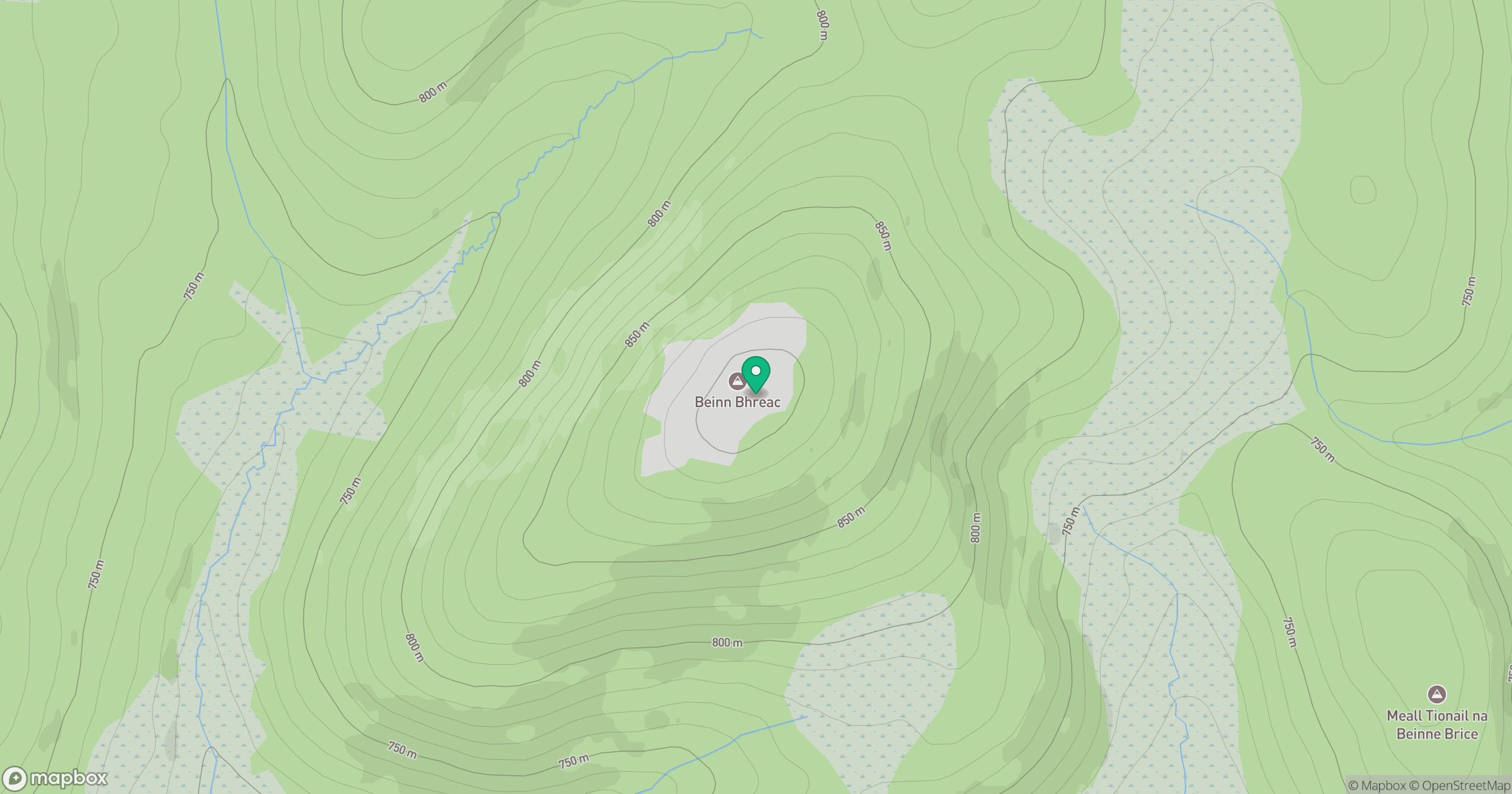
Grid reference: NN868820
View on OpenStreetMapOpens a map in a new tab, centred on the hill.
No comments yet. Be the first.