
Beinn Bhreac NE Top
Good walks are even better shared.
Overview
Beinn Bhreac NE Top
Overview
Nestled in the heart of the Scottish Highlands, Beinn Bhreac NE Top stands tall at 885 meters, offering outdoor enthusiasts a delightful blend of challenging hiking and stunning vistas. A true Munro, this top is a favourite among those looking to bag another peak while relishing the Scottish landscape.
Geology
The geology of Beinn Bhreac NE Top is dominated by schist and granite formations, shaped over millennia by glacial activity. These ancient rocks tell the story of a time long past, making it an interesting spot for geology enthusiasts.
Routes
Several routes lead to the summit, each with its charm and challenge. The popular route from Glenshee is a moderate trek through the Highland terrain, taking about 4.5 hours to complete. For the more adventurous, the trek via the Lairig Ghru offers a longer, yet rewarding challenge.
Summit Features
The summit is marked by a stone cairn, the perfect place for a well-earned break and photo opportunity. As you rest, consider adding a small stone to the cairn - a hiking tradition that brings good luck!
Terrain and Hazards
You can expect a mix of rocky paths and grassy areas, with some sections prone to bogginess. Good footwear is essential to navigate the terrain safely. While the views are rewarding, keep an eye on the weather, as conditions can change rapidly in the Highlands.
Views
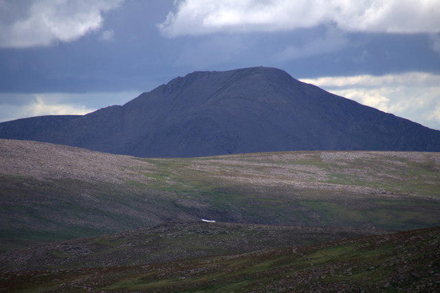
From the top, enjoy breathtaking views of the Cairngorms and the surrounding highlands, especially stunning in spring when wildflowers bloom. There's nothing quite like a sunny day atop Beinn Bhreac NE Top.
Access
Easily accessible from the Glenshee Ski Centre, hikers can find ample parking and facilities in nearby Braemar. This area is a great starting point for your Highland adventure.
Conclusion
Whether you're in it for the views, the geography or simply the joy of climbing, Beinn Bhreac NE Top should be on your bucket list. However, be prepared, pack wisely, and, most importantly, enjoy the journey! Remember, every hike has a story - make yours a good one!
Explore routes near Beinn Bhreac NE Top
Walks starting near this hill. Open a route to check its map, distance and full itinerary.
Rothiemurchus: Beaver Trail and Lochan Mor
View route
Aviemore: Loch an Eilein and the Croft Track from Rothiemurchus
View route
Aberfeldy: Glassie Woodland and River Tay Circular
View route
Kenmore: Drummond Hill Black Rock Trail above Loch Tay
View route
Route planning notes
These notes describe possible approaches. Check a route's map and access information when planning your walk.
From Glenshee
A scenic route starting from the Glenshee Ski Centre leading through beautiful highland scenery.
Via the Lairig Ghru
A longer trek that incorporates the famous Lairig Ghru pass, an excellent option for adventurous souls.
Make a day of it, together
Find someone to share the walk with, or organise a day out along a route you like.
Hill facts and local notes
Classifications
Elevation
845m
2,771 ft
Prominence
29m
Coordinates
56.9250, -3.8528
NN873830
OS Map
43
Explorer: OL51E 394E
At the Summit
At the summit, you'll find a stone cairn where weary hikers can rest and take in the breathtaking views. Don't forget to leave a small stone to add to the collection!
Terrain & Geology
The mountain is primarily composed of schist and granite, typical of the rugged terrain found in this part of the Highlands. The erosion and glacial activity in the region have shaped its craggy appearance.
Views & Scenery
From the summit, you can see the majestic peaks of the Cairngorms and the rolling hills of Aberdeenshire, making for a picturesque landscape worthy of a postcard.
History & Heritage
Name Origin
The name 'Beinn Bhreac' translates to 'speckled mountain' in Gaelic, which reflects its unique geology and appearance.
Historical Significance
This mountain is part of the Cairngorms National Park and has historical significance as an area that showcases both natural beauty and wildlife.
Getting There & Facilities
Parking
Parking is available at the Glenshee Ski Centre, offering a convenient starting point for hikes.
Public Transport
Limited bus services connect nearby towns, but a car is recommended for easier access.
Nearby Facilities
Cafés and facilities can be found in Braemar, including restrooms and food vendors to fuel up before or after your hike.
Safety Information
Known Hazards
- Watch out for sudden weather changes, particularly fog and rain, which can obscure the path. The terrain can also be slippery, especially after rain.
General Safety Tips
- Check weather conditions before setting out
- Carry appropriate clothing and equipment
- Let someone know your planned route
- Take a map, compass, and GPS device
- Carry emergency supplies: food, water, first aid kit, torch
Hills
Some common questions about the hills answered
Are there group walks up Beinn Bhreac NE Top?
Many walkers use Walkmates to join or organise walks with others. You can check for group walks around Beinn Bhreac NE Top through the maps
Are there other walkers around Beinn Bhreac NE Top?
Activity varies by location and time, but Walkmates lets you see whether others have shared walks or shown interest in this area. Find other people through the walking friends search walking friends for Beinn Bhreac NE Top search or of course create your own walk for Beinn Bhreac NE Top
Can I organise a walk to Beinn Bhreac NE Top?
Yes. If there aren’t any walks listed already, you can create a walk and make it available for others to join.
If you're signed up to Walkmates, you can create a walk to Beinn Bhreac NE Top.
How do I find a walk up this hill?
There are often multiple ways to walk this hill, depending on experience and route preference. Walkmates helps you explore walks and routes that others have shared.
Can I suggest a new route up Beinn Bhreac NE Top?
Yes. You can suggest or create routes to share with others. Walkmates focuses on the social side of walking, so routes are used to help people organise walks and explore areas together, rather than as detailed navigation tools or route libraries.
Other uses really appreciate knowledgeable walkers sharing their routes. Share your favourite route to Beinn Bhreac NE Top here
The is an error or something incorrect about this hill. How do I let you know?
We always strive to keep the information on Walkmates as accurate as possible. If you find an error, please let us know through the contact form and we'll aim to correct it as quickly as possible
Community Discussion
Comments
Location
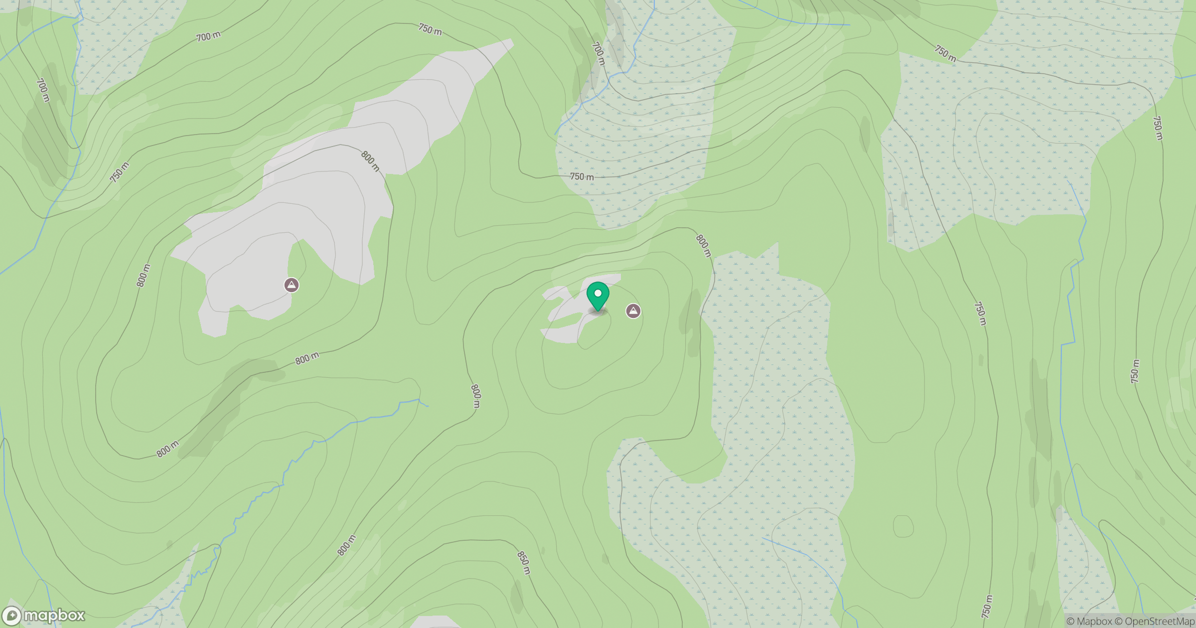
Grid reference: NN873830
View on OpenStreetMapOpens a map in a new tab, centred on the hill.
No comments yet. Be the first.