
Beinn Bheag
Good walks are even better shared.
Overview
Beinn Bheag: A Hidden Gem in the Highlands
Beinn Bheag may not be the tallest mountain in Scotland, but it certainly packs a punch when it comes to stunning views and dramatic landscapes. At an elevation of 688 meters, this Marilyn offers a satisfying climb for walkers of varying skill levels.
Geology
The mountain is a splendid example of the volcanic geology typical of the region. Composed primarily of andesite, Beinn Bheag features rugged terrain reminiscent of ancient eruptions, providing a rich tapestry of rock formations and stunning backdrops.
Access
Getting to Beinn Bheag is half the fun! The nearest parking can be found near NM913630 at a small lot that can accommodate several cars. If you prefer public transport, you can catch a bus from Oban to Taynuilt, followed by a scenic 5 km walk to the start of the trail. Taynuilt itself offers local amenities and a chance to grab a warm meal or a cuppa before you embark on your adventure.
Routes
One of the popular routes to conquer Beinn Bheag begins on the West Highland Way. This well-trodden path leads you eastwards and delivers a manageable (yet fulfilling) day hike spanning around 10 km. Plan for roughly 4.5 hours to complete the journey while soaking up the beauty along the way.
Summit Features
At the summit of Beinn Bheag lies a small but mighty cairn, which acts as a friendly marker for all who reach this peak. The rock outcrop provides an excellent vantage point to absorb the panoramic views, so have your camera ready!
Views
From the top, you can gaze upon the breathtaking landscapes that include Ben Nevis, the UK’s highest peak, alongside spectacular vistas of Loch Awe. Beinn Bheag is best visited during late spring through early autumn, when visibility is at its best and the weather is mild (no promises, though; this is Scotland!).
Hazards
As with any outdoor adventure, be aware of your surroundings—Scottish weather is known to change faster than you can say "let's have a cuppa!" Additionally, keep an eye on rocky terrain that may be a bit loose in places.
So lace up your boots, grab your walking sticks, and enjoy the majesty of Beinn Bheag—an adventure waiting just for you!
Whether you're a seasoned mountaineer or just fancy a stroll, Beinn Bheag has something for everyone. Just don't forget your sense of humour!
Explore routes near Beinn Bheag
Walks starting near this hill. Open a route to check its map, distance and full itinerary.
Ben Nevis via Mountain Path
View route
Banavie to Glen Loy Aqueduct: Neptune’s Staircase Canal Towpath
View route
Fort Augustus to Kytra Lock: Caledonian Canal Towpath
View route
Beinn Ime from Succoth
View route
Route planning notes
These notes describe possible approaches. Check a route's map and access information when planning your walk.
West Highland Way to Beinn Bheag
This route begins from the West Highland Way, a popular long-distance footpath, before diverting eastwards towards the summit.
Make a day of it, together
Find someone to share the walk with, or organise a day out along a route you like.
Hill facts and local notes
Classifications
Elevation
737m
2,419 ft
Prominence
202m
Coordinates
56.7168, -5.4094
NM914635
OS Map
40
Explorer: 391
At the Summit
The summit boasts a rocky outcrop, adorned with a small cairn—a monument to the intrepid souls who've ventured to the top.
Terrain & Geology
Beinn Bheag is primarily composed of volcanic rock, specifically andesite, and showcases the characteristic rugged terrain of the Highlands, resulting from ancient geological activity.
Views & Scenery
Panoramic views of the surrounding peaks, including the iconic Ben Nevis in the distance, as well as Loch Awe and the surrounding glens.
History & Heritage
Name Origin
Beinn Bheag translates to 'Little Mountain' in Gaelic, a bit of an understatement considering its rugged charm.
Historical Significance
Historically, this area has been important for both its natural resources and as a symbol of local culture, with many legends surrounding the peaks.
Getting There & Facilities
Parking
There is a small parking area near the base of the West Highland Way, around NM913630, suitable for several cars.
Public Transport
The nearest bus service runs from Oban to Taynuilt, with a walk of about 5 km to the start of the route.
Nearby Facilities
There are no facilities on the mountain itself, but Taynuilt has cafes and public toilets to refresh before or after your hike.
Safety Information
Known Hazards
- Beware of sudden weather changes, as the Scottish Highlands are notorious for rapid shifts, and loose rocks can make footing tricky.
General Safety Tips
- Check weather conditions before setting out
- Carry appropriate clothing and equipment
- Let someone know your planned route
- Take a map, compass, and GPS device
- Carry emergency supplies: food, water, first aid kit, torch
Hills
Some common questions about the hills answered
Are there group walks up Beinn Bheag?
Many walkers use Walkmates to join or organise walks with others. You can check for group walks around Beinn Bheag through the maps
Are there other walkers around Beinn Bheag?
Activity varies by location and time, but Walkmates lets you see whether others have shared walks or shown interest in this area. Find other people through the walking friends search walking friends for Beinn Bheag search or of course create your own walk for Beinn Bheag
Can I organise a walk to Beinn Bheag?
Yes. If there aren’t any walks listed already, you can create a walk and make it available for others to join.
If you're signed up to Walkmates, you can create a walk to Beinn Bheag.
How do I find a walk up this hill?
There are often multiple ways to walk this hill, depending on experience and route preference. Walkmates helps you explore walks and routes that others have shared.
Can I suggest a new route up Beinn Bheag?
Yes. You can suggest or create routes to share with others. Walkmates focuses on the social side of walking, so routes are used to help people organise walks and explore areas together, rather than as detailed navigation tools or route libraries.
Other uses really appreciate knowledgeable walkers sharing their routes. Share your favourite route to Beinn Bheag here
The is an error or something incorrect about this hill. How do I let you know?
We always strive to keep the information on Walkmates as accurate as possible. If you find an error, please let us know through the contact form and we'll aim to correct it as quickly as possible
Community Discussion
Comments
Location
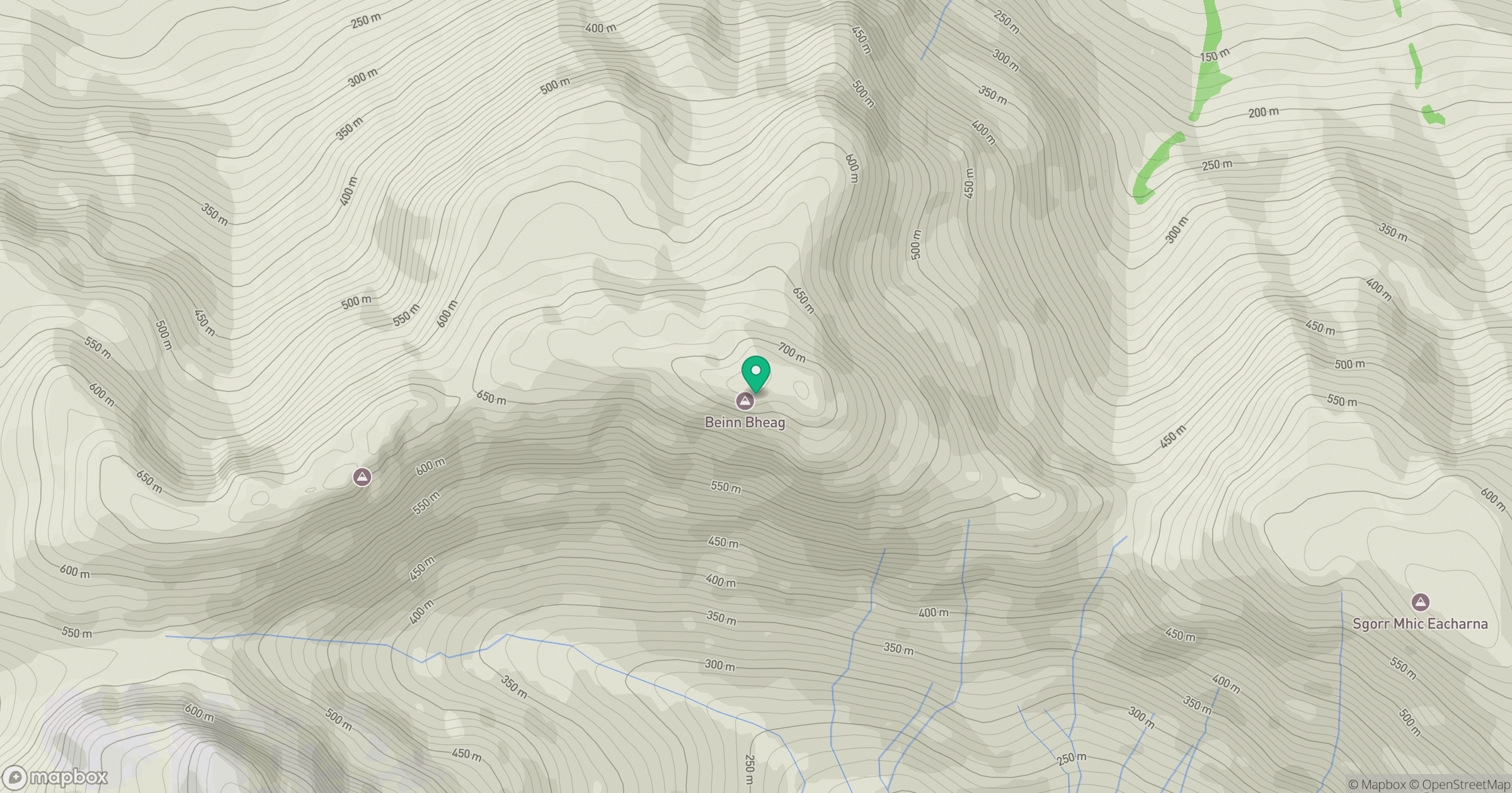
Grid reference: NM914635
View on OpenStreetMapOpens a map in a new tab, centred on the hill.
No comments yet. Be the first.