
Beinn Bhan
Good walks are even better shared.
Overview
Beinn Bhan: A Jewel of the Scottish Highlands
Nestled within the rugged beauty of the Scottish Highlands, Beinn Bhan stands at a proud 775 metres, inviting hikers and adventurers alike to experience its breathtaking vistas and intriguing geology. As a classified Munro, it represents not just a physical challenge but also a cultural icon of the picturesque landscape.
Geology
The mountain's foundation is composed of schists and gneisses, giving it a character that is both imposing and exquisite. As you traverse its slopes, you are walking on rock that has been shaped by millennia of geological forces, and you'll want to keep your footing – it can be a trifle slippery!
Routes
Two popular routes offer unique approaches to the summit. The Glen Finnan Route is clearly well-trodden, offering walkers a delightful experience along scenic pathways with moderately challenging gradients. Alternatively, the Glen Pean Approach leads hikers through a less-beaten track, perfect for those who enjoy a touch of solitude.
Summit Features
Upon reaching the summit, you'll be greeted by a stone cairn, which serves as a perfect lookout point. Don’t forget to check your selfies – the wind may be keen to help you lose a hat or two!
Terrain Type
Expect a mix of rocky paths and boggy ground, particularly lower down. Pack your gaiters, lest you wish to have soggy socks for the day!
Views
From Beinn Bhan, the panoramas are staggering. Loch Shiel stretches out below, framed by other peaks of the Highlands, and the vista is especially captivating at sunrise or sunset. Bring your camera, and keep an eye on the clouds – they can whisk away the views faster than you can say 'Mochaccino'!
Hazards
As with many mountain climbs, be wary of sudden weather changes, which can transform clear blue skies into a downpour without so much as a warning. The rocky sections can be a challenge, especially underfoot when wet.
Access
Parking is convenient at the Glen Finnan visitor centre, while public transport options from Fort William make this hill surprisingly accessible. Just remember, good planning is key if you want to avoid a lengthy walk back after a long day!
Facilities
For weary travellers, the Glen Finnan visitor centre features a lovely wee café – ideal for resting your legs and refuelling.
History
The name ‘Beinn Bhan’ embodies the beauty of the Scottish landscape. It translates to 'White Mountain', hinting not only at its physical characteristics but also at its cultural resonance. This mountain has whispered tales to poets, painters, and hikers for generations.
Conclusion
Whether you're a seasoned climber or a casual hiker, Beinn Bhan offers a splendid day out in the great outdoors. Just be sure to pack your sense of adventure (and maybe a spare hat or two) because the Highlands are waiting for you!
Happy hiking!
Explore routes near Beinn Bhan
Walks starting near this hill. Open a route to check its map, distance and full itinerary.
Banavie to Glen Loy Aqueduct: Neptune’s Staircase Canal Towpath
View route
Ben Nevis via Mountain Path
View route
Fort Augustus to Kytra Lock: Caledonian Canal Towpath
View route
Glen Affric: Coire Loch Woodland Trail
View route
Route planning notes
These notes describe possible approaches. Check a route's map and access information when planning your walk.
Glen Finnan Route
A popular route starting from Glen Finnan, leading you through beautiful landscapes with moderate elevation gain.
Glen Pean Approach
A lesser-known but stunning approach through Glen Pean, offering a more secluded experience.
Make a day of it, together
Find someone to share the walk with, or organise a day out along a route you like.
Hill facts and local notes
Classifications
Elevation
796m
2,611 ft
Prominence
495m
Coordinates
56.9253, -5.0569
NN140857
OS Map
34 41
Explorer: 399
At the Summit
The summit is marked by a rough stone cairn, a perfect backdrop for that elusive summit selfie. Make sure you don’t lose your hat up there!
Terrain & Geology
Beinn Bhan is primarily composed of schists and gneisses, which give the mountain its rugged character and are typical of the region's geology. The schistose rock can be rather grippy, but don't you dare get too cocky!
Views & Scenery
From the summit, you can expect breathtaking views of Loch Shiel, the surrounding hills, and, on a clear day, you might even spot the infamous Ben Nevis brooding in the distance.
History & Heritage
Name Origin
The name Beinn Bhan translates to 'White Mountain' in Scottish Gaelic, likely due to its often snow-capped peaks or the pale hue of its rocks.
Historical Significance
A popular mountain in Scottish culture and hiking circles, Beinn Bhan was part of the landscape that inspired many poets and artists.
Getting There & Facilities
Parking
Parking is available at the Glen Finnan visitor centre, which provides decent space but can get busy during peak times.
Public Transport
The nearest train station is at Fort William, from which you can take a bus to Glen Finnan, though it may require some planning.
Nearby Facilities
The Glen Finnan visitor centre has a small café and toilets, perfect for a pre-hike cuppa or a post-hike cake to celebrate your summit success.
Safety Information
Known Hazards
- Potential for sudden weather changes; be prepared or risk becoming a soggy sandwich! Steep and rocky sections may require care, especially when wet.
General Safety Tips
- Check weather conditions before setting out
- Carry appropriate clothing and equipment
- Let someone know your planned route
- Take a map, compass, and GPS device
- Carry emergency supplies: food, water, first aid kit, torch
Hills
Some common questions about the hills answered
Are there group walks up Beinn Bhan?
Many walkers use Walkmates to join or organise walks with others. You can check for group walks around Beinn Bhan through the maps
Are there other walkers around Beinn Bhan?
Activity varies by location and time, but Walkmates lets you see whether others have shared walks or shown interest in this area. Find other people through the walking friends search walking friends for Beinn Bhan search or of course create your own walk for Beinn Bhan
Can I organise a walk to Beinn Bhan?
Yes. If there aren’t any walks listed already, you can create a walk and make it available for others to join.
If you're signed up to Walkmates, you can create a walk to Beinn Bhan.
How do I find a walk up this hill?
There are often multiple ways to walk this hill, depending on experience and route preference. Walkmates helps you explore walks and routes that others have shared.
Can I suggest a new route up Beinn Bhan?
Yes. You can suggest or create routes to share with others. Walkmates focuses on the social side of walking, so routes are used to help people organise walks and explore areas together, rather than as detailed navigation tools or route libraries.
Other uses really appreciate knowledgeable walkers sharing their routes. Share your favourite route to Beinn Bhan here
The is an error or something incorrect about this hill. How do I let you know?
We always strive to keep the information on Walkmates as accurate as possible. If you find an error, please let us know through the contact form and we'll aim to correct it as quickly as possible
Community Discussion
Comments
Location
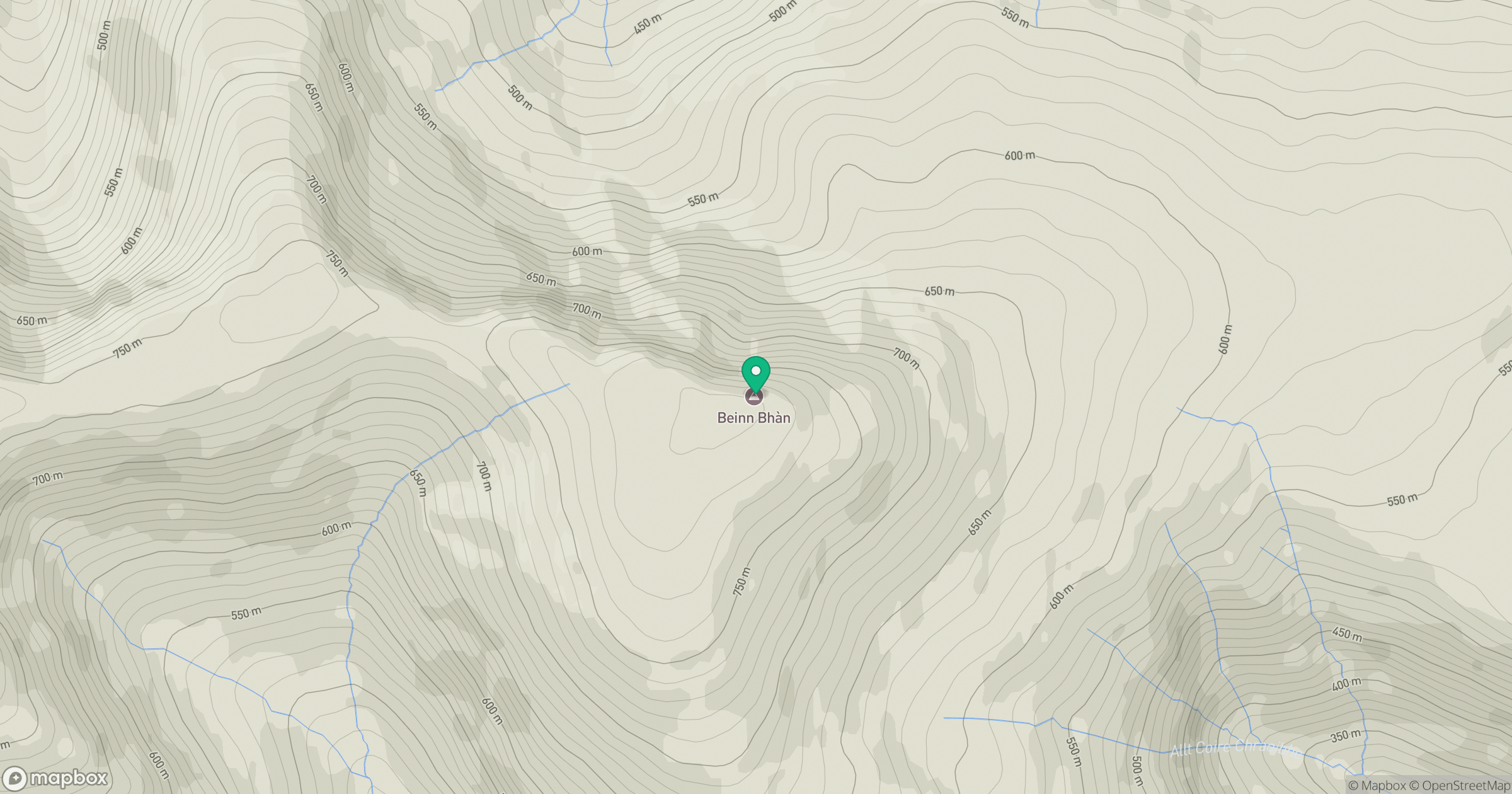
Grid reference: NN140857
View on OpenStreetMapOpens a map in a new tab, centred on the hill.
Nearby Hills
![Ben Nevis [Beinn Nibheis]](https://cdn.walkmates.com/gallery-images/44e34d25abc849e78f7b99a97863fffb.jpg)
Ben Nevis [Beinn Nibheis]
1,345m
Carn Mor Dearg
1,221m
Aonach Mor
1,220m
Aonach Beag
1,234m
Sgurr a' Mhaim
1,099m
No comments yet. Be the first.