
Ballincollop Hill
Good walks are even better shared.
Overview
Ballincollop Hill
Overview
Nestled within the beautiful County Kerry, Ballincollop Hill may not be the most formidable peak around, but it holds its own charm and allure. Standing at 360 meters in elevation, it's a perfect choice for those looking for a pleasant outing without getting too knackered.
Geology
This hill boasts a rich geological tapestry, primarily comprising Old Red Sandstone. The rocks tell stories of ancient river systems, while the varied layers whisper secrets of a time long past.
Routes
Starting from Ballyduff, this route is a doddle! At approximately 5 km and taking around 2 hours, it offers moderate terrain that’s fantastic for both novice and experienced hikers. Watch out for the sheep, though; they're a cheeky lot!
Summit Features
At the summit, you’ll find a quaint cairn where you can catch your breath and enjoy the views. Don't forget to snap some selfies here—your followers will be impressed! There's also a handy signpost illuminating the best paths for subsequent adventures.
Terrain
The trek features a predominantly grassy surface, perfect for leisurely strolls, with occasional rocky outcrops—ideal for those who enjoy a bit of scrambling without diving into extreme rock climbing.
Views
Once you reach the top, prepare to feast your eyes! The breathtaking scene includes the magnificent Macgillycuddy Reeks and Tralee Bay. For the most spectacular sight, visit in late spring or early autumn when everything is in full bloom.
Hazards
While the path is relatively straightforward, be cautious after rain when surfaces can become slippery. Proper hiking boots—don't underestimate the power of good footwear!
Access
You can find parking in Ballyduff. If you rely on public transport, set your sights on Tralee for bus services, but check ahead for timings.
Facilities
Before you head back, slide into the local café in Ballyduff for a cup of something warm or a bite to eat. Always a great way to finish a hike!
History
The name translates to 'townland of the swineherd'. While the image of a swineherd with a stick might not make it the most glamorous of names, it certainly roots the hill in local history, marking its significance as a guide through the ages.
Conclusion
Ballincollop Hill is a delightful slice of nature, perfect for a peaceful day out. With magnificent views, easy access, and an inviting atmosphere, it’s a gem waiting to be explored.
Remember to bring your camera and perhaps your favourite snack; the summit is the perfect lunch spot!
Explore routes near Ballincollop Hill
Public walks starting within 80 km of this hill. Nearby does not mean a route reaches the summit; check its map and access before setting out.
No public routes are currently listed within 80 km of Ballincollop Hill on Walkmates. This does not mean there are no paths here. Explore the map and check local access information before planning a walk.
Route planning notes
These notes describe possible approaches, not verified navigable routes or permission to cross land. Check current paths, local access rules and conditions before setting out.
Ballyduff Start
A scenic trek beginning in the village of Ballyduff, leading through lush fields and gentle slopes before ascending the hill with panoramic views.
Make a day of it, together
Find someone to share the walk with, or organise a day out along a route you like.
Hill facts and local notes
Classifications
Elevation
141m
463 ft
Prominence
116m
Coordinates
51.6243, -8.7400
W488415
OS Map
86 87
At the Summit
The summit features a small cairn which adds a touch of charm, alongside a delightful wooden signpost that provides directions for the intrepid wanderers.
Terrain & Geology
Composed primarily of Old Red Sandstone, Ballincollop Hill offers a glimpse into the geological history of the region with rock formations dating back to the Late Devonian period. The sedimentary layers tell tales of ancient river deltas and environments long gone.
Views & Scenery
From the summit, on a clear day, you can gaze across the stunning vista of the Macgillycuddy Reeks, the rolling hills of the Kerry countryside, and even catch a glimpse of Tralee Bay in the distance.
History & Heritage
Name Origin
The name 'Ballincollop' is believed to derive from the Irish 'Baile an Chollópa,' meaning 'townland of the swineherd,' hinting at the area’s agricultural past.
Historical Significance
Ballincollop Hill has served as a local landmark for centuries, often used by shepherds and farmers for navigation and now a lovely spot for hikers seeking beauty and tranquility.
Getting There & Facilities
Check current local access restrictions, parking rules and transport timetables before travelling. These notes do not confirm public access to the summit.
Parking
There is a small gravel parking area in Ballyduff, just off the main road. Please be sure to park responsibly.
Public Transport
Bus services are available from Tralee to Ballyduff, but check the latest schedules as they can be infrequent.
Nearby Facilities
While no facilities are located directly at the hill, the village of Ballyduff has a charming local café where you can grab a hearty meal or a warm drink before or after your hike.
Safety Information
Known Hazards
- Occasional slippery surfaces in wet weather; ensure to wear appropriate footwear.
General Safety Tips
- Check weather conditions before setting out
- Carry appropriate clothing and equipment
- Let someone know your planned route
- Take a map, compass, and GPS device
- Carry emergency supplies: food, water, first aid kit, torch
Hills
Some common questions about the hills answered
Are there group walks up Ballincollop Hill?
Many walkers use Walkmates to join or organise walks with others. You can check for group walks around Ballincollop Hill through the maps
Are there other walkers around Ballincollop Hill?
Activity varies by location and time, but Walkmates lets you see whether others have shared walks or shown interest in this area. Find other people through the walking friends search walking friends for Ballincollop Hill search or of course create your own walk for Ballincollop Hill
Can I organise a walk to Ballincollop Hill?
Yes. If there aren’t any walks listed already, you can create a walk and make it available for others to join.
If you're signed up to Walkmates, you can create a walk to Ballincollop Hill.
How do I find a walk up this hill?
There are often multiple ways to walk this hill, depending on experience and route preference. Walkmates helps you explore walks and routes that others have shared.
Can I suggest a new route up Ballincollop Hill?
Yes. You can suggest or create routes to share with others. Walkmates focuses on the social side of walking, so routes are used to help people organise walks and explore areas together, rather than as detailed navigation tools or route libraries.
Other uses really appreciate knowledgeable walkers sharing their routes. Share your favourite route to Ballincollop Hill here
The is an error or something incorrect about this hill. How do I let you know?
We always strive to keep the information on Walkmates as accurate as possible. If you find an error, please let us know through the contact form and we'll aim to correct it as quickly as possible
Community Discussion
Comments
Location
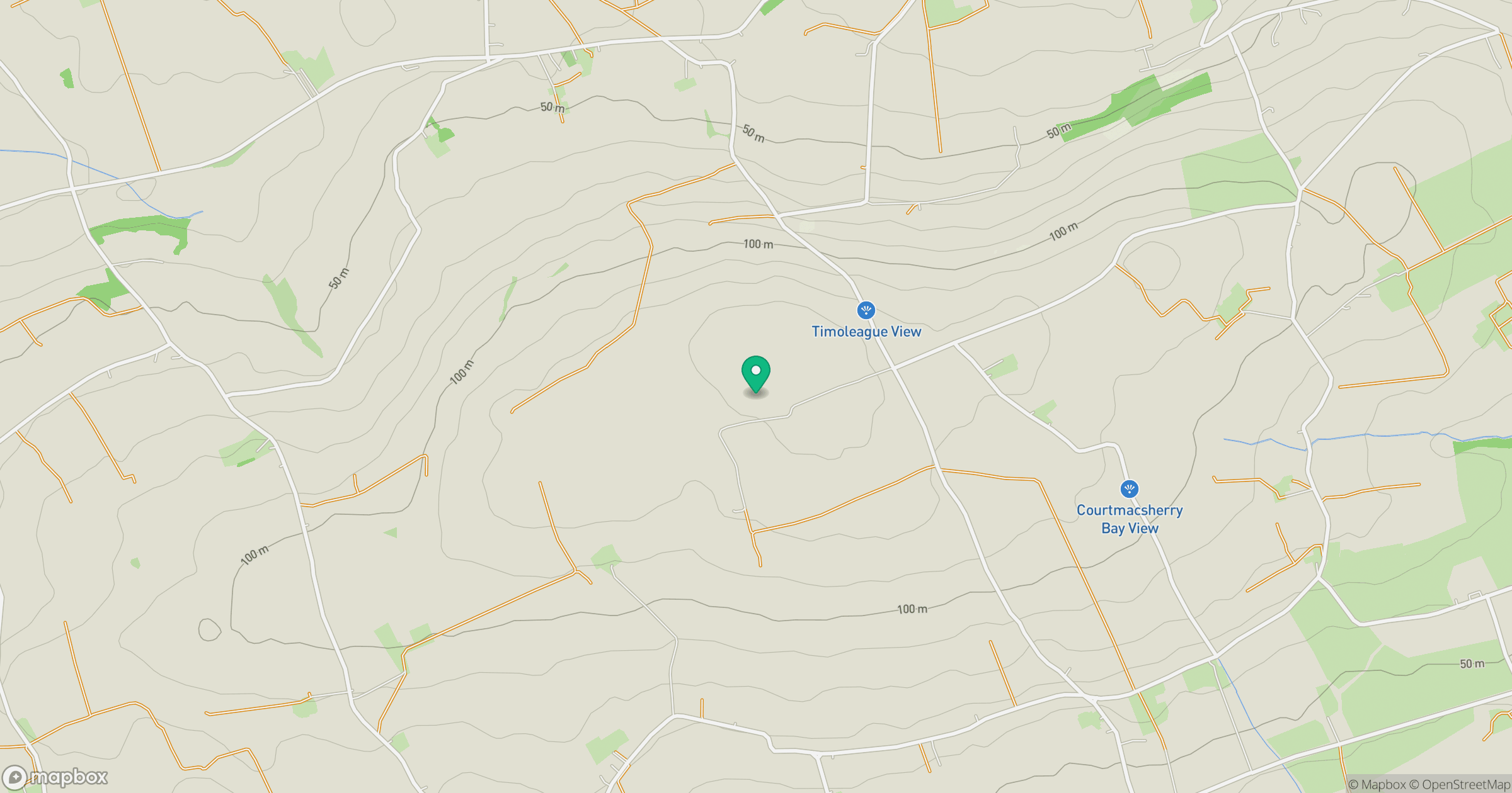
Grid reference: W488415
View on OpenStreetMapOpens a map in a new tab, centred on the hill.
Hills within 30 km
Straight-line distance, not a walking route or confirmation of access.
Slieveadrohid [Hare Hill]
201m
Currane Hill
228m
Knockshanawee
209m
Clearagh Hill
287m
Doolieve
182m
No comments yet. Be the first.