
Clearagh Hill
Good walks are even better shared.
Overview
Clearagh Hill
Clearagh Hill stands proudly in County Kerry, reaching an elevation of 482 meters. With its modest prominence, it offers a welcoming challenge for hikers looking to stretch their legs and breathe in some fresh air.
Geology
The composition of Clearagh Hill is primarily slate, a hallmark of Ireland's ancient geological past. This sedimentary rock not only shapes the landscape but also contributes to the rich variety of flora and fauna found in this area. So while you’re here enjoying the fresh air, remember that these rocks have witnessed millions of years of history.
Routes
A popular route is the Clearagh Hill Loop, approximately 6.5 km long. Starting from a small farm track, this moderate hike will take about 2.5 hours. The ascent is slightly challenging but very rewarding, with stunning vistas at each turn. Just watch your footing, as it can get slippery!
Summit Features
At the summit, you'll find a quaint cairn, the perfect spot for a selfie. From here, the view is nothing short of breath-taking. You’ll be looking down on the valley with all its rolling hills stretching into the distance.
Terrain
The terrain is primarily grassy with rocky outcrops, offering a mixed bag of hiking experiences. Fair warning: it can be quite slippery after a rain shower, so those hiking boots better have some grip! A good walking stick might come in handy too.
Views
The views from Clearagh Hill are like a postcard come to life. On a clear day, you'll catch a glimpse of the majestic Slieve Mish Mountains and the picturesque Tralee Bay. For the best views, aim for spring or autumn when the weather is typically clearer, and the scenery is kissed with seasonal colours.
Hazards
Although it's a delightful hike, hikers should remain vigilant. Wet conditions can make the paths treacherous, and weather in this region can change faster than you can say 'hiker's paradise.'
Nearby Summits
Don’t forget to check out Knocknaguish, just a stone's throw away at 492 meters high. It’s a delightful neighbour that beckons the adventurous soul.
Access
The nearest parking is a convenient layby along the R561, and for those relying on public transport, the closest bus stop is in Tralee. A taxi can easily transport you from there. The nearest town, Ballyheigue, is just around the corner, offering charming cafes and local pubs for a well-deserved refreshment after your hike.
Facilities
Ballyheigue provides several options for food and drink, making it easy to refuel post-hike. Public toilets are also available in the village to freshen up.
History
The name 'Clearagh' possibly signifies a 'cleared place' in Irish, hinting at a long agricultural history. It's also steeped in local folklore, often intertwined with tales of the past and the folklore of the Irish hills.
So pack your walking shoes and set off to Clearagh Hill for a day filled with adventure, beauty, and maybe a giggle or two. Happy hiking!
Explore routes near Clearagh Hill
Public walks starting within 80 km of this hill. Nearby does not mean a route reaches the summit; check its map and access before setting out.
No public routes are currently listed within 80 km of Clearagh Hill on Walkmates. This does not mean there are no paths here. Explore the map and check local access information before planning a walk.
Route planning notes
These notes describe possible approaches, not verified navigable routes or permission to cross land. Check current paths, local access rules and conditions before setting out.
Clearagh Hill Loop
A scenic loop starting from a nearby farm track, offering splendid views as you ascend.
Make a day of it, together
Find someone to share the walk with, or organise a day out along a route you like.
Hill facts and local notes
Classifications
Elevation
287m
942 ft
Prominence
133m
Coordinates
51.8297, -8.9262
W362645
OS Map
86
At the Summit
The summit is marked by a modest cairn and offers a 360-degree view that would put a panoramic camera to shame.
Terrain & Geology
Clearagh Hill is primarily composed of slate, indicative of the sedimentary rock formations often found in this part of Ireland. The underlying geology contributes to the rich biodiversity of the surrounding area.
Views & Scenery
On a clear day, one can spot the distant outlines of the Slieve Mish Mountains, the beautiful Tralee Bay, and areas of the rugged Kerry coastline.
History & Heritage
Name Origin
The name 'Clearagh' may derive from the Irish 'Cléireach', meaning 'the cleared place', hinting at historical farming methods.
Historical Significance
The hill holds significance in local folklore, often associated with ancient tales of the land and its caretakers.
Getting There & Facilities
Check current local access restrictions, parking rules and transport timetables before travelling. These notes do not confirm public access to the summit.
Parking
There is a small layby at the start of the route on the R561 road.
Public Transport
The nearest bus stop is in Tralee, from where a taxi can be arranged to the start point.
Nearby Facilities
Ballyheigue has several cafes and pubs where one can refill on calories after a hike. Public toilets are also available in the village.
Safety Information
Known Hazards
- Slippery terrain in wet conditions, sudden weather changes.
General Safety Tips
- Check weather conditions before setting out
- Carry appropriate clothing and equipment
- Let someone know your planned route
- Take a map, compass, and GPS device
- Carry emergency supplies: food, water, first aid kit, torch
Hills
Some common questions about the hills answered
Are there group walks up Clearagh Hill?
Many walkers use Walkmates to join or organise walks with others. You can check for group walks around Clearagh Hill through the maps
Are there other walkers around Clearagh Hill?
Activity varies by location and time, but Walkmates lets you see whether others have shared walks or shown interest in this area. Find other people through the walking friends search walking friends for Clearagh Hill search or of course create your own walk for Clearagh Hill
Can I organise a walk to Clearagh Hill?
Yes. If there aren’t any walks listed already, you can create a walk and make it available for others to join.
If you're signed up to Walkmates, you can create a walk to Clearagh Hill.
How do I find a walk up this hill?
There are often multiple ways to walk this hill, depending on experience and route preference. Walkmates helps you explore walks and routes that others have shared.
Can I suggest a new route up Clearagh Hill?
Yes. You can suggest or create routes to share with others. Walkmates focuses on the social side of walking, so routes are used to help people organise walks and explore areas together, rather than as detailed navigation tools or route libraries.
Other uses really appreciate knowledgeable walkers sharing their routes. Share your favourite route to Clearagh Hill here
The is an error or something incorrect about this hill. How do I let you know?
We always strive to keep the information on Walkmates as accurate as possible. If you find an error, please let us know through the contact form and we'll aim to correct it as quickly as possible
Community Discussion
Comments
Location
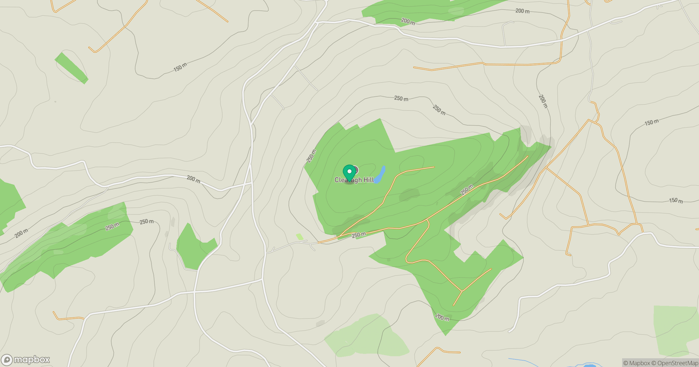
Grid reference: W362645
View on OpenStreetMapOpens a map in a new tab, centred on the hill.
Hills within 30 km
Straight-line distance, not a walking route or confirmation of access.
No comments yet. Be the first.