
Knockarudane Hill
Good walks are even better shared.
Overview
Knockarudane Hill Overview
Knockarudane Hill, perched at a respectable 246 meters, is a classic Marilyn that offers hikers a delightful slice of Scotland’s mountainous charm. Situated in the Southern Uplands, it might not reach Munro status, but what it lacks in height, it more than compensates for in beauty.
Geological Wonders
This hill is made up of ancient volcanic rocks, which gives it a character distinct from many fellow peaks in the region. As you traverse the terrain, you'll see different rock formations that tell a story steeped in the Earth's history. Just don't get too lost in thought—you might trip over a rock!
Hiking Routes
The Glenmuckloch Circuit is the primary route, a moderately challenging loop that's perfect for a casual day's hike. Covering about 8.5 km, it generally takes about 3.5 hours to complete, depending on your pace and the number of selfies you take. Plan for a few ups and downs, but nothing too strenuous. Remember: the slower you go, the more time you have to enjoy the scenery!
Summit Features
At the summit, you will find a quaint stone cairn—a nod to the numerous hikers who have visited before you. Take a moment here to soak in the views. After all, it’s the journey and the destination that makes hiking so fulfilling, isn’t it?
Terrain & Views
The hill’s terrain is primarily grassy with occasional rocky patches, ideal for those who prefer a more forgiving hiking experience. The panorama from the top won’t disappoint either; you’ll have a front-row seat to the Rhinns of Kells and the undulating valleys below. For utter bliss, consider visiting in spring or autumn when nature really puts on a show.
Safety First
As with many hikes, be prepared for a few wet patches here and there. It’s just a gentle reminder that Mother Nature has a sense of humour—always watch your footing.
Access & Amenities
Parking is available at a convenient lay-by along the Glenmuckloch road, but do ensure you’re not blocking any farmland access. The nearest town, Sanquhar, is where you can fill up on essentials but leave the soufflés at home; it’s not that sort of area!
Interesting Tidbits
The name 'Knockarudane' translates to 'the hill of the fort,’ evidence of its historical significance as a lookout point. Imagine standing atop this hill centuries ago, keeping an eye on the valleys below—now that’s a job anyone could forget their sandwich on!
So, lace up your boots, pack a picnic, and head out to explore Knockarudane Hill. It’s a delightful retreat into the heart of the Scottish countryside, and remember: it’s a small hill, but the experience is grand!
Explore routes near Knockarudane Hill
Public walks starting within 80 km of this hill. Nearby does not mean a route reaches the summit; check its map and access before setting out.
No public routes are currently listed within 80 km of Knockarudane Hill on Walkmates. This does not mean there are no paths here. Explore the map and check local access information before planning a walk.
Route planning notes
These notes describe possible approaches, not verified navigable routes or permission to cross land. Check current paths, local access rules and conditions before setting out.
Glenmuckloch Circuit
A circular route starting from the Glenmuckloch, offering stunning views throughout the hike.
Make a day of it, together
Find someone to share the walk with, or organise a day out along a route you like.
Hill facts and local notes
Classifications
Elevation
169m
554 ft
Prominence
113m
Coordinates
51.5720, -9.0983
W239360
OS Map
89
At the Summit
The summit is crowned with a small stone cairn, which provides a modest but satisfying vantage point for all climbers. No unique rock formations to report, but the scenery makes up for it!
Terrain & Geology
Knockarudane Hill is primarily composed of volcanic rock formations, providing a unique geological context compared to its limestone and sandstone neighbours. The summit offers a glance at the processes that shaped the local landscape over millions of years.
Views & Scenery
On a clear day, you can spot the Rhinns of Kells and the expansive valley below. The picturesque hills surrounding the area make for some prime Instagram moments.
History & Heritage
Name Origin
The name 'Knockarudane' derives from Gaelic, meaning 'the hill of the fort,' hinting at its historically strategic importance.
Historical Significance
Historically, the hill may have been a lookout point for ancient residents. Appreciate where they once stood while you enjoy your own views!
Getting There & Facilities
Check current local access restrictions, parking rules and transport timetables before travelling. These notes do not confirm public access to the summit.
Parking
A small lay-by at the start of the Glenmuckloch road (Grid Reference: NX 364 891) provides adequate space for several cars. Don't block access, or you might make an enemy of a local farmer.
Public Transport
Bus services operate from Sanquhar to Dalmellington. However, you may need to arrange for a lift to the trailhead.
Nearby Facilities
Although facilities are sparse, Sanquhar offers a local pub and a few shops for basic necessities. Don't expect a Starbucks—mocha lovers might have to make do with instant brew!
Safety Information
Known Hazards
- Wet and boggy patches can catch the unsuspecting hiker off guard; do watch your step to avoid taking an unintentional swim.
General Safety Tips
- Check weather conditions before setting out
- Carry appropriate clothing and equipment
- Let someone know your planned route
- Take a map, compass, and GPS device
- Carry emergency supplies: food, water, first aid kit, torch
Hills
Some common questions about the hills answered
Are there group walks up Knockarudane Hill?
Many walkers use Walkmates to join or organise walks with others. You can check for group walks around Knockarudane Hill through the maps
Are there other walkers around Knockarudane Hill?
Activity varies by location and time, but Walkmates lets you see whether others have shared walks or shown interest in this area. Find other people through the walking friends search walking friends for Knockarudane Hill search or of course create your own walk for Knockarudane Hill
Can I organise a walk to Knockarudane Hill?
Yes. If there aren’t any walks listed already, you can create a walk and make it available for others to join.
If you're signed up to Walkmates, you can create a walk to Knockarudane Hill.
How do I find a walk up this hill?
There are often multiple ways to walk this hill, depending on experience and route preference. Walkmates helps you explore walks and routes that others have shared.
Can I suggest a new route up Knockarudane Hill?
Yes. You can suggest or create routes to share with others. Walkmates focuses on the social side of walking, so routes are used to help people organise walks and explore areas together, rather than as detailed navigation tools or route libraries.
Other uses really appreciate knowledgeable walkers sharing their routes. Share your favourite route to Knockarudane Hill here
The is an error or something incorrect about this hill. How do I let you know?
We always strive to keep the information on Walkmates as accurate as possible. If you find an error, please let us know through the contact form and we'll aim to correct it as quickly as possible
Community Discussion
Comments
Location
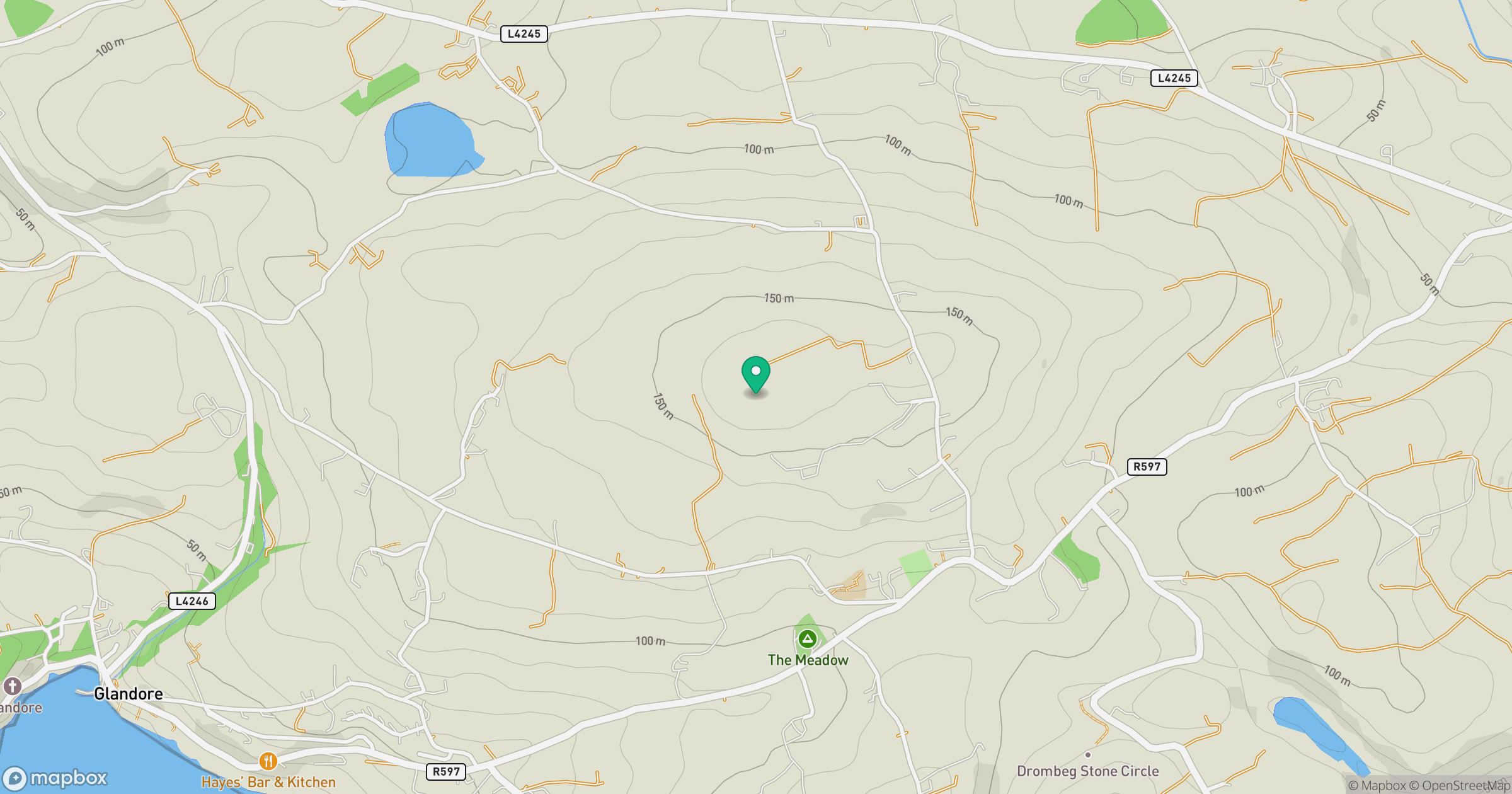
Grid reference: W239360
View on OpenStreetMapOpens a map in a new tab, centred on the hill.
Hills within 30 km
Straight-line distance, not a walking route or confirmation of access.
No comments yet. Be the first.