
Killeigh Hill
Good walks are even better shared.
Overview
Killeigh Hill: A Hidden Gem in County Offaly
Overview
Killeigh Hill, standing proudly at 326 meters, might not be the highest peak on the block, but what it lacks in elevation, it makes up for in charm and stunning vistas. Nestled in County Offaly, this Marilyn is an inviting destination for hikers of all levels. Whether you are a seasoned veteran with feet like iron or a casual walker looking for a gentle ramble, Killeigh welcomes you.
Geology
The hill’s limestone composition tells a tale of enduring geological processes, from ancient sea beds to modern karst landscapes. These formations yield a rich environment, bursting with diverse flora and fauna, where you might spot a few local critters scurrying about—hopefully not too close to your sandwich!
Routes
The most recommended route is the Killeigh Hill Loop. Spanning about 6.5 kilometers (4 miles), this moderate loop begins in the quaint village of Killeigh. As you wind your way through fields, you’ll cross paths with grazing cattle and enjoy the fragrant countryside before tackling the gentle ascent, leading you straight to the summit cairn.
Summit Features
At the top, you’re greeted by a modest stone cairn and a trig point—ideal for snapping the obligatory summit selfie. Stretch your legs and take a moment to absorb the panoramic views; they could be worth their weight in gold.
Terrain
The terrain is primarily grassy with the occasional rocky outcrop and, let’s be honest, a few muddy patches that can surprise the best of us. Dress appropriately, lest you want mud-caked boots as a badge of honour.
Views
On reaching the summit, you’ll be rewarded with breathtaking views that stretch across the Irish landscape. Gaze upon the Slieve Bloom Mountains rising like ancient sentinels in the distance. There’s something to be said for experiencing a sunrise from up here; it just makes you feel alive!
Hazards
As with any hike, be aware of potential hazards. Muddy paths can be a menace, particularly following a heavy rainfall. When in doubt, tread wisely and ensure your footwear is up to the task!
Access
Access to Killeigh Hill is quite straightforward. The nearest parking facilities are at the trailhead, with ample space for vehicles. For those relying on public transport, services from Tullamore can drop you off within walking distance.
Facilities
Once you’re back down, the village of Killeigh has a small shop and a delightful café to replenish lost calories—because we all know there’s no such thing as too many snacks!
Conclusion
Killeigh Hill may be small in stature, but it packs a punch when it comes to beauty and accessibility. It's a fantastic escape into nature, perfect for a family outing or a quick solo adventure. So grab your gear and hit the trail; Killeigh awaits!
Last Update
- Last Updated: 2023-10-15
Explore routes near Killeigh Hill
Public walks starting within 80 km of this hill. Nearby does not mean a route reaches the summit; check its map and access before setting out.
No public routes are currently listed within 80 km of Killeigh Hill on Walkmates. This does not mean there are no paths here. Explore the map and check local access information before planning a walk.
Route planning notes
These notes describe possible approaches, not verified navigable routes or permission to cross land. Check current paths, local access rules and conditions before setting out.
Killeigh Hill Loop
A scenic loop that starts from the local village, winding through lush countryside before ascending the hill. Ideal for a pleasant afternoon hike.
Make a day of it, together
Find someone to share the walk with, or organise a day out along a route you like.
Hill facts and local notes
Classifications
Elevation
229m
751 ft
Prominence
103m
Coordinates
51.6113, -9.0257
W290403
OS Map
86 89
At the Summit
The summit of Killeigh Hill features a small stone cairn along with a trig point, perfect for a quick photo op to prove you made it to the top.
Terrain & Geology
Killeigh Hill is primarily composed of limestone, which makes for a unique habitat and tends to be home to a variety of flora and fauna. The geology also features notable karst formations due to weathering, providing nice photo opportunities.
Views & Scenery
From the summit, you can enjoy sweeping views of the surrounding countryside, including the Slieve Bloom Mountains in the distance. On a clear day, you might even spot the River Shannon.
History & Heritage
Name Origin
The name 'Killeigh' derives from the Irish 'Cill Aodha', meaning 'church of Aodh', named after the patron saint of the area.
Historical Significance
The hill has been a significant feature for local folklore and provides insight into the early Christian period in Ireland.
Getting There & Facilities
Check current local access restrictions, parking rules and transport timetables before travelling. These notes do not confirm public access to the summit.
Parking
There is a small car park at the start of the loop trail, located just off the road leading from Killeigh village.
Public Transport
Nearest bus service runs from Tullamore to Killeigh with a short walk to the starting point.
Nearby Facilities
The nearest facilities are found in Killeigh, which has a local shop and a café for post-hike refreshments.
Safety Information
Known Hazards
- Muddy paths can be slippery, especially in wet conditions. Watch your step and bring proper footwear to avoid a soggy sock situation.
General Safety Tips
- Check weather conditions before setting out
- Carry appropriate clothing and equipment
- Let someone know your planned route
- Take a map, compass, and GPS device
- Carry emergency supplies: food, water, first aid kit, torch
Hills
Some common questions about the hills answered
Are there group walks up Killeigh Hill?
Many walkers use Walkmates to join or organise walks with others. You can check for group walks around Killeigh Hill through the maps
Are there other walkers around Killeigh Hill?
Activity varies by location and time, but Walkmates lets you see whether others have shared walks or shown interest in this area. Find other people through the walking friends search walking friends for Killeigh Hill search or of course create your own walk for Killeigh Hill
Can I organise a walk to Killeigh Hill?
Yes. If there aren’t any walks listed already, you can create a walk and make it available for others to join.
If you're signed up to Walkmates, you can create a walk to Killeigh Hill.
How do I find a walk up this hill?
There are often multiple ways to walk this hill, depending on experience and route preference. Walkmates helps you explore walks and routes that others have shared.
Can I suggest a new route up Killeigh Hill?
Yes. You can suggest or create routes to share with others. Walkmates focuses on the social side of walking, so routes are used to help people organise walks and explore areas together, rather than as detailed navigation tools or route libraries.
Other uses really appreciate knowledgeable walkers sharing their routes. Share your favourite route to Killeigh Hill here
The is an error or something incorrect about this hill. How do I let you know?
We always strive to keep the information on Walkmates as accurate as possible. If you find an error, please let us know through the contact form and we'll aim to correct it as quickly as possible
Community Discussion
Comments
Location
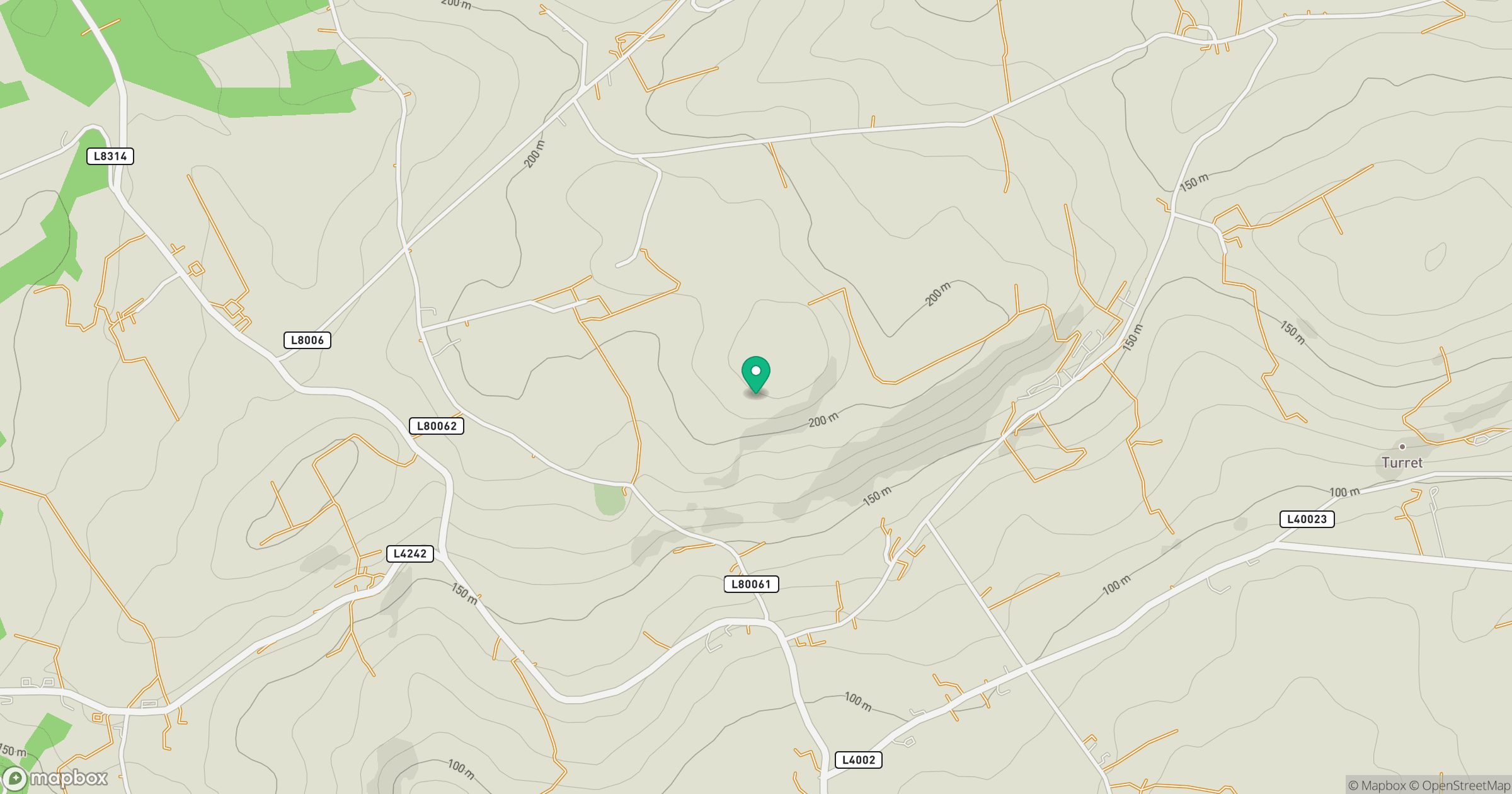
Grid reference: W290403
View on OpenStreetMapOpens a map in a new tab, centred on the hill.
Hills within 30 km
Straight-line distance, not a walking route or confirmation of access.
No comments yet. Be the first.