
Knockscagh
Good walks are even better shared.
Overview
Knockscagh: A Hiker's Delight
Overview
Knockscagh is a splendid Marilyn in the Atlantic Coastal Range, reaching a respectable height of 495 meters. It's a hill that punches its weight despite not being the tallest around.
Geology
The mountain is formed mainly from quartzite and sandstone, remnants of an ancient seabed. This rock formation not only contributes to its steep slopes and rugged landscape but has also created the perfect setting for a challenging yet rewarding hike.
Routes
The Knockscagh Loop offers a moderately challenging route that’s perfect for a weekend trekking adventure. The circular route is approximately 6.5 km long and usually takes around 2.5 hours to complete. Hikers will traverse through grassy fields with the occasional rocky outcrop throwing in a bit of excitement along the way.
Summit Features
Reaching the summit, you’ll be greeted by a sizeable stone cairn along with a granite trig point. Make sure to snap a few photos, as your friends back home will be wishing they had joined you!
Terrain Type
Expect primarily grassy terrain interspersed with rocky outcroppings. In certain areas, especially after rain, bogs can form, so good footwear is a must. Every now and then, a loose rock may add to the adventure.
Views
Upon reaching the peak, hikers are rewarded with breathtaking views of Lough Allen and the distant Sliabh an Iarainn Mountains. Spring and autumn are truly spectacular seasons to visit, with clear skies making the landscapes pop and come alive.
Hazards
Stay cautious: a few loose rocks may be encountered on steeper sections. After rains, the path can become a tad slippery, so tread carefully.
Nearby Summits
For the keen explorer, nearby summits such as Sliabh an Iarainn (612 m) and the legendary Croagh Patrick (764 m) beckon!
Access
There’s convenient parking in Derrykeenan, leading you directly to the trailhead. Public transport links connect through the nearby town of Ballaghaderreen, making logistics a breeze.
Facilities
Ballaghaderreen boasts various facilities catering to the needs of hikers. You’ll find charming cafes and clean toilets to aid your post-hike recovery.
History
The etymology of 'Knockscagh' adds a lovely narrative layer to this hike. Meaning 'hill of the thorn bush' in Irish, it hints at a rich tapestry of local folklore and history. Historically, the hill has served as an important landmark in regional stories.
In conclusion, taking on Knockscagh is sure to be memorable, providing both a challenge and an opportunity to bask in the beauty of Ireland's landscapes. So lace up your boots and hit the trails!
Explore routes near Knockscagh
Public walks starting within 80 km of this hill. Nearby does not mean a route reaches the summit; check its map and access before setting out.
No public routes are currently listed within 80 km of Knockscagh on Walkmates. This does not mean there are no paths here. Explore the map and check local access information before planning a walk.
Route planning notes
These notes describe possible approaches, not verified navigable routes or permission to cross land. Check current paths, local access rules and conditions before setting out.
Knockscagh Loop
A circular route starting from the village of Derrykeenan, leading hikers through scenic landscapes and offering stunning views of the surrounding hills.
Make a day of it, together
Find someone to share the walk with, or organise a day out along a route you like.
Hill facts and local notes
Classifications
Elevation
195m
640 ft
Prominence
102m
Coordinates
51.6065, -9.1584
W198399
OS Map
89
At the Summit
The summit of Knockscagh boasts a large stone cairn that provides excellent photo opportunities. There's also a trig point, which you can gloat about to your non-hiking friends.
Terrain & Geology
Knockscagh is primarily composed of quartzite and sandstone, remnants of ancient seabeds that formed millions of years ago. The rugged nature of its geology gives rise to steep slopes and rocky outcrops, perfect for an adventurous hike.
Views & Scenery
From the summit, you can catch glimpses of Lough Allen and the majestic Sliabh an Iarainn Mountains in the distance. On a clear day, you might even see as far as the Slieve Blooms, making it a real feast for the eyes!
History & Heritage
Name Origin
The name 'Knockscagh' is derived from the Irish 'Cnoc Sceach', meaning 'hill of the thorn bush', which adds a touch of mystery to its aesthetic.
Historical Significance
Historically, Knockscagh has been a landmark for local folk, often featuring in tales of old; it's said to be the site of various local legends.
Getting There & Facilities
Check current local access restrictions, parking rules and transport timetables before travelling. These notes do not confirm public access to the summit.
Parking
Parking is available at the village of Derrykeenan, just a short walk from the trailhead. Please respect local parking regulations.
Public Transport
Regular bus services operate from nearby towns, with the nearest stop located in the village. Check local schedules for more information.
Nearby Facilities
There are no facilities directly on the mountain but Ballaghaderreen offers cafes and toilets, perfect for a post-hike treat.
Safety Information
Known Hazards
- Loose rocks on steeper sections can be slippery, especially following rain. Always keep an eye on the weather conditions and dress appropriately.
General Safety Tips
- Check weather conditions before setting out
- Carry appropriate clothing and equipment
- Let someone know your planned route
- Take a map, compass, and GPS device
- Carry emergency supplies: food, water, first aid kit, torch
Hills
Some common questions about the hills answered
Are there group walks up Knockscagh?
Many walkers use Walkmates to join or organise walks with others. You can check for group walks around Knockscagh through the maps
Are there other walkers around Knockscagh?
Activity varies by location and time, but Walkmates lets you see whether others have shared walks or shown interest in this area. Find other people through the walking friends search walking friends for Knockscagh search or of course create your own walk for Knockscagh
Can I organise a walk to Knockscagh?
Yes. If there aren’t any walks listed already, you can create a walk and make it available for others to join.
If you're signed up to Walkmates, you can create a walk to Knockscagh.
How do I find a walk up this hill?
There are often multiple ways to walk this hill, depending on experience and route preference. Walkmates helps you explore walks and routes that others have shared.
Can I suggest a new route up Knockscagh?
Yes. You can suggest or create routes to share with others. Walkmates focuses on the social side of walking, so routes are used to help people organise walks and explore areas together, rather than as detailed navigation tools or route libraries.
Other uses really appreciate knowledgeable walkers sharing their routes. Share your favourite route to Knockscagh here
The is an error or something incorrect about this hill. How do I let you know?
We always strive to keep the information on Walkmates as accurate as possible. If you find an error, please let us know through the contact form and we'll aim to correct it as quickly as possible
Community Discussion
Comments
Location
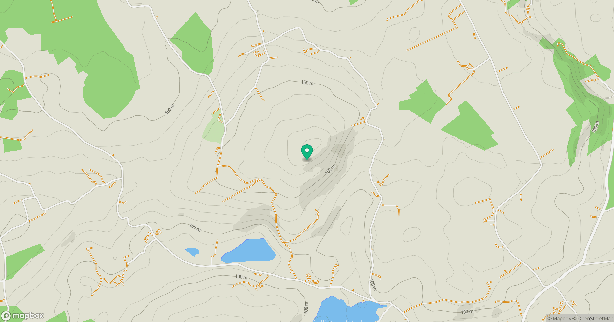
Grid reference: W198399
View on OpenStreetMapOpens a map in a new tab, centred on the hill.
Hills within 30 km
Straight-line distance, not a walking route or confirmation of access.
No comments yet. Be the first.