

Bad a' Chlamhain
Good walks are even better shared.
Overview
Bad a' Chlamhain
Introduction
Nestled in the rolling hills of the Scottish Highlands, Bad a' Chlamhain is a Munro that invites adventurers to tackle its rocky ridges and revel in the splendour of nature.
Geology
This mountain is a splendid example of granitic gneiss, often resembling a jigsaw puzzle of ancient rock. Its rugged terrain offers insights into glacial processes that shaped the stunning landscape.
Routes
The most frequented route to the summit is the North Ridge, which stretches approximately 9.2 km. Expect a moderate hike with a mix of rocky and grassy terrain. Just remember the golden rule of hillwalking: it's not a race! The summit is sure to reward your efforts with spectacular views.
Summit Features
On reaching the top, hikers are greeted by a stone cairn. A bit of a beacon for lost souls and a perfect spot for a celebratory snack. Keep an eye out for the clouds sneaking in, they seem to have a knack for photobombing your summit selfies!
Terrain
The terrain varies—it’s a delightful mix of rocky paths interspersed with lush patches of grass. Be wary of the boggy sections; you'd rather not wade through what feels like a field of quicksand. Sturdy footwear is essential, along with a sense of humour!
Views
You won’t find many places that offer views quite like those from Bad a' Chlamhain. Look out towards Loch Awe and the majestic peaks of Ben Lui and Ben Cruachan. The best time for those jaw-dropping vistas? Late spring through early autumn when the heather is in bloom. It’s nature’s way of saying “Smile for the camera!”
Hazards
As with many Highland walks, be alert to sudden shifts in weather. Visibility can drop faster than you can say 'where's my map?', so always check the forecast before you lace up those boots and head out.
Access
For the road warriors, there's a parking area near the A82 road. If you're relying on public transport, make your way to Crianlarich and then bus it to the A82. The journey is as beautiful as the destination.
Facilities
Tyndrum is the nearest village where you can stock up on goodies. Trust me, climbing is thirsty work! A cup of tea and a slice of cake are essential for the ride back down.
History
The meaning behind the name, “the hill of the cloud”, captures the essence of many a misty morning shrouding its summit. Culturally significant, it holds a special place in local folklore, where stories of daring do and whispered legends come to life.
Conclusion
In short, Bad a' Chlamhain is a worthy addition to any hiker’s list. Whether you’re after breathtaking views, a solid workout, or just a good excuse to eat cake in the great outdoors, this Munro checks all the boxes.
Happy hiking, and may the path be ever in your favour!
Explore routes near Bad a' Chlamhain
Public walks starting within 80 km of this hill. Nearby does not mean a route reaches the summit; check its map and access before setting out.
Glen Affric: Coire Loch Woodland Trail
View route
Inverness: River Ness and Caledonian Canal circuit
View route
Loch Affric full circuit from River Affric
View route
Great Glen Way low route: Fort Augustus to Invermoriston Old Bridge
View route
Route planning notes
These notes describe possible approaches, not verified navigable routes or permission to cross land. Check current paths, local access rules and conditions before setting out.
North Ridge Route
A popular and scenic route starting from the A82 road, leading along the north ridge to the summit.
Make a day of it, together
Find someone to share the walk with, or organise a day out along a route you like.
Photo Gallery
View all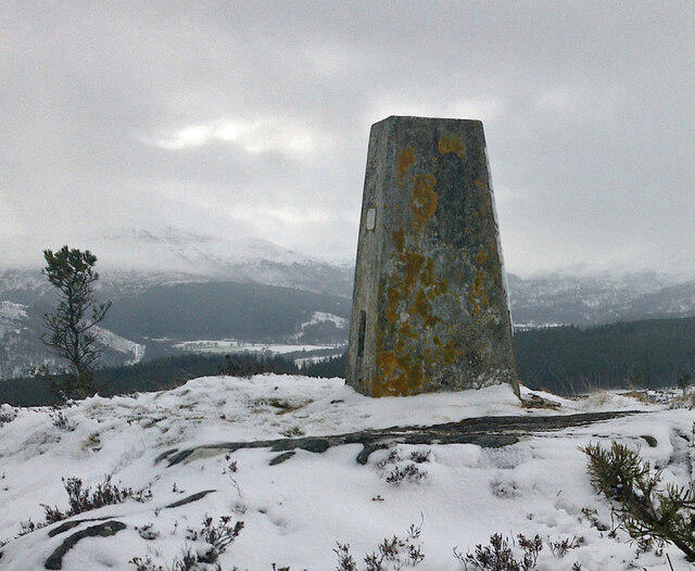 Photo could not load
NH4441 : Bad A Chlamhain Trig Point Flush Bracket S7522
thejackrustles
Hill facts and local notes
Classifications
Elevation
306m
1,004 ft
Prominence
102m
Coordinates
57.4369, -4.5987
NH441414
OS Map
26
Explorer: 431
At the Summit
The summit boasts a stone cairn which, despite its sturdy appearance, seems to play hide and seek with the cloud cover! A fantastic panoramic view when visibility allows.
Terrain & Geology
The mountain is primarily composed of granitic gneiss, which forms some stunning crags and steep slopes. The weathering process leads to distinctive glacial features and fascinating rock formations that will make any geologist's heart skip a beat.
Views & Scenery
From the summit, you can enjoy views of the surrounding peaks, Loch Awe, and the distant Mull of Kintyre. Don't forget your camera!
History & Heritage
Name Origin
Bad a' Chlamhain translates roughly as 'the hill of the cloud'.
Historical Significance
The mountain has been a popular site for hillwalkers and has historical ties to local folklore, often featuring in stories told by locals.
Getting There & Facilities
Check current local access restrictions, parking rules and transport timetables before travelling. These notes do not confirm public access to the summit.
Parking
There is a parking area off the A82 road at NH416430, approximately 3 km from the start of the North Ridge Route. Beware of parking fines if not in designated areas.
Public Transport
Nearest train station is in Crianlarich, from where you can catch a bus or taxi to the A82. The bus service can be limited, so check the schedules.
Nearby Facilities
In Tyndrum, you'll find cafes, a post office, and public toilets. Bring cake—it's a hiker's fuel!
Safety Information
Known Hazards
- Sudden weather changes, slippery rocks, and occasional visibility issues. Always check the forecast before venturing out.
General Safety Tips
- Check weather conditions before setting out
- Carry appropriate clothing and equipment
- Let someone know your planned route
- Take a map, compass, and GPS device
- Carry emergency supplies: food, water, first aid kit, torch
Hills
Some common questions about the hills answered
Are there group walks up Bad a' Chlamhain?
Many walkers use Walkmates to join or organise walks with others. You can check for group walks around Bad a' Chlamhain through the maps
Are there other walkers around Bad a' Chlamhain?
Activity varies by location and time, but Walkmates lets you see whether others have shared walks or shown interest in this area. Find other people through the walking friends search walking friends for Bad a' Chlamhain search or of course create your own walk for Bad a' Chlamhain
Can I organise a walk to Bad a' Chlamhain?
Yes. If there aren’t any walks listed already, you can create a walk and make it available for others to join.
If you're signed up to Walkmates, you can create a walk to Bad a' Chlamhain.
How do I find a walk up this hill?
There are often multiple ways to walk this hill, depending on experience and route preference. Walkmates helps you explore walks and routes that others have shared.
Can I suggest a new route up Bad a' Chlamhain?
Yes. You can suggest or create routes to share with others. Walkmates focuses on the social side of walking, so routes are used to help people organise walks and explore areas together, rather than as detailed navigation tools or route libraries.
Other uses really appreciate knowledgeable walkers sharing their routes. Share your favourite route to Bad a' Chlamhain here
The is an error or something incorrect about this hill. How do I let you know?
We always strive to keep the information on Walkmates as accurate as possible. If you find an error, please let us know through the contact form and we'll aim to correct it as quickly as possible
Community Discussion
Comments
Location
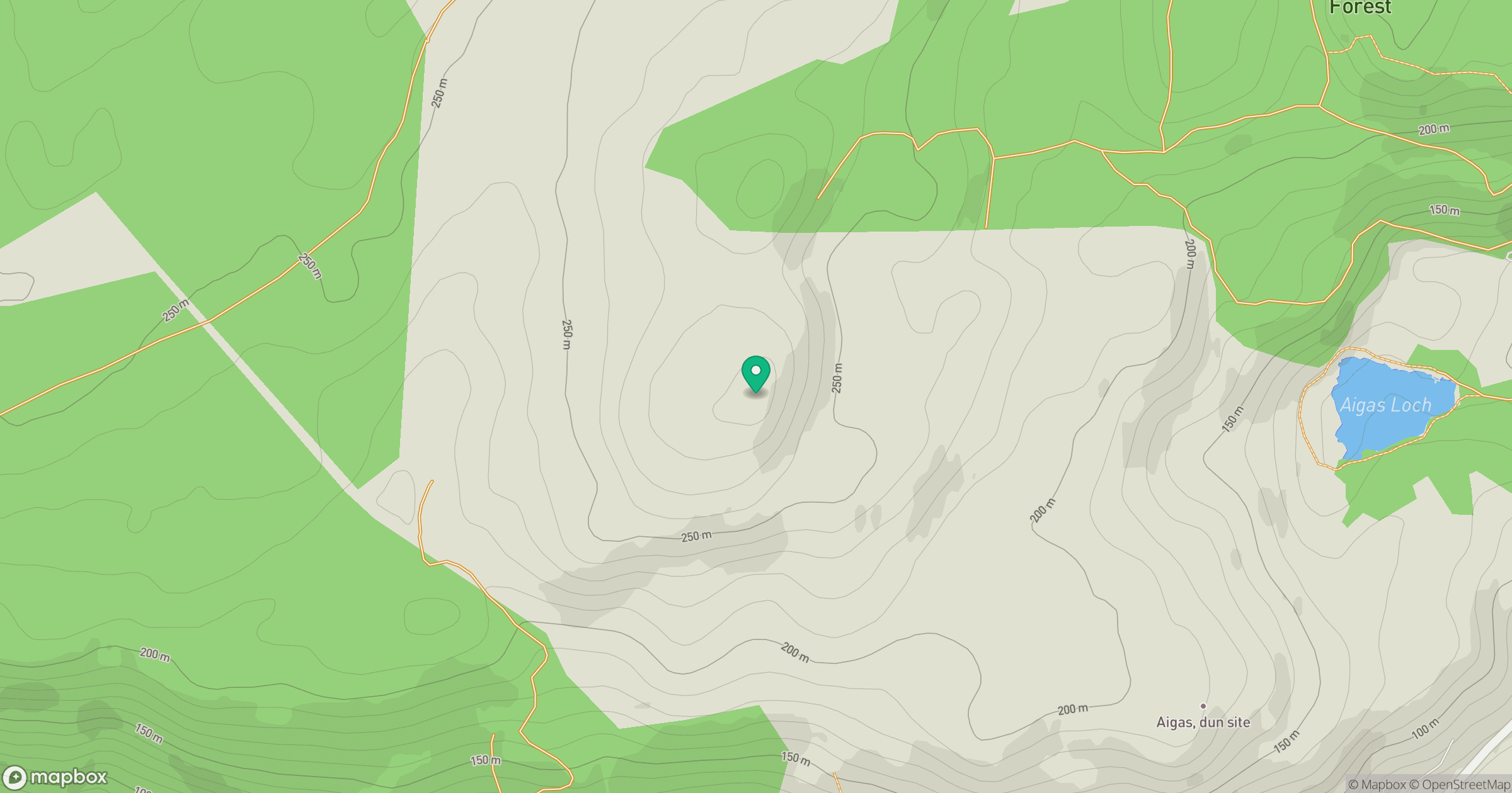
Grid reference: NH441414
View on OpenStreetMapOpens a map in a new tab, centred on the hill.
Hills within 30 km
Straight-line distance, not a walking route or confirmation of access.
Cul Mor
393m
Sgurr a' Choire Ghlais
1,084m
Meall Mor
407m
Carn na Gearraig
403m
Meall nan Caorach
426m
No comments yet. Be the first.