

Carn a' Choin Deirg
Good walks are even better shared.
NH3992 : Càrn a'Choin Dheirg
Richard Webb Photo source
Overview
Carn a' Choin Deirg
Overview
Carn a' Choin Deirg stands proudly at 735 meters above sea level, offering a rewarding hike that caters to those keen on experiencing Scotland's rugged beauty. Nestled in the heart of the Scottish Highlands, it forms part of a landscape that is steeped in history and geology.
Geology
The mountain is primarily composed of granite and schist, which gives the area its striking geological features. The diverse rock formations reveal a hidden history of intense geological activity and provide an excellent setting for geology enthusiasts to explore.
Routes
The most popular route is the Carn a' Choin Deirg Circular Route. At approximately 9.5 km, this moderate hike typically takes about 4.5 hours to complete. Be prepared to encounter some breathtaking scenery and enjoy the satisfaction of a circular route that returns you to your starting point, where a hot cup of tea awaits!
Terrain
The terrain varies, featuring grassy sections interspersed with rocky outcrops. Some areas can be boggy, especially in cooler months, so sturdy footwear is advised. Keep your sense of humour handy; you may need it when attempting to navigate around the squelchy spots!
Summit Features
At the summit, you'll be greeted by a significant cairn, an ideal landmark for taking in the stunning views and snapping that all-important summit selfie. Enjoy a well-earned snack while admiring the vista!
Views
From the summit, the views are absolutely stunning, with panoramic sights of the Cairngorms looming majestically in the distance. Optimal viewing seasons range from late spring to early autumn, when the skies are clearer and the days are longer. Winter transforms the landscape into a fairy-tale setting, but do come prepared!
Hazards
Like many mountains in Scotland, the weather can turn on a dime. Ensure you're equipped with proper hiking gear and check weather forecasts before setting out. Additionally, be cautious of the uneven terrain, particularly in boggy stretches, where a misstep might send you off on an unexpected detour.
Access
Accessing this gem is straightforward. The nearest parking is located at Inverey, with public transport options available, though they are somewhat limited. Braemar serves as the closest town and is well worth a visit. It offers a quaint escape with plenty of facilities.
Facilities
Once you've conquered Carn a' Choin Deirg, treat yourself to one of Braemar’s delightful cafes. Whether it’s a hearty meal or a piece of cake calling your name, you deserve a reward for your efforts!
History
The name 'Carn a' Choin Deirg' is as intriguing as the mountain itself, translating to 'Mound of the Red Dog'. The historical significance of this area stretches back centuries, with its connection to both local folklore and the natural beauty of Scotland.
In conclusion, Carn a' Choin Deirg is a must-visit for any hiking enthusiast or nature lover. With its rich history, geological intrigue, and breathtaking views, a trip here is sure to create lasting memories. Plus, who doesn’t want to say they’ve hiked a mountain with a name like that?
Explore routes near Carn a' Choin Deirg
Walks starting near this hill. Open a route to check its map, distance and full itinerary.
Loch Migdale from Torroy: Spinningdale pinewood and loch shore walk
View route
Ben Klibreck
View route
Beinn Eighe Lancaster Wreckage at Coire Mhic Fhearchair
View route
Fairy Lochs Liberator Wreckage Circuit
View route
Route planning notes
These notes describe possible approaches. Check a route's map and access information when planning your walk.
Carn a' Choin Deirg Circular Route
A scenic circular route that takes in the beauty of the surrounding moors and lochs, offering a real treat for the eyes and legs alike!
Make a day of it, together
Find someone to share the walk with, or organise a day out along a route you like.
Photo Gallery
View all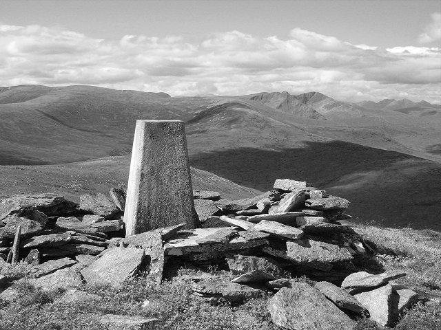 Photo could not load
NH3992 : Càrn a'Choin Dheirg
Richard Webb
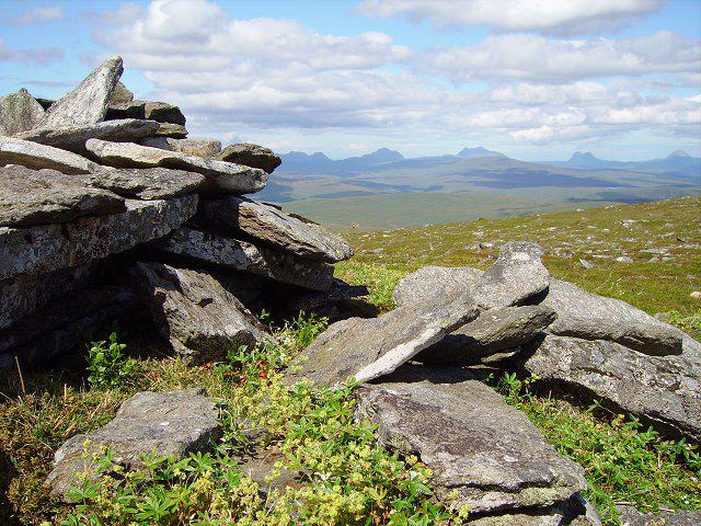 Photo could not load
NH3992 : Càrn a' Choin Dheirg
Richard Webb
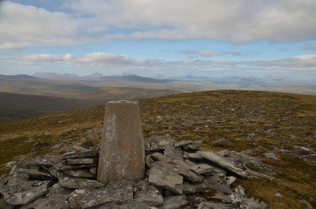 Photo could not load
NH3992 : Summit of Carn a' Chion Deirg, Scottish Highlands
Andrew Tryon
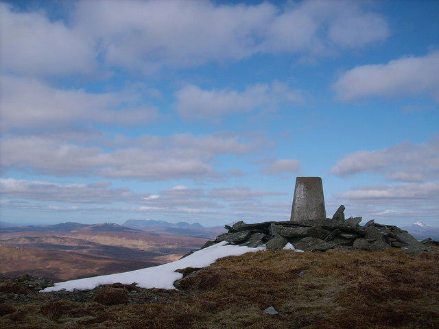 Photo could not load
NH3992 : Triangulation Pillar on Carn a' Choin Deirg
Stephen Middlemiss
Hill facts and local notes
Classifications
Elevation
701m
2,300 ft
Prominence
319m
Coordinates
57.8917, -4.7050
NH397923
OS Map
20
Explorer: 437N 440S
At the Summit
The summit is crowned by a substantial cairn which could serve as the perfect spot for a celebratory sandwich or two after your ascent.
Terrain & Geology
Primarily composed of granite and schist, giving it a rugged appearance and varied terrain. The area's geological history allows for insights into the tumultuous forces that shaped the Highlands over millennia.
Views & Scenery
Panoramic views of the surrounding Cairngorms, including distant peaks and shimmering lochs that stretch out like a well-set table with a view to be envied.
History & Heritage
Name Origin
The name 'Carn a' Choin Deirg' translates to 'Mound of the Red Dog', though one must wonder what the canine did to earn this distinction!
Historical Significance
This area has long been a retreat for those seeking both adventure and a glimpse into Scotland's cultural heritage, with nearby castles and the famous Highland Games.
Getting There & Facilities
Parking
Parking is available at Inverey, from where the trail begins. Arrive early to secure a spot, especially during summer weekends.
Public Transport
Public transport options are limited, but the nearest bus service runs from Braemar to the local area. Check the schedules and prepare for a bit of a walk.
Nearby Facilities
Braemar has a selection of cafes and toilets, making it a suitable place to fuel up before your hike or celebrate afterward with some cake.
Safety Information
Known Hazards
- Weather can change rapidly, so be prepared with appropriate gear. The terrain may be uneven, and boggy sections can be quite deceptive.
General Safety Tips
- Check weather conditions before setting out
- Carry appropriate clothing and equipment
- Let someone know your planned route
- Take a map, compass, and GPS device
- Carry emergency supplies: food, water, first aid kit, torch
Hills
Some common questions about the hills answered
Are there group walks up Carn a' Choin Deirg?
Many walkers use Walkmates to join or organise walks with others. You can check for group walks around Carn a' Choin Deirg through the maps
Are there other walkers around Carn a' Choin Deirg?
Activity varies by location and time, but Walkmates lets you see whether others have shared walks or shown interest in this area. Find other people through the walking friends search walking friends for Carn a' Choin Deirg search or of course create your own walk for Carn a' Choin Deirg
Can I organise a walk to Carn a' Choin Deirg?
Yes. If there aren’t any walks listed already, you can create a walk and make it available for others to join.
If you're signed up to Walkmates, you can create a walk to Carn a' Choin Deirg.
How do I find a walk up this hill?
There are often multiple ways to walk this hill, depending on experience and route preference. Walkmates helps you explore walks and routes that others have shared.
Can I suggest a new route up Carn a' Choin Deirg?
Yes. You can suggest or create routes to share with others. Walkmates focuses on the social side of walking, so routes are used to help people organise walks and explore areas together, rather than as detailed navigation tools or route libraries.
Other uses really appreciate knowledgeable walkers sharing their routes. Share your favourite route to Carn a' Choin Deirg here
The is an error or something incorrect about this hill. How do I let you know?
We always strive to keep the information on Walkmates as accurate as possible. If you find an error, please let us know through the contact form and we'll aim to correct it as quickly as possible
Community Discussion
Comments
Location
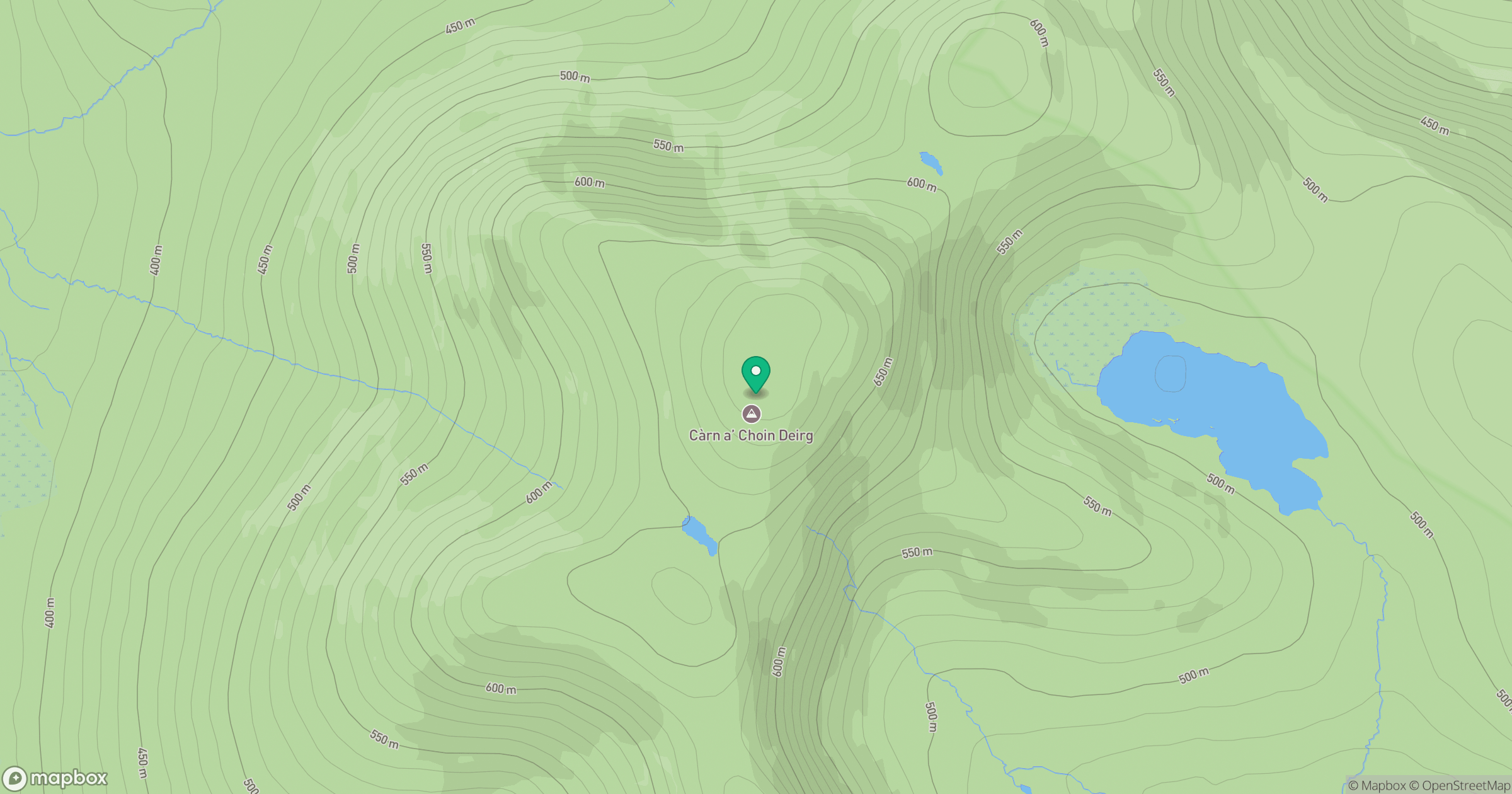
Grid reference: NH397923
View on OpenStreetMapOpens a map in a new tab, centred on the hill.
No comments yet. Be the first.