
An Grianan
Good walks are even better shared.
Overview
An Grianan: A Gem in the Highlands
Introduction
An Grianan, sitting at 1005 meters, is a Marilyn that's not just notable for its elevation, but also for its breathtaking views and approachable routes. If you're on a quest for a solid hike without needing to scale the heights of Ben Nevis, look no further!
Geology
An Grianan's granite essence offers a window into the earth’s distant past. Formed millions of years ago, the rock tells stories of ancient climates and landscapes shaped by glacial action. Nothing quite like a bit of geology to impress your friends on the trail!
Hiking Routes
The most popular route starts from the A832, covering 6.5 km round trip. Expect a moderate hike – suitable for families and those looking to stretch their legs without too much puffing and panting. Along the way, soak in the sights and sounds of Highland moorland – it might just convince you to give up that treadmill membership!
Summit Features
Once you reach the summit, you'll find a sizeable cairn awaiting your arrival. A perfect backdrop for those Instagram snaps, or just to indulge in that age-old tradition of mountain-top posing.
Terrain
The mix of grassy slopes and rocky outcrops can make for a delightful wander. Just watch out for the odd boggy patch that might try to pull you in – it's the Highlands' version of a welcoming hug, albeit a muddy one!
Scenic Views
Prepare to be awe-inspired! From the summit, the panoramic views are nothing short of spectacular. Bask in the glory of peaks in every direction, including the majestic Ben More to the south. If you're lucky, the weather might even grant you a glimpse of the Isle of Arran.
Hazards
Be mindful of unpredictable weather – Highland conditions can change faster than you can say 'Where's my jacket?' And those bogs, they can be a slippery slope to a muddy bottom!
Explore routes near An Grianan
Walks starting near this hill. Open a route to check its map, distance and full itinerary.
Ben Nevis via Mountain Path
View route
Banavie to Glen Loy Aqueduct: Neptune’s Staircase Canal Towpath
View route
Beinn Ime from Succoth
View route
The Cobbler from Succoth Carpark
View route
Route planning notes
These notes describe possible approaches. Check a route's map and access information when planning your walk.
Start from the A832
A straightforward path leading up from the A832, suitable for all levels of hikers. The ascent takes you through scenic moorland, providing a great introduction to the Highland landscape.
Make a day of it, together
Find someone to share the walk with, or organise a day out along a route you like.
Hill facts and local notes
Classifications
Elevation
549m
1,801 ft
Prominence
179m
Coordinates
56.5828, -5.1358
NN075478
OS Map
50
Explorer: 384
At the Summit
The summit features a prominent cairn, a fantastic photo op, and expansive views across the Highlands. At times, you might be lucky enough to spot local wildlife.
Terrain & Geology
An Grianan is primarily composed of granite, typical of the North West Highlands, which has been shaped by glacial activity. The ancient rocks reveal a fascinating geological history.
Views & Scenery
Stunning panoramic views of the surrounding mountains, including the peaks of the Cowal Peninsula. On a clear day, you might even glimpse the distant Isle of Arran.
History & Heritage
Name Origin
The name 'An Grianan' translates to 'The Sunny Place' in Gaelic, a fitting title for a spot that dazzles under the right light.
Historical Significance
This mountain has cultural importance, with nearby ancient ruins hinting at the historic lifestyle of the Highland clans.
Getting There & Facilities
Parking
Parking is available at the layby on the A832, approximately 400 meters from the start of the trail.
Public Transport
Buses run from nearby towns to the A832, but services may be limited. Best check the timetable before you set off.
Nearby Facilities
There are no facilities at the summit, but Mallaig has cafes, shops, and public toilets. Pack your provisions!
Safety Information
Known Hazards
- Watch out for sudden weather changes, which can lead to less-than-ideal conditions in a jiffy. Boggy ground can also be tricky, so keep your footing in check.
General Safety Tips
- Check weather conditions before setting out
- Carry appropriate clothing and equipment
- Let someone know your planned route
- Take a map, compass, and GPS device
- Carry emergency supplies: food, water, first aid kit, torch
Hills
Some common questions about the hills answered
Are there group walks up An Grianan?
Many walkers use Walkmates to join or organise walks with others. You can check for group walks around An Grianan through the maps
Are there other walkers around An Grianan?
Activity varies by location and time, but Walkmates lets you see whether others have shared walks or shown interest in this area. Find other people through the walking friends search walking friends for An Grianan search or of course create your own walk for An Grianan
Can I organise a walk to An Grianan?
Yes. If there aren’t any walks listed already, you can create a walk and make it available for others to join.
If you're signed up to Walkmates, you can create a walk to An Grianan.
How do I find a walk up this hill?
There are often multiple ways to walk this hill, depending on experience and route preference. Walkmates helps you explore walks and routes that others have shared.
Can I suggest a new route up An Grianan?
Yes. You can suggest or create routes to share with others. Walkmates focuses on the social side of walking, so routes are used to help people organise walks and explore areas together, rather than as detailed navigation tools or route libraries.
Other uses really appreciate knowledgeable walkers sharing their routes. Share your favourite route to An Grianan here
The is an error or something incorrect about this hill. How do I let you know?
We always strive to keep the information on Walkmates as accurate as possible. If you find an error, please let us know through the contact form and we'll aim to correct it as quickly as possible
Community Discussion
Comments
Location
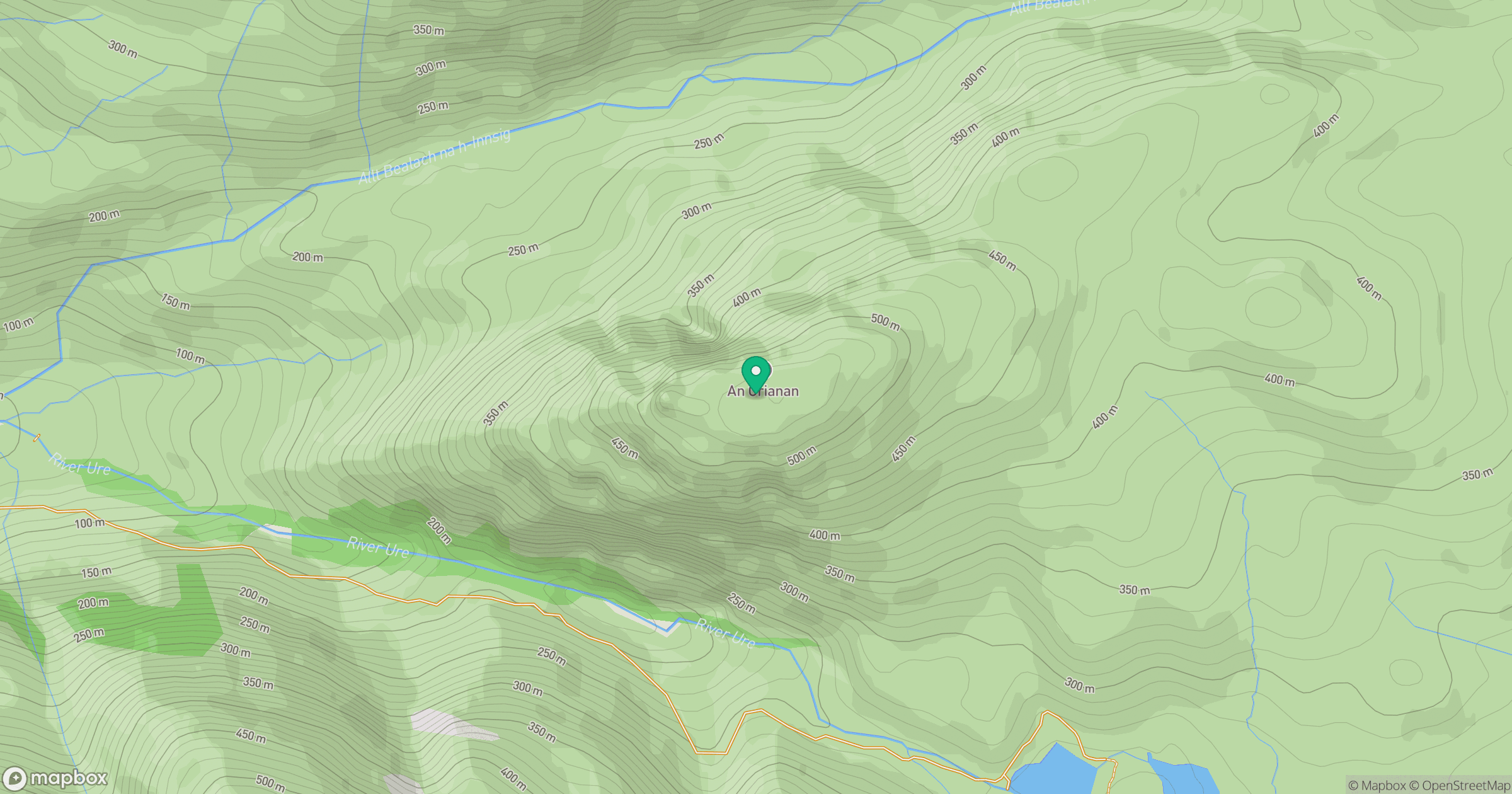
Grid reference: NN075478
View on OpenStreetMapOpens a map in a new tab, centred on the hill.
Nearby Hills
Sgurr na h-Ulaidh [Sgor na h-Ulaidh]
994m
Beinn a' Bheithir - Sgorr Dhearg
1,024m
Beinn a' Bheithir - Sgorr Dhonuill
1,002m
Ben Starav
1,080m
Bidean nam Bian
1,149m
No comments yet. Be the first.