
Am Bodach
Good walks are even better shared.
Overview
Am Bodach: A Hiker's Delight
Introduction
Nestled in the heart of the Scottish Highlands, Am Bodach stands tall at 843 metres (2,766 feet) and beckons adventurers with its rugged charm and breathtaking vistas. Whether you're an experienced Munro-bagger or a curious first-timer, this mountain offers a captivating experience that won't break the bank.
Geology
Am Bodach is a geological wonder formed from ancient volcanic activity. The basalt rock, coupled with its distinct topography, presents an interesting study for geology enthusiasts and provides a dramatic backdrop for your ascent.
Routes
Two popular hiking routes guide trekkers to the summit:
- North Face Route: This challenging path begins in Kinlochleven and scales the rugged north face, delivering awe-inspiring views along the way. Be prepared for an invigorating climb, motivational snacks recommended!
- East Ridge Route: This moderable trail starts at the Blackwater Reservoir. It's scenic and slightly less taxing on both spirit and legs, making it a preferred choice for families.
Summit Features
Upon reaching the summit, you'll be greeted by a well-built cairn—perfect for photo ops! The panoramic views will leave you breathless and possibly reconsidering your lunch choice.
Terrain and Views
Expect rocky terrain dotted with heather and patches of lush grass. The summit treats you with magnificent sights of the Glencoe mountains and Loch Leven, making every step worthwhile. The photo ops are simply incredible!
Hazards
The Scottish weather loves to play tricks, so be prepared for sudden changes. Wet rocks can be slippery, so tread carefully—no one wants a tumble!
Access
Kinlochleven, charming as ever, is your gateway to Am Bodach. Limited parking is available, and public transport from Fort William is frequent—we recommend a bus ride to enjoy the Highlands soberly!
Facilities
After your descent, rehydrate and refuel at the local cafe in Kinlochleven. Don’t forget to stop by the public toilets before your adventure continues!
History
The name Am Bodach, meaning 'The Old Man', evokes tales from the Gaelic folk tradition. A perfect moniker for a mountain steeped in Highland tales.
Conclusion
So there you have it, Am Bodach—a mountain that's as welcoming as it is majestic. Don your walking boots, pack your sense of adventure, and get ready for a hike of a lifetime!
Happy hiking!
Explore routes near Am Bodach
Walks starting near this hill. Open a route to check its map, distance and full itinerary.
Ben Nevis via Mountain Path
View route
Banavie to Glen Loy Aqueduct: Neptune’s Staircase Canal Towpath
View route
Fort Augustus to Kytra Lock: Caledonian Canal Towpath
View route
Killin: Falls of Dochart, Finlarig and Moirlanich Longhouse
View route
Route planning notes
These notes describe possible approaches. Check a route's map and access information when planning your walk.
North Face Route
This route begins in the village of Kinlochleven and takes you up the less-travelled north face, offering stunning views and a more adventurous ascent.
East Ridge Route
Starting from the Blackwater Reservoir, this route gently winds up through scenic moorland before tackling the steep ridge towards the summit.
Make a day of it, together
Find someone to share the walk with, or organise a day out along a route you like.
Hill facts and local notes
Classifications
Elevation
1,032m
3,385 ft
Prominence
153m
Coordinates
56.7417, -4.9834
NN176650
OS Map
41
Explorer: 392
At the Summit
The summit features a prominent cairn, beautifully constructed and a true testament to the mountain's climbing history. Besides, the views will have you thinking you've reached the edge of the world!
Terrain & Geology
Am Bodach primarily consists of ancient volcanic rock known as basalt, which dates back to the Tertiary period. Its rugged cliffs are a testament to the dramatic geological processes that shaped the Scottish landscape.
Views & Scenery
From the summit, you'll be treated to panoramic views of the surrounding Glencoe mountains, Ben Nevis, and Loch Leven. Spotting the faint outline of the Isle of Mull on a clear day is a hidden gem.
History & Heritage
Name Origin
The name 'Am Bodach' translates to 'The Old Man' in Scots Gaelic, adding a touch of folklore to your hike.
Historical Significance
The mountain has a rich cultural significance in local folklore, often referenced in tales of Highland spirits and ancient clans.
Getting There & Facilities
Parking
There is limited roadside parking near the start of the North Face route in Kinlochleven. Please park responsibly to avoid obstructing local access.
Public Transport
Regular buses run from Fort William to Kinlochleven; check the local timetable for updates.
Nearby Facilities
There is a small cafe in Kinlochleven for pre- or post-hike refreshments, and public toilets are available near the village.
Safety Information
Known Hazards
- Rock slips in wet weather can be treacherous, and fog can appear without warning. Ensure you are well-prepared and equipped for sudden changes in weather.
General Safety Tips
- Check weather conditions before setting out
- Carry appropriate clothing and equipment
- Let someone know your planned route
- Take a map, compass, and GPS device
- Carry emergency supplies: food, water, first aid kit, torch
Hills
Some common questions about the hills answered
Are there group walks up Am Bodach?
Many walkers use Walkmates to join or organise walks with others. You can check for group walks around Am Bodach through the maps
Are there other walkers around Am Bodach?
Activity varies by location and time, but Walkmates lets you see whether others have shared walks or shown interest in this area. Find other people through the walking friends search walking friends for Am Bodach search or of course create your own walk for Am Bodach
Can I organise a walk to Am Bodach?
Yes. If there aren’t any walks listed already, you can create a walk and make it available for others to join.
If you're signed up to Walkmates, you can create a walk to Am Bodach.
How do I find a walk up this hill?
There are often multiple ways to walk this hill, depending on experience and route preference. Walkmates helps you explore walks and routes that others have shared.
Can I suggest a new route up Am Bodach?
Yes. You can suggest or create routes to share with others. Walkmates focuses on the social side of walking, so routes are used to help people organise walks and explore areas together, rather than as detailed navigation tools or route libraries.
Other uses really appreciate knowledgeable walkers sharing their routes. Share your favourite route to Am Bodach here
The is an error or something incorrect about this hill. How do I let you know?
We always strive to keep the information on Walkmates as accurate as possible. If you find an error, please let us know through the contact form and we'll aim to correct it as quickly as possible
Community Discussion
Comments
Location
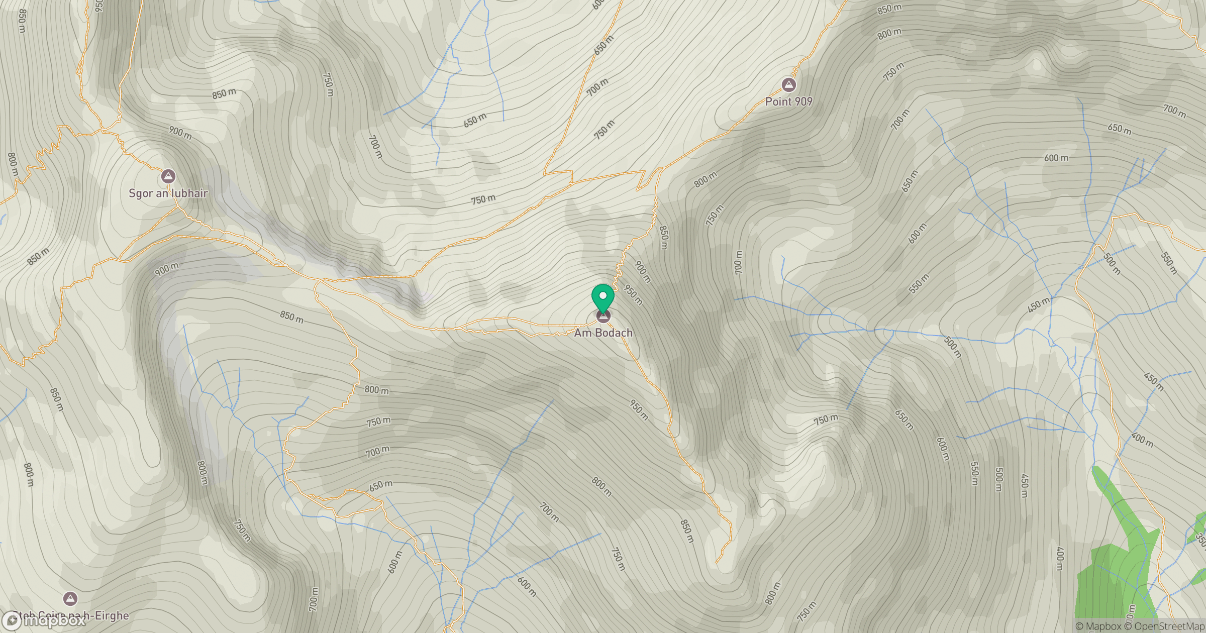
Grid reference: NN176650
View on OpenStreetMapOpens a map in a new tab, centred on the hill.
![Ben Nevis [Beinn Nibheis]](https://cdn.walkmates.com/gallery-images/44e34d25abc849e78f7b99a97863fffb.jpg)
No comments yet. Be the first.