
Am Bodach
Good walks are even better shared.
Overview
Am Bodach
Overview
Am Bodach, rising majestically to 942 meters, is one of the lesser-known Munros, located in the stunning Scottish Highlands. With a prominence of 37 meters, it might not be the tallest player on the block, but this mountain surely knows how to wear a crown.
Geology
This mountain is primarily composed of granite, lending itself to a rugged and dramatic landscape. The region showcases geological diversity, from granite outcrops to ancient schist rocks, making it a geologist's playground or a hiker's rocky wonderland.
Routes
The most common route begins in Glen Nevis, a favourite among locals and visitors alike. This route stretches approximately 10.5 km and typically takes around 4.5 hours to complete, depending on your pace and how many times you stop to take photos of the scenery (which, let's face it, will be often).
Summit Features
As you reach the top, you'll be greeted by a large stone cairn. It's a perfect spot for a selfie with a backdrop of sprawling landscapes. And if you squint hard enough, you might just see Ben Nevis giving a cheeky wave.
Terrain
Expect rocky paths interspersed with patches of grass and the occasional bog. It’s advisable to wear sturdy hiking boots, unless you fancy an impromptu swim!
Views
The views from the summit are astounding, offering panoramic vistas of Ben Nevis and the surrounding Mamores. The best times to soak it all in are during late spring to early autumn; trust us, it’s much prettier without a snowstorm in your face!
Hazards
The weather in the Highlands is notoriously fickle. Be prepared for anything and everything, and double-check the forecast before heading out.
Nearby Summits
Just a pebble's throw away is Stob Ban, standing proud at 999 meters, waiting for your next adventure.
Access
Nearest Parking
The Glen Nevis car park is your best bet, with plenty of space but can fill up fast during peak seasons.
Public Transport
Buses run regularly from Fort William to Glen Nevis, making life easier for those not in a four-wheeled chariot.
Nearest Town
Fort William is your closest town, with all the amenities you could need after a long hike.
Facilities
Cafes, shops, and public toilets can all be found in Fort William. Don’t forget to stock up on flapjacks!
History
Name Meaning
Am Bodach translates to 'The Old Man'—a fitting name that evokes a sense of ancient wisdom from the mountain itself.
Significance
Tales from folklore often weave their way through the landscape, with stories passed down that add depth to your hiking experience.
So, strap on those boots and get ready to tackle Am Bodach; there’s a memory waiting to be made at the top!
Explore routes near Am Bodach
Walks starting near this hill. Open a route to check its map, distance and full itinerary.
Ben Nevis via Mountain Path
View route
Banavie to Glen Loy Aqueduct: Neptune’s Staircase Canal Towpath
View route
Killin: Falls of Dochart, Finlarig and Moirlanich Longhouse
View route
Beinn Ime from Succoth
View route
Route planning notes
These notes describe possible approaches. Check a route's map and access information when planning your walk.
via Glen Nevis
This popular route begins in Glen Nevis and offers a scenic climb with breathtaking views of the valley.
Make a day of it, together
Find someone to share the walk with, or organise a day out along a route you like.
Hill facts and local notes
Classifications
Elevation
942m
3,090 ft
Prominence
74m
Coordinates
56.6779, -4.9915
NN168580
OS Map
41
Explorer: 384
At the Summit
The summit features a large stone cairn and offers a spectacular panoramic view of the surrounding peaks.
Terrain & Geology
The mountain is primarily composed of granite, which provides stunning rugged terrain. The surrounding area features ancient schist rocks, contributing to the geological diversity of the region.
Views & Scenery
From the summit, you can see Ben Nevis, the highest mountain in the UK, and the stunning landscapes of Glen Nevis and the Mamores.
History & Heritage
Name Origin
The name 'Am Bodach' translates to 'The Old Man', which is fitting for the mountain's imposing stature atop the landscape.
Historical Significance
The area holds historical significance with ancient paths and stories from local folklore, often shared around the fire after a long day on the mountain.
Getting There & Facilities
Parking
There's ample parking available in the Glen Nevis car park, which is well-signposted from Fort William.
Public Transport
Regular bus services operate between Fort William and Glen Nevis, making it accessible for those relying on public transport.
Nearby Facilities
Fort William has numerous facilities, including cafes, shops, and public toilets, ensuring you're well-prepared for your adventure.
Safety Information
Known Hazards
- Watch out for sudden weather changes in the Highlands – it can be bright sunshine one minute and a torrential downpour the next.
General Safety Tips
- Check weather conditions before setting out
- Carry appropriate clothing and equipment
- Let someone know your planned route
- Take a map, compass, and GPS device
- Carry emergency supplies: food, water, first aid kit, torch
Hills
Some common questions about the hills answered
Are there group walks up Am Bodach?
Many walkers use Walkmates to join or organise walks with others. You can check for group walks around Am Bodach through the maps
Are there other walkers around Am Bodach?
Activity varies by location and time, but Walkmates lets you see whether others have shared walks or shown interest in this area. Find other people through the walking friends search walking friends for Am Bodach search or of course create your own walk for Am Bodach
Can I organise a walk to Am Bodach?
Yes. If there aren’t any walks listed already, you can create a walk and make it available for others to join.
If you're signed up to Walkmates, you can create a walk to Am Bodach.
How do I find a walk up this hill?
There are often multiple ways to walk this hill, depending on experience and route preference. Walkmates helps you explore walks and routes that others have shared.
Can I suggest a new route up Am Bodach?
Yes. You can suggest or create routes to share with others. Walkmates focuses on the social side of walking, so routes are used to help people organise walks and explore areas together, rather than as detailed navigation tools or route libraries.
Other uses really appreciate knowledgeable walkers sharing their routes. Share your favourite route to Am Bodach here
The is an error or something incorrect about this hill. How do I let you know?
We always strive to keep the information on Walkmates as accurate as possible. If you find an error, please let us know through the contact form and we'll aim to correct it as quickly as possible
Community Discussion
Comments
Location
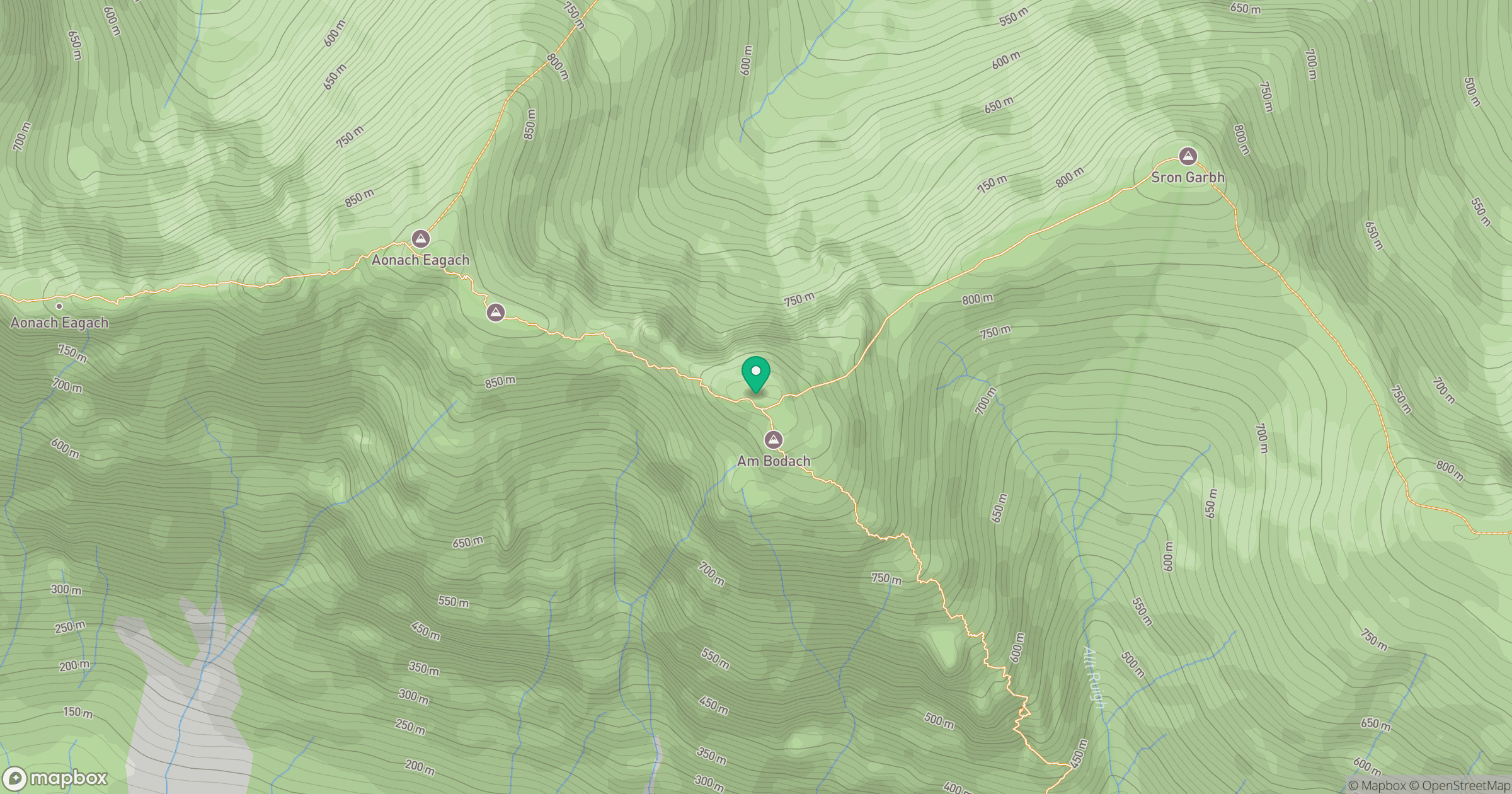
Grid reference: NN168580
View on OpenStreetMapOpens a map in a new tab, centred on the hill.
No comments yet. Be the first.