
A' Bhuidheanach
Good walks are even better shared.
Overview
A' Bhuidheanach: The Yellow Hill of the Highlands
Nestled in the heart of the Scottish Highlands, A' Bhuidheanach towers at an impressive 883 meters. A Munro by stature, this mountain isn’t just a stunning backdrop in photographs; it offers hikers a great day out with a dash of adventure.
Geology
Among the ancient rocks, A' Bhuidheanach stands proud, formed mainly of schist and granite, with its landscape sculpted by glacial activity. Watch out for the shimmering streams that run down its slopes, a contrast to the rugged terrain!
Routes
The most popular route is the Cairn Gorm to A' Bhuidheanach trail. It spans about 10.5 km and takes approximately 3.5 hours to conquer. The beauty of this route is in the panoramic views, where the vibrancy of heather adds colour to your trekking experience. While it’s a moderate hike that rises gently, one should have a sturdy pair of boots at the ready—soggy socks are not a highlight of any hike!
Summit Features
When you finally reach the summit, you'll be greeted by a grand stone cairn—a perfect spot to catch your breath (and maybe a snack!) while soaking in the views.
Terrain Type
The terrain varies widely, with grassy stretches complemented by rocky outcrops. Just remember, not all 'heather' is good for your socks; watch out for those hidden bogs!
Views
From the top, you’ll witness an extraordinary vista of the Cairngorms, along with striking views of Loch Ness. The best time to visit is during late spring or early autumn, where the landscapes flourish in colour and clarity.
Hazards
Like all good tales, there's a plot twist. Weather conditions can change with little warning, so it’s wise to be prepared with layers. Also, footing can be tricky, particularly when the rocks are slick from rain, so always check the forecast before heading out.
Nearby Summits
If you’re feeling adventurous, nearby Carn na Caim proudly rises to 1042 meters, beckoning those willing to extend their journey beyond A' Bhuidheanach.
Access
Getting there is straightforward. The nearest parking can be found at the Cairn Gorm Ski Centre, NH977073, a handy location for both avid skiers in winter and hikers in the warmer months. If you prefer public transport, Aviemore has regular bus services that connect directly to the ski centre.
Facilities
Take advantage of the facilities at the Cairn Gorm Ski Centre—cozy café, a visitor centre, and toilet facilities are all within reach, turning your adventure into a full-day expedition.
History
Etymology: The name 'A' Bhuidheanach' translates to 'the yellow hill,' possibly inspired by the vibrant flora that blankets the lower slopes during certain seasons.
Cultural Significance: The mountain has a rich history, serving as a strategic point during clan disputes of yore, and continues to inspire local tales and legends.
So lace up those boots, pack your waterproofs, and prepare for a day filled with breathtaking views and exhilarating adventure on A' Bhuidheanach!
Happy hiking!
Explore routes near A' Bhuidheanach
Walks starting near this hill. Open a route to check its map, distance and full itinerary.
Coire Ardair lochan from Aberarder and back
View route
Glen Banvie Trail with the Bruar viewpoint
View route
Kenmore: Drummond Hill Black Rock Trail above Loch Tay
View route
Aberfeldy: Glassie Woodland and River Tay Circular
View route
Route planning notes
These notes describe possible approaches. Check a route's map and access information when planning your walk.
Cairn Gorm to A' Bhuidheanach
A scenic route starting from Cairn Gorm that weaves through heather and offers remarkable views.
Make a day of it, together
Find someone to share the walk with, or organise a day out along a route you like.
Hill facts and local notes
Classifications
Elevation
881m
2,891 ft
Prominence
23m
Coordinates
56.8889, -4.2080
NN655796
OS Map
42
Explorer: OL51W 394W
At the Summit
The summit features a large stone cairn, which is a favourite spot for hikers to pause for photos and admiring the surrounding views.
Terrain & Geology
Primarily composed of schist and granite, A' Bhuidheanach exhibits classic Highland geological features with evidence of glacial erosion and unique rock formations that make the landscape breathtaking.
Views & Scenery
On a clear day, one can see the majestic Cairngorms, Loch Ness, and the rolling hills of the Highlands.
History & Heritage
Name Origin
The name 'A' Bhuidheanach' translates roughly to 'the yellow hill,' hinting at the flora that adorns its slopes.
Historical Significance
The mountain holds historical significance as a strategic landscape during past clan conflicts, and it's a popular subject of local folklore.
Getting There & Facilities
Parking
Cairn Gorm Ski Centre, NH977073, with ample parking space and facilities.
Public Transport
Regular bus services operate from Aviemore to the ski centre, making it accessible without a car.
Nearby Facilities
Cairn Gorm Ski Centre has a café, visitor centre, and toilet facilities, perfect for a pre- or post-hike coffee break.
Safety Information
Known Hazards
- Sudden weather changes, potential for slippery rocks, and challenging terrain in foggy conditions.
General Safety Tips
- Check weather conditions before setting out
- Carry appropriate clothing and equipment
- Let someone know your planned route
- Take a map, compass, and GPS device
- Carry emergency supplies: food, water, first aid kit, torch
Hills
Some common questions about the hills answered
Are there group walks up A' Bhuidheanach?
Many walkers use Walkmates to join or organise walks with others. You can check for group walks around A' Bhuidheanach through the maps
Are there other walkers around A' Bhuidheanach?
Activity varies by location and time, but Walkmates lets you see whether others have shared walks or shown interest in this area. Find other people through the walking friends search walking friends for A' Bhuidheanach search or of course create your own walk for A' Bhuidheanach
Can I organise a walk to A' Bhuidheanach?
Yes. If there aren’t any walks listed already, you can create a walk and make it available for others to join.
If you're signed up to Walkmates, you can create a walk to A' Bhuidheanach.
How do I find a walk up this hill?
There are often multiple ways to walk this hill, depending on experience and route preference. Walkmates helps you explore walks and routes that others have shared.
Can I suggest a new route up A' Bhuidheanach?
Yes. You can suggest or create routes to share with others. Walkmates focuses on the social side of walking, so routes are used to help people organise walks and explore areas together, rather than as detailed navigation tools or route libraries.
Other uses really appreciate knowledgeable walkers sharing their routes. Share your favourite route to A' Bhuidheanach here
The is an error or something incorrect about this hill. How do I let you know?
We always strive to keep the information on Walkmates as accurate as possible. If you find an error, please let us know through the contact form and we'll aim to correct it as quickly as possible
Community Discussion
Comments
Location
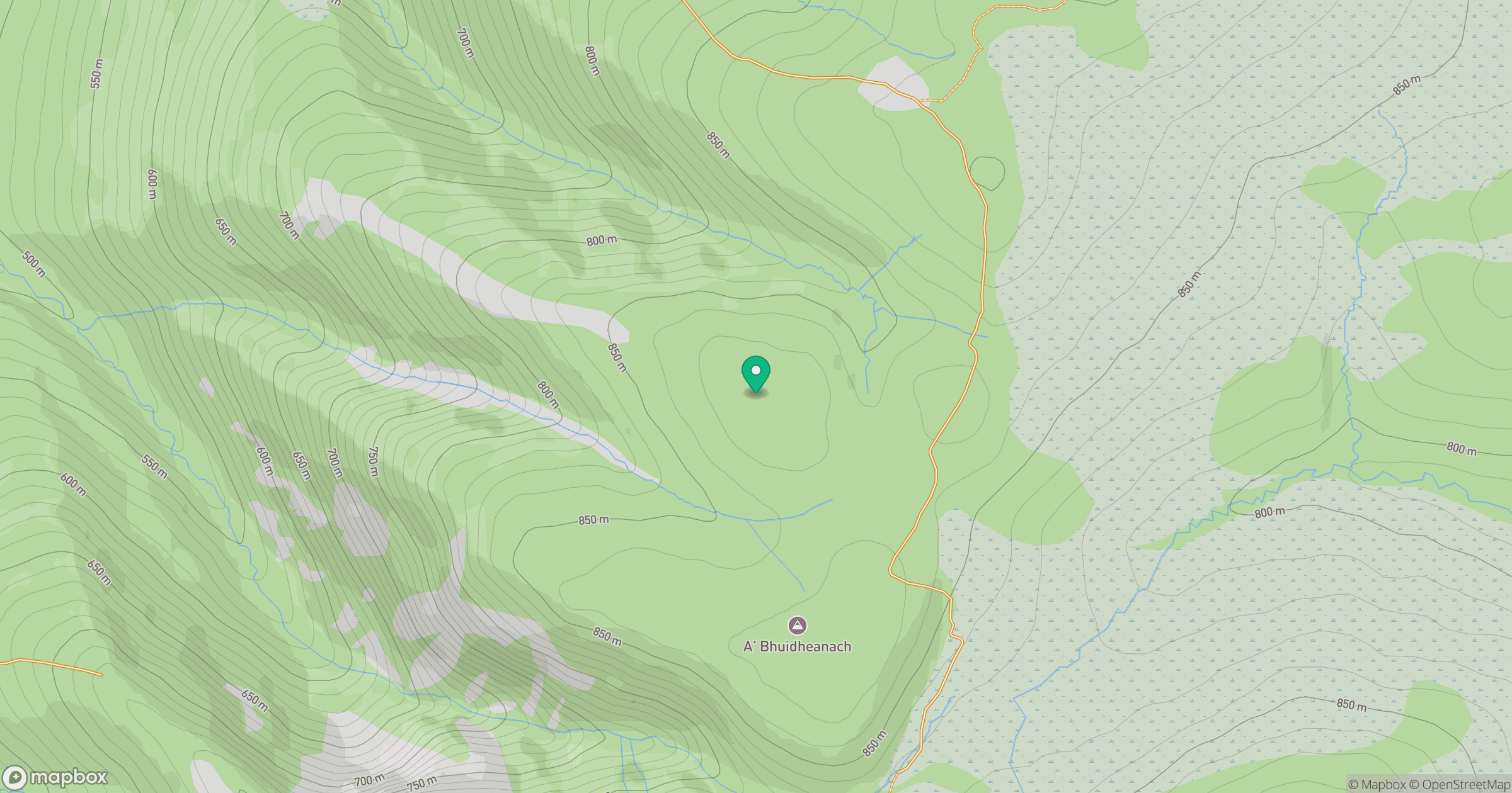
Grid reference: NN655796
View on OpenStreetMapOpens a map in a new tab, centred on the hill.
No comments yet. Be the first.