

Winterscleugh
Good walks are even better shared.
NY5702 : The summit of Winterscleugh
Michael Earnshaw Photo source
Overview
Winterscleugh: A Hidden Gem in the North Pennines
Nestled in the heart of the North Pennines, Winterscleugh may not be the highest peak, but it certainly has its own charm. Rising to an elevation of 578 meters, it promises adventurous hikers a rewarding experience without the hair-raising challenges of its taller neighbours.
Geology
The formation of Winterscleugh owes its character to the layers of sandstone and limestone that dominate the region. The sedimentary rocks tell a tale of ancient marine environments, with glacial deposits in the vicinity showcasing the mountain's Ice Age heritage.
Access and Parking
Getting to Winterscleugh is a breeze! Park your car in the friendly village of Alston, which serves as the hub for many hiking adventures in the area. There's a decent car park, and if you're feeling adventurous, you can even pop into one of the local cafes to fuel up before your trek!
Routes
For those eager to explore, the Winterscleugh Circular route is a favourite among locals. Covering around 9.5 kilometers, this moderate hike provides the perfect mix of uphill and downhill sections to keep the heart pumping. Expect to spend about 3.5 hours soaking in the splendid vistas!
Summit Features
As you reach the summit, you'll be greeted by a small but mighty cairn that has weathered many storms, standing as a testament to the many adventurers who've cherished this spot. The panoramic views are nothing short of spectacular, especially on a clear day when the peaks of the Lake District poke through the horizon like shy kids at a school dance.
Terrain
Hikers will encounter a delightful mix of grassy slopes and rocky outcrops, so sturdy footwear is a must. Be aware that after a rain, things can get a bit slippery, adding to the thrill of your adventure!
Seasonal Views
To enjoy the best views, the spring and summer months are ideal. However, if you fancy a touch of autumnal beauty, the shifting colours can provide a stunning backdrop against the rugged landscape.
Nearby Summits
If you feel like conquering more than just Winterscleugh, nearby peaks such as Cross Fell and Great Dun Fell await, each boasting their own unique challenges and breathtaking views.
Conclusion
Winterscleugh may not steal the spotlight in terms of elevation, but it sure knows how to charm hikers with its scenic beauty, fascinating geology, and a rich history that whispers tales of both nature's artistry and human endeavour. So lace up those hiking boots, don your explorer’s hat, and set forth on an adventure that promises delightful views and a slice of British history.
Last Updated
2023-10-01
Explore routes near Winterscleugh
Walks starting near this hill. Open a route to check its map, distance and full itinerary.
Sizergh: Park End Moss and Brigsteer Park Wood Circuit
View route
Striding Edge, Helvellyn and Catstye Cam
View route
Helvellyn via Striding Edge
View route
Tarn Hows Fast Route
View route
Route planning notes
These notes describe possible approaches. Check a route's map and access information when planning your walk.
Winterscleugh Circular
A popular circular route starting from the nearby village of Alston, offering a good mix of ascents and descents along well-marked trails.
Make a day of it, together
Find someone to share the walk with, or organise a day out along a route you like.
Photo Gallery
View all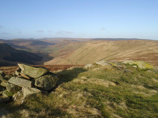 Photo could not load
NY5702 : The summit of Winterscleugh
Michael Earnshaw
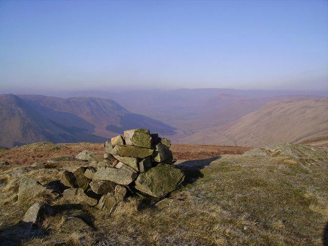 Photo could not load
NY5702 : Cairn, Winterscleugh
Michael Graham
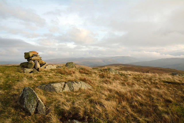 Photo could not load
NY5702 : Summit area of Winterscleugh
Trevor Littlewood
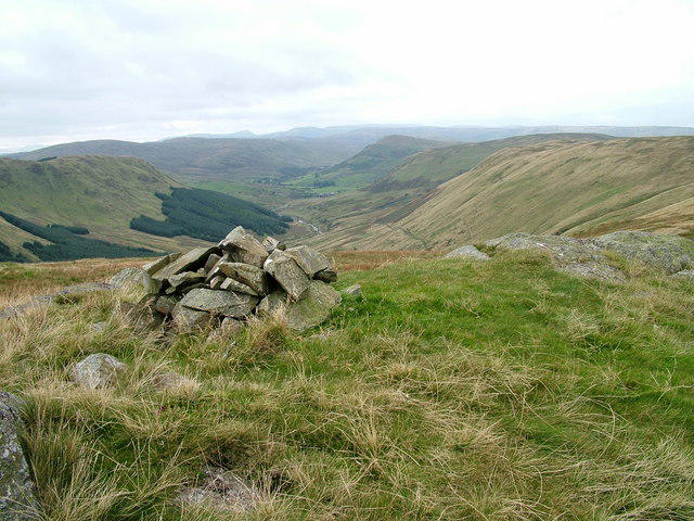 Photo could not load
NY5702 : Winterscleugh and Borrowdale
David Brown
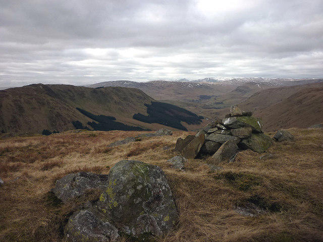 Photo could not load
NY5702 : The summit of Winterscleugh (464m)
Karl and Ali
Hill facts and local notes
Classifications
Elevation
464m
1,523 ft
Prominence
27m
Coordinates
54.4195, -2.6542
NY576028
OS Map
91
Explorer: OL7N
At the Summit
The summit is marked by a small, weathered cairn and offers panoramic views across the North Pennines.
Terrain & Geology
Primarily composed of sandstone and limestone with interesting sedimentary features. The surrounding area showcases glacial deposits, giving it a unique landscape shaped by the Ice Age.
Views & Scenery
Stunning views towards the North Pennines and the Eden Valley, along with a glimpse of the distant Lake District peaks on a clear day.
History & Heritage
Name Origin
The name 'Winterscleugh' is thought to derive from the Old Norse word 'sklu' meaning 'hill', combined with 'winter' reflecting its chilly conditions during colder months.
Historical Significance
The region is steeped in mining history, with remnants of lead mines visible along some trails.
Getting There & Facilities
Parking
There is ample parking available in the village of Alston, which is the starting point for most hikes.
Public Transport
Alston is accessible by bus from Carlisle and Penrith, with limited services, so check the timings.
Nearby Facilities
In Alston, you will find several cafes, a small supermarket, and public toilets to cater to your needs.
Safety Information
Known Hazards
- Potentially slippery terrain after rain; be wary of sudden weather changes typical of the region.
General Safety Tips
- Check weather conditions before setting out
- Carry appropriate clothing and equipment
- Let someone know your planned route
- Take a map, compass, and GPS device
- Carry emergency supplies: food, water, first aid kit, torch
Hills
Some common questions about the hills answered
Are there group walks up Winterscleugh?
Many walkers use Walkmates to join or organise walks with others. You can check for group walks around Winterscleugh through the maps
Are there other walkers around Winterscleugh?
Activity varies by location and time, but Walkmates lets you see whether others have shared walks or shown interest in this area. Find other people through the walking friends search walking friends for Winterscleugh search or of course create your own walk for Winterscleugh
Can I organise a walk to Winterscleugh?
Yes. If there aren’t any walks listed already, you can create a walk and make it available for others to join.
If you're signed up to Walkmates, you can create a walk to Winterscleugh.
How do I find a walk up this hill?
There are often multiple ways to walk this hill, depending on experience and route preference. Walkmates helps you explore walks and routes that others have shared.
Can I suggest a new route up Winterscleugh?
Yes. You can suggest or create routes to share with others. Walkmates focuses on the social side of walking, so routes are used to help people organise walks and explore areas together, rather than as detailed navigation tools or route libraries.
Other uses really appreciate knowledgeable walkers sharing their routes. Share your favourite route to Winterscleugh here
The is an error or something incorrect about this hill. How do I let you know?
We always strive to keep the information on Walkmates as accurate as possible. If you find an error, please let us know through the contact form and we'll aim to correct it as quickly as possible
Community Discussion
Comments
Location
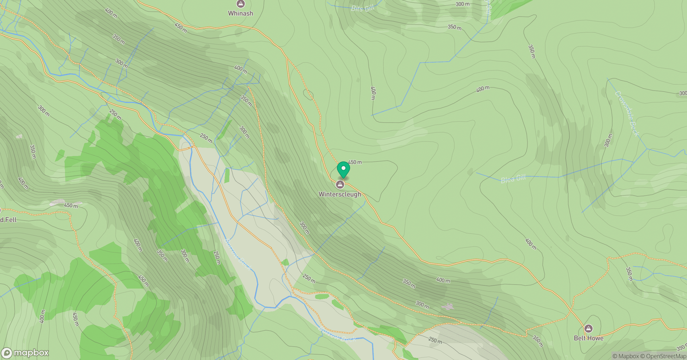
Grid reference: NY576028
View on OpenStreetMapOpens a map in a new tab, centred on the hill.


No comments yet. Be the first.