
Wether Hill
Good walks are even better shared.
Overview
Wether Hill
Wether Hill, standing proud at 609 meters, is a proud Marilyn nestled within the heart of the Lake District, offering stunning views and a delightful walk for all abilities.
Geology
The majestic formation of Wether Hill showcases the area’s volcanic origins, primarily consisting of tuff and andesite. These rocks not only shape the landscape but also tell the story of volcanic activity that shaped the region millions of years ago – geology lovers will find it a treasure trove of interest.
Routes
The Wether Hill Circular from Braithwaite is a delightful choice for hikers. Stretching roughly 8.5 km, this moderate hike promises stunning scenery without testing your limits. You’ll find yourself surrounded by lush greenery, rocky outcrops, and the occasional sheep looking confused by your presence!
Summit Features
On reaching the summit, you’re greeted by a sturdy stone cairn, a beacon for fellow hikers and a great spot to catch your breath (and a photo for Instagram). It's the kind of place that makes the journey worthwhile.
Terrain Type
Expect a mix of grassy paths with a few rocky sections, making it perfect for those seeking a mild adventure without the need for crampons or ninja skills.
Views
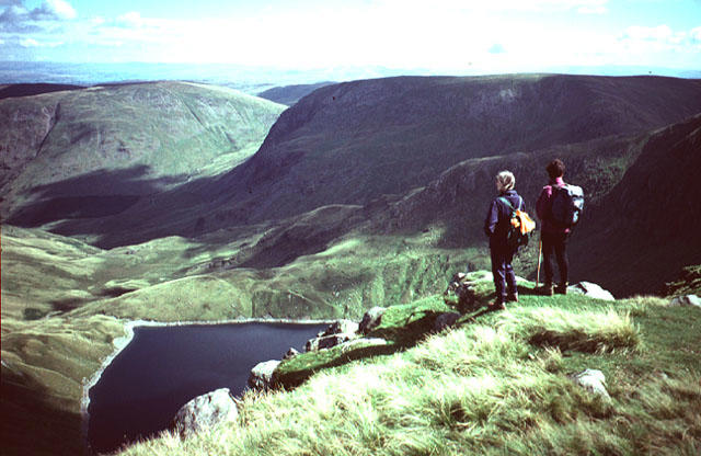
From the top, you can feast your eyes on some of the Lake District’s most iconic peaks. Notable sights include Skiddaw and Blencathra, with their jagged profiles standing out against the horizon. The best time to drink it all in is during the spring or autumn months, when clarity is at its peak.
Hazards
Stay on your toes! The weather can shift like a diva; one moment it's sunny, the next you're dodging raindrops. The terrain can also be a bit squelchy after a downpour, so sturdy boots are a must to prevent any unsightly tumbles!
Access
Nearest Parking
The Braithwaite car park is your best bet for easy access, though remember to keep some change handy for the parking fees.
Public Transport
If you prefer not to drive, regular bus services from Keswick to Braithwaite can drop you off close to the trailhead, so you won't need to hitchhike to the top!
Nearest Town
Braithwaite is your go-to village. After your hike, you can reward yourself with a well-deserved cuppa or pint at the local pub.
Facilities
Café and toilets are conveniently located in Braithwaite, so there's no need to fret about post-hike necessities. Trust me, your comfort is of utmost importance!
History
The name 'Wether' connects to the region’s sheep farming heritage, a nod to the past when such practices were vital for local livelihoods. The mountain has seen its fair share of hikers, farmers, and perhaps even an adventurous sheep or two!
In summary, Wether Hill is not just another mound of earth; it's a slice of natural beauty perfect for all sorts of adventurers. Whether you're dragging your feet or racing your mates, it's a hill with charm and character galore!
Happy hiking!
Explore routes near Wether Hill
Walks starting near this hill. Open a route to check its map, distance and full itinerary.
Striding Edge, Helvellyn and Catstye Cam
View route
Helvellyn via Striding Edge
View route
Bannerdale Crags from Mungrisdale Wainwright
View route
Bow Fell from Langdale
View route
Route planning notes
These notes describe possible approaches. Check a route's map and access information when planning your walk.
Wether Hill Circular from Braithwaite
A scenic loop that provides a gentle ascent followed by a rewarding descent, ideal for those looking to enjoy a bit of everything without breaking a sweat.
Make a day of it, together
Find someone to share the walk with, or organise a day out along a route you like.
Hill facts and local notes
Classifications
Elevation
672m
2,206 ft
Prominence
4m
Coordinates
54.5432, -2.8425
NY455167
OS Map
90
Explorer: OL5S
At the Summit
At the summit, you’ll find a stone cairn that marks the highest point, offering a place to take a well-deserved breather and reflect on your accomplishments.
Terrain & Geology
Wether Hill is primarily composed of volcanic rock formations, specifically tuff and andesite, creating a rugged yet fascinating landscape. This geological makeup is a testimony to the volcanic activity that shaped the region millions of years ago.
Views & Scenery
The sweeping vista from Wether Hill includes views of Skiddaw, Blencathra, and the lush valleys that make the Lake District a hiker's paradise.
History & Heritage
Name Origin
The name 'Wether' likely derives from the Old Norse word for 'wether', referring to a male sheep, indicating the pastoral practices in the area.
Historical Significance
Wether Hill has been a part of local culture for centuries, featuring in folklore and providing a vital grazing ground for livestock.
Getting There & Facilities
Parking
The nearest parking area is the car park at Braithwaite, which provides convenient access to the trailhead. Parking fees apply.
Public Transport
Regular bus services operate from Keswick to Braithwaite, making it accessible for those relying on public transport.
Nearby Facilities
The village of Braithwaite has a café and a pub for refreshments post-hike, as well as public toilets.
Safety Information
Known Hazards
- Variable weather conditions can change rapidly, so always be prepared for rain and wind. Some areas can be boggy, so watch your step to avoid a muddy mishap!
General Safety Tips
- Check weather conditions before setting out
- Carry appropriate clothing and equipment
- Let someone know your planned route
- Take a map, compass, and GPS device
- Carry emergency supplies: food, water, first aid kit, torch
Hills
Some common questions about the hills answered
Are there group walks up Wether Hill?
Many walkers use Walkmates to join or organise walks with others. You can check for group walks around Wether Hill through the maps
Are there other walkers around Wether Hill?
Activity varies by location and time, but Walkmates lets you see whether others have shared walks or shown interest in this area. Find other people through the walking friends search walking friends for Wether Hill search or of course create your own walk for Wether Hill
Can I organise a walk to Wether Hill?
Yes. If there aren’t any walks listed already, you can create a walk and make it available for others to join.
If you're signed up to Walkmates, you can create a walk to Wether Hill.
How do I find a walk up this hill?
There are often multiple ways to walk this hill, depending on experience and route preference. Walkmates helps you explore walks and routes that others have shared.
Can I suggest a new route up Wether Hill?
Yes. You can suggest or create routes to share with others. Walkmates focuses on the social side of walking, so routes are used to help people organise walks and explore areas together, rather than as detailed navigation tools or route libraries.
Other uses really appreciate knowledgeable walkers sharing their routes. Share your favourite route to Wether Hill here
The is an error or something incorrect about this hill. How do I let you know?
We always strive to keep the information on Walkmates as accurate as possible. If you find an error, please let us know through the contact form and we'll aim to correct it as quickly as possible
Community Discussion
Comments
Location
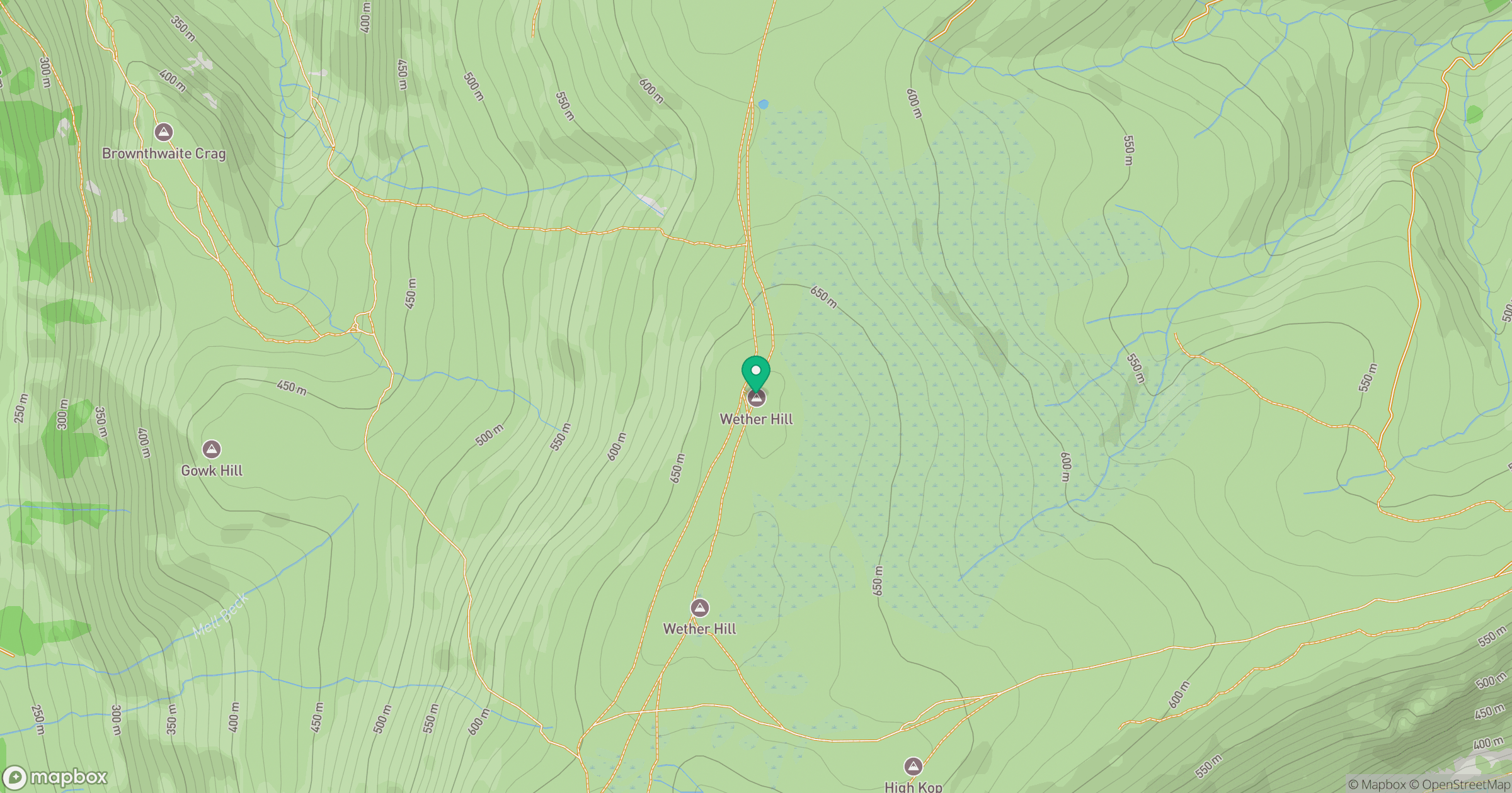
Grid reference: NY455167
View on OpenStreetMapOpens a map in a new tab, centred on the hill.
No comments yet. Be the first.