
Wether Hill
Good walks are even better shared.
Overview
Wether Hill
Introduction
Nestled in the scenic splendour of the Lake District, Wether Hill stands proud at 602 meters. This charming Hewitt is a favourite among locals and visitors alike, offering an accessible hiking experience while treating trekkers to some truly breathtaking views.
Geology
The foundation of Wether Hill consists largely of volcanic rock from the remnants of ancient eruptions. With its unique geological features, including outcroppings of andesite, the hill serves as both a geological classroom and an adventurous playground for hikers.
Route Suggestions
One popular route to the summit is via the Old Corpse Road. This picturesque trail is well-marked and leads you steadily upwards, with ample opportunities to stop, snap some photos, and catch your breath. The total distance is approximately 6.4 kilometres, and you can expect a moderate level of difficulty. An average trekker should budget around 2.5 hours for the ascent.
Summit Features
Upon reaching the summit, you'll encounter a stone cairn, a signalling point left by fellow adventurers. It's said that if you hum the theme from 'Rocky', it’ll inspire you to conquer the next hill (results may vary).
Terrain
The terrain on Wether Hill offers a delightful mix of grassy paths and rocky outcrops, perfect for those who enjoy a wee scramble rather than simply strolling through a park.
Views
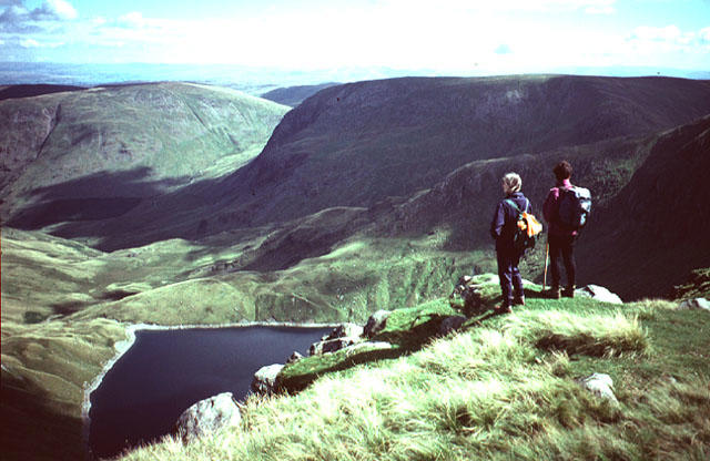
Once atop Wether Hill, the views are nothing short of spectacular. You can see the expansive Ullswater shimmering in the distance and the majestic fells that make up the backdrop. To fully appreciate these panoramic vistas, aim to hike in spring or autumn, when visibility is at its peak.
Hazards
Be prepared for the unforeseen; the weather can change faster than you can say, 'Hold your horses!' Dress in layers and be cautious on rocky sections. Also, keep an eye out for muddy patches that can be slippery.
Nearby Summits
Wether Hill is surrounded by several noteworthy neighbours. Place Fell, at 657 meters, offers its own set of challenges, while Gowbarrow Fell can be summited at a less strenuous 481 meters.
Access Information
To get to Wether Hill, there’s a convenient car park at the base along the A592. It does get busy, so consider arriving early. For those travelling via public transport, local bus services frequently connect from Patterdale.
Facilities
After your hike, Patterdale is ready to serve you with local cafés, shops, and public toilets. Just the ticket to rejuvenate yourself!
History
The hill’s name comes from the old term 'wether,' relating to the area’s sheep farming history. Wether Hill reflects a rich cultural significance that intertwines with the local landscape.
Conclusion
Wether Hill stands as a testament to the beauty and adventure that the Lake District has to offer. Whether you're after a peaceful hike or an exhilarating climb, Wether Hill is certainly worth your time—and your leg muscles will thank you for it later!
Happy hiking!
Explore routes near Wether Hill
Walks starting near this hill. Open a route to check its map, distance and full itinerary.
Striding Edge, Helvellyn and Catstye Cam
View route
Helvellyn via Striding Edge
View route
Bannerdale Crags from Mungrisdale Wainwright
View route
Bow Fell from Langdale
View route
Route planning notes
These notes describe possible approaches. Check a route's map and access information when planning your walk.
Old Corpse Road
A picturesque and well-trodden route that takes you to the summit through scenic upland paths.
Make a day of it, together
Find someone to share the walk with, or organise a day out along a route you like.
Hill facts and local notes
Classifications
Elevation
676m
2,217 ft
Prominence
19m
Coordinates
54.5391, -2.8444
NY454163
OS Map
90
Explorer: OL5S
At the Summit
The summit is marked by a stone cairn, which may look like it was constructed by particularly ambitious sheep who also fancied themselves as architects.
Terrain & Geology
The hill is primarily composed of volcanic rock, a reminder of the region's fiery past. Most notably, the landscape features excellent outcroppings of andesite rock.
Views & Scenery
From the summit, one can gaze upon the stunning vistas of Ullswater and the surrounding fells. On a clear day, you'll feel on top of the world—quite literally!
History & Heritage
Name Origin
The name 'Wether' refers to a male sheep, which might explain the hill's woolly inhabitants!
Historical Significance
Historically, the area around Wether Hill was used for herding and farming, and remnants of ancient paths can still be traced.
Getting There & Facilities
Parking
There is a small car park at the foot of the hill along the A592. Arrive early to secure a space, as it tends to fill up quicker than a kettle.
Public Transport
Bus services to Glenridding run frequently from nearby towns, making it accessible for non-drivers.
Nearby Facilities
In Patterdale, you’ll find cafés, a village shop, and public toilets to prepare you for your adventure—or to regroup after your descent.
Safety Information
Known Hazards
- Be cautious of sudden weather changes; the Lake District is notorious for its unpredictable climate. Also, watch your step on rocky sections and avoid wandering too close to damp patches.
General Safety Tips
- Check weather conditions before setting out
- Carry appropriate clothing and equipment
- Let someone know your planned route
- Take a map, compass, and GPS device
- Carry emergency supplies: food, water, first aid kit, torch
Hills
Some common questions about the hills answered
Are there group walks up Wether Hill?
Many walkers use Walkmates to join or organise walks with others. You can check for group walks around Wether Hill through the maps
Are there other walkers around Wether Hill?
Activity varies by location and time, but Walkmates lets you see whether others have shared walks or shown interest in this area. Find other people through the walking friends search walking friends for Wether Hill search or of course create your own walk for Wether Hill
Can I organise a walk to Wether Hill?
Yes. If there aren’t any walks listed already, you can create a walk and make it available for others to join.
If you're signed up to Walkmates, you can create a walk to Wether Hill.
How do I find a walk up this hill?
There are often multiple ways to walk this hill, depending on experience and route preference. Walkmates helps you explore walks and routes that others have shared.
Can I suggest a new route up Wether Hill?
Yes. You can suggest or create routes to share with others. Walkmates focuses on the social side of walking, so routes are used to help people organise walks and explore areas together, rather than as detailed navigation tools or route libraries.
Other uses really appreciate knowledgeable walkers sharing their routes. Share your favourite route to Wether Hill here
The is an error or something incorrect about this hill. How do I let you know?
We always strive to keep the information on Walkmates as accurate as possible. If you find an error, please let us know through the contact form and we'll aim to correct it as quickly as possible
Community Discussion
Comments
Location
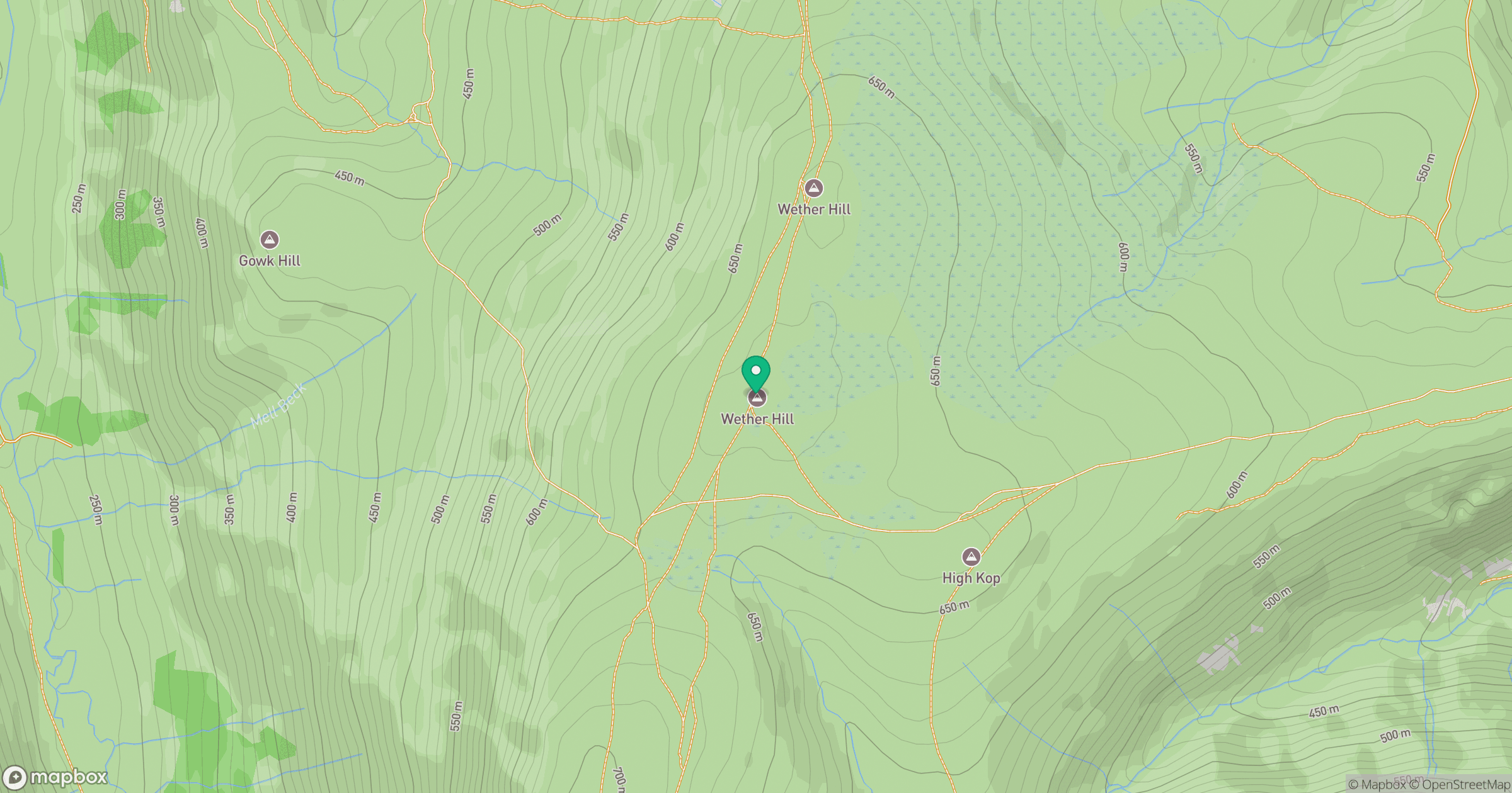
Grid reference: NY454163
View on OpenStreetMapOpens a map in a new tab, centred on the hill.
No comments yet. Be the first.