

Waun-oer
Good walks are even better shared.
Overview
Exploring Waun-oer
Nestled within the stunning Brecon Beacons National Park, Waun-oer stands proudly at 671 meters, showcasing a delightful mix of natural beauty and rich history. This mountain is not just another bump in the landscape; it's a cherished gem that offers both challenge and charm to hikers.
Geology
The geology of Waun-oer is dominated by Old Red Sandstone. This formation brings interest not only for geology buffs but also adds a vibrant touch to the scenic views. So when you're munching on your sandwich at the summit, you can impress your hiking companions with some fun facts about sedimentary rock!
Access
Before you lace up your boots, you'll want to sort out your parking. The nearest car park can be found at Talybont reservoir, just a hop, skip and a jump away from the trailhead. If public transport is more your style, Talybont-on-Usk is served by regular buses. Just be sure to check the schedules – you wouldn’t want to find yourself stuck waiting for a bus that forgot it had a route!
Routes
The 'Waun-oer Circular Walk' is a fantastic choice for those eager to explore. At around 10km and taking about 3.5 hours, it’s a moderate challenge suitable for most hikers. The scenery is diverse, and the paths are well-trodden – ideal for enjoying the great outdoors without dodging too many tree branches!
Summit Features
The summit is marked with a classic trig point, standing stoically in the midst of a stone cairn, ready for your Instagram moment. Don’t forget to take a selfie because nobody will believe you summited without the evidence!
Views
When you reach the top, take a moment to soak in the breathtaking views. You’re treated to scenes of the surrounding valleys and peaks, with the Black Mountains shimmering in the distance. Spring and autumn are particularly splendid times to visit – the colours change as if nature is showing off its finest outfit.
Hazards
As with most mountains, be cautious of the unpredictable weather. It can change quicker than a squirrel on the run, so it’s wise to bring layers. And do keep an eye out for soggy patches – unless you fancy a surprise dip!
Nearby Summits
If you're still feeling adventurous, consider checking out nearby Glyntawe Peak and Cwm Llwch. These additional hikes offer a great way to extend your outdoor excursions.
Facilities
The village of Talybont-on-Usk has a delightful little café and a horsebox for refreshments. And let’s not forget the all-important toilet facilities at the car park! You’ll thank yourself later!
Conclusion
In conclusion, Waun-oer is a splendid choice for hikers of all stripes, blending challenge with astounding views and historical intrigue. Perfect for a day out, or perhaps just a cheeky weekend adventure. Grab your gear, and let the great Welsh outdoors work its charm!
Explore routes near Waun-oer
Public walks starting within 80 km of this hill. Nearby does not mean a route reaches the summit; check its map and access before setting out.
Mawddach Trail: Dolgellau to Barmouth
View route
Waun-oer, Maesglase and Cribin Fawr guided mountain walk
View route
Cadair Idris - Pony Path
View route
Mawddach Trail: Penmaenpool to Arthog Estuary Return
View route
Route planning notes
These notes describe possible approaches, not verified navigable routes or permission to cross land. Check current paths, local access rules and conditions before setting out.
Waun-oer Circular Walk
A scenic circular route starting from the small village of Talybont-on-Usk, offering stunning views and diverse terrain.
Make a day of it, together
Find someone to share the walk with, or organise a day out along a route you like.
Photo Gallery
View all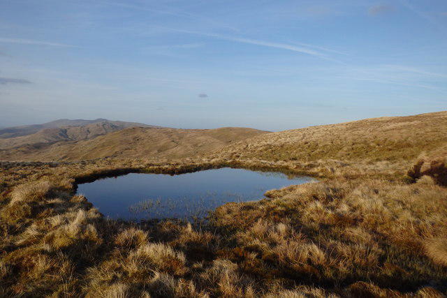 Photo could not load
SH7814 : Pool on Waun-oer
Michael Graham
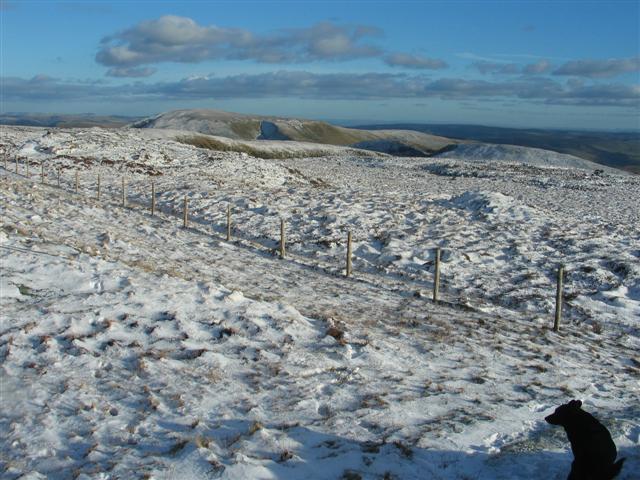 Photo could not load
SH7814 : Looking SE from Waun-oer summit
Barry Hunter
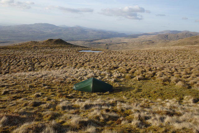 Photo could not load
SH7814 : Wild camp, Waun-oer
Michael Graham
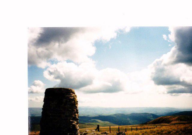 Photo could not load
SH7814 : The summit plateau of Waen-oer from the Trig Point
Eric Jones
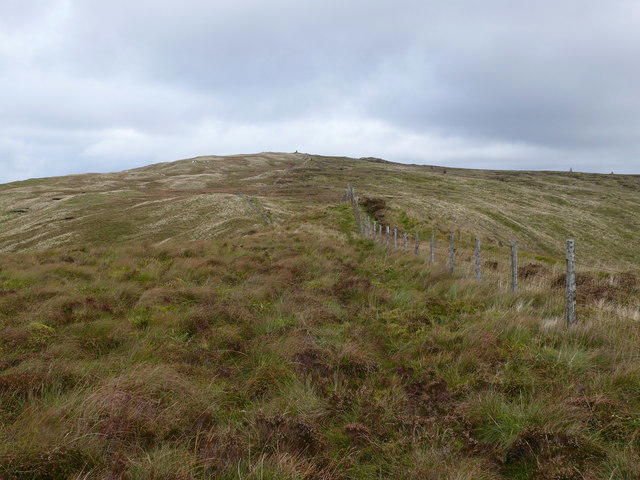 Photo could not load
SH7814 : Waun Oer
Ian Medcalf
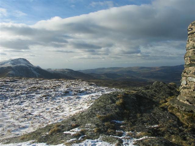 Photo could not load
SH7814 : Looking NW from Waun-oer summit
Barry Hunter
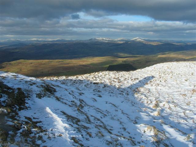 Photo could not load
SH7814 : Looking NE from Waun-oer summit
Barry Hunter
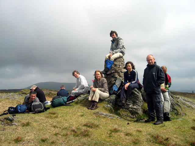 Photo could not load
SH7814 : Waun Oer
Alan Richards
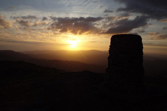 Photo could not load
SH7814 : Sunset from Waun-oer
Michael Graham
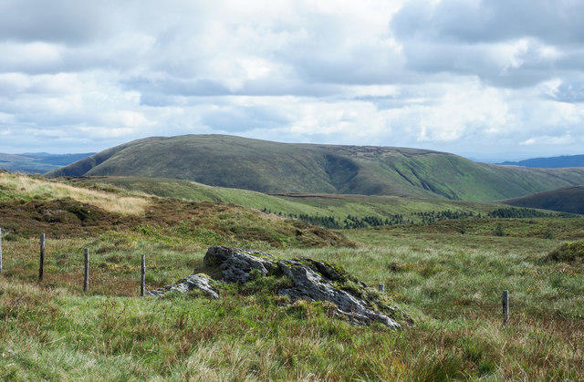
SH7814 : Rock with passing fence on Waun-oer
Trevor Littlewood
Hill facts and local notes
Classifications
Elevation
670m
2,198 ft
Prominence
120m
Coordinates
52.7170, -3.7994
SH785147
OS Map
124
Explorer: OL23E
At the Summit
The summit is marked by a prominent trig point, with a sturdy stone cairn nearby for those who fancy a quick photo op.
Terrain & Geology
Predominantly composed of Old Red Sandstone, providing a rich geological backdrop that attracts geology enthusiasts.
Views & Scenery
From the summit, you can enjoy panoramic views of the surrounding valleys, the distant peaks of the Black Mountains, and on a clear day, even the Bristol Channel.
History & Heritage
Name Origin
Waun-oer translates to 'The Great Moor', capturing its expansive upland landscape.
Historical Significance
Historically, this area was used by local farmers for grazing, and remnants of traditional stone walls can still be found along the paths.
Getting There & Facilities
Check current local access restrictions, parking rules and transport timetables before travelling. These notes do not confirm public access to the summit.
Parking
There's a car park at the Talybont reservoir, located just a short walk from the trailhead.
Public Transport
Regular bus services connect Talybont-on-Usk with nearby towns, though check schedules as they can be a bit 'hit or miss'.
Nearby Facilities
The village has a charming café and a small horsebox serving refreshments, plus toilet facilities in the car park – just don’t forget to bring your own picnic!
Safety Information
Known Hazards
- Watch out for sudden weather changes, as they can turn your sunny hike into a foggy adventure faster than you can say 'Where's the path?'
General Safety Tips
- Check weather conditions before setting out
- Carry appropriate clothing and equipment
- Let someone know your planned route
- Take a map, compass, and GPS device
- Carry emergency supplies: food, water, first aid kit, torch
Hills
Some common questions about the hills answered
Are there group walks up Waun-oer?
Many walkers use Walkmates to join or organise walks with others. You can check for group walks around Waun-oer through the maps
Are there other walkers around Waun-oer?
Activity varies by location and time, but Walkmates lets you see whether others have shared walks or shown interest in this area. Find other people through the walking friends search walking friends for Waun-oer search or of course create your own walk for Waun-oer
Can I organise a walk to Waun-oer?
Yes. If there aren’t any walks listed already, you can create a walk and make it available for others to join.
If you're signed up to Walkmates, you can create a walk to Waun-oer.
How do I find a walk up this hill?
There are often multiple ways to walk this hill, depending on experience and route preference. Walkmates helps you explore walks and routes that others have shared.
Can I suggest a new route up Waun-oer?
Yes. You can suggest or create routes to share with others. Walkmates focuses on the social side of walking, so routes are used to help people organise walks and explore areas together, rather than as detailed navigation tools or route libraries.
Other uses really appreciate knowledgeable walkers sharing their routes. Share your favourite route to Waun-oer here
The is an error or something incorrect about this hill. How do I let you know?
We always strive to keep the information on Walkmates as accurate as possible. If you find an error, please let us know through the contact form and we'll aim to correct it as quickly as possible
Community Discussion
Comments
Location
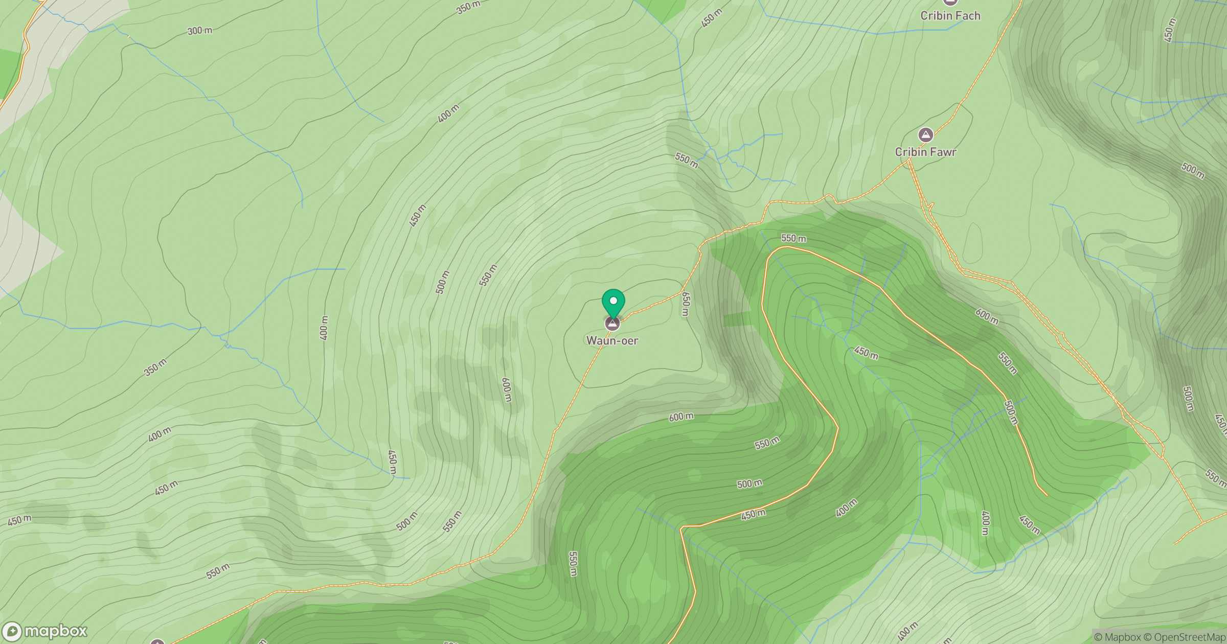
Grid reference: SH785147
View on OpenStreetMapOpens a map in a new tab, centred on the hill.
Hills within 30 km
Straight-line distance, not a walking route or confirmation of access.
No comments yet. Be the first.