

Urra Moor - Round Hill
Good walks are even better shared.
NZ5901 : Round Hill Trig Point
John Ryles Photo source
Overview
Urra Moor - Round Hill
Urra Moor, affectionately dubbed Round Hill, is a gem nestled in the North York Moors National Park. Standing tall at 565 meters, it is a Marilyn—a title given to hills in the UK that have a prominence of at least 150 metres.
Geology
The landscape is primarily shaped by sandstone and limestone, creating a patchwork of peaty moorland interspersed with rocky outcrops. The geology here tells a tale of ancient seas and shifting landscapes.
Routes
Urra Moor Circuit
This delightful circuit covers about 6.5 km and will take around 2.5 hours to complete. It’s a moderate trek, ideal for those looking for a bit of adventure without too much hardship. You’ll traverse stunning heathland, feel the wind in your hair, and possibly make a few sheep friends along the way.
Summit Features
At the summit, you’ll find a sizeable stone cairn and a trig point. These markers not only provide a chance for a triumphant photo but also make excellent spotlights for any aspiring amateur geologists who fancy themselves a bit of a rock whisperer.
Terrain Type
Be prepared for a moorland adventure; the routes can be boggy in spots, especially after a good rain. The upland rocks will challenge your footing at times, so sturdy footwear is a must!
Views
When you reach the summit, revel in the panoramic views of the North York Moors, where rolling hills and vibrant greenery abound. Spring and early summer are particularly glorious for flowering heather, while the crispness of autumn shows Mother Nature at her most colorful.
Hazards
As with any moorland path, be alert! Slippery terrain can make for an unexpected slip-and-slide. And do keep your distance from the sheep; they might take umbrage at your intrusion onto their turf.
Nearby Summits
Don’t forget to check out Carlton Moor and Fish Hill, both offering additional routes and stunning views.
Access
There’s a handy car park north at NZ596021, but you may want to arrive early to nab a spot. Public transport is limited, so consider carpooling with fellow adventurers. The nearest town, Stokesley, offers all the conveniences you might need.
Facilities
Post-hike, you can head to Stokesley where you’ll find some quaint cafes and pubs—perfect for a pint and a slice of something sweet.
History
Etymologically, 'Urra' is rooted in Old Norse, hinting at its longstanding significance as a high vantage point. Historically, the moor has served as a grazing ground and a part of ancient routes.
Enjoy your trek and don’t forget to pack a snack—or perhaps a picnic for a moment of reflection upon reaching the summit. After all, nothing finishes a good walk like a chance to munch on some sarnies while taking in the view!
Explore routes near Urra Moor - Round Hill
Walks starting near this hill. Open a route to check its map, distance and full itinerary.
Commondale and Hob Cross
View route
Cod Beck Reservoir circuit
View route
Silton Forest and Red Way circuit
View route
River Tees industrial heritage
View route
Route planning notes
These notes describe possible approaches. Check a route's map and access information when planning your walk.
Urra Moor Circuit
A scenic loop that takes you around the moors, providing stunning views of the surrounding area.
Make a day of it, together
Find someone to share the walk with, or organise a day out along a route you like.
Photo Gallery
View all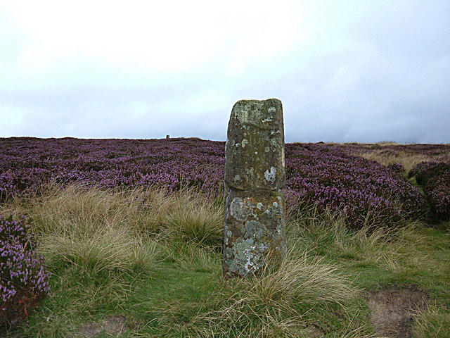 Photo could not load
NZ5901 : The Hand Stone, Urra Moor
michael ely
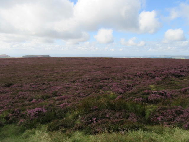 Photo could not load
NZ5901 : Urra Moor
T Eyre
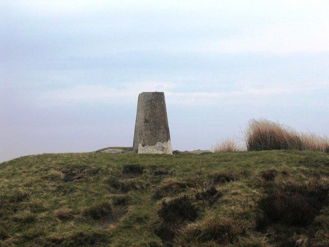 Photo could not load
NZ5901 : Trig point on Round Hill
Philip Barker
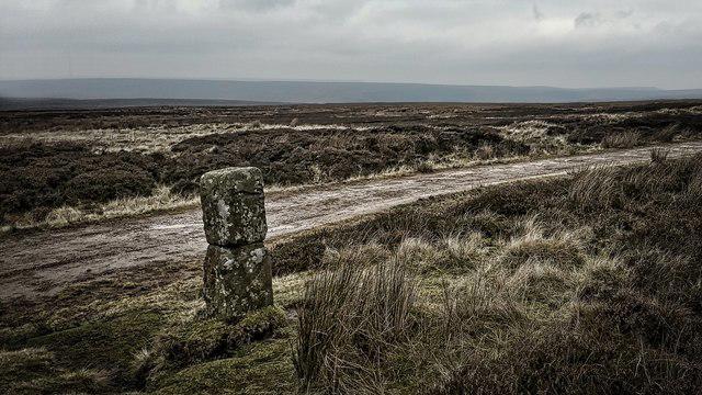 Photo could not load
NZ5901 : The Hand Stone on Urra Moor
Mick Garratt
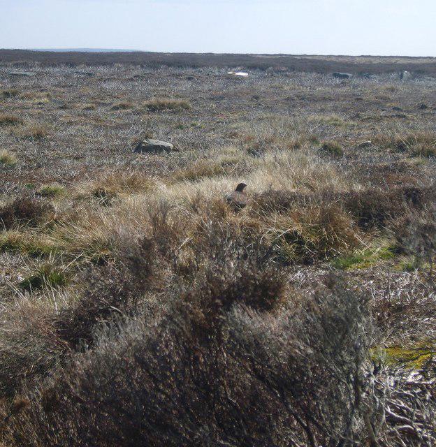 Photo could not load
NZ5901 : On Round Hill
Michael Graham
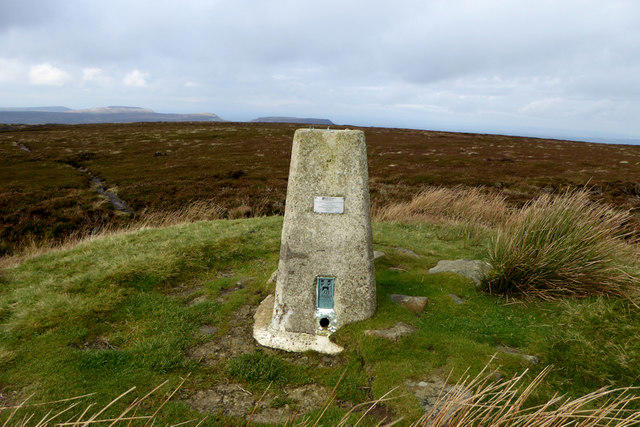 Photo could not load
NZ5901 : Round Hill Trig Point
John Ryles
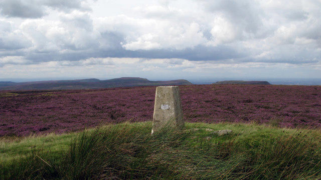 Photo could not load
NZ5901 : Trig point of Round Hill
Trevor Littlewood
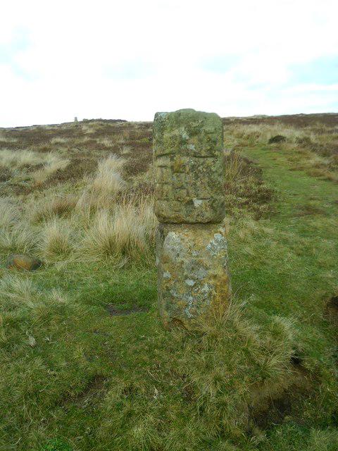 Photo could not load
NZ5901 : The Hand Stone
Gordon Hatton
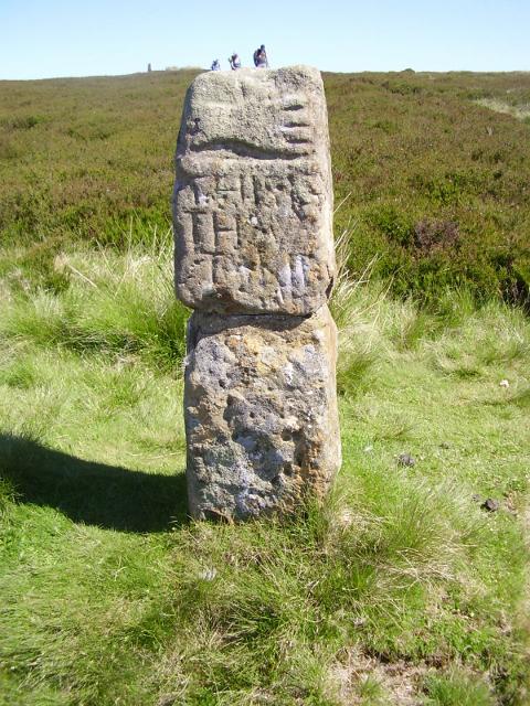 Photo could not load
NZ5901 : Old Guide Stone - The Hand Stone, Round Hill, Urra Moor
Milestone Society
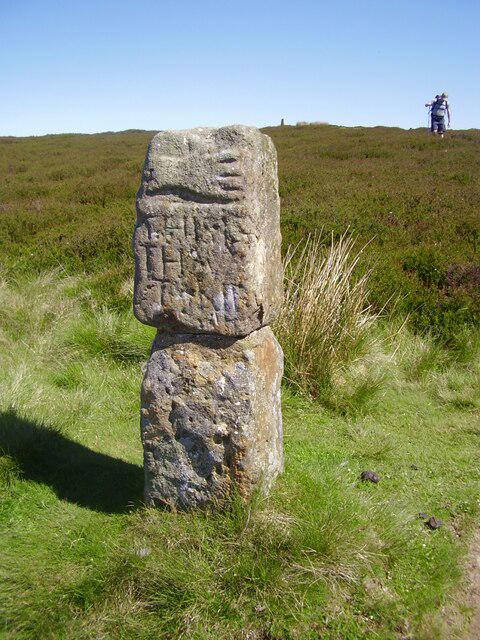
NZ5901 : Old guidestone at Round Hill on Urra Moor
David Garside
Hill facts and local notes
Classifications
Elevation
455m
1,491 ft
Prominence
409m
Coordinates
54.4064, -1.0859
NZ594015
OS Map
93
Explorer: OL26N
At the Summit
The summit features a prominent cairn and a trig point, making it a fantastic spot for a photo op. Just be careful not to make too many friends with the sheep—they're very territorial about their hills.
Terrain & Geology
Primarily composed of sandstone and limestone, the area showcases classic moorland geology with interesting rock formations and peat deposits.
Views & Scenery
From the summit, you can see the rolling hills of the North York Moors, the Cleveland Hills, and on a clear day, all the way to the Dales.
History & Heritage
Name Origin
The name 'Urra' is believed to derive from Old Norse, meaning 'a high place'—which is quite fitting!
Historical Significance
The moorland has historical significance as a traditional grazing area and is part of ancient routes used by locals.
Getting There & Facilities
Parking
There is a small car park off the road to the north of the moor at NZ596021. It's a popular spot, so arrive early!
Public Transport
Limited public transport is available, but the nearest rail station is in Kildale, approximately 8 km away.
Nearby Facilities
Nearby facilities are limited, but Stokesley offers cafes, pubs, and shops for a post-walk refreshment.
Safety Information
Known Hazards
- Beware of slippery bogs, especially after rain. Keep an eye on the weather as conditions can change rapidly in the moors. Also, there are sheep—be respectful!
General Safety Tips
- Check weather conditions before setting out
- Carry appropriate clothing and equipment
- Let someone know your planned route
- Take a map, compass, and GPS device
- Carry emergency supplies: food, water, first aid kit, torch
Hills
Some common questions about the hills answered
Are there group walks up Urra Moor - Round Hill?
Many walkers use Walkmates to join or organise walks with others. You can check for group walks around Urra Moor - Round Hill through the maps
Are there other walkers around Urra Moor - Round Hill?
Activity varies by location and time, but Walkmates lets you see whether others have shared walks or shown interest in this area. Find other people through the walking friends search walking friends for Urra Moor - Round Hill search or of course create your own walk for Urra Moor - Round Hill
Can I organise a walk to Urra Moor - Round Hill?
Yes. If there aren’t any walks listed already, you can create a walk and make it available for others to join.
If you're signed up to Walkmates, you can create a walk to Urra Moor - Round Hill.
How do I find a walk up this hill?
There are often multiple ways to walk this hill, depending on experience and route preference. Walkmates helps you explore walks and routes that others have shared.
Can I suggest a new route up Urra Moor - Round Hill?
Yes. You can suggest or create routes to share with others. Walkmates focuses on the social side of walking, so routes are used to help people organise walks and explore areas together, rather than as detailed navigation tools or route libraries.
Other uses really appreciate knowledgeable walkers sharing their routes. Share your favourite route to Urra Moor - Round Hill here
The is an error or something incorrect about this hill. How do I let you know?
We always strive to keep the information on Walkmates as accurate as possible. If you find an error, please let us know through the contact form and we'll aim to correct it as quickly as possible
Community Discussion
Comments
Location
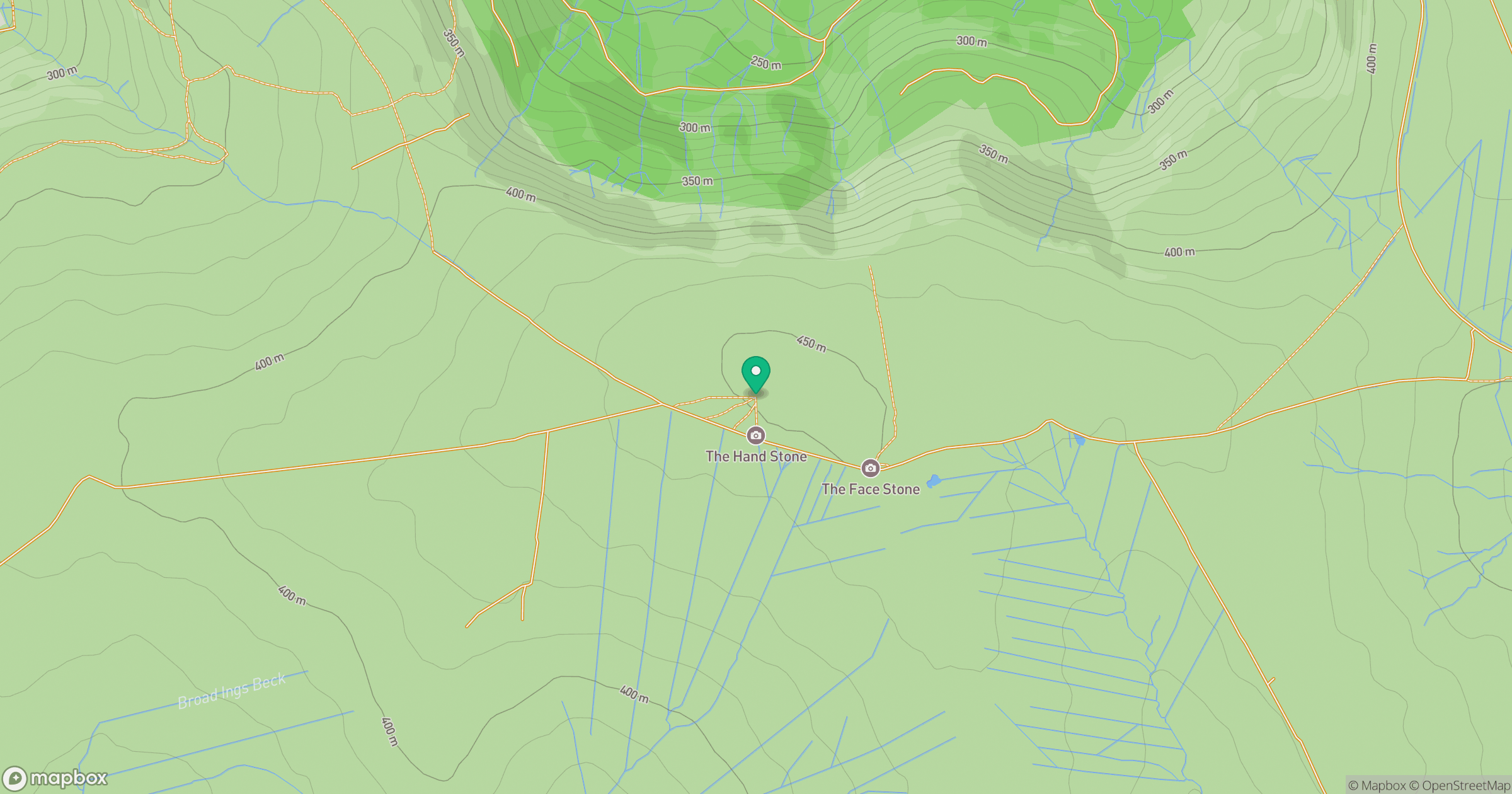
Grid reference: NZ594015
View on OpenStreetMapOpens a map in a new tab, centred on the hill.
Nearby Hills
Rombalds Moor [Ilkley Moor]
402m
Buckden Pike
702m
Nine Standards Rigg
662m

Pen-y-ghent
694m

Kinder Scout
636m
No comments yet. Be the first.