

Ullister Hill
Good walks are even better shared.
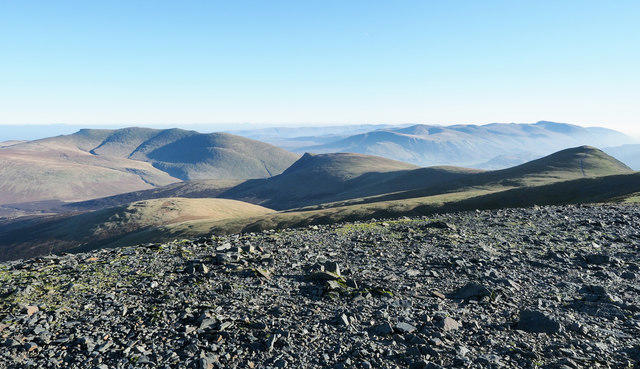
NY2026 : On Ullister Hill
Michael Graham Photo source
Overview
Ullister Hill: A Hidden Gem of the Southern Uplands
Ullister Hill, standing at a respectable height of 386 meters, may not have the towering presence of its more famous neighbours but don’t let that fool you. This Marilyn offers splendid views and a tranquil hiking experience just waiting to be discovered.
Geology
Ullister Hill boasts characteristics typical of the Southern Uplands. The landscape is a striking combination of greywacke and shale, offering a fascinating study for geology enthusiasts. The rugged terrain and varying elevations create a picturesque setting that's constantly changing, making it ideal for exploration.
Access
Peace and quiet come at a premium here, and the closest parking is in the village of Glentrool. Be warned, though: on sunny weekends, this little car park can fill up quicker than you can say 'baked potato'! If public transport is your key to adventure, you'll have to plan ahead, as services are a bit sparse. The nearest town, Newton Stewart, is about 15 miles away and has some charming local cafes where you can grab a bite.
The Route
The Ullister Hill Circuit is a superb round, covering approximately 7.5 km and taking about 2.5 hours if you keep a moderate pace. The trail is marked, but like a game of hide and seek, you might find the path elusive in some places – so keep your wits about you!
Summit Features
At the summit, hikers are greeted by a modest stone cairn, a lovely spot to take in those refreshing views. Here, you can capture moments that deserve a spot on the mantlepiece, perhaps next to your best snail collection.
Views
And speaking of views, prepare to be blown away! The summit rewards you with magnificent sights across the Southern Uplands. On a good day, you might even catch a glimpse of the Solway Firth—it’s like nature’s own version of a postcard.
Hazards
However, not all is perfect! The terrain includes some boggy patches, so mind your step; you wouldn’t want to end up knee-deep in mud. And keep an eye on those well-fed sheep—they can be surprisingly swift!
Nearby Summits
If you’re keen to tick off a few more peaks, consider a jaunt to Bennan Hill or Merrick, the latter being a Munro and a must-see for serious peak-baggers.
Conclusion
In summary, Ullister Hill might be the underdog of the Southern Uplands, but with its captivating scenery and varied terrain, it promises a delightful trek for all. Don’t miss out on this little slice of hiking paradise!
Last updated: 2023-10-01
Explore routes near Ullister Hill
Walks starting near this hill. Open a route to check its map, distance and full itinerary.
Whinlatter dark skies walk
View route
Whinlatter dark skies walk
View route
Binsey from Binsey Lodge Direct Out and Back Wainwright
View route
Brae Fell from Longlands Wainwright
View route
Route planning notes
These notes describe possible approaches. Check a route's map and access information when planning your walk.
Ullister Hill Circuit
A scenic loop that offers a delightful combination of rolling hills and panoramic views of the surrounding countryside.
Make a day of it, together
Find someone to share the walk with, or organise a day out along a route you like.
Photo Gallery
View all Photo could not load
NY2026 : On Ullister Hill
Michael Graham
 Photo could not load
NY2026 : On Ullister Hill
Michael Graham
Hill facts and local notes
Classifications
Elevation
525m
1,722 ft
Prominence
34m
Coordinates
54.6231, -3.2259
NY209260
OS Map
89 90
Explorer: OL4S
At the Summit
The summit features a small stone cairn, which has seen more selfies than a celebrity at a red carpet event.
Terrain & Geology
Predominantly composed of sedimentary rocks, typical of the Southern Uplands, including greywacke and shale, forming a rugged landscape with striking features.
Views & Scenery
Panoramic views over the Southern Uplands, with the Solway Firth glistening in the distance and the peaks of the nearby Galloway Hills.
History & Heritage
Name Origin
The name Ullister is believed to derive from the Gaelic 'Ullaistir', meaning 'over the hill'.
Historical Significance
The hill has significance as part of the ancient landscape, with historical links to local folklore and Scottish heritage.
Getting There & Facilities
Parking
Parking available at the village of Glentrool, which has a small car park that fills up quickly on sunny weekends.
Public Transport
Limited public transport; best accessed by car but regular buses run from Newton Stewart, around 15 miles away.
Nearby Facilities
Local cafes and pubs in Newton Stewart provide a perfect pit stop for hikers. Toilets are available in the village.
Safety Information
Known Hazards
- Care should be taken on the boggy sections, which can be surprisingly deep. Also, watch out for the occasional low-flying sheep!
General Safety Tips
- Check weather conditions before setting out
- Carry appropriate clothing and equipment
- Let someone know your planned route
- Take a map, compass, and GPS device
- Carry emergency supplies: food, water, first aid kit, torch
Hills
Some common questions about the hills answered
Are there group walks up Ullister Hill?
Many walkers use Walkmates to join or organise walks with others. You can check for group walks around Ullister Hill through the maps
Are there other walkers around Ullister Hill?
Activity varies by location and time, but Walkmates lets you see whether others have shared walks or shown interest in this area. Find other people through the walking friends search walking friends for Ullister Hill search or of course create your own walk for Ullister Hill
Can I organise a walk to Ullister Hill?
Yes. If there aren’t any walks listed already, you can create a walk and make it available for others to join.
If you're signed up to Walkmates, you can create a walk to Ullister Hill.
How do I find a walk up this hill?
There are often multiple ways to walk this hill, depending on experience and route preference. Walkmates helps you explore walks and routes that others have shared.
Can I suggest a new route up Ullister Hill?
Yes. You can suggest or create routes to share with others. Walkmates focuses on the social side of walking, so routes are used to help people organise walks and explore areas together, rather than as detailed navigation tools or route libraries.
Other uses really appreciate knowledgeable walkers sharing their routes. Share your favourite route to Ullister Hill here
The is an error or something incorrect about this hill. How do I let you know?
We always strive to keep the information on Walkmates as accurate as possible. If you find an error, please let us know through the contact form and we'll aim to correct it as quickly as possible
Community Discussion
Comments
Location
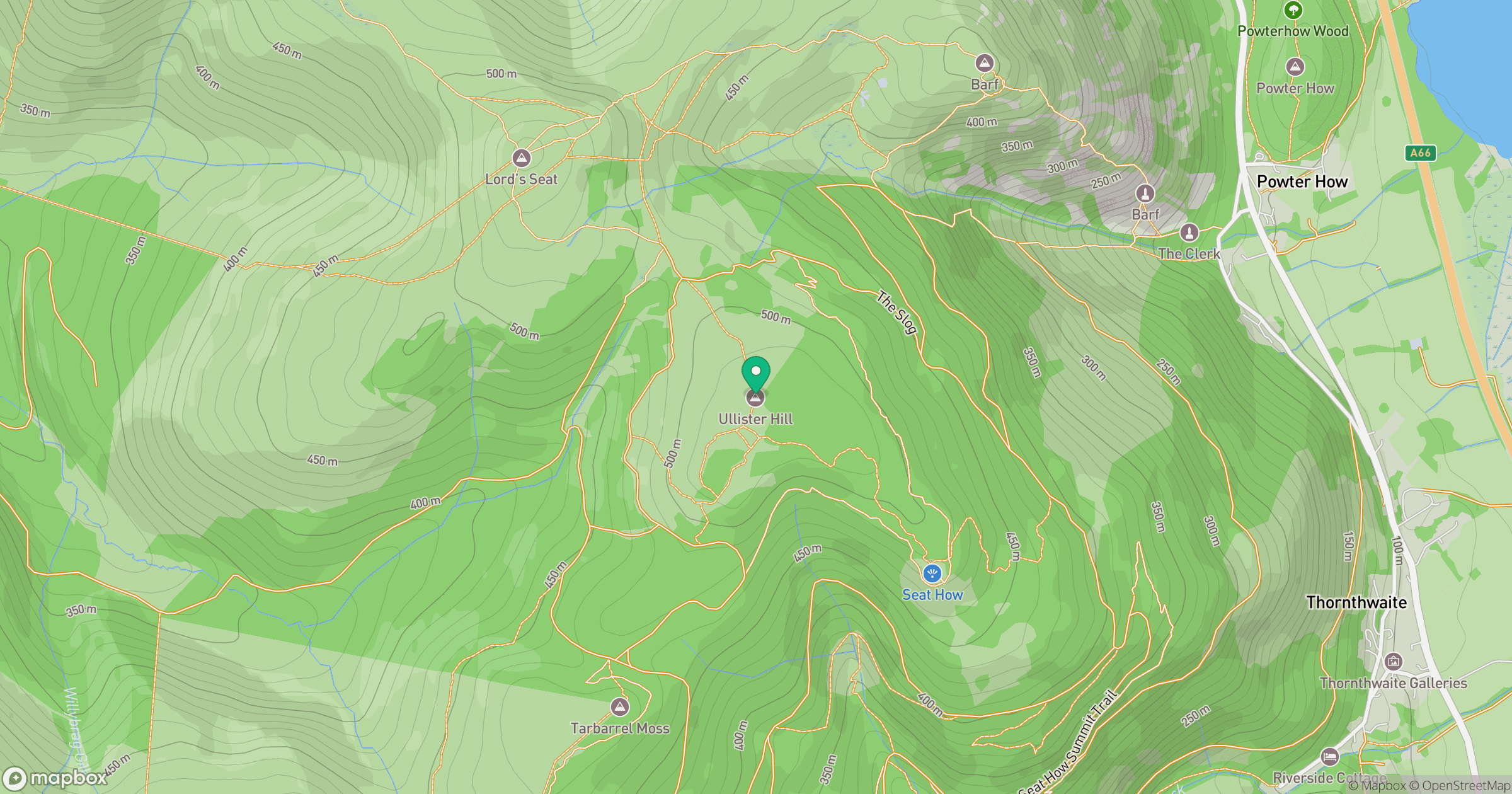
Grid reference: NY209260
View on OpenStreetMapOpens a map in a new tab, centred on the hill.
No comments yet. Be the first.