

Tullyhappy
Good walks are even better shared.
Overview
Tullyhappy: A Hidden Gem in the Southern Uplands
Nestled in the picturesque Southern Uplands of Scotland, Tullyhappy may not be the tallest hill out there, but it certainly has character! Standing proud at 410 meters, it's a Marilyn that invites outdoor enthusiasts and those looking to stretch their legs.
Geology
Tullyhappy’s foundation is formed from resilient sedimentary rocks, primarily interbedded sandstones and shales. This gives the hill both a sturdy build and interesting textures underfoot. Just watch your step; a bit of mud can turn you into a right soggy bottom faster than you can say ‘slippery slope’!
Routes
The most popular route is the Tullyhappy Circular Route, starting in the quaint village of Dalmellington. Spanning 6.4 km, this moderate walk weaves through scenic forests and delightful open spaces. It takes about 2.5 hours to complete, depending on how often you stop to take photos or chat up the sheep.
Summit Features
At the top, hikers are greeted by a small cairn—perfect for those ‘I conquered the hill’ selfies. The summit provides ample space for enjoying snacks and, let’s be honest, this is where you’ll likely take an obligatory summit group photo.
Terrain
Expect a delightful mix of grassy slopes, rocky outcrops, and patches of lovely heather. The terrain is comfortable for most, but do keep an eye on those slick spots, especially after rain. You wouldn’t want to make an unexpected trip down the mountain!
Views
From Tullyhappy's summit, take a moment to soak in the captivating vistas. You'll marvel at the sprawling valleys, the nearby Galloway Forest Park, and a horizon dotted with the Ayrshire hills. The best time for these views? Spring and autumn, when the landscape is at its most vibrant and crystal clear.
Hazards
While Tullyhappy isn’t known for extremes, the northern face can feature steep drops. Always keep a close eye on kids and pets! Also, be prepared for sudden changes in weather, a classic Scottish surprise that can turn your hike from pleasant to 'where did I put my raincoat?'.
Access
Parking is conveniently available in Dalmellington, a charming little village with enough space for several vehicles. If public transport is more your style, remember to check room schedules—you don’t want to be left hanging!
Nearby Summits
For those looking to extend the adventure, nearby Bennan Hill (525 meters) and Knockdolian Hill (494 meters) provide further delightful hikes.
Facilities
After you’ve conquered Tullyhappy, treat yourself to a café visit in Dalmellington. A post-hike piece of cake can work wonders, especially paired with a hot drink!
History
The name Tullyhappy hints at local dialect origins and perhaps conveys the hill's inviting charm. While it may not have grand historical tales, it represents the stunning beauty of the Southern Uplands, a sector that continues to enchant hikers from near and far.
In conclusion, Tullyhappy is a fantastic destination for a day out—perfect for families, seasoned hikers, or anyone in between. So lace up those boots, pack that walker’s packed lunch, and get ready for adventure!
Happy hiking!
Explore routes near Tullyhappy
Public walks starting within 80 km of this hill. Nearby does not mean a route reaches the summit; check its map and access before setting out.
Scarva to Poyntzpass: Newry Canal and Lough Shark Return
View route
Portadown to Knock Bridge: Bann Boulevard and Moneypenny’s Lock
View route
Silent Valley to Ben Crom Dam: Reservoir Road Walk, County Down
View route
Castlewellan Forest Park: Lake, Arboretum and Mitchell's Lake Circuit
View route
Route planning notes
These notes describe possible approaches, not verified navigable routes or permission to cross land. Check current paths, local access rules and conditions before setting out.
Tullyhappy Circular Route
A scenic loop starting from the village of Dalmellington, providing a delightful blend of forest trails and open hillside walking.
Make a day of it, together
Find someone to share the walk with, or organise a day out along a route you like.
Photo Gallery
View all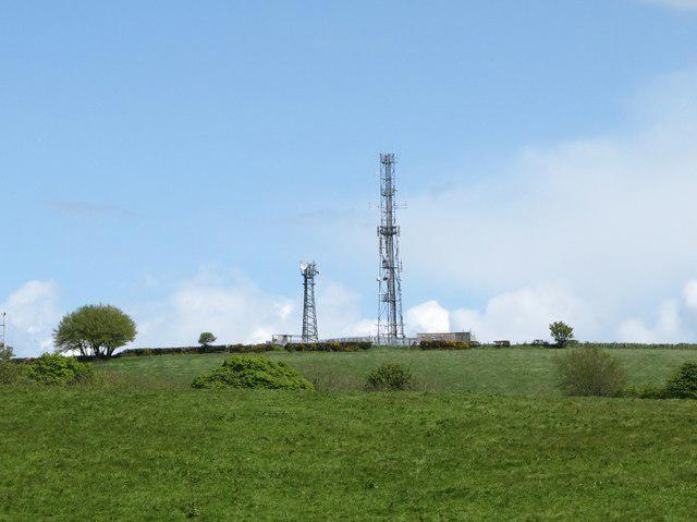 Photo could not load
J0332 : Telecommunications masts in the Townland of Tullyhappy
Eric Jones
Hill facts and local notes
Classifications
Elevation
209m
686 ft
Prominence
101m
Coordinates
54.2273, -6.4107
J037321
OS Map
29
At the Summit
The summit boasts a small cairn and offers plenty of room to spread out for a well-deserved rest, as well as some stunning views that'll make your Instagram followers envious.
Terrain & Geology
Tullyhappy is primarily composed of sedimentary rocks, specifically interbedded sandstones and shales, which have formed due to the geological processes over millions of years. This rocky foundation makes for a sturdy hill but keep an eye out for the occasional slippery spot after rain!
Views & Scenery
From the summit, expect sweeping vistas of the surrounding valleys, with the Galloway Forest Park and the Ayrshire hills dominating the horizon.
History & Heritage
Name Origin
The name 'Tullyhappy' possibly derives from the Gaelic 'Tulaig', meaning 'hill', combined with a local dialect descriptor that may reference its pleasantness – taking a mountain can be so uplifting!
Historical Significance
While Tullyhappy may not be steeped in ancient lore, it embodies the beauty and serenity of the Southern Uplands, making it a favourite among local hikers.
Getting There & Facilities
Check current local access restrictions, parking rules and transport timetables before travelling. These notes do not confirm public access to the summit.
Parking
There's parking available near the village of Dalmellington, where you can easily find space for a few cars. Be mindful of not blocking any driveways.
Public Transport
Buses run from larger nearby towns like Ayr, but do check the schedule as they may be infrequent. A good excuse to get out and stretch before starting the hike!
Nearby Facilities
Limited facilities are available in Dalmellington, with a couple of cafes and a public toilet. Perfect for a pre-hike cuppa or post-hike cake.
Safety Information
Known Hazards
- Steep drops on the northern face may pose risks; ensure to keep children and pets close at hand. Also, be cautious of changing weather conditions, particularly in winter.
General Safety Tips
- Check weather conditions before setting out
- Carry appropriate clothing and equipment
- Let someone know your planned route
- Take a map, compass, and GPS device
- Carry emergency supplies: food, water, first aid kit, torch
Hills
Some common questions about the hills answered
Are there group walks up Tullyhappy?
Many walkers use Walkmates to join or organise walks with others. You can check for group walks around Tullyhappy through the maps
Are there other walkers around Tullyhappy?
Activity varies by location and time, but Walkmates lets you see whether others have shared walks or shown interest in this area. Find other people through the walking friends search walking friends for Tullyhappy search or of course create your own walk for Tullyhappy
Can I organise a walk to Tullyhappy?
Yes. If there aren’t any walks listed already, you can create a walk and make it available for others to join.
If you're signed up to Walkmates, you can create a walk to Tullyhappy.
How do I find a walk up this hill?
There are often multiple ways to walk this hill, depending on experience and route preference. Walkmates helps you explore walks and routes that others have shared.
Can I suggest a new route up Tullyhappy?
Yes. You can suggest or create routes to share with others. Walkmates focuses on the social side of walking, so routes are used to help people organise walks and explore areas together, rather than as detailed navigation tools or route libraries.
Other uses really appreciate knowledgeable walkers sharing their routes. Share your favourite route to Tullyhappy here
The is an error or something incorrect about this hill. How do I let you know?
We always strive to keep the information on Walkmates as accurate as possible. If you find an error, please let us know through the contact form and we'll aim to correct it as quickly as possible
Community Discussion
Comments
Location
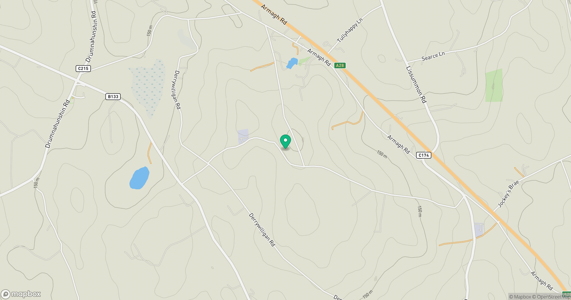
Grid reference: J037321
View on OpenStreetMapOpens a map in a new tab, centred on the hill.
Hills within 30 km
Straight-line distance, not a walking route or confirmation of access.
No comments yet. Be the first.