

Tinshill Moor
Good walks are even better shared.
SE2539 : Cookridge Fire Station - Otley Old Road
Betty Longbottom Photo source
Overview
Tinshill Moor
Nestled just northwest of Leeds, Tinshill Moor is a hidden gem for outdoor enthusiasts looking to escape the hustle and bustle of city life. Standing at an elevation of 245 meters, it may not be the highest peak, but it certainly packs a punch in terms of natural beauty and serenity.
Geology
If you're curious about geology and love a bit of grit, then Tinshill Moor's sandy gritstone is sure to please. With its robust formation, the moor bears witness to both geological history and human activity, having been quarried for its stone for centuries.
Getting There
The Tinshill Circular Walk is a fantastic way to experience the moor. Stretching about 6.5 kilometers, it leads you through diverse landscapes of lush woodland and expansive moorland. It can be completed in around 2.5 hours, making it a perfect half-day adventure.
Summit Features
Upon reaching the summit, adventurers will find a stone cairn and a trig point, both of which make great backdrops for photo opportunities. Be sure to pop a 'cairn selfie' to show the folks back home—never mind the fact that they might roll their eyes!
Terrain and Views
The terrain varies from soft, grassy patches to rocky outcrops that may pose a bit of a challenge. But for those with a spirit for exploration, the views from the top are well worth any minor obstacles.
Notable landmarks visible from the top include the sprawling Leeds city skyline and the distant rolling hills of the Dales. Spring and autumn are breathtaking seasons to visit, with blooming flowers or autumn's rich colours adding to the landscape's charm.
Hazards
While this moorland is generally safe for hikers, be wary of uneven ground and boggy areas, especially after a good downpour. You don’t want to return home muddy all over and claiming you last had a splash fight with a puddle!
Access and Facilities
Parking can be found on the streets of Tinshill, where you can conveniently leave your vehicle before heading out. For those relying on public transport, buses run regularly from Leeds. After a satisfying hike, pop into one of the local cafes for a warm drink or a bite to eat.
History and Significance
The illustrious name 'Tinshill' alludes to its historical roots, thought to reference the area's unique geographical character. This moor's strong ties to local agriculture and traditional grazing practices add an air of historical charm to your hiking experience.
So, whether you’re looking for a quick stroll or a thorough adventure through nature, Tinshill Moor offers it all. Just remember to pack your sense of adventure, and maybe a few snacks for the journey!
Certainly, Tinshill Moor may not make headlines like some lofty peaks, but it guarantees a delightful day out in nature's embrace.
Explore routes near Tinshill Moor
Walks starting near this hill. Open a route to check its map, distance and full itinerary.
Golden Acre Park Arboretum and Lake
View route
Adel Dam barefoot walking introduction
View route
Roundhay Park Waterloo Lake Circuit
View route
Leeds Dock to Knostrop Weir
View route
Route planning notes
These notes describe possible approaches. Check a route's map and access information when planning your walk.
Tinshill Circular Walk
A scenic loop starting from the village of Tinshill, this route offers a mix of woodland paths and open moorland.
Make a day of it, together
Find someone to share the walk with, or organise a day out along a route you like.
Photo Gallery
View all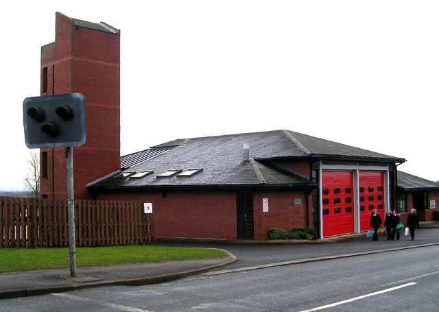 Photo could not load
SE2539 : Cookridge Fire Station - Otley Old Road
Betty Longbottom
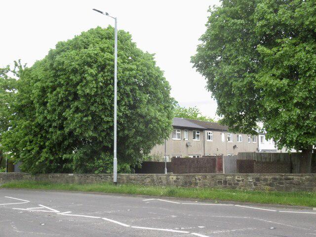 Photo could not load
SE2540 : Otley Old Road, Tinshill
Richard Webb
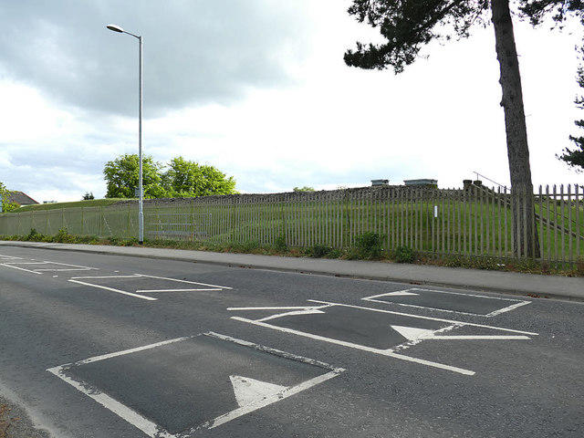 Photo could not load
SE2539 : Tinshill Service Reservoir
Stephen Craven
 Photo could not load
SE2539 : Tinshill transmitter from Holtdale Approach
Stephen Craven
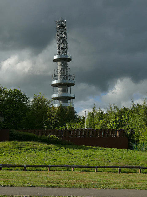 Photo could not load
SE2539 : Tinshill transmitter from the south
Stephen Craven
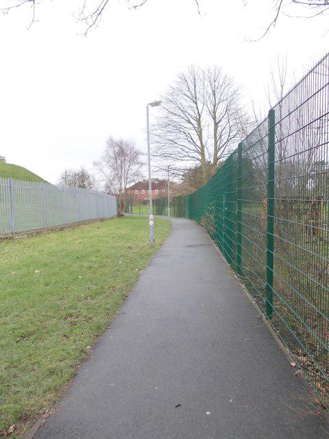 Photo could not load
SE2539 : Footpath - Tinshill Drive
Betty Longbottom
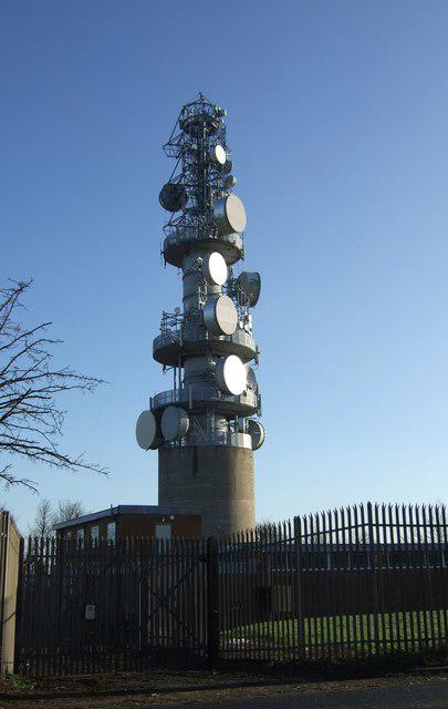 Photo could not load
SE2539 : Tinshill Communications Tower
JThomas
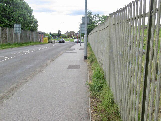 Photo could not load
SE2539 : Tinshill Moor
Richard Webb
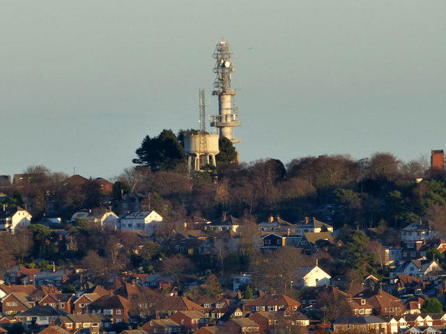 Photo could not load
SE2539 : Tinshill water tower and mast
Stephen Craven
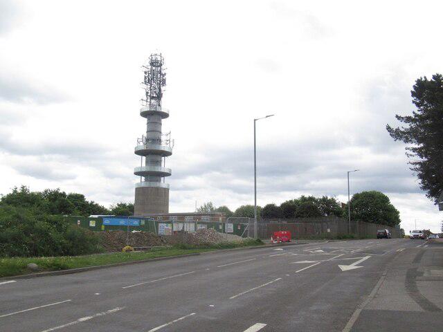
SE2539 : Communications tower, Tinshill
Richard Webb
Hill facts and local notes
Classifications
Elevation
198m
650 ft
Prominence
47m
Coordinates
53.8548, -1.6131
SE255399
OS Map
104
Explorer: 288N 289S
At the Summit
The summit features a stone cairn and a trig point, perfect for those ‘I've conquered it!’ selfies. Trust us, they won’t believe you without the evidence.
Terrain & Geology
Tinshill Moor is primarily composed of gritty sandstone, which adds a delightful crunch to your step as you traverse its paths. The underlying geology owes itself to the millstone grit formations of the Pennines, known for their historical use in stone quarrying.
Views & Scenery
From the summit, you can catch glimpses of the Leeds skyline to the south and rolling hills of the Dales beyond. Keep an eye out for aeroplanes as they glide through the skies, they possibly have better views than you!
History & Heritage
Name Origin
The name 'Tinshill' derives from the old English words referencing the area’s geographical features, likely meaning 'hill where tin is found.' Although, nowadays, you're more likely to find sheep than precious metals!
Historical Significance
Tinshill Moor has historical significance as part of the traditional moorland grazing systems that supported local agriculture.
Getting There & Facilities
Parking
Street parking is available at several points in Tinshill; however, please park responsibly to avoid congestion.
Public Transport
Regular bus services operate from Leeds city centre to Tinshill, making it accessible for public transport users.
Nearby Facilities
There are a few local cafes and pubs in Tinshill where you can grab a bite or a refreshing drink before or after your trek.
Safety Information
Known Hazards
- Uneven ground and boggy patches can be encountered, especially after rainfall. Always keep an eye on the weather.
General Safety Tips
- Check weather conditions before setting out
- Carry appropriate clothing and equipment
- Let someone know your planned route
- Take a map, compass, and GPS device
- Carry emergency supplies: food, water, first aid kit, torch
Hills
Some common questions about the hills answered
Are there group walks up Tinshill Moor?
Many walkers use Walkmates to join or organise walks with others. You can check for group walks around Tinshill Moor through the maps
Are there other walkers around Tinshill Moor?
Activity varies by location and time, but Walkmates lets you see whether others have shared walks or shown interest in this area. Find other people through the walking friends search walking friends for Tinshill Moor search or of course create your own walk for Tinshill Moor
Can I organise a walk to Tinshill Moor?
Yes. If there aren’t any walks listed already, you can create a walk and make it available for others to join.
If you're signed up to Walkmates, you can create a walk to Tinshill Moor.
How do I find a walk up this hill?
There are often multiple ways to walk this hill, depending on experience and route preference. Walkmates helps you explore walks and routes that others have shared.
Can I suggest a new route up Tinshill Moor?
Yes. You can suggest or create routes to share with others. Walkmates focuses on the social side of walking, so routes are used to help people organise walks and explore areas together, rather than as detailed navigation tools or route libraries.
Other uses really appreciate knowledgeable walkers sharing their routes. Share your favourite route to Tinshill Moor here
The is an error or something incorrect about this hill. How do I let you know?
We always strive to keep the information on Walkmates as accurate as possible. If you find an error, please let us know through the contact form and we'll aim to correct it as quickly as possible
Community Discussion
Comments
Location
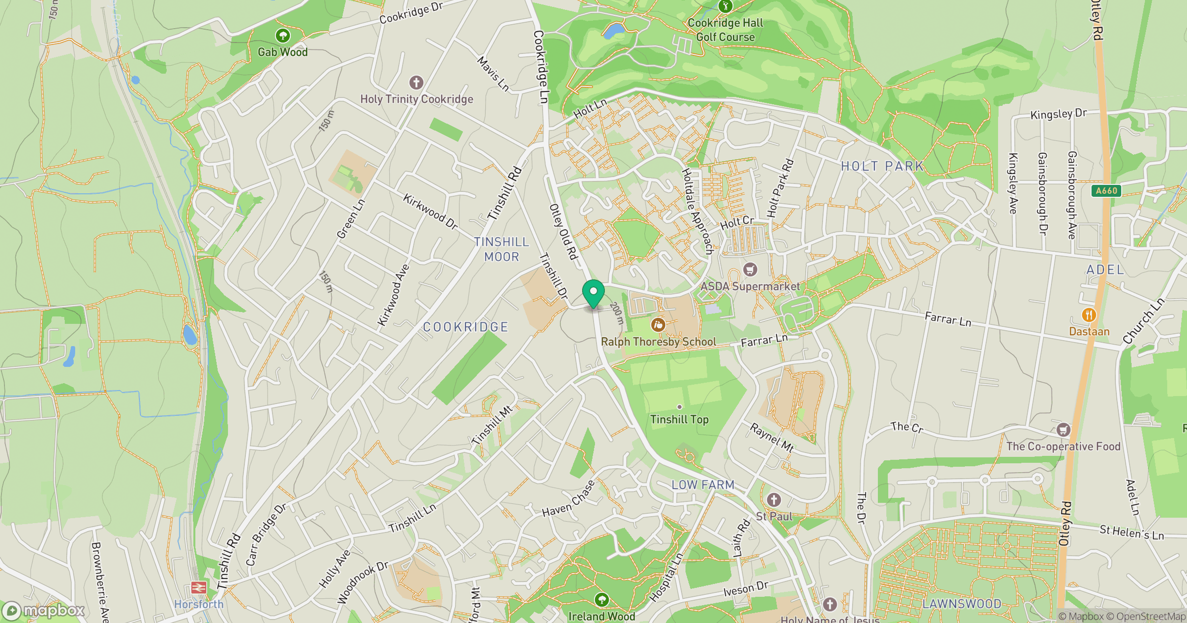
Grid reference: SE255399
View on OpenStreetMapOpens a map in a new tab, centred on the hill.
Nearby Hills
Rombalds Moor [Ilkley Moor]
402m

Kinder Scout
636m
Buckden Pike
702m

Pendle Hill
557m

Pen-y-ghent
694m
No comments yet. Be the first.