

The Hoe
Good walks are even better shared.
Overview
The Hoe: A Journey Along the Waterside
Nestled proudly in Devon, The Hoe is perhaps best known not for towering peaks but for its cultural and historical significance. This iconic landmark grants visitors exceptional views over Plymouth Sound and the English Channel, reminding us that sometimes it's the flatlands that hold the most charm.
Geology
The landscape here is formed predominantly from Devonian schist and limestone, telling a geological tale of erosion and formation that stretches back millions of years. While it may not be a mountain climber’s paradise, the surrounding area certainly makes for a fascinating exploration of nature’s artistry.
Routes
One of the best and most accessible ways to experience The Hoe is via the Promenade Walk. This easy route covers approximately 2 km along the scenic waterfront. Perfect for families or those looking to stretch their legs while enjoying the sea air, it should take no more than an hour at a leisurely pace.
Summit Features
While there is no summit to reach, the features scattered around The Hoe are impressive in their own right. Don’t miss Smeaton's Tower – a lighthouse that stands as a sentinel over the waters, guiding mariners and offering visitors a glimpse into nautical history.
Terrain Type
The terrain is predominantly flat with paved paths and well-maintained grassy areas, making it accessible for all levels of hikers.
Views
The Hoe provides breathtaking views of the expansive Plymouth Sound, the naval warships stationed in the harbour, and the picturesque coastline. For the best experience, plan your visit in spring or summer when the colours of the landscape are in full bloom.
Hazards
Though the walk is easy-going, remaining alert is advised; the coastal paths can become slippery, particularly following rainfall. Steer clear of the edges if you want to avoid an unplanned swim!
Nearby Summits
Just a short distance away lies the Peninsula of Mount Edgcumbe, which offers a more traditional hiking experience.
Access
Accessing The Hoe is straightforward. Nearest parking is available on Hoe Road, with public transport connections aplenty to Plymouth city centre. Visitors can benefit from both bus and train services, making it easy to embark on your journey.
Facilities
Cafes and eateries are abundant, making it convenient to grab a bite or enjoy a cup of tea while soaking in the views. Public toilets are also available close to the main attractions for visitor convenience.
History
The name 'Hoe' might leave one amused, but it carries a deeper meaning. Rooted in 'hoh', it signifies a heel or a promontory, aptly describing the land's shape. Historically, this site has been a focal point for maritime events, having witnessed numerous pivotal moments in British naval history.
So lace up those walking shoes and prepare for a delightful experience at The Hoe – where history meets stunning coastal views in a boastful display of the best that Devon has to offer!
Explore routes near The Hoe
Public walks starting within 80 km of this hill. Nearby does not mean a route reaches the summit; check its map and access before setting out.
Dun Mhulan Broch Quick Walk
View route
Berneray Community Hall to the beautiful beach
View route
Fairy Lochs Liberator Wreckage Circuit
View route
Beautiful private beach walk Isle of Harris
View route
Route planning notes
These notes describe possible approaches, not verified navigable routes or permission to cross land. Check current paths, local access rules and conditions before setting out.
Promenade Walk
A simple stroll along the waterfront offering panoramic views of Plymouth Sound.
Make a day of it, together
Find someone to share the walk with, or organise a day out along a route you like.
Photo Gallery
View all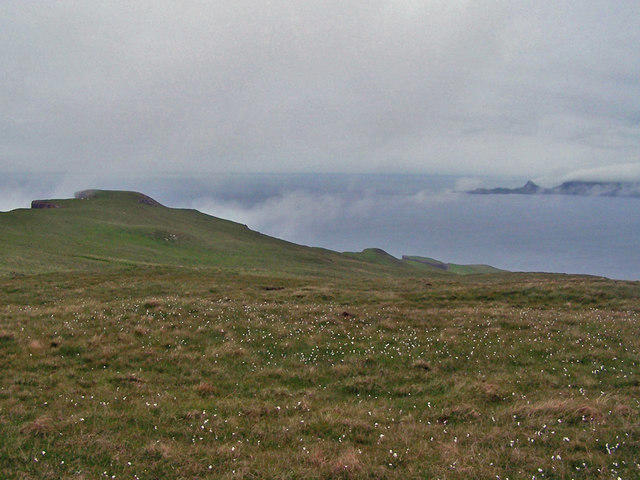 Photo could not load
NG1641 : North west from The Hoe
Richard Dorrell
Hill facts and local notes
Classifications
Elevation
231m
758 ft
Prominence
129m
Coordinates
57.3789, -6.7194
NG164418
OS Map
23
Explorer: 407
At the Summit
The Hoe features iconic landmarks including the iconic Smeaton's Tower lighthouse and the Royal Citadel, adding to its historical charm.
Terrain & Geology
The Hoe consists mainly of Devonian schist and limestone, indicative of the area's geological history which has shaped its stunning coastal landscape.
Views & Scenery
Panoramic views of Plymouth Sound, the English Channel, and the historic naval port.
History & Heritage
Name Origin
The name 'Hoe' is derived from the Old English word 'hoh', meaning 'heel' or 'promontory'.
Historical Significance
Historically, The Hoe is significant for its naval heritage, having been a site of many important battles and royal events.
Getting There & Facilities
Check current local access restrictions, parking rules and transport timetables before travelling. These notes do not confirm public access to the summit.
Parking
The Hoe offers metered parking on Hoe Road and is close to other public parking facilities.
Public Transport
Plymouth provides ample bus and train services to the city centre, just a short walk from The Hoe.
Nearby Facilities
Several cafes and restaurants line the area, along with public toilets near the main attractions.
Safety Information
Known Hazards
- Coastal paths can be slippery, especially after rain; watch your step near edges.
General Safety Tips
- Check weather conditions before setting out
- Carry appropriate clothing and equipment
- Let someone know your planned route
- Take a map, compass, and GPS device
- Carry emergency supplies: food, water, first aid kit, torch
Hills
Some common questions about the hills answered
Are there group walks up The Hoe?
Many walkers use Walkmates to join or organise walks with others. You can check for group walks around The Hoe through the maps
Are there other walkers around The Hoe?
Activity varies by location and time, but Walkmates lets you see whether others have shared walks or shown interest in this area. Find other people through the walking friends search walking friends for The Hoe search or of course create your own walk for The Hoe
Can I organise a walk to The Hoe?
Yes. If there aren’t any walks listed already, you can create a walk and make it available for others to join.
If you're signed up to Walkmates, you can create a walk to The Hoe.
How do I find a walk up this hill?
There are often multiple ways to walk this hill, depending on experience and route preference. Walkmates helps you explore walks and routes that others have shared.
Can I suggest a new route up The Hoe?
Yes. You can suggest or create routes to share with others. Walkmates focuses on the social side of walking, so routes are used to help people organise walks and explore areas together, rather than as detailed navigation tools or route libraries.
Other uses really appreciate knowledgeable walkers sharing their routes. Share your favourite route to The Hoe here
The is an error or something incorrect about this hill. How do I let you know?
We always strive to keep the information on Walkmates as accurate as possible. If you find an error, please let us know through the contact form and we'll aim to correct it as quickly as possible
Community Discussion
Comments
Location
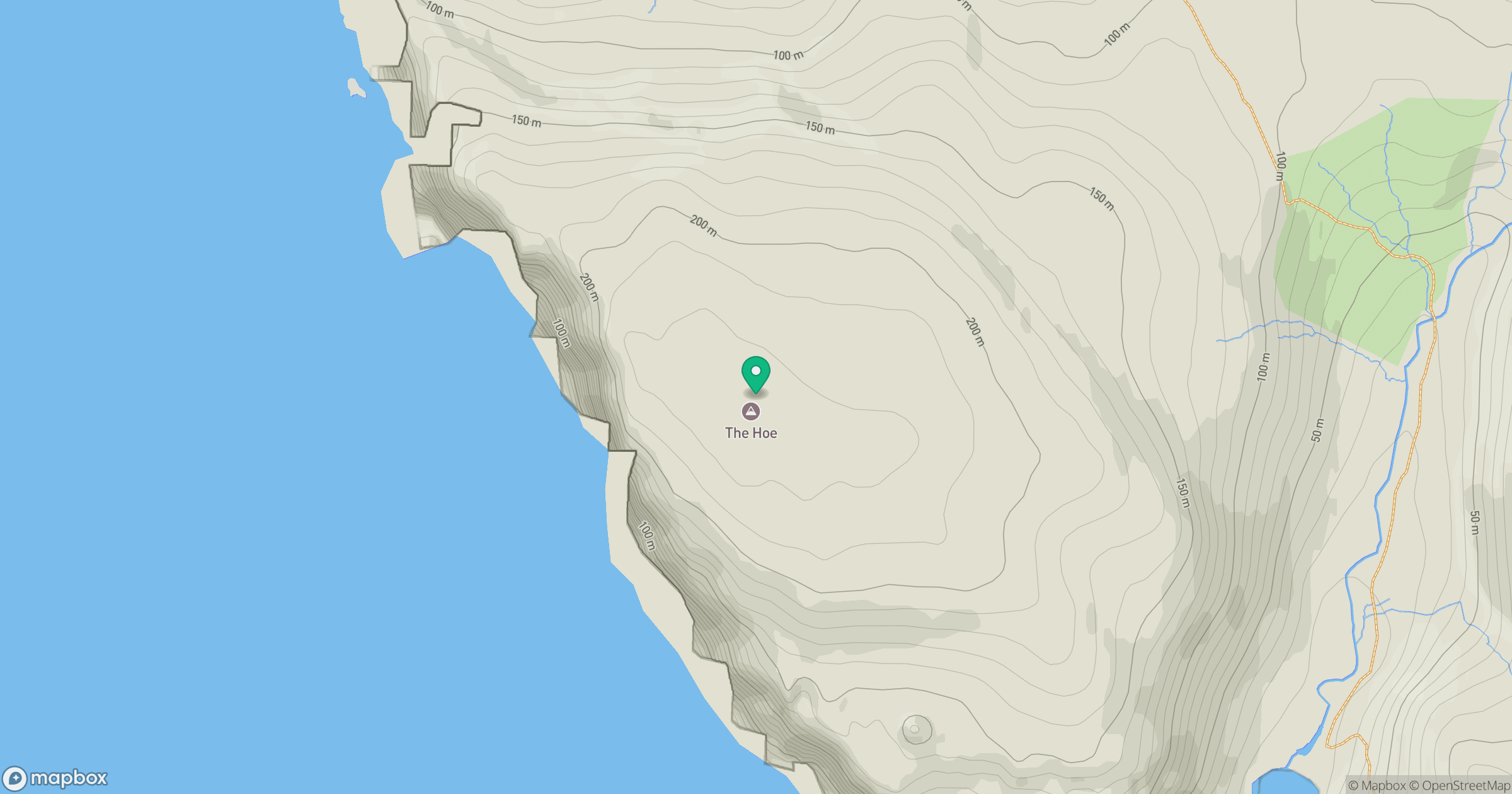
Grid reference: NG164418
View on OpenStreetMapOpens a map in a new tab, centred on the hill.
Hills within 30 km
Straight-line distance, not a walking route or confirmation of access.
No comments yet. Be the first.