

Ben Skriaig
Good walks are even better shared.
Overview
Ben Skriaig: An Overview
Ben Skriaig, standing at 393 meters, might not be the highest mountain in the Scottish Highlands, but what it lacks in height, it more than compensates with stunning views and a delightful walking experience. Nestled in the enchanting surroundings near NG164535, this Marilyn beckons walking enthusiasts keen to explore its rugged charm.
Geology
Picture this: the very rocks under your feet are ancient, dating back billions of years! Ben Skriaig is primarily made of Lewisian Gneiss, a testament to the geological history of Scotland. If you’re into geology, you’ll find the weathered textures and striking rock formations irresistible.
Route Details
The Northwest Ridge Route is your best bet for a satisfying ascent. It spans approximately 6.5 km and typically takes about 3.5 hours to complete—perfect to fit in a cheeky snack at the summit. The terrain is generally moderate, just watch out for the odd bog; they love to pretend they’re solid ground until you step on them!
Summit Features
Upon reaching the summit, adventurers are greeted by a modest cairn that stands like a trophy for your hard work. Take a moment to enjoy the panoramic views that stretch out ahead of you; it's the kind of sight that makes you want to shout, 'I’m on top of the world!' (Though, do refrain from actually shouting—sound carries, and you might scare off the locals).
Terrain Type
Expect a mix of rocky outcrops and grassy slopes, with an abundance of heather colouring the path as you climb. Initially easy on the legs, the middle section offers a chance to channel your inner mountain goat as you scramble up some steeper parts.
Best Viewing Seasons
The best time to take in the spectacular sights from Ben Skriaig is during Late Spring to Early Autumn. Sunrise and sunset are particularly magical times; just keep an eye on the clock, or you might find yourself navigating in the dark—unless you fancy a nocturnal adventure!
Hazards
Stay vigilant as the weather can change faster than you can say 'where's my thermal layer?' Poor visibility can pop up in the blink of an eye, so always be prepared with the right gear and err on the side of caution.
Nearby Attractions
After conquering Ben Skriaig, consider tackling the nearby Beinn an Leathaid or Beinn a' Chuirn—because why not load up on the calories and burn them off again?
Access Points
Parking is available at the end of a public road leading towards Kilchattan Bay. If you opt for public transport, you’ll be able to catch a bus from Oban—though it's a bit of a juggling act with the schedules.
Facilities
Before you set forth, ensure you pop into Bowmore for a quick cuppa or a last-minute snack. The local cafes offer a warm welcome and the toilets will make your trek much more comfortable.
A Bit of Local History
Interestingly, the name 'Skriaig' means 'mountain of the scrub' in Gaelic. While it may not have a history of epic tales, it embodies the spirit of the Highlands as a serene escape.
Conclusion
In conclusion, Ben Skriaig may demand only a small investment in time and effort, yet it rewards hikers with awe-inspiring views and a taste of the Highland experience. Whether you're a serious climber or a casual walker, this little gem is worth your while. Put on your boots, pack that flask of tea, and set forth to explore!
Explore routes near Ben Skriaig
Public walks starting within 80 km of this hill. Nearby does not mean a route reaches the summit; check its map and access before setting out.
Berneray Community Hall to the beautiful beach
View route
Dun Mhulan Broch Quick Walk
View route
Beautiful private beach walk Isle of Harris
View route
Fairy Lochs Liberator Wreckage Circuit
View route
Route planning notes
These notes describe possible approaches, not verified navigable routes or permission to cross land. Check current paths, local access rules and conditions before setting out.
Northwest Ridge Route
A straightforward ascent via the northwest ridge, suitable for most walkers, though a decent pair of boots is recommended for tackling the occasional boggy patch.
Make a day of it, together
Find someone to share the walk with, or organise a day out along a route you like.
Photo Gallery
View all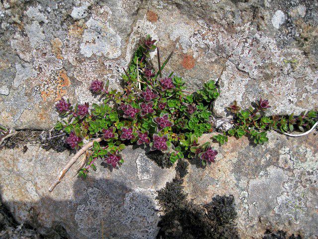 Photo could not load
NG1653 : Rock plant on Ben Skriaig
Richard Dorrell
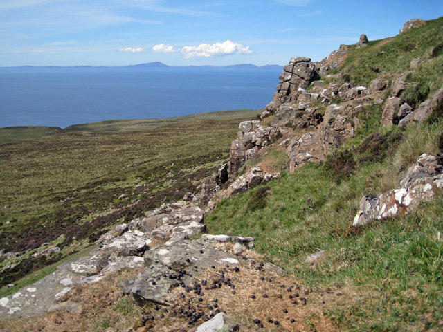 Photo could not load
NG1653 : On Ben Skriaig's crag
Richard Dorrell
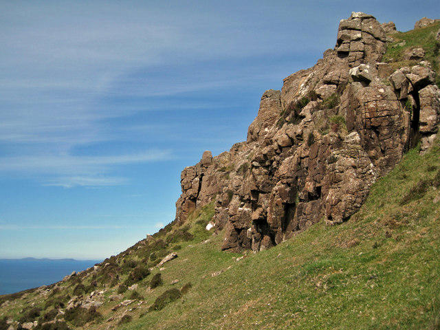 Photo could not load
NG1653 : Crag on Ben Skriaig
Richard Dorrell
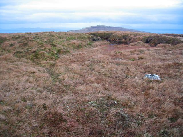 Photo could not load
NG1653 : Summit of Ben Skriaig
John Allan
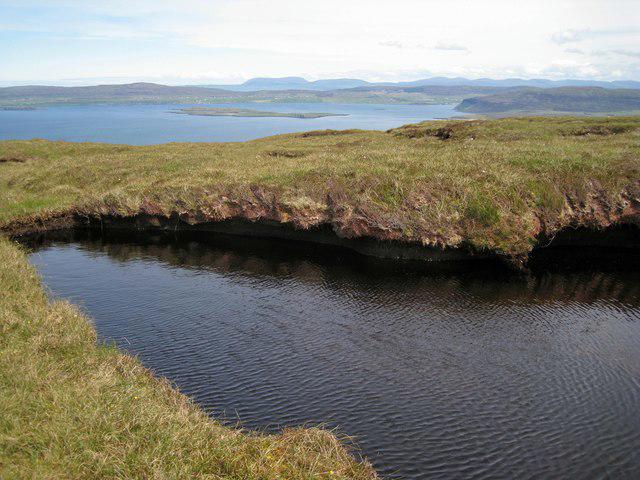 Photo could not load
NG1653 : Little summit lochan
Richard Dorrell
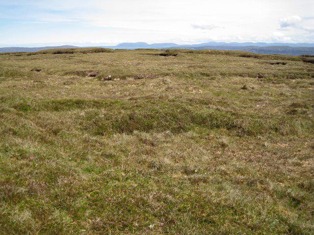 Photo could not load
NG1653 : The summit is about here
Richard Dorrell
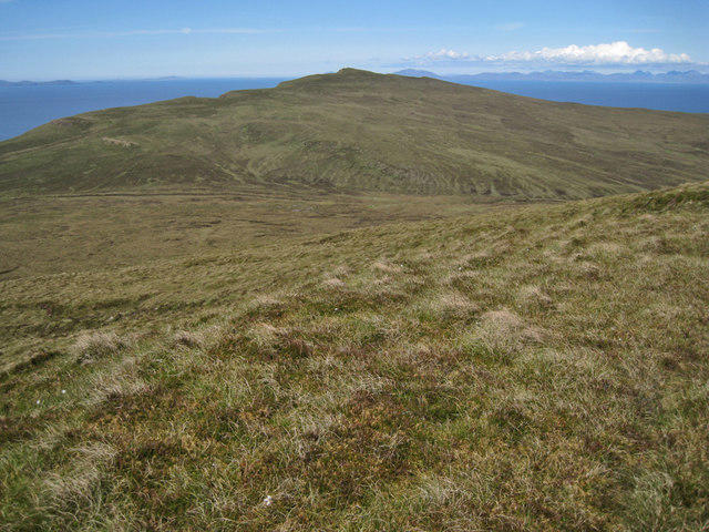 Photo could not load
NG1653 : From Ben Skriaig to Biod an Athair
Richard Dorrell
Hill facts and local notes
Classifications
Elevation
309m
1,014 ft
Prominence
100m
Coordinates
57.4831, -6.7326
NG164535
OS Map
23
Explorer: 407
At the Summit
The summit boasts a modest cairn and impressive panoramic views. It's a perfect spot to catch your breath, or take a fleeting selfie with the wind blowing your hair in all directions.
Terrain & Geology
Ben Skriaig is primarily composed of ancient Lewisian Gneiss, part of some of the oldest rocks in the UK. The mountain features rocky outcrops and rugged terrain, giving it a slightly overstressed look after a hard day's hike.
Views & Scenery
From the summit, you can enjoy views of the distant Paps of Jura, the rolling hills of Colonsay, and even the vast expanse of the Atlantic Ocean on a clear day.
History & Heritage
Name Origin
The name 'Skriaig' derives from the Gaelic 'Sgriobhaig', which translates to 'mountain of the scrub', possibly indicating the lush vegetation found on its slopes.
Historical Significance
This mountain may not have been a centre of historical battles or ancient rituals, but it stands proud in the landscape, offering hikers a welcome sense of solitude and achievement.
Getting There & Facilities
Check current local access restrictions, parking rules and transport timetables before travelling. These notes do not confirm public access to the summit.
Parking
There is a small parking area at the end of the public road leading to Kilchattan Bay, approximately 5 km from the trailhead.
Public Transport
Buses from Oban are available, although they are not particularly frequent. A taxi might be more reliable for reaching your starting point.
Nearby Facilities
Bowmore has several cafes and shops for stocking up on energy snacks, as well as toilets, but make sure to utilise these before embarking on your adventure.
Safety Information
Known Hazards
- Watch for sudden changes in weather, as conditions can turn in the blink of an eye in the Highlands. Additionally, avoid the bogs unless you're particularly fond of muddy boots.
General Safety Tips
- Check weather conditions before setting out
- Carry appropriate clothing and equipment
- Let someone know your planned route
- Take a map, compass, and GPS device
- Carry emergency supplies: food, water, first aid kit, torch
Hills
Some common questions about the hills answered
Are there group walks up Ben Skriaig?
Many walkers use Walkmates to join or organise walks with others. You can check for group walks around Ben Skriaig through the maps
Are there other walkers around Ben Skriaig?
Activity varies by location and time, but Walkmates lets you see whether others have shared walks or shown interest in this area. Find other people through the walking friends search walking friends for Ben Skriaig search or of course create your own walk for Ben Skriaig
Can I organise a walk to Ben Skriaig?
Yes. If there aren’t any walks listed already, you can create a walk and make it available for others to join.
If you're signed up to Walkmates, you can create a walk to Ben Skriaig.
How do I find a walk up this hill?
There are often multiple ways to walk this hill, depending on experience and route preference. Walkmates helps you explore walks and routes that others have shared.
Can I suggest a new route up Ben Skriaig?
Yes. You can suggest or create routes to share with others. Walkmates focuses on the social side of walking, so routes are used to help people organise walks and explore areas together, rather than as detailed navigation tools or route libraries.
Other uses really appreciate knowledgeable walkers sharing their routes. Share your favourite route to Ben Skriaig here
The is an error or something incorrect about this hill. How do I let you know?
We always strive to keep the information on Walkmates as accurate as possible. If you find an error, please let us know through the contact form and we'll aim to correct it as quickly as possible
Community Discussion
Comments
Location
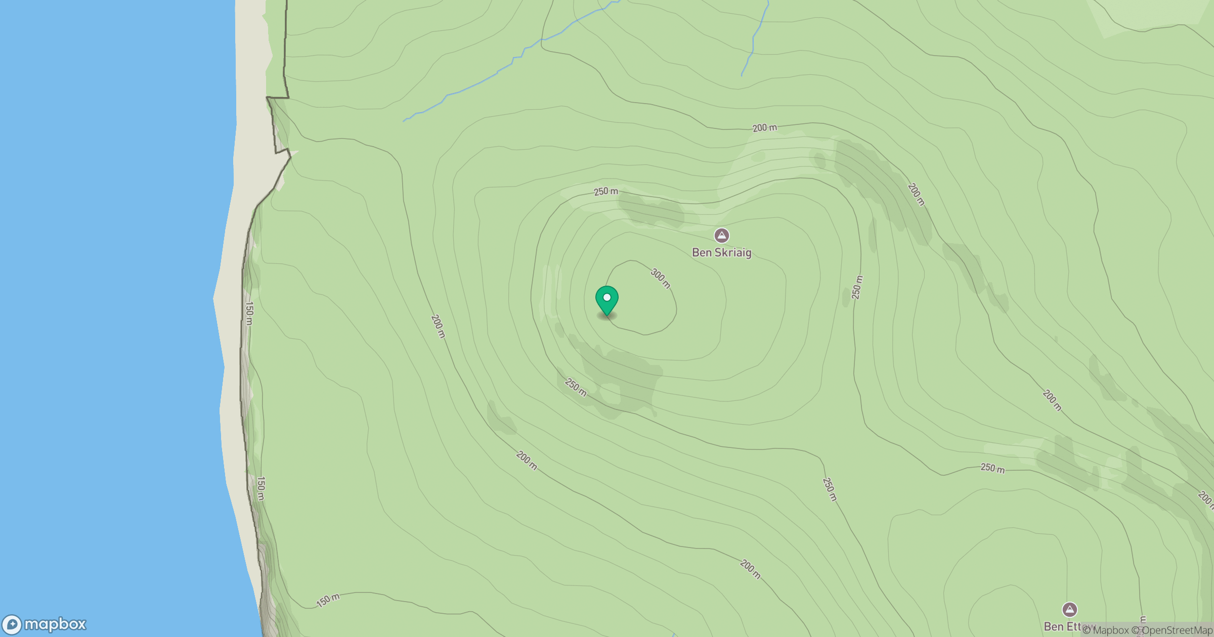
Grid reference: NG164535
View on OpenStreetMapOpens a map in a new tab, centred on the hill.
Hills within 30 km
Straight-line distance, not a walking route or confirmation of access.
No comments yet. Be the first.