

Talkin Fell
Good walks are even better shared.
NY5656 : Curricks, Kelky Fell
Richard Webb Photo source
Overview
Talkin Fell
At a modest height of 235 metres, Talkin Fell may not be the highest peak in the North Pennines, but what it lacks in elevation, it makes up for in charm.
Geology
The interesting geology of Talkin Fell is primarily limestone, and if you’re keen on geology, you’ll have a lot to marvel at. Limestone pavements and karst features weave a captivating story of the Earth’s formation.
Routes
The Talkin Fell Circular Walk is the most popular route, taking you around 6.4 km with a pleasant duration of about 2.5 hours. It’s an easy trek, perfect for unfurling your hiking boots without breaking a sweat. The start point at Talkin Tarn is a site of beauty in its own right!
Summit Features
At the summit, you’ll find a trig point—a classic British marker. It's a great place for a quick photo op or snack break, assuming you packed something delicious to nibble on!
Terrain
The terrain consists mainly of grassy expanses with some rocky outcrops to keep things interesting. It’s a pleasant walk that even attracts ‘first-timers’ embarking on their hiking journey.
Views
Those who make the ascent are rewarded with splendid views. On a clear day, the peaks of the Lake District stretch out before you, and the lush valleys of the North Pennines are a sight to behold. The best times to soak in these vistas are during the late spring and autumn months when the landscape is particularly resplendent.
Hazards
As you embark on your adventure, keep an eye on the skies—weather can change quicker than you can say 'Bob's your uncle.' And do watch out for sheep; they may not appreciate you cutting through their lounging spots!
Nearby Summits
If you're looking for more, nearby Great Mell Fell and Little Mell Fell are worth a jaunt. They offer both challenge and beauty, complementing a day out on Talkin Fell.
Access
If you're driving, free parking is situated at Talkin Tarn, making for easy access. For those relying on public transport, buses run from Carlisle to Brampton, so no worries if you've forgotten to bring the family car.
Facilities
A cheeky coffee or a well-deserved slice of cake awaits you at the Talkin Tarn café, complete with toilet facilities. Perfect for a pre- or post-walk treat!
History
Did you know the name 'Talkin' stems from Norse origins? That's right; it often makes one think about tall stones—fitting, considering the impressive rock formations of the Fell!
Conclusion
All in all, Talkin Fell might be a small hill, but it certainly has a big heart. Whether you're an experienced hiker or merely in for a stroll, this walk is sure to charm your socks off. Happy hiking!
Explore routes near Talkin Fell
Walks starting near this hill. Open a route to check its map, distance and full itinerary.
Cawfields Quarry and the Vallum
View route
Long Meg and Lacy's Caves
View route
Steel Rigg and Crag Lough
View route
Allen Banks and Morralee Tarn
View route
Route planning notes
These notes describe possible approaches. Check a route's map and access information when planning your walk.
Talkin Fell Circular Walk
A pleasant circular route that begins at Talkin Tarn and winds around the hill, providing ample opportunities to take in the stunning scenery.
Make a day of it, together
Find someone to share the walk with, or organise a day out along a route you like.
Photo Gallery
View all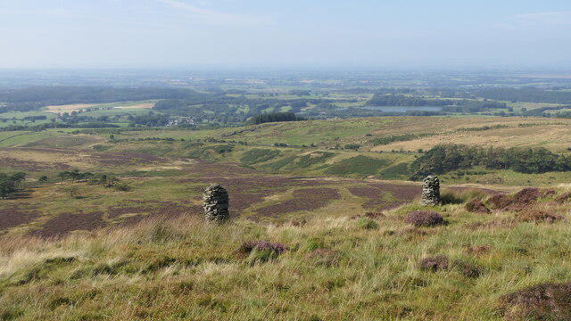 Photo could not load
NY5656 : Curricks, Kelky Fell
Richard Webb
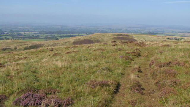 Photo could not load
NY5656 : Path, Kelky Fell
Richard Webb
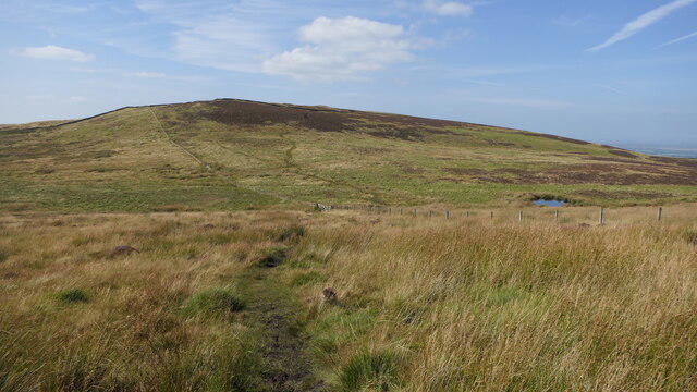 Photo could not load
NY5756 : Kelky Fell
Richard Webb
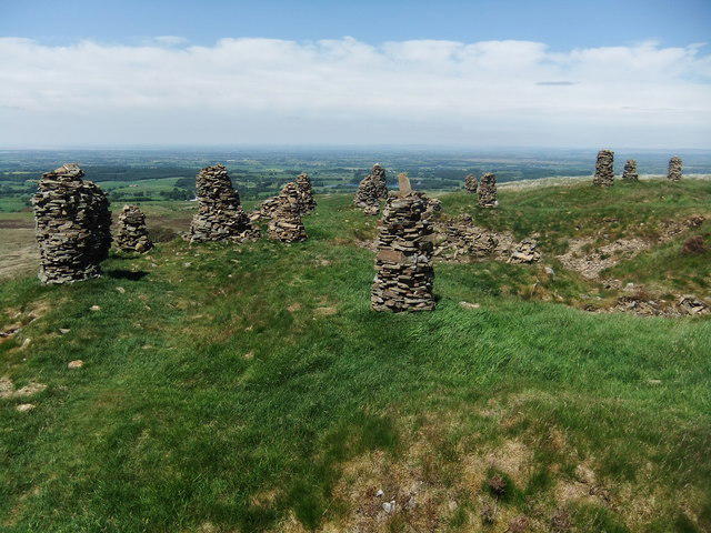 Photo could not load
NY5656 : Curricks on Talkin Fell
David Brown
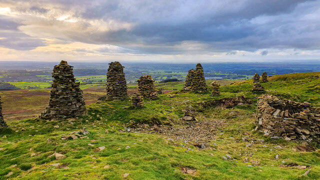 Photo could not load
NY5656 : Kelky Fell
Peter McDermott
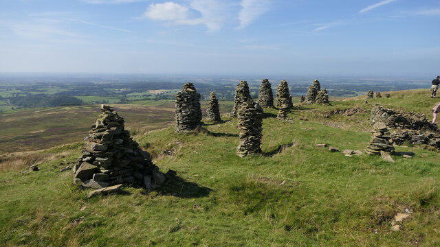 Photo could not load
NY5656 : Kelky Fell curricks
Richard Webb
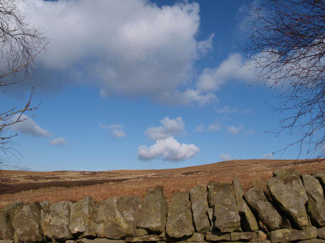 Photo could not load
NY5656 : View to Talkin/Kelky Fell from Hynam
Sharon Leedell
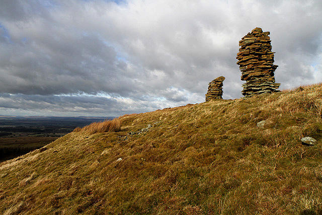 Photo could not load
NY5656 : Two cairns on Talkin Fell
Walter Baxter
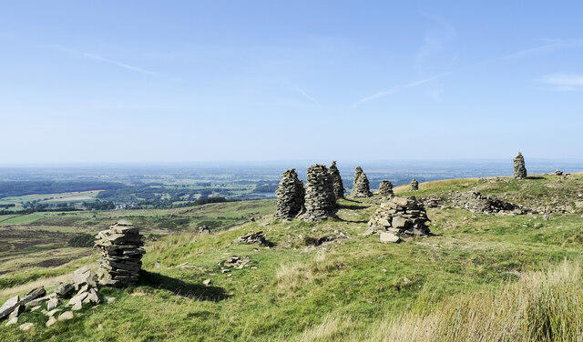 Photo could not load
NY5656 : Multiple cairns on Kelky Fell
Trevor Littlewood
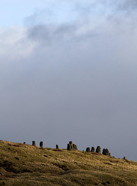
NY5656 : Cairns on Talkin Fell
Walter Baxter
Hill facts and local notes
Classifications
Elevation
382m
1,252 ft
Prominence
33m
Coordinates
54.8996, -2.6708
NY570563
OS Map
86
Explorer: 315
At the Summit
The summit features a modest yet commemorative trig point surrounded by grassy knolls, offering a perfect spot for a picnic—sandwiches not included.
Terrain & Geology
Talkin Fell is primarily composed of limestone, which gives rise to a unique landscape featuring limestone pavements and several karst features. The surrounding areas are rich in carboniferous rocks, contributing to its intriguing geology.
Views & Scenery
From the summit, you can catch glimpses of the stunning Lake District fells to the west and the rich valleys of the North Pennines.
History & Heritage
Name Origin
The name 'Talkin' is derived from the Old Norse word 'Tolkyn', meaning 'tall stone', referring to the prominent rocks in the area.
Historical Significance
Talkin Fell and its surroundings have historical significance due to ancient farming practices and the remnants of traditional stone walls that dot the landscape.
Getting There & Facilities
Parking
Free parking is available at the Talkin Tarn car park, which is around 1 mile from the start of the walk.
Public Transport
The nearest bus service is from Carlisle, with regular connections to the village of Brampton. Timetables can be checked on local transport sites.
Nearby Facilities
There is a café at Talkin Tarn offering refreshments and light meals, plus toilet facilities are available.
Safety Information
Known Hazards
- Beware of sudden weather changes; visibility can diminish quickly. Keep an eye out for sheep crossing the paths—these fluff balls have priority!
General Safety Tips
- Check weather conditions before setting out
- Carry appropriate clothing and equipment
- Let someone know your planned route
- Take a map, compass, and GPS device
- Carry emergency supplies: food, water, first aid kit, torch
Hills
Some common questions about the hills answered
Are there group walks up Talkin Fell?
Many walkers use Walkmates to join or organise walks with others. You can check for group walks around Talkin Fell through the maps
Are there other walkers around Talkin Fell?
Activity varies by location and time, but Walkmates lets you see whether others have shared walks or shown interest in this area. Find other people through the walking friends search walking friends for Talkin Fell search or of course create your own walk for Talkin Fell
Can I organise a walk to Talkin Fell?
Yes. If there aren’t any walks listed already, you can create a walk and make it available for others to join.
If you're signed up to Walkmates, you can create a walk to Talkin Fell.
How do I find a walk up this hill?
There are often multiple ways to walk this hill, depending on experience and route preference. Walkmates helps you explore walks and routes that others have shared.
Can I suggest a new route up Talkin Fell?
Yes. You can suggest or create routes to share with others. Walkmates focuses on the social side of walking, so routes are used to help people organise walks and explore areas together, rather than as detailed navigation tools or route libraries.
Other uses really appreciate knowledgeable walkers sharing their routes. Share your favourite route to Talkin Fell here
The is an error or something incorrect about this hill. How do I let you know?
We always strive to keep the information on Walkmates as accurate as possible. If you find an error, please let us know through the contact form and we'll aim to correct it as quickly as possible
Community Discussion
Comments
Location
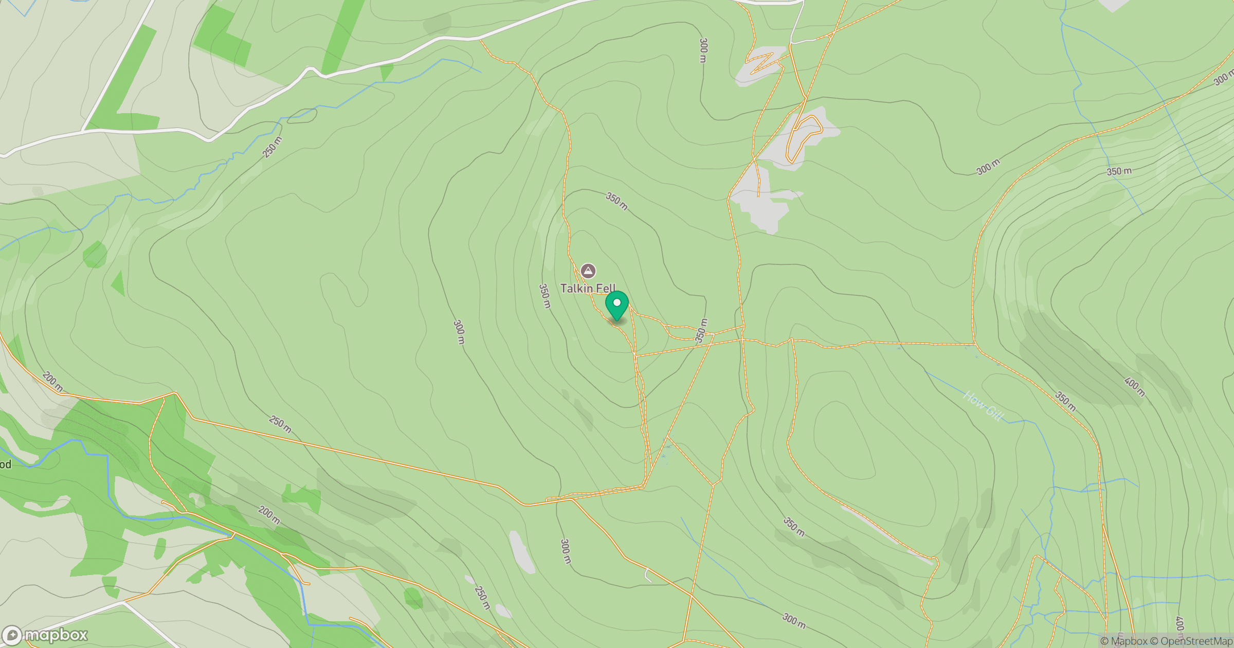
Grid reference: NY570563
View on OpenStreetMapOpens a map in a new tab, centred on the hill.
Nearby Hills

Cross Fell
893m
Place Fell
657m

High Street
828m

Blencathra - Hallsfell Top
868m
St Sunday Crag
841m
No comments yet. Be the first.