
Cold Fell
Good walks are even better shared.
Overview
Discover Cold Fell
Introduction
Cold Fell stands proudly at an elevation of 600 meters in the stunning Lake District. Known for its wild beauty and remote location, this Marilyn offers haven to both keen hikers and a variety of wildlife.
Geology
The landscape of Cold Fell is a testament to volcanic activity from centuries ago, featuring a range of rock types including andesite and basalt. These sturdy rocks form a spectacular canvas against the sky and shape the paths trails meander up the fell.
Route Description
A popular path to the top is the Cold Fell Circular Walk, starting from Ennerdale Bridge. This moderate trek of 8.5 km takes around 3.5 hours, drawing hikers through lush valleys and ensuring plenty of opportunities to encounter the local wildlife. Be mindful of the traditional British weather – it has a knack for changing on a dime!
Summit Features
At the summit, a humble cairn welcomes you, seemingly guarding the breathtaking views that stretch out in every direction. It’s the perfect spot to pause and reflect – or pose for the obligatory summit selfie!
Terrain
Expect a delightful mix of grassy areas punctuated by rocky outcrops; watch for surprisingly deep pockets of bog that can transform your jaunt into an adventure. Proper footwear is essential – leave the flip-flops at home!
Views
The views from Cold Fell are nothing short of spectacular. Encounter shadows of Pillar and Great Gable towering majestically nearby, and take in the serene sight of Ennerdale Water, glistening in the sunlight. The best time to appreciate this lovely vista is late spring through early autumn.
Hazards
Although Cold Fell is a delightful hike, it does come with a few hazards to be mindful of. Enjoy the views but be wary of those deceptively smooth-looking rocks and soggy patches that might just decide to claim your boots!
Access and Facilities
Ennerdale Bridge serves as the primary gateway to Cold Fell, complete with parking and facilities including a cozy café and pub for a post-hike refreshment. If you prefer public transport, the bus service from Cockermouth is a convenient option.
Conclusion
For anyone looking to stretch their legs and enjoy the beauty of the Lake District, Cold Fell is a fantastic choice. With its stunning vistas, rich geological history, and accessible routes, it’s a hike that’s well worth the trek. Just remember to pack a sense of adventure – and maybe a snack or two!
Explore routes near Cold Fell
Walks starting near this hill. Open a route to check its map, distance and full itinerary.
Cawfields Quarry and the Vallum
View route
Steel Rigg and Crag Lough
View route
Long Meg and Lacy's Caves
View route
Allen Banks and Morralee Tarn
View route
Route planning notes
These notes describe possible approaches. Check a route's map and access information when planning your walk.
Cold Fell Circular Walk
A scenic circular route starting from the small village of Ennerdale Bridge, winding through picturesque valleys and past tranquil streams, with a lovely climb to the summit of Cold Fell.
Make a day of it, together
Find someone to share the walk with, or organise a day out along a route you like.
Hill facts and local notes
Classifications
Elevation
621m
2,037 ft
Prominence
168m
Coordinates
54.8939, -2.6163
NY605556
OS Map
86
Explorer: OL43W
At the Summit
The summit features a modest cairn that provides a perfect spot to soak in the panoramic views. There's also a small weathered stone marker hinting at the area's history.
Terrain & Geology
Cold Fell is primarily composed of volcanic rock, specifically andesite and basalt, which contributes to the rugged beauty and unique landscapes of the area. The remnants of past volcanic activity can be observed in the various rock formations.
Views & Scenery
From the summit, you can admire views of the surrounding valleys, with sightings of nearby peaks such as Pillar and Great Gable. The stunning Ennerdale Water is also visible, lying serenely below.
History & Heritage
Name Origin
The name 'Cold Fell' is derived from the Old Norse 'kald', meaning 'cold' – which is quite fitting given the chill that can hang around the summit even in summer!
Historical Significance
Historically, Cold Fell has been a significant point for shepherds and locals who have traversed its slopes for centuries, integrating it into their daily lives and practices.
Getting There & Facilities
Parking
There is parking available at Ennerdale Bridge, with designated spaces for hikers near the village green.
Public Transport
The nearest bus service runs from Cockermouth to Ennerdale Bridge, making it quite handy for public transport users.
Nearby Facilities
Ennerdale Bridge has a quaint little café and a pub, perfect for a post-hike pint or a slice of homemade cake. Toilets are also available in the village.
Safety Information
Known Hazards
- Watch out for slippery stones and unexpected bogs – they have a sneaky habit of hiding under lovely green grass!
General Safety Tips
- Check weather conditions before setting out
- Carry appropriate clothing and equipment
- Let someone know your planned route
- Take a map, compass, and GPS device
- Carry emergency supplies: food, water, first aid kit, torch
Hills
Some common questions about the hills answered
Are there group walks up Cold Fell?
Many walkers use Walkmates to join or organise walks with others. You can check for group walks around Cold Fell through the maps
Are there other walkers around Cold Fell?
Activity varies by location and time, but Walkmates lets you see whether others have shared walks or shown interest in this area. Find other people through the walking friends search walking friends for Cold Fell search or of course create your own walk for Cold Fell
Can I organise a walk to Cold Fell?
Yes. If there aren’t any walks listed already, you can create a walk and make it available for others to join.
If you're signed up to Walkmates, you can create a walk to Cold Fell.
How do I find a walk up this hill?
There are often multiple ways to walk this hill, depending on experience and route preference. Walkmates helps you explore walks and routes that others have shared.
Can I suggest a new route up Cold Fell?
Yes. You can suggest or create routes to share with others. Walkmates focuses on the social side of walking, so routes are used to help people organise walks and explore areas together, rather than as detailed navigation tools or route libraries.
Other uses really appreciate knowledgeable walkers sharing their routes. Share your favourite route to Cold Fell here
The is an error or something incorrect about this hill. How do I let you know?
We always strive to keep the information on Walkmates as accurate as possible. If you find an error, please let us know through the contact form and we'll aim to correct it as quickly as possible
Community Discussion
Comments
Location
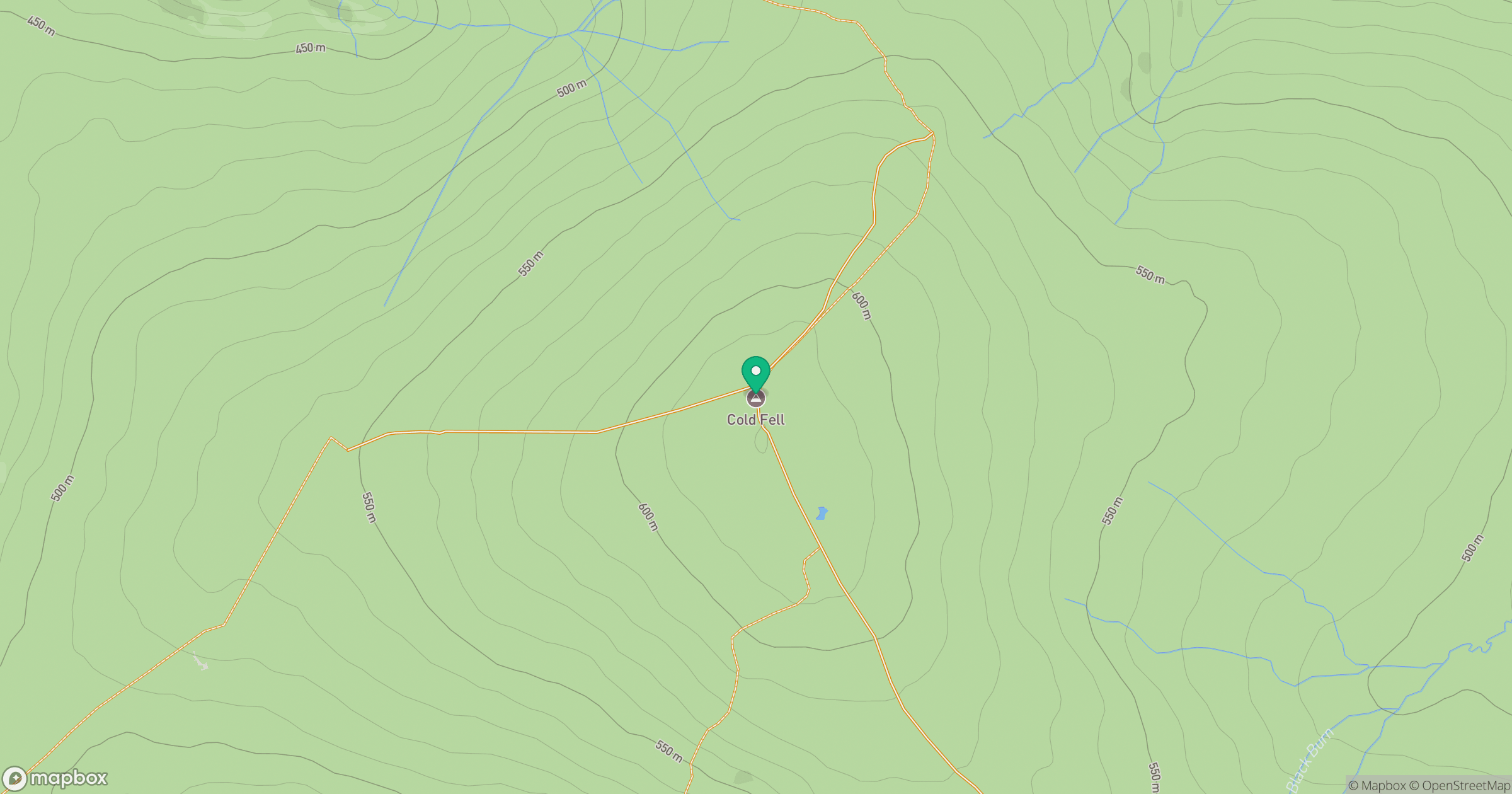
Grid reference: NY605556
View on OpenStreetMapOpens a map in a new tab, centred on the hill.
Nearby Hills

Cross Fell
893m
Place Fell
657m

High Street
828m

Blencathra - Hallsfell Top
868m
St Sunday Crag
841m
No comments yet. Be the first.