

Cumrew Fell
Good walks are even better shared.
Overview
Cumrew Fell: A Gem in the North Pennines
Nestled in the heart of the North Pennines, Cumrew Fell offers a delightful escape for hikers and nature enthusiasts alike. Standing at an elevation of 331 meters, it's a Marilyn, which means it may not be the tallest mountain around, but it's no less impressive.
Geology
Cumrew Fell is predominantly limestone, ideal for those intrigued by the Earth's history. The mix of sandstone and shale here tells a tale of ancient waters and shifting climates, leaving the landscape we see today.
Routes
The Cumrew Fell Circular route is a delightful choice, stretching around 8.5 kilometers with a moderate level of challenge. Starting from the village of Cumrew, you’ll meander through undulating ground, encounter a few rocky areas, and soak in those fantastic views that make hiking worthwhile.
Summit Features
Reaching the summit, you'll find a gentle mound marked by a smattering of stones—no TRIG here, but sometimes the simplest things bring the most joy! It's a peaceful spot for a break, where you can admire the breathtaking scenery.
Terrain
Expect grassy expanses, rocky outcrops, and the occasional squishy bit that nature has generously provided. Proper footwear is your best friend, and if they happen to be waterproof, consider that a bonus!
Views
On a clear day, the landscape reveals its treasures. Look to the west for the Solway Firth, and don’t forget to spot the distant peaks of the Lake District—ideal for the camera enthusiast. The best seasons for viewing are spring and autumn, when air clarity and vibrant colours combine beautifully.
Hazards
While Cumrew Fell is generally safe, be mindful of slippery rocks, especially after rainfall. There are patches that can be boggy, so it pays to tread carefully and keep those socks fresh and dry.
Nearby Summits
For those looking to extend their adventure, nearby summits include Great Dun Fell and Little Dun Fell. Climbing these gives an excellent horizon view, leaving no dull moment in your exploration of the North Pennines.
Access
Parking can be found in the village of Cumrew, but remember that considerate parking is key to maintaining local access. For those relying on public transport, options are limited, so check local schedules before heading out. The closest town is Longtown, where you can stock up on supplies.
Facilities
Longtown offers cafes and toilets, the perfect spots to fuel up both before and after your hike. Always best to be prepared!
History
The name Cumrew likely stems from Old Norse, suggesting a rich agricultural past. With a name that conjures images of pastoral beauty, it’s clear that this fell has held significance for residents over the centuries.
In summary, Cumrew Fell is a spirited little mountain that’s just waiting for you to uncover its many treasures. Whether you’re an experienced hiker or just fancy a lovely jaunt, this fell offers the charm and beauty only nature can provide. So lace up your boots and venture out—you won’t regret it!
Happy hiking!
Explore routes near Cumrew Fell
Public walks starting within 80 km of this hill. Nearby does not mean a route reaches the summit; check its map and access before setting out.
Long Meg and Lacy's Caves
View route
Walltown Quarry and Crags: a short Whin Sill walk
View route
Haltwhistle Burn: geology along the valley path
View route
Cawfields Quarry and the Vallum
View route
Route planning notes
These notes describe possible approaches, not verified navigable routes or permission to cross land. Check current paths, local access rules and conditions before setting out.
Cumrew Fell Circular
A scenic circular route starting from the village of Cumrew, offering varied terrain and stunning views.
Make a day of it, together
Find someone to share the walk with, or organise a day out along a route you like.
Photo Gallery
View all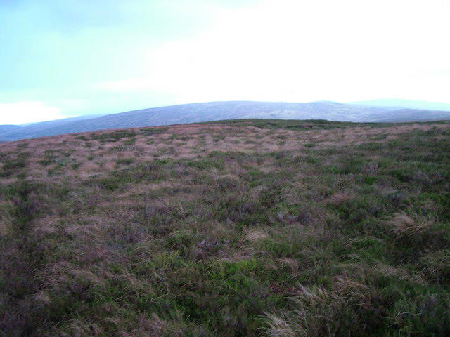 Photo could not load
NY5652 : The unmarked 483 top of Cumrew Fell
David Brown
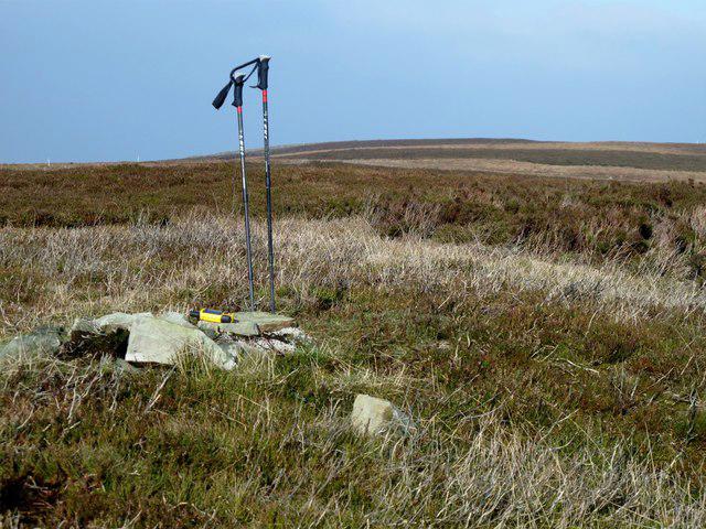 Photo could not load
NY5652 : Cumrew Fell
Rude Health
Hill facts and local notes
Classifications
Elevation
483m
1,585 ft
Prominence
120m
Coordinates
54.8617, -2.6804
NY564520
OS Map
86
Explorer: 315
At the Summit
The summit is marked by a small grassy mound and a few scattered stones, reminiscent of a secret hideaway that nature forgot. There's no fancy trig point here, but the panoramic views more than make up for it.
Terrain & Geology
Cumrew Fell is primarily composed of limestone, contributing to its distinctive rugged terrain. The area also features a mix of sandstone and shale, providing a fascinating glimpse into the geological history of the region.
Views & Scenery
On a clear day, you can spot the rolling hills of the North Pennines and perhaps the distant peaks of the Lake District. Keep an eye out for the Solway Firth sparkling on the western horizon.
History & Heritage
Name Origin
The name 'Cumrew' is thought to derive from Old Norse, potentially meaning 'the valley of the cows.'
Historical Significance
The fell is noted in local history for its rich agricultural land, and it's a reminder of the rugged beauty that characterises the North Pennines.
Getting There & Facilities
Check current local access restrictions, parking rules and transport timetables before travelling. These notes do not confirm public access to the summit.
Parking
Parking is available at Cumrew village, where a small layby can accommodate several cars. Ensure you park considerately to maintain village access.
Public Transport
Limited public transport options; the nearest bus stop is in the village of Longtown, about 5 miles away.
Nearby Facilities
Local facilities in Longtown include cafes, a shop, and public toilets. It’s a good idea to fuel up before the hike!
Safety Information
Known Hazards
- Careful of slippery rocks, especially after rain. Some parts may be boggy, so sturdy footwear is advisable to keep your socks dry.
General Safety Tips
- Check weather conditions before setting out
- Carry appropriate clothing and equipment
- Let someone know your planned route
- Take a map, compass, and GPS device
- Carry emergency supplies: food, water, first aid kit, torch
Hills
Some common questions about the hills answered
Are there group walks up Cumrew Fell?
Many walkers use Walkmates to join or organise walks with others. You can check for group walks around Cumrew Fell through the maps
Are there other walkers around Cumrew Fell?
Activity varies by location and time, but Walkmates lets you see whether others have shared walks or shown interest in this area. Find other people through the walking friends search walking friends for Cumrew Fell search or of course create your own walk for Cumrew Fell
Can I organise a walk to Cumrew Fell?
Yes. If there aren’t any walks listed already, you can create a walk and make it available for others to join.
If you're signed up to Walkmates, you can create a walk to Cumrew Fell.
How do I find a walk up this hill?
There are often multiple ways to walk this hill, depending on experience and route preference. Walkmates helps you explore walks and routes that others have shared.
Can I suggest a new route up Cumrew Fell?
Yes. You can suggest or create routes to share with others. Walkmates focuses on the social side of walking, so routes are used to help people organise walks and explore areas together, rather than as detailed navigation tools or route libraries.
Other uses really appreciate knowledgeable walkers sharing their routes. Share your favourite route to Cumrew Fell here
The is an error or something incorrect about this hill. How do I let you know?
We always strive to keep the information on Walkmates as accurate as possible. If you find an error, please let us know through the contact form and we'll aim to correct it as quickly as possible
Community Discussion
Comments
Location
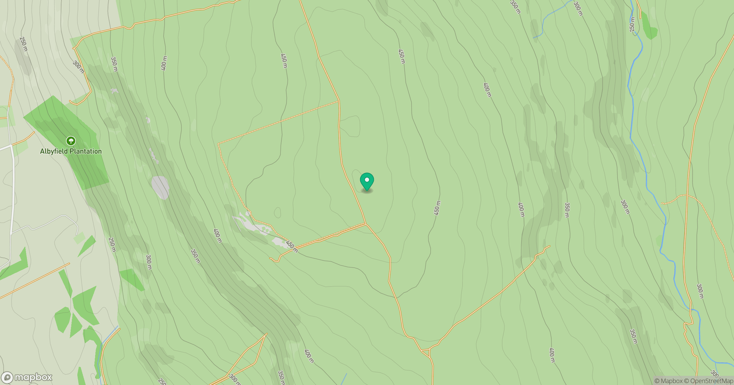
Grid reference: NY564520
View on OpenStreetMapOpens a map in a new tab, centred on the hill.
Hills within 30 km
Straight-line distance, not a walking route or confirmation of access.
No comments yet. Be the first.