

Slieve Beagh SE Top
Good walks are even better shared.
H5343 : Slieve Beagh SE Top (Co Monaghan County top)
Colin Park Photo source
Overview
Slieve Beagh SE Top
Welcome to Slieve Beagh SE Top, a delightful Marilyn that graces the Northern Irish landscape with its modest but proud stature! Standing at 680 meters with a prominence of 18 meters, this summit might not be the highest in the land, but it sure has a view that could make higher peaks a tad envious.
Geology
The geology of Slieve Beagh is primarily formed from Old Red Sandstone, which not only makes for interesting rock formations but also contributes to the vibrant ecosystems you’ll experience along the trails. Just try not to get distracted by the geological wonders—there's a summit waiting for you!
Routes
Slieve Beagh Forest Trail
This 6.5 km route starts at the Slieve Beagh Forest car park and typically takes around 2.5 hours to traverse. It's classified as moderate, making it a perfect choice for those who enjoy a bit of a challenge without entirely pushing their limits. Keep an eye out for the various wildlife that calls these woods home!
Summit Features
Upon reaching the summit, you’ll find a friendly little cairn eagerly awaiting your arrival! Revel in the sweeping views and feel free to strike a pose or two for your social media. After all, who could resist the allure of a mountain-top selfie?
Terrain Type
The terrain is a mixed bag of rocky and grassy patches with a few boggy sections thrown in for good measure. Wear sturdy boots, as they'll be your best friends in these parts—especially if you prefer your socks dry!
Views
The views from Slieve Beagh SE Top are nothing short of spectacular. On a good day, you can spot the Mourne Mountains in the distance and Lough Erne gleaming to the north. Truly, the vistas are panoramic enough to make you want to book a return trip before you even leave!
Best Seasons
For the best views, consider visiting in spring or autumn. These seasons provide clearer sightlines and vibrant colours, making each glance a feast for the eyes.
Hazards
While there are no dragons lurking around, it's wise to be aware of uneven terrain and sparse bogs. Be cautious, as one misstep could leave your boots having a rare bath!
Nearby Summits
Just a hop, skip, and a jump away is the slightly shorter Slieve Beagh, standing at 665 meters. If you’re feeling adventurous, why not tackle both?
Access
Getting to Slieve Beagh SE Top is pretty straightforward. The nearest parking is available at the Slieve Beagh Forest car park, where you'll find plenty of space to stow your trusty steed (or car, if you prefer). Unfortunately, public transport options are limited, so driving is your best bet. The nearest town, Fintona, is about 10 km away and offers a charming pit stop.
Facilities
Facilities are a bit sparse on the summit, so be sure to pack your own refreshments. The nearest café resides in Fintona, where a well-deserved treat awaits after your hike.
History
The name 'Slieve Beagh' has its roots in the Irish language, roughly translating to 'mountain of the life'. This mountain is not just a scenic spot but a part of local heritage, rich in folklore and history that adds to the mystique of your hike.
So there you have it—an engaging romp through the stats, sights, and secrets of Slieve Beagh SE Top. Happy hiking!
Explore routes near Slieve Beagh SE Top
Walks starting near this hill. Open a route to check its map, distance and full itinerary.
Florence Court: Riverside and Forest Circuit, County Fermanagh
View route
Peatlands Park Red Trail: Annagarriff Wood and Derryadd Lough
View route
Portadown to Knock Bridge: Bann Boulevard and Moneypenny’s Lock
View route
Scarva to Poyntzpass: Newry Canal and Lough Shark Return
View route
Route planning notes
These notes describe possible approaches. Check a route's map and access information when planning your walk.
Slieve Beagh Forest Trail
A moderate route starting from the Slieve Beagh Forest car park, leading through lush forestry before tackling the summit’s rocky path.
Make a day of it, together
Find someone to share the walk with, or organise a day out along a route you like.
Photo Gallery
View all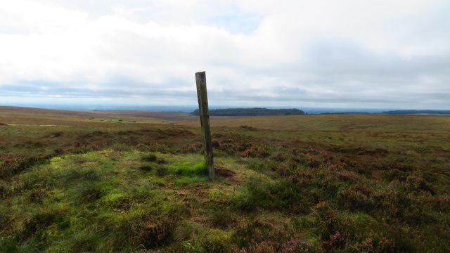 Photo could not load
H5343 : Slieve Beagh SE Top (Co Monaghan County top)
Colin Park
Hill facts and local notes
Classifications
Elevation
373m
1,224 ft
Prominence
5m
Coordinates
54.3383, -7.1831
H531435
OS Map
18
At the Summit
The summit features a modest cairn along with stunning panoramic views that will make you want to shout, 'Hello, world!'
Terrain & Geology
The mountain features primarily Old Red Sandstone formations, contributing to the scenic landscapes and varied terrain.
Views & Scenery
On a clear day, you can see as far as the Mourne Mountains and even catch glimpses of Lough Erne to the north.
History & Heritage
Name Origin
The name 'Slieve Beagh' derives from the Irish 'Sliabh Beatha', meaning 'mountain of the life'.
Historical Significance
Slieve Beagh is part of a larger range that holds cultural significance to local communities, and it's often steeped in folklore.
Getting There & Facilities
Parking
Slieve Beagh Forest car park is the most convenient, with ample spaces available.
Public Transport
Limited public transport options; best approached by car.
Nearby Facilities
There are no facilities directly on the mountain, so pack a picnic. The nearest café can be found down in Fintona.
Safety Information
Known Hazards
- Uneven terrain, particularly in boggy areas; be careful not to get your boots submerged!
General Safety Tips
- Check weather conditions before setting out
- Carry appropriate clothing and equipment
- Let someone know your planned route
- Take a map, compass, and GPS device
- Carry emergency supplies: food, water, first aid kit, torch
Hills
Some common questions about the hills answered
Are there group walks up Slieve Beagh SE Top?
Many walkers use Walkmates to join or organise walks with others. You can check for group walks around Slieve Beagh SE Top through the maps
Are there other walkers around Slieve Beagh SE Top?
Activity varies by location and time, but Walkmates lets you see whether others have shared walks or shown interest in this area. Find other people through the walking friends search walking friends for Slieve Beagh SE Top search or of course create your own walk for Slieve Beagh SE Top
Can I organise a walk to Slieve Beagh SE Top?
Yes. If there aren’t any walks listed already, you can create a walk and make it available for others to join.
If you're signed up to Walkmates, you can create a walk to Slieve Beagh SE Top.
How do I find a walk up this hill?
There are often multiple ways to walk this hill, depending on experience and route preference. Walkmates helps you explore walks and routes that others have shared.
Can I suggest a new route up Slieve Beagh SE Top?
Yes. You can suggest or create routes to share with others. Walkmates focuses on the social side of walking, so routes are used to help people organise walks and explore areas together, rather than as detailed navigation tools or route libraries.
Other uses really appreciate knowledgeable walkers sharing their routes. Share your favourite route to Slieve Beagh SE Top here
The is an error or something incorrect about this hill. How do I let you know?
We always strive to keep the information on Walkmates as accurate as possible. If you find an error, please let us know through the contact form and we'll aim to correct it as quickly as possible
Community Discussion
Comments
Location
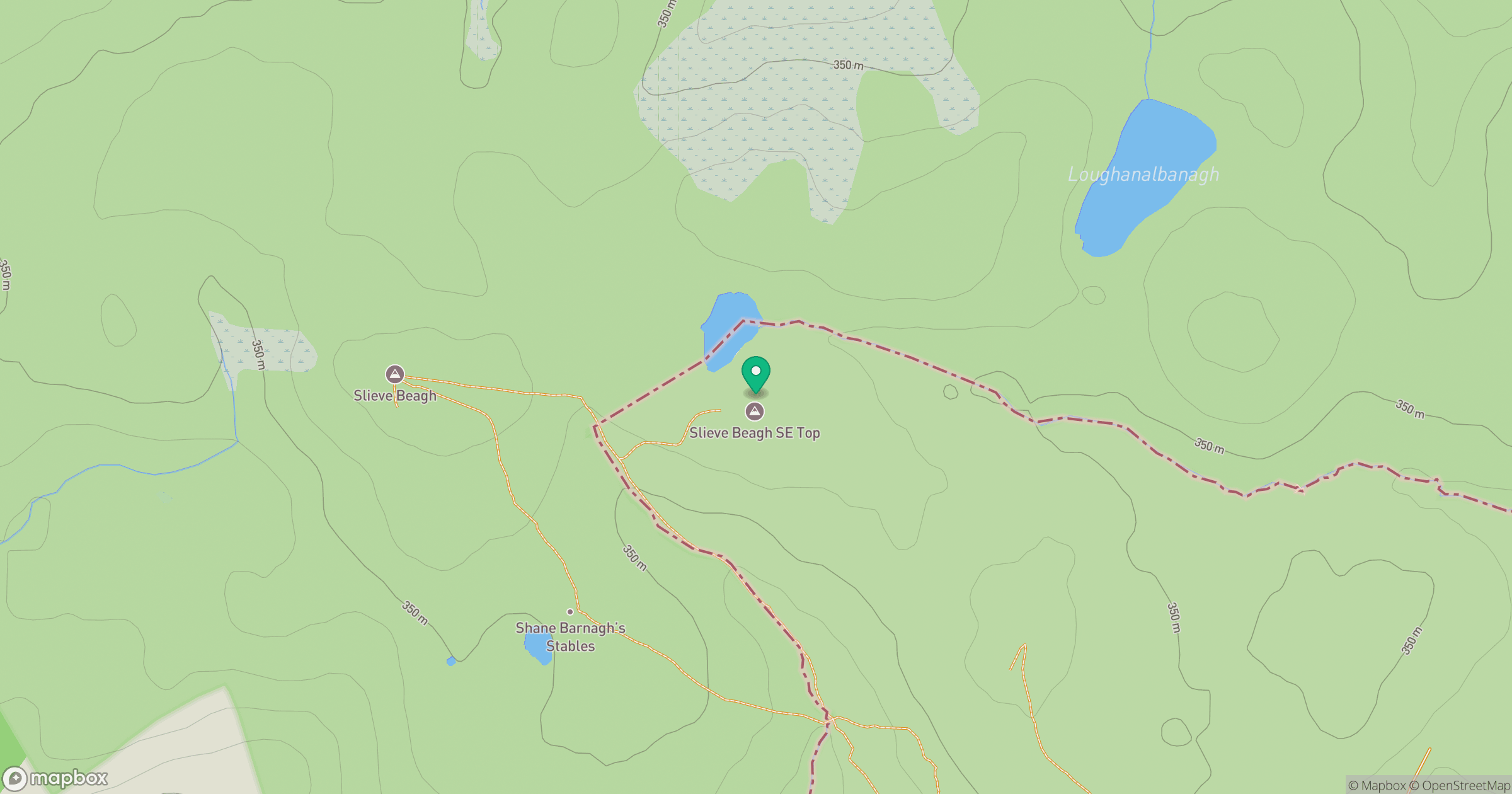
Grid reference: H531435
View on OpenStreetMapOpens a map in a new tab, centred on the hill.
Nearby Hills
Cuilcagh [Binn Chuilceach]
666m
Slieve Gullion
576m
Binevenagh
385m
Slieve Foye
587m
Muckish [An Mhucais]
667m
No comments yet. Be the first.