
Derrin
Good walks are even better shared.
Overview
Hiking Derrin
Derrin, standing proud at 463 meters, is a Marilyn situated in the picturesque Mourne Mountains of Northern Ireland. While it may not be the tallest in the range, she certainly has her charm and offers splendid views worthy of a good Instagram post.
Geology
Derrin's rugged granite outlines formed from ancient volcanic activity provide not just an aesthetic feast for the eyes but also an intriguing lesson in geology. The smooth rocks and jagged edges tell a story that goes back millennia, making this mountain not just a hike, but a journey through time.
Routes
The most popular route to the summit is the Derrymore Forest Trail, a delightful 5.5 km loop that weaves through lush woodland with the perfect mix of scenic vistas and challenging uphills. Expect to take around 2 hours to complete this moderate trail, with frequent opportunities for a breather and a snack. Don't worry; we all know that hiking burns calories!
Summit Features
Upon your arrival at the summit, you'll be greeted by a stone cairn that serves as a glorified selfie spot. Stand on top, take a deep breath, and enjoy that fresh mountain air—just try to keep your hat on; the wind can be quite cheeky!
Terrain
Expect a classic Mourne mix of grassy trails intersected by rocky patches and the occasional muddy area, especially after rain, which is often in these parts. Strong walking boots are your best friends here.
Views
The summit rewards hikers with breathtaking panoramic views. Look south towards Slieve Donard, the highest peak in Northern Ireland, and to the east, spot the shimmering Irish Sea.
The best times to catch these views are during late spring or early autumn when the flora is in full bloom, and the skies can be clearer than a politician’s promise—well, most of the time!
Hazards
Keep an eye on the weather as it can change quicker than you can say 'where did the sun go?' Muddy paths and slippery rocks mean appropriate footwear is essential to prevent any unexpected tumbles.
Access
Parking is conveniently located near Derrymore Forest, with ample space, but be mindful in peak season; it can fill up faster than a kettle on the boil! Public transport options are fewer, so having a car or a friend with a car is a great boon.
Facilities
Post-hike, why not indulge in a well-deserved treat? Newcastle boasts a variety of cafes and restaurants, not to mention public toilets if nature calls!
History
Ever wondered about the name? 'Derrin' comes from the Irish 'Doire', a lovely nod to the oak trees that once thrived here. It’s a place rich in myth and legend, grounding hikers in a sense of tradition as they ascend.
Enjoy your walk up Derrin—just remember, it’s not a race. Take your time, drink in the scenery, and relish the peace that only a good mountain hike can bring.
Explore routes near Derrin
Public walks starting within 80 km of this hill. Nearby does not mean a route reaches the summit; check its map and access before setting out.
Florence Court: Riverside and Forest Circuit, County Fermanagh
View route
Peatlands Park Red Trail: Annagarriff Wood and Derryadd Lough
View route
Banagher Glen and Forest: complete higher-return circuit
View route
Portadown to Knock Bridge: Bann Boulevard and Moneypenny’s Lock
View route
Route planning notes
These notes describe possible approaches, not verified navigable routes or permission to cross land. Check current paths, local access rules and conditions before setting out.
Derrymore Forest Trail
A beautiful circuit through Derrymore Forest, offering scenic views and a relatively gentle ascent.
Make a day of it, together
Find someone to share the walk with, or organise a day out along a route you like.
Hill facts and local notes
Classifications
Elevation
268m
879 ft
Prominence
102m
Coordinates
54.3885, -7.4836
H336490
OS Map
18
At the Summit
The summit features a well-maintained stone pillar (cairn) marking the highest point, providing a great photo opportunity.
Terrain & Geology
Derrin is primarily composed of granite, a rock type formed from cooled magma deep within the Earth. This geological formation creates the rugged yet attractive features visible along the hiking trails.
Views & Scenery
Panoramic views of the Mourne Mountains, the Irish Sea, and across to the coast of the Republic of Ireland.
History & Heritage
Name Origin
The name 'Derrin' is thought to derive from the Irish 'Doire', meaning 'oak grove', reflecting the historical proliferation of oak trees in the area.
Historical Significance
The Mourne Mountains are steeped in folklore and have long been a site of cultural significance, hosting various myths and legends of ancient Irish lore.
Getting There & Facilities
Check current local access restrictions, parking rules and transport timetables before travelling. These notes do not confirm public access to the summit.
Parking
There is a parking area at the entrance to Derrymore Forest, around 1 km from the trailhead.
Public Transport
Bus services run from Newcastle to the nearest bus stop at the bottom of the Mourne Mountains, but consider check for current schedules.
Nearby Facilities
A number of cafes and restaurants can be found in Newcastle, along with public toilets near the beach.
Safety Information
Known Hazards
- Changing weather conditions can lead to mist and slippery trails. Ensure proper footwear and clothing.
General Safety Tips
- Check weather conditions before setting out
- Carry appropriate clothing and equipment
- Let someone know your planned route
- Take a map, compass, and GPS device
- Carry emergency supplies: food, water, first aid kit, torch
Hills
Some common questions about the hills answered
Are there group walks up Derrin?
Many walkers use Walkmates to join or organise walks with others. You can check for group walks around Derrin through the maps
Are there other walkers around Derrin?
Activity varies by location and time, but Walkmates lets you see whether others have shared walks or shown interest in this area. Find other people through the walking friends search walking friends for Derrin search or of course create your own walk for Derrin
Can I organise a walk to Derrin?
Yes. If there aren’t any walks listed already, you can create a walk and make it available for others to join.
If you're signed up to Walkmates, you can create a walk to Derrin.
How do I find a walk up this hill?
There are often multiple ways to walk this hill, depending on experience and route preference. Walkmates helps you explore walks and routes that others have shared.
Can I suggest a new route up Derrin?
Yes. You can suggest or create routes to share with others. Walkmates focuses on the social side of walking, so routes are used to help people organise walks and explore areas together, rather than as detailed navigation tools or route libraries.
Other uses really appreciate knowledgeable walkers sharing their routes. Share your favourite route to Derrin here
The is an error or something incorrect about this hill. How do I let you know?
We always strive to keep the information on Walkmates as accurate as possible. If you find an error, please let us know through the contact form and we'll aim to correct it as quickly as possible
Community Discussion
Comments
Location
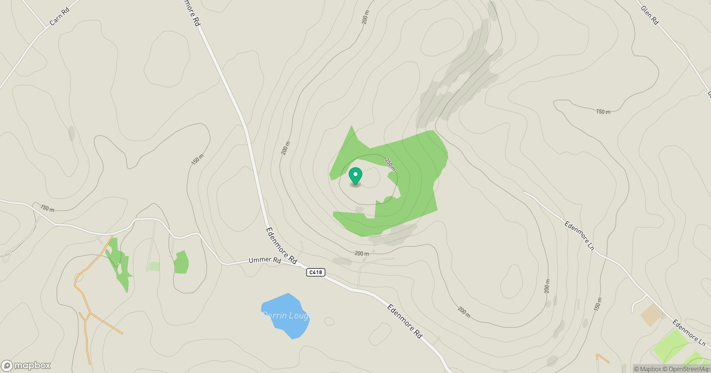
Grid reference: H336490
View on OpenStreetMapOpens a map in a new tab, centred on the hill.
Hills within 30 km
Straight-line distance, not a walking route or confirmation of access.
Cuilcagh [Binn Chuilceach]
666m
Brougher Mountain
317m
Topped Mountain [Mullyknock]
277m
Dooish [An Dubhais]
341m
Knockninny Hill
191m
No comments yet. Be the first.