
Stranisk
Good walks are even better shared.
Overview
Stranisk: A Hidden Gem of Argyll and Bute
Stranisk, standing at a modest elevation of 399 meters, may not hold the title of the highest peak in the region, but it's certainly an undiscovered treasure for hikers looking to explore the scenic wonders of Argyll.
Geology
The mountain is mainly formed from granite, with some intriguing schist added into the mix. The unique geological composition creates stunning outcrops and is a delight for both geologists and inquisitive hikers. Don’t forget to pick up a stone as a souvenir... or leave it be, it’s just very tempting!
Routes
The most popular route starts from the village of Kilberry and covers approximately 8.1 km. The pathway meanders through lush woodlands adorned with wildflowers, eventually leading you to the rocky slopes of Stranisk. With a duration of about 3.5 hours, it's classified as moderate, so lace up those hiking boots and get ready for a bit of stretching too!
Summit Features
Upon reaching the summit, you'll be greeted by a charming cairn and expansive views that go beyond your wildest Instagram dreams! The area is spacious enough for a quick breather while marveling at the postcard-perfect scenery. As they say in Scotland, it’s the view that makes the walk worthwhile!
Terrain Type
The terrain consists of soft grass that eventually transitions into rocky outcrops nearer the summit. Expect a bit of a workout as the incline can become steeper closer to the top — clearly not designed for the faint-hearted!
Views
From the summit, the view is simply spectacular. You’ll witness the breathtaking panorama of the Firth of Clyde, with the islands of Gigha and Jura adorning the horizon. Late spring and early autumn are the prime times to visit, offering the clearest visibility — and who wouldn’t want to bask in a view that feels like a 'high five' from nature?
Hazards
Be mindful that the weather can change faster than you can say 'ach aye the noo'. Be prepared with the correct gear and a bit of common sense — it's your best friend out here!
Nearby Summits
If you're up for more adventure, check out the nearby Beinn Sgulaird, which adds a few more meters of elevation for the challenge-seekers among you.
Access
While public transport is limited (the nearest bus stop sits in Tarbert, about 12 miles away), you can easily park at Kilberry village hall. After your epic hike, stop by local cafes for a well-deserved treat!
Facilities
There are public toilets in Kilberry, so fear not; you won't need to track down a bush!
History
The name Stranisk comes from the Gaelic 'Sruthan', meaning 'little stream', rather fitting for a location that’s home to gleeful trickles of water. The mountain is steeped in local folklore and should it ever make your list, be sure to heed the stories and embrace the Scottish charm.
In conclusion, Stranisk may not be the tallest mountain, but it certainly puts up a case for one of the most rewarding hikes in Argyll and Bute. So grab your gear, gather your friends, and prepare for a day of exploration and discovery!
Explore routes near Stranisk
Public walks starting within 80 km of this hill. Nearby does not mean a route reaches the summit; check its map and access before setting out.
Florence Court: Riverside and Forest Circuit, County Fermanagh
View route
Peatlands Park Red Trail: Annagarriff Wood and Derryadd Lough
View route
Banagher Glen and Forest: complete higher-return circuit
View route
Portadown to Knock Bridge: Bann Boulevard and Moneypenny’s Lock
View route
Route planning notes
These notes describe possible approaches, not verified navigable routes or permission to cross land. Check current paths, local access rules and conditions before setting out.
Kilberry to Stranisk
A scenic route starting from the village of Kilberry that winds through lush woodlands before ascending the mountain slopes.
Make a day of it, together
Find someone to share the walk with, or organise a day out along a route you like.
Hill facts and local notes
Classifications
Elevation
312m
1,024 ft
Prominence
126m
Coordinates
54.4498, -7.3410
H428559
OS Map
18
At the Summit
The summit possesses a neat cairn and offers breathtaking views across the Firth of Clyde. There’s just enough space for a quick selfie before you tackle the descent!
Terrain & Geology
Stranisk is predominantly composed of granite with some schist, providing a unique view of the region's geological history. This mixture of rock types creates interesting outcrops that can be fascinating to geologists and casual hikers alike.
Views & Scenery
Panoramic views of the surrounding countryside, including the islands of Gigha and Jura, and the scenic coastline of Argyll.
History & Heritage
Name Origin
The name 'Stranisk' derives from the Gaelic 'Sruthan' meaning 'little stream', a nod to the streams that cascade down its slopes.
Historical Significance
This area has a rich cultural history, and the mountain itself is part of the local folklore, often said to be a hiding place for ancient treasures.
Getting There & Facilities
Check current local access restrictions, parking rules and transport timetables before travelling. These notes do not confirm public access to the summit.
Parking
Parking is available at the Kilberry village hall, which provides a convenient base for your hike.
Public Transport
Limited public transport is available; the nearest bus stop is in the village of Tarbert, approximately 12 miles away.
Nearby Facilities
There are public toilets in the village of Kilberry, and Tarbert has several cafes and shops for post-hike refreshments.
Safety Information
Known Hazards
- Watch out for sudden weather changes; conditions can shift quickly in this part of Scotland, so always be prepared with the right gear.
General Safety Tips
- Check weather conditions before setting out
- Carry appropriate clothing and equipment
- Let someone know your planned route
- Take a map, compass, and GPS device
- Carry emergency supplies: food, water, first aid kit, torch
Hills
Some common questions about the hills answered
Are there group walks up Stranisk?
Many walkers use Walkmates to join or organise walks with others. You can check for group walks around Stranisk through the maps
Are there other walkers around Stranisk?
Activity varies by location and time, but Walkmates lets you see whether others have shared walks or shown interest in this area. Find other people through the walking friends search walking friends for Stranisk search or of course create your own walk for Stranisk
Can I organise a walk to Stranisk?
Yes. If there aren’t any walks listed already, you can create a walk and make it available for others to join.
If you're signed up to Walkmates, you can create a walk to Stranisk.
How do I find a walk up this hill?
There are often multiple ways to walk this hill, depending on experience and route preference. Walkmates helps you explore walks and routes that others have shared.
Can I suggest a new route up Stranisk?
Yes. You can suggest or create routes to share with others. Walkmates focuses on the social side of walking, so routes are used to help people organise walks and explore areas together, rather than as detailed navigation tools or route libraries.
Other uses really appreciate knowledgeable walkers sharing their routes. Share your favourite route to Stranisk here
The is an error or something incorrect about this hill. How do I let you know?
We always strive to keep the information on Walkmates as accurate as possible. If you find an error, please let us know through the contact form and we'll aim to correct it as quickly as possible
Community Discussion
Comments
Location
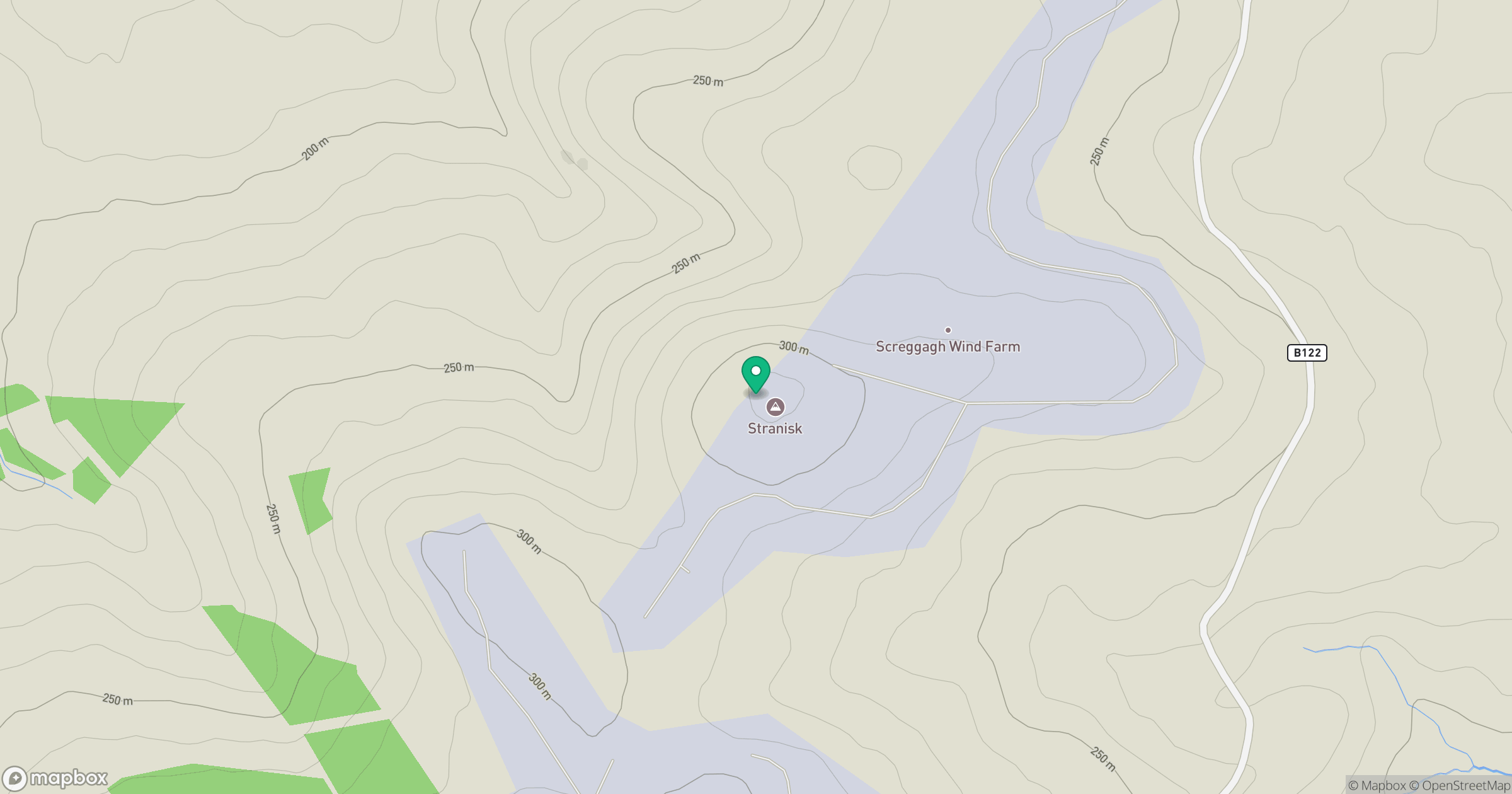
Grid reference: H428559
View on OpenStreetMapOpens a map in a new tab, centred on the hill.
Hills within 30 km
Straight-line distance, not a walking route or confirmation of access.
Brougher Mountain
317m
Pollnalaght [Poll na Leacht]
298m
Slieve Beagh [Sliabh Beatha]
380m
Topped Mountain [Mullyknock]
277m
Dooish [An Dubhais]
341m
No comments yet. Be the first.