

Shipman Knotts
Good walks are even better shared.
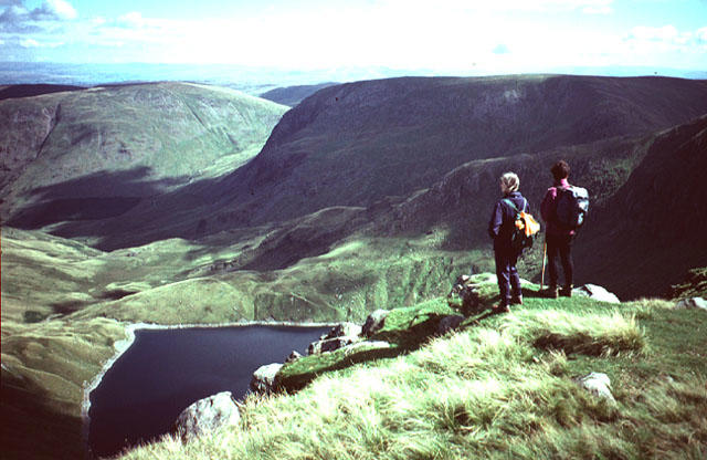
NY4706 : Path on Shipman Knotts
Anthony Parkes Photo source
Overview
Shipman Knotts - A Hiker's Delight
Nestled within the breathtaking Lake District, Shipman Knotts stands at an elevation of 575 meters and offers an enticing adventure for hikers of all levels. Known for its Marilyn classification, this fell beckons outdoor enthusiasts who seek to experience both tranquillity and stunning vistas.
Geology
Intriguingly formed by sedimentary rocks, Shipman Knotts presents a geological tapestry of sandstone and shale. The unique formations tell tales of a time long past, shaped by glacial forces that carved this majestic landscape.
Routes
One of the most popular routes to the summit is the Kentmere Circle, a moderate circular trail that spans approximately 9 km and typically takes about 3.5 hours to complete. The route provides an engaging mix of scenery as it winds around the picturesque Kentmere Valley, leading you gradually upward to the summit, where a stone cairn awaits your arrival.
Summit Features
Upon reaching the summit, you'll be treated with a fine view, made all the more charming by the presence of a well-constructed cairn—a perfect backdrop for your victory photo. Why not pat yourself on the back while enjoying a well-deserved snack?
Terrain
The terrain range is mostly grassy with rocky outcrops, so keep an eye on your step! Some steep sections may offer more of a challenge than expected, particularly after rain.
Views
The summit treats you to jaw-dropping views of the entire Kentmere Valley, with the surrounding fells painting a picturesque postcard scene. If you're lucky, you might even spot the peaks of the Lake District glittering on the horizon on a clear day! The best time for these breathtaking vistas is during spring and early summer, when wildflowers burst into colour. Autumn provides a vibrant canvas as the leaves change.
Hazards
As with any outdoor adventure, some caution is warranted. Be mindful of slippery rocks and steep drops. Flash floods can also be an issue after heavy rainfall, so always keep an eager eye on the weather!
Access and Facilities
Getting there is easy; park at the Kentmere Village car park, just a short walk from the trailhead. If public transport is more your style, the 555 bus service from Windermere will get you to Kentmere. Once you've conquered the summit, treat yourself to some local fare at the Kentmere pub or café.
Nearby Summits
Shipman Knotts is a splendid gateway to other nearby peaks. Harter Fell and Kentmere Pike are just a hop, skip and jump away, perfect for the adventurous hiker wanting to extend the day.
History
The name Shipman Knotts has intriguing roots; 'Shipman' is thought to derive from Old English, denoting sheep, whilst 'Knotts' refers to small hillocks. Historically, the area has been vital for sheep grazing, contributing to the locale's agrarian lifestyle.
Whether you're a seasoned trekker or just fancy a stroll with spectacular views, Shipman Knotts offers the perfect blend of adventure and scenery. Lace up those boots and get ready for a memorable hike!
Happy hiking!
Explore routes near Shipman Knotts
Walks starting near this hill. Open a route to check its map, distance and full itinerary.
Striding Edge, Helvellyn and Catstye Cam
View route
Helvellyn via Striding Edge
View route
Tarn Hows Fast Route
View route
Coniston to Tarn Hows: Monk Coniston Gardens and Woodland Circuit
View route
Route planning notes
These notes describe possible approaches. Check a route's map and access information when planning your walk.
Kentmere Circle
A popular circular route that takes hikers around the beautiful Kentmere Valley before ascending to the summit of Shipman Knotts.
Make a day of it, together
Find someone to share the walk with, or organise a day out along a route you like.
Photo Gallery
View all Photo could not load
NY4706 : Path on Shipman Knotts
Anthony Parkes
 Photo could not load
NY4706 : Shipman Knotts, Summit
Michael Graham
 Photo could not load
NY4706 : Wire and Puddle
Michael Graham
 Photo could not load
NY4706 : Crossing Shipman Knotts
Karl and Ali
 Photo could not load
NY4706 : On Shipman Knotts
Michael Graham
 Photo could not load
NY4706 : Wall, Shipman Knotts
Michael Graham
 Photo could not load
NY4706 : Shipman Knotts
David Brown
 Photo could not load
NY4706 : Shipman Knotts
steven ruffles
 Photo could not load
NY4706 : On Shipman Knotts
Michael Graham
Hill facts and local notes
Classifications
Elevation
587m
1,926 ft
Prominence
11m
Coordinates
54.4486, -2.8147
NY472062
OS Map
90
Explorer: OL7N
At the Summit
The summit is characterised by a large stone cairn and stunning panoramic views, providing an excellent spot for a well-deserved snack break or a good old chinwag.
Terrain & Geology
Shipman Knotts is primarily composed of sedimentary rocks, including sandstone and shale, offering fascinating insights into the geological history of the region. The ridge features distinct rock formations that have been shaped by glacial activity over millennia.
Views & Scenery
From the summit, enjoy sweeping views of the Kentmere Valley, surrounding fells, and on clear days, look out towards the iconic peaks of the Lake District.
History & Heritage
Name Origin
The name 'Shipman' may refer to the Old English word 'sceap', meaning sheep, while 'Knotts' is derived from the term for a small hillock.
Historical Significance
Historically, this area was a vital grazing ground for sheep, integral to the local economy and culture of the Lake District.
Getting There & Facilities
Parking
The nearest parking is available at the Kentmere Village car park, which offers ample space and is only a short walk to the start of the route.
Public Transport
The 555 bus service runs from Windermere to Kentmere, with a stop at the village. Check schedules as they can be infrequent.
Nearby Facilities
There are no facilities directly on the mountain, but Kentmere Village boasts a local pub and small café for post-hike refreshments.
Safety Information
Known Hazards
- Beware of slippery rocks, especially after rain, and some steep drops along the way. Flash floods can occur in heavy rainfall, so always check the weather before setting out.
General Safety Tips
- Check weather conditions before setting out
- Carry appropriate clothing and equipment
- Let someone know your planned route
- Take a map, compass, and GPS device
- Carry emergency supplies: food, water, first aid kit, torch
Hills
Some common questions about the hills answered
Are there group walks up Shipman Knotts?
Many walkers use Walkmates to join or organise walks with others. You can check for group walks around Shipman Knotts through the maps
Are there other walkers around Shipman Knotts?
Activity varies by location and time, but Walkmates lets you see whether others have shared walks or shown interest in this area. Find other people through the walking friends search walking friends for Shipman Knotts search or of course create your own walk for Shipman Knotts
Can I organise a walk to Shipman Knotts?
Yes. If there aren’t any walks listed already, you can create a walk and make it available for others to join.
If you're signed up to Walkmates, you can create a walk to Shipman Knotts.
How do I find a walk up this hill?
There are often multiple ways to walk this hill, depending on experience and route preference. Walkmates helps you explore walks and routes that others have shared.
Can I suggest a new route up Shipman Knotts?
Yes. You can suggest or create routes to share with others. Walkmates focuses on the social side of walking, so routes are used to help people organise walks and explore areas together, rather than as detailed navigation tools or route libraries.
Other uses really appreciate knowledgeable walkers sharing their routes. Share your favourite route to Shipman Knotts here
The is an error or something incorrect about this hill. How do I let you know?
We always strive to keep the information on Walkmates as accurate as possible. If you find an error, please let us know through the contact form and we'll aim to correct it as quickly as possible
Community Discussion
Comments
Location
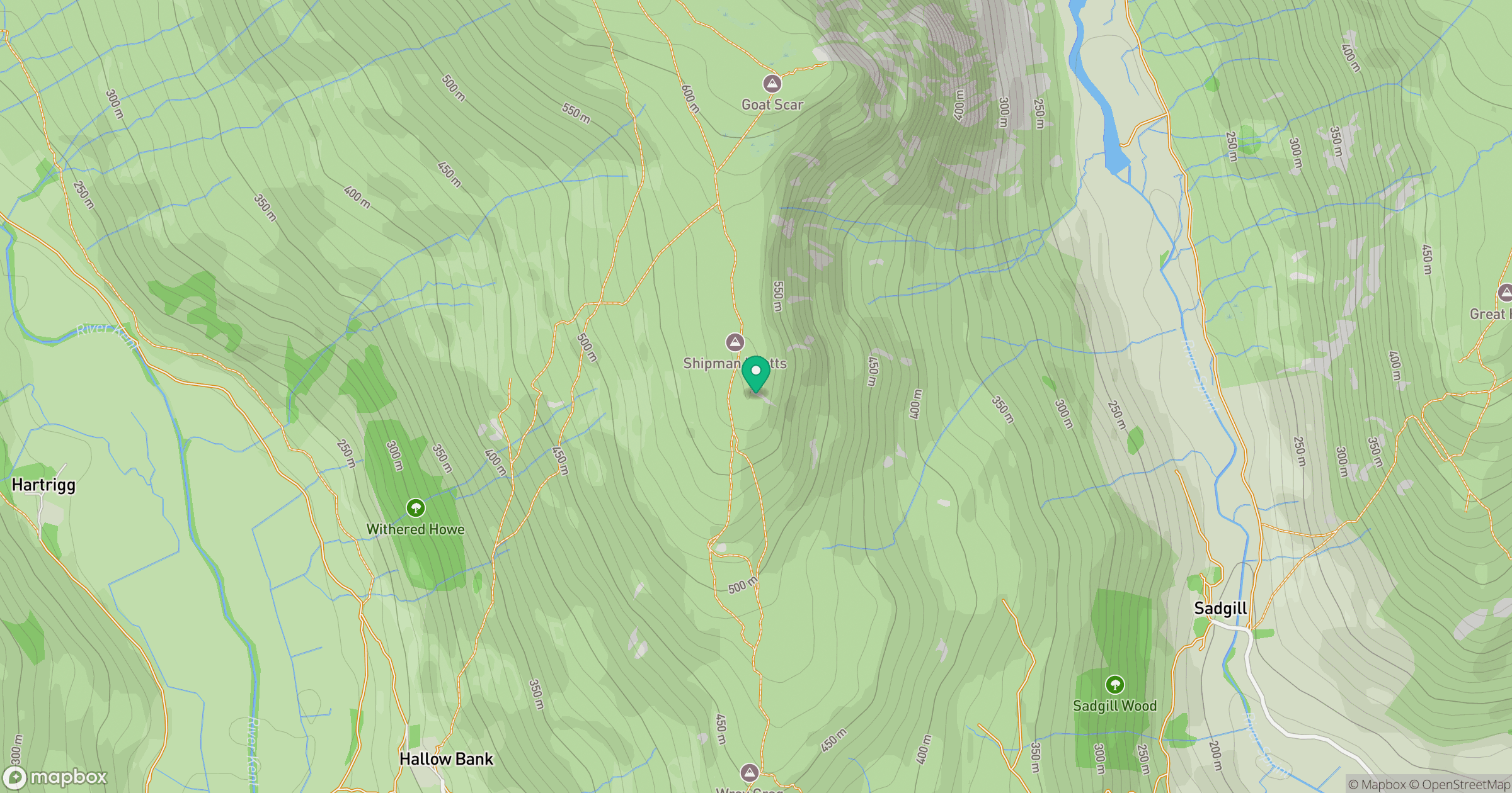
Grid reference: NY472062
View on OpenStreetMapOpens a map in a new tab, centred on the hill.
No comments yet. Be the first.