

Sgor an h-Iolaire
Good walks are even better shared.
Overview
Introduction
Sgor an h-Iolaire, standing at an impressive 550 meters, is a classic Munro situated in the heart of the Scottish Highlands. Its grandeur and the rich natural beauty of the surrounding areas make it a popular destination for hikers and nature enthusiasts alike.
Geology
The mountain boasts a rugged geological structure primarily composed of granite, a remnant from the Caledonian Orogeny. As you ascend, keep an eye out for interesting rock formations and the diverse flora that thrives here.
Routes
Glen Creran Route: For those looking to take in the scenery comfortably, this route offers an enchanting pathway through lush landscapes. The 8 km distance is manageable for most, taking around 4 hours to complete.
North Ridge: If you’re seeking a thrill, the North Ridge should be your go-to. It's a 6 km route that incorporates some exhilarating scrambling sections and takes roughly 3.5 hours to scale, making it perfect for seasoned climbers.
Summit Features
At the summit, you'll find a sturdy cairn that could use a friendly wave to add to its history. The view from the top is simply spectacular, with breathtaking vistas that can be enjoyed on a clear day.
Terrain Type
The terrain varies from rocky pathways to grassy slopes peppered with heather. Make sure to wear appropriate footwear and keep an eye on the weather; the Highlands can be unpredictable!
Views
From the summit, not only do you get a view of Loch Creran, but you're also treated to a captivating panorama of Glencoe’s peaks. The late spring and early autumn months offer the most delightful conditions to soak in these views.
Hazards
As with any mountain adventure, be cautious of loose rocks and changing weather conditions. Prepare adequately, and you should have a safe and enjoyable hike!
Nearby Summits
Consider extending your adventure to nearby summits like Sgor na h-Ulaidh or Beinn a' Bheithir. Both promise additional challenges and stunning scenery.
Access
The Glen Creran car park is your best bet for access, located conveniently off the A828. For those relying on public transport, it's worth double-checking bus times from Oban, as they can be a little temperamental.
Facilities
Before you embark on your journey, pop into the nearest village, Benderloch, to grab a bite or use the facilities. A well-earned tea awaits you after your efforts on the mountain.
History
The name itself evokes imagery of eagles soaring gracefully overhead, a sight you may just be lucky enough to witness. Rich in Scottish history, Sgor an h-Iolaire is more than just a mountain; it's a slice of the cultural tapestry of the region.
Conclusion
Whether you're a seasoned Munro bagger or just looking for a beautiful place to spend a day, Sgor an h-Iolaire offers a delightful experience in nature’s embrace. Pack your rucksack, lace up those boots, and enjoy!
Explore routes near Sgor an h-Iolaire
Public walks starting within 80 km of this hill. Nearby does not mean a route reaches the summit; check its map and access before setting out.
Cairngorms night walk and stargazing (event meeting)
View route
Cairngorms night walk and stargazing (event meeting)
View route
Cairngorms night walk and stargazing (event meeting)
View route
Cairngorms night walk and stargazing (event meeting)
View route
Route planning notes
These notes describe possible approaches, not verified navigable routes or permission to cross land. Check current paths, local access rules and conditions before setting out.
Glen Creran Route
A scenic path leading through picturesque landscapes, ideal for those who fancy a gentle hike with breathtaking views.
North Ridge
An exhilarating route with some scrambling sections that is well-suited for those who enjoy a bit of a challenge.
Make a day of it, together
Find someone to share the walk with, or organise a day out along a route you like.
Photo Gallery
View all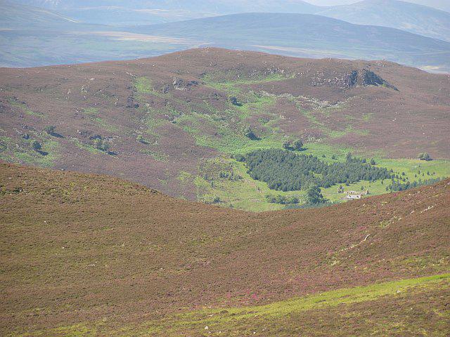 Photo could not load
NO3093 : Sgor an h-Iolaire
Richard Webb
Hill facts and local notes
Classifications
Elevation
544m
1,785 ft
Prominence
137m
Coordinates
57.0255, -3.1504
NO302932
OS Map
37 44
Explorer: OL53N 388N
At the Summit
At the summit lies a prominent cairn and a stunning panoramic view that would make any postcard jealous.
Terrain & Geology
The mountain is primarily composed of granite, formed during the Caledonian Orogeny, which gives it its rugged appearance and impressive cliffs.
Views & Scenery
From the summit, one can see the majestic peaks of Glencoe and the shimmering waters of Loch Creran, a sight that simply takes your breath away.
History & Heritage
Name Origin
The name 'Sgor an h-Iolaire' translates to 'Peak of the Eagle', a nod to the majestic birds often spotted gliding above its cliffs.
Historical Significance
This mountain is part of the traditional land of the MacDougalls, steeped in tales of Scottish folklore and rich history.
Getting There & Facilities
Check current local access restrictions, parking rules and transport timetables before travelling. These notes do not confirm public access to the summit.
Parking
There is a designated parking area at the Glen Creran car park, conveniently located just off the A828.
Public Transport
Limited public transport is available from Oban; check local bus schedules for updates.
Nearby Facilities
A couple of local cafes and public toilets can be found in Benderloch, perfect for a pre-hike snack or pit stop.
Safety Information
Known Hazards
- Loose rock on paths, sudden weather changes, and challenging terrain in winter.
General Safety Tips
- Check weather conditions before setting out
- Carry appropriate clothing and equipment
- Let someone know your planned route
- Take a map, compass, and GPS device
- Carry emergency supplies: food, water, first aid kit, torch
Hills
Some common questions about the hills answered
Are there group walks up Sgor an h-Iolaire?
Many walkers use Walkmates to join or organise walks with others. You can check for group walks around Sgor an h-Iolaire through the maps
Are there other walkers around Sgor an h-Iolaire?
Activity varies by location and time, but Walkmates lets you see whether others have shared walks or shown interest in this area. Find other people through the walking friends search walking friends for Sgor an h-Iolaire search or of course create your own walk for Sgor an h-Iolaire
Can I organise a walk to Sgor an h-Iolaire?
Yes. If there aren’t any walks listed already, you can create a walk and make it available for others to join.
If you're signed up to Walkmates, you can create a walk to Sgor an h-Iolaire.
How do I find a walk up this hill?
There are often multiple ways to walk this hill, depending on experience and route preference. Walkmates helps you explore walks and routes that others have shared.
Can I suggest a new route up Sgor an h-Iolaire?
Yes. You can suggest or create routes to share with others. Walkmates focuses on the social side of walking, so routes are used to help people organise walks and explore areas together, rather than as detailed navigation tools or route libraries.
Other uses really appreciate knowledgeable walkers sharing their routes. Share your favourite route to Sgor an h-Iolaire here
The is an error or something incorrect about this hill. How do I let you know?
We always strive to keep the information on Walkmates as accurate as possible. If you find an error, please let us know through the contact form and we'll aim to correct it as quickly as possible
Community Discussion
Comments
Location
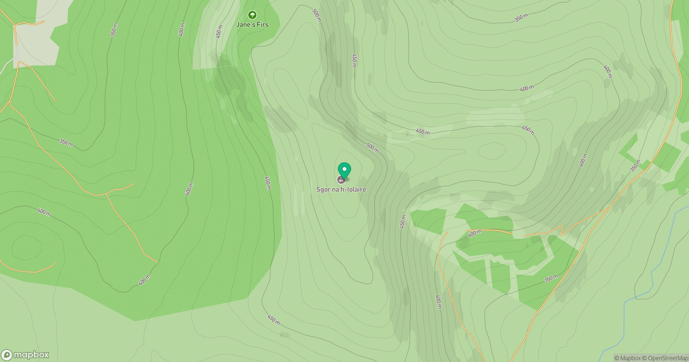
Grid reference: NO302932
View on OpenStreetMapOpens a map in a new tab, centred on the hill.
Hills within 30 km
Straight-line distance, not a walking route or confirmation of access.
Lochnagar - Cac Carn Beag
1,156m
Driesh
948m
Ben Avon - Leabaidh an Daimh Bhuidhe
1,172m
Bynack More
1,090m
Beinn Mheadhoin
1,183m
No comments yet. Be the first.