

The Coyles of Muick
Good walks are even better shared.
NO3391 : The Coyles of Muick summit.
Colin Kinnear Photo source
Overview
The Coyles of Muick
Nestled within the breathtaking Cairngorms National Park, The Coyles of Muick stand as a Marilyn, reaching an elevation of 503 meters. This delightful peak is easily accessible and popular among hikers seeking a taste of the Scottish wilderness.
Geology
The Coyles are primarily formed of durable granite, a rock that has shaped the region's rugged landscape. The area's geology not only adds to its visual appeal but also contributes to the biodiversity found here, making it ripe for exploration.
Routes
From Loch Muick
This charming route along the eastern shore of Loch Muick offers picturesque views right from the start. Expect a moderate walk that will take about 2.5 hours to complete. Grab your walking boots and appreciate the fresh Highland air!
Via the Culardoch Path
For those looking for a more strenuous challenge, this ambitious route stretches about 10 km and can take upwards of four hours. The footpath meanders through stunning vistas that can make you forget about the burn in your legs.
Summit Features
Reaching the summit, you'll be greeted by a substantial cairn—ideal for those classic Scotland selfies. Plus, the panoramic views from here are nothing short of breathtaking!
Terrain
The terrain varies from rocky and uneven to softer patches of heather and grass, providing a fun mix of walking experiences. Just try not to trip over your own feet!
Views
The summits of nearby Lochnagar will make you mumble under your breath, 'Why didn't I climb that one instead?’ Nonetheless, the view of Loch Muick from above is simply majestic, especially during sunset.
Hazards
Watch your step; the terrain can get a bit tricky, especially when the rain decides to show up. The weather can also be quite moody, so be prepared for anything from sunshine to a sudden downpour!
Access
Head to the Loch Muick car park for your starting point. Public transport options are available via bus routes from nearby Aboyne, ensuring you won’t have to hitchhike!
Facilities
While the mountain itself lacks amenities, Ballater is nearby and boasts plenty of cafes and even a lovely toilet or two—perfect for post-hike recovery!
History
The Coyles of Muick carries a name steeped in Gaelic history. The etymological roots hint at the landscape's story and charm, adding character to your hike.
So lace up those hiking boots, grab a trusted walking stick, and set off on an adventure to The Coyles of Muick. Just remember to take it all in and maybe leave some room for a scone in Ballater afterwards. Bon Voyage!
Explore routes near The Coyles of Muick
Walks starting near this hill. Open a route to check its map, distance and full itinerary.
Cairngorms night walk and stargazing (event meeting)
View route
Cairngorms night walk and stargazing (event meeting)
View route
Cairngorms night walk and stargazing (event meeting)
View route
Cairngorms night walk and stargazing (event meeting)
View route
Route planning notes
These notes describe possible approaches. Check a route's map and access information when planning your walk.
From Loch Muick
A popular route that follows the eastern shore of Loch Muick before ascending the mountain through scenic landscapes.
Via the Culardoch Path
A longer approach that offers beautiful vistas across the surrounding area, leading to the summit via a well-defined footpath.
Make a day of it, together
Find someone to share the walk with, or organise a day out along a route you like.
Photo Gallery
View all Photo could not load
NO3391 : The Coyles of Muick summit.
Colin Kinnear
 Photo could not load
NO3290 : The Coyles of Muick
Nigel Corby
 Photo could not load
NO3291 : The Coyle
Richard Webb
 Photo could not load
NO3291 : Cairn, The Coyle
Richard Webb
 Photo could not load
NO3291 : Cairn, Coyles of Muick
Richard Webb
 Photo could not load
NO3290 : South side of the Coyle
Richard Webb
 Photo could not load
NO3291 : Between the two summits on The Coyles of Muick.
Nigel Corby
 Photo could not load
NO3291 : Coyles Cottage & The Coyles of Muick
Keith Grinsted
 Photo could not load
NO3290 : Coyles of Muick.
Colin Kinnear

NO3291 : The Coyle
Richard Webb
Hill facts and local notes
Classifications
Elevation
599m
1,966 ft
Prominence
234m
Coordinates
57.0056, -3.1069
NO328910
OS Map
44
Explorer: OL53N 388N
At the Summit
The summit features a large cairn and provides panoramic views of the surrounding hills, making it a perfect place to catch your breath—or perhaps decide to take a cheeky nap.
Terrain & Geology
The Coyles of Muick is primarily composed of granite, characteristic of the Cairngorms. This sturdy rock has withstood the test of time and weather, making the mountain a reliable sight in all seasons.
Views & Scenery
From the top, you can see the impressive Lochnagar and the rolling hills of the Cairngorms, as well as the shimmering waters of Loch Muick below.
History & Heritage
Name Origin
The name 'Coyles' is believed to originate from the Gaelic word 'coinneach', referring to a 'hillock' or 'hill', combined with 'Muick', which stems from 'moine', meaning 'moor'.
Historical Significance
The mountain is part of the rich cultural heritage of the Cairngorms, often associated with local folklore and myths that intrigue visitors.
Getting There & Facilities
Parking
There is parking available at the Loch Muick car park, which is about a 30-minute walk from the trailhead.
Public Transport
Regular bus services run from Aboyne to Ballater, where further transport options are available to reach the start of the hike.
Nearby Facilities
There are no facilities directly on the mountain, but Ballater has cafes, restaurants, and public toilets. Bring your own snacks to keep the energy up!
Safety Information
Known Hazards
- Be aware of uneven and rocky terrain, especially in wet conditions. Watch for sudden weather changes common in the Highlands.
General Safety Tips
- Check weather conditions before setting out
- Carry appropriate clothing and equipment
- Let someone know your planned route
- Take a map, compass, and GPS device
- Carry emergency supplies: food, water, first aid kit, torch
Hills
Some common questions about the hills answered
Are there group walks up The Coyles of Muick?
Many walkers use Walkmates to join or organise walks with others. You can check for group walks around The Coyles of Muick through the maps
Are there other walkers around The Coyles of Muick?
Activity varies by location and time, but Walkmates lets you see whether others have shared walks or shown interest in this area. Find other people through the walking friends search walking friends for The Coyles of Muick search or of course create your own walk for The Coyles of Muick
Can I organise a walk to The Coyles of Muick?
Yes. If there aren’t any walks listed already, you can create a walk and make it available for others to join.
If you're signed up to Walkmates, you can create a walk to The Coyles of Muick.
How do I find a walk up this hill?
There are often multiple ways to walk this hill, depending on experience and route preference. Walkmates helps you explore walks and routes that others have shared.
Can I suggest a new route up The Coyles of Muick?
Yes. You can suggest or create routes to share with others. Walkmates focuses on the social side of walking, so routes are used to help people organise walks and explore areas together, rather than as detailed navigation tools or route libraries.
Other uses really appreciate knowledgeable walkers sharing their routes. Share your favourite route to The Coyles of Muick here
The is an error or something incorrect about this hill. How do I let you know?
We always strive to keep the information on Walkmates as accurate as possible. If you find an error, please let us know through the contact form and we'll aim to correct it as quickly as possible
Community Discussion
Comments
Location
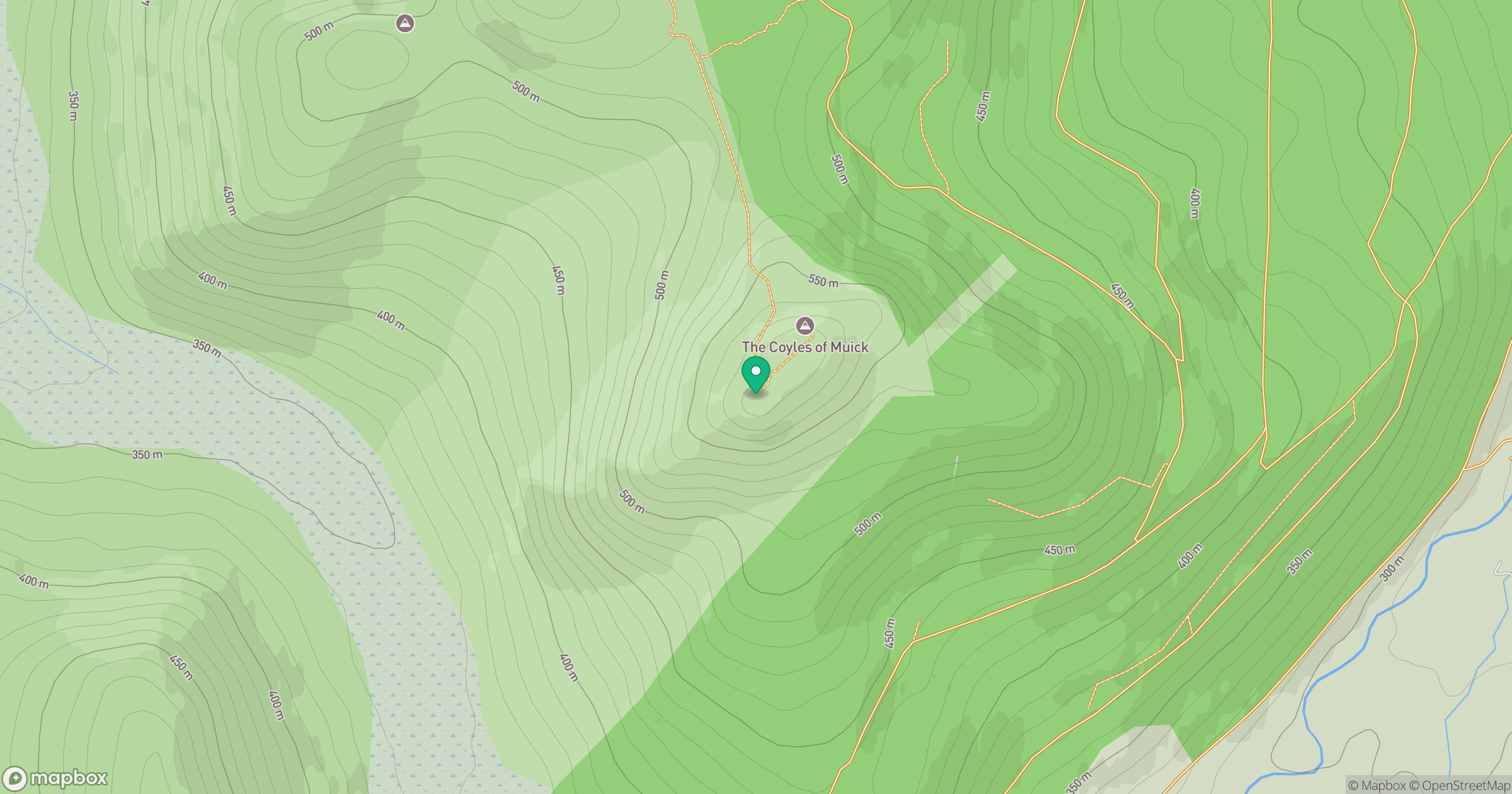
Grid reference: NO328910
View on OpenStreetMapOpens a map in a new tab, centred on the hill.
No comments yet. Be the first.