

Rossett Pike
Good walks are even better shared.
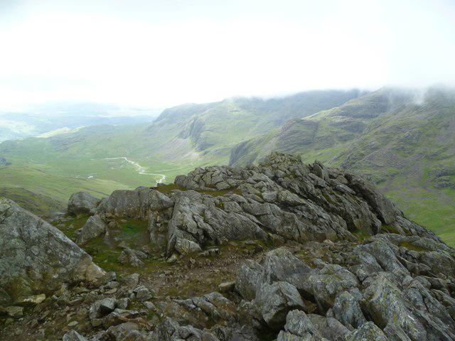
NY2407 : Above Rossett Pike
Michael Graham Photo source
Overview
Rossett Pike
Welcome to Rossett Pike, a stunning mountain in the Lake District that never fails to captivate hikers and adventurers alike. Standing tall at 550 meters, it not only offers a sense of achievement but also some of the most breathtaking views in the region.
Geology
Rossett Pike’s geological makeup mainly consists of volcanic rocks including andesite and basalt, reflecting its explosive history. The valleys that surround it were shaped by glacial activity, giving it a unique ruggedness that defines the Lake District. So, if you're scrambling over some rocks, just remember: you’re climbing history!
Routes
Langdale to Rossett Pike
This popular route starts in the picturesque Langdale Valley. The well-marked paths will guide you through stunning landscapes filled with the magical charm typical of the Lake District. It's a moderate hike, around 9.5 km, and can be done in roughly 4 hours. Don't forget to pack a sandwich; the peak has a great picnic spot!
Borrowdale Circuit
For those up for a challenge, the Borrowdale Circuit offers a thrilling 11 km journey around Borrowdale, incorporating a steep ascent to Rossett Pike. This trek is estimated to take around 5 hours, but you'll want to leave ample time for picture-taking and catching your breath!
Summit Features
At the summit, you’ll find a small rocky outcrop topped with a cairn, which marks the height of your achievement. The feeling of standing atop Rossett Pike can only be matched by the views of Scafell Pike and Bowfell that greet you from the top.
Terrain Type
Expect rugged and rocky paths, interspersed with some grassy sections. A good pair of boots will be your best friend, especially in damp conditions.
Views
From the summit, you're in for a treat! The views extend over the majestic peaks of Scafell Pike and Bowfell, plus the beautiful valleys of Langdale and Borrowdale. For the best experience, try to hike during spring or early autumn for clearer skies. However, a summer sunrise is nothing to scoff at either!
Hazards
As always, be cautious when hiking, especially in wet weather, as paths can become slippery. Keep an eye out for loose rocks and prepare for sudden weather changes — the Lake District can be feisty!
Access
Parking is available at the National Trust car park in Langdale, but make sure you get there early to snag a spot! If you’re relying on public transport, there are buses from Ambleside to Elterwater, alongside a short walk to begin your adventure. The nearest town is Ambleside, which has all the amenities you may need.
Facilities
For those in need of refreshments or a loo break, Ambleside has cafes and pubs ready to cater to you post-hike.
History
The name Rossett Pike translates to a 'rose place', hinting at its natural beauty. Historically, it has been a firm favourite among walkers, celebrated for its outstanding views and challenging ascents.
In conclusion, whether you’re a seasoned hiker or a novice seeking an adventure, Rossett Pike undoubtedly offers a rewarding experience that will leave you with memorable stories and perhaps a few sore muscles!
Happy trails!
Explore routes near Rossett Pike
Walks starting near this hill. Open a route to check its map, distance and full itinerary.
Bow Fell from Langdale
View route
Scafell Pike from Seathwaite via the Corridor Route
View route
Great Carrs Halifax Wreckage from Wrynose Pass
View route
Scafell Pike via Brown Tongue and Hollow Stones
View route
Route planning notes
These notes describe possible approaches. Check a route's map and access information when planning your walk.
Rossett Pike via Mickleden Valley
This popular route starts at the Old Dungeon Ghyll in Great Langdale. Follow the well-trodden path through Mickleden Valley, ascending via Rossett Gill. After reaching Rossett Pike, you can enjoy stunning views of Langdale Pikes and Bowfell before returning the same way.
Rossett Pike Circular via Stake Pass
Begin at the Old Dungeon Ghyll and follow the Cumbria Way towards Stake Pass. Ascend Stake Pass before diverting towards Rossett Pike. Return via Rossett Gill, creating a scenic circular route that provides varied terrain and dramatic vistas.
Rossett Pike and Bowfell Traverse
A longer and more challenging route, this starts at the Old Dungeon Ghyll and ascends Rossett Pike via Mickleden Valley and Rossett Gill. Continue the hike to Bowfell, taking in breathtaking views, before descending via The Band back to the starting point.
Rossett Pike from Borrowdale
Starting from Stonethwaite in Borrowdale, follow the path through Langstrath Valley and ascend via Stake Pass. From here, make your way to Rossett Pike for spectacular views of the surrounding fells. Retrace your steps for the return journey.
Rossett Pike and High Raise Loop
A more extensive loop starting at the Old Dungeon Ghyll, this route includes an ascent of Rossett Pike via Rossett Gill, followed by a traverse to High Raise. Descend via Stake Pass, offering a comprehensive exploration of the central fells.
Make a day of it, together
Find someone to share the walk with, or organise a day out along a route you like.
Photo Gallery
View all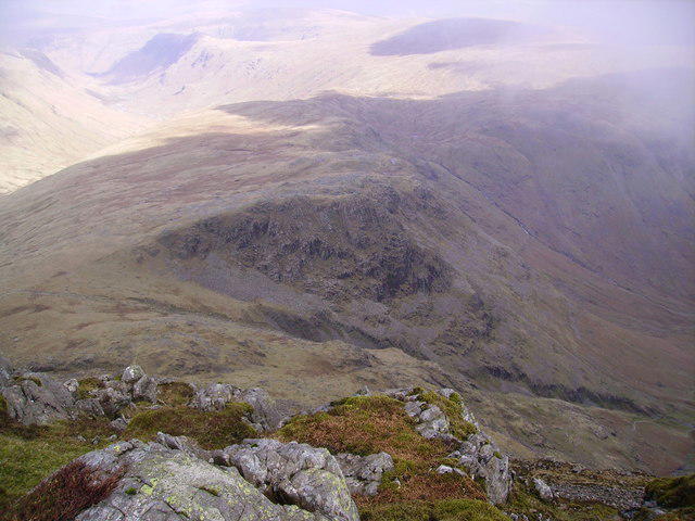 Photo could not load
NY2407 : Above Rossett Pike
Michael Graham
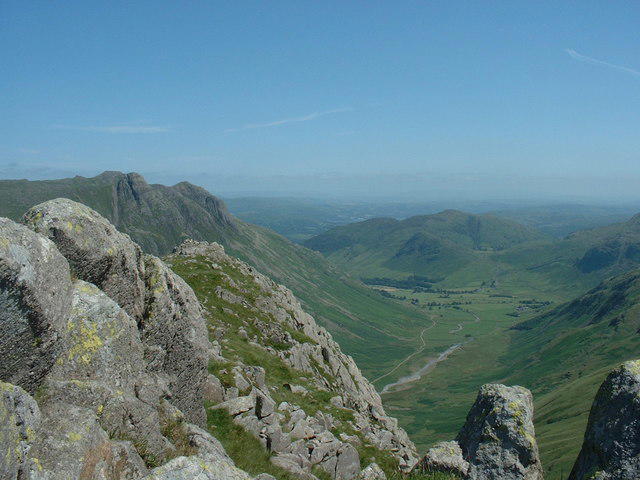 Photo could not load
NY2407 : From Rossett Pike
Michael Graham
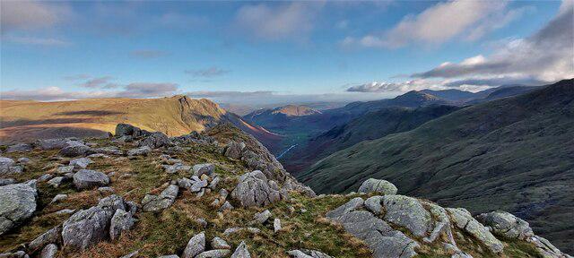 Photo could not load
NY2507 : Rossett Pike
DrewBull
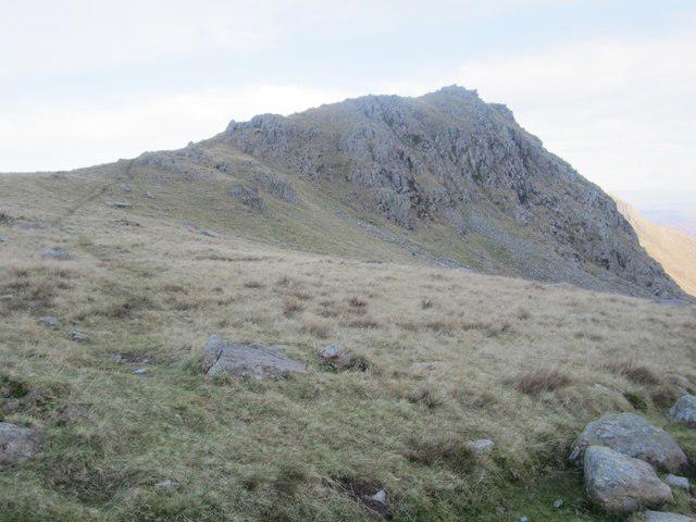 Photo could not load
NY2407 : Rossett Pike
Graham Robson
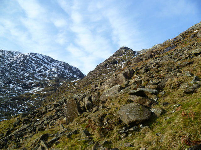 Photo could not load
NY2507 : Under Rossett Crag
Michael Graham
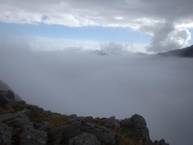 Photo could not load
NY2407 : On Rosset Pike
Michael Graham
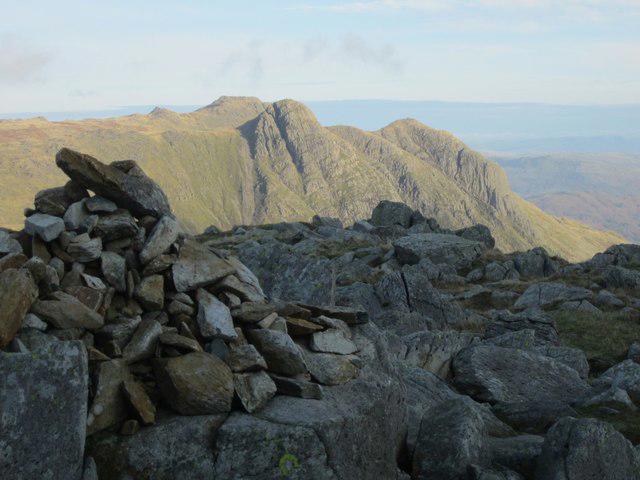 Photo could not load
NY2407 : Summit of Rossett Pike
Graham Robson
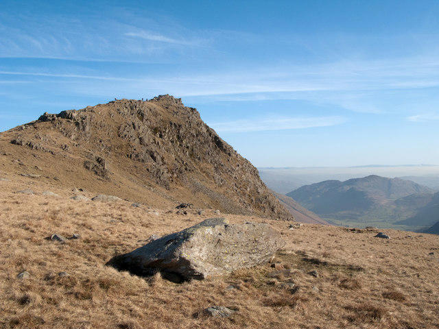 Photo could not load
NY2407 : Rossett Pike
Trevor Littlewood
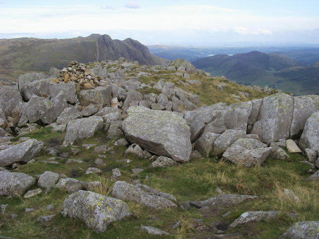 Photo could not load
NY2407 : Summit of Rossett Pike
Shaun Ferguson
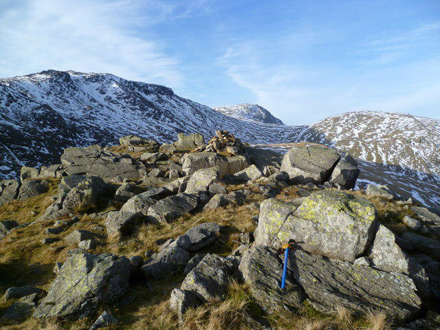
NY2407 : Rossett Pike Summit
Michael Graham
Hill facts and local notes
Classifications
Elevation
651m
2,136 ft
Prominence
42m
Coordinates
54.4579, -3.1598
NY249075
OS Map
89 90
Explorer: OL6N
At the Summit
The summit of Rossett Pike features a rocky outcrop with a small cairn and offers fantastic panoramic views of the surrounding mountains.
Terrain & Geology
Rossett Pike is primarily composed of volcanic rocks, including andesite and basalt, typical of the Lake District's rugged terrain. The landscape features typical glacially-shaped valleys, making for dramatic scenery.
Views & Scenery
From the summit, you can see the stunning Scafell Pike, Bowfell, and the vast valleys of Langdale and Borrowdale stretching below.
History & Heritage
Name Origin
The name Rossett is derived from the Old Norse 'rós', meaning 'rose', and 'ett', meaning 'a place'.
Historical Significance
Historically, Rossett Pike has been a well-trodden path for walkers throughout the years and is celebrated for its vistas and challenging ascents.
Getting There & Facilities
Parking
Parking is available at the National Trust car park in Langdale for a fee. It's suggested to arrive early as spaces fill up quickly.
Public Transport
Public transport includes buses from Ambleside to Elterwater, followed by a short walk to the trailhead.
Nearby Facilities
The nearest facilities are in the nearby town of Ambleside, which offers cafes, pubs, and public restrooms.
Safety Information
Known Hazards
- Care should be taken during wet weather as the paths can become slippery. Watch out for loose rocks and be mindful of sudden changes in weather.
General Safety Tips
- Check weather conditions before setting out
- Carry appropriate clothing and equipment
- Let someone know your planned route
- Take a map, compass, and GPS device
- Carry emergency supplies: food, water, first aid kit, torch
Hills
Some common questions about the hills answered
Are there group walks up Rossett Pike?
Many walkers use Walkmates to join or organise walks with others. You can check for group walks around Rossett Pike through the maps
Are there other walkers around Rossett Pike?
Activity varies by location and time, but Walkmates lets you see whether others have shared walks or shown interest in this area. Find other people through the walking friends search walking friends for Rossett Pike search or of course create your own walk for Rossett Pike
Can I organise a walk to Rossett Pike?
Yes. If there aren’t any walks listed already, you can create a walk and make it available for others to join.
If you're signed up to Walkmates, you can create a walk to Rossett Pike.
How do I find a walk up this hill?
There are often multiple ways to walk this hill, depending on experience and route preference. Walkmates helps you explore walks and routes that others have shared.
Can I suggest a new route up Rossett Pike?
Yes. You can suggest or create routes to share with others. Walkmates focuses on the social side of walking, so routes are used to help people organise walks and explore areas together, rather than as detailed navigation tools or route libraries.
Other uses really appreciate knowledgeable walkers sharing their routes. Share your favourite route to Rossett Pike here
The is an error or something incorrect about this hill. How do I let you know?
We always strive to keep the information on Walkmates as accurate as possible. If you find an error, please let us know through the contact form and we'll aim to correct it as quickly as possible
Community Discussion
Comments
Location
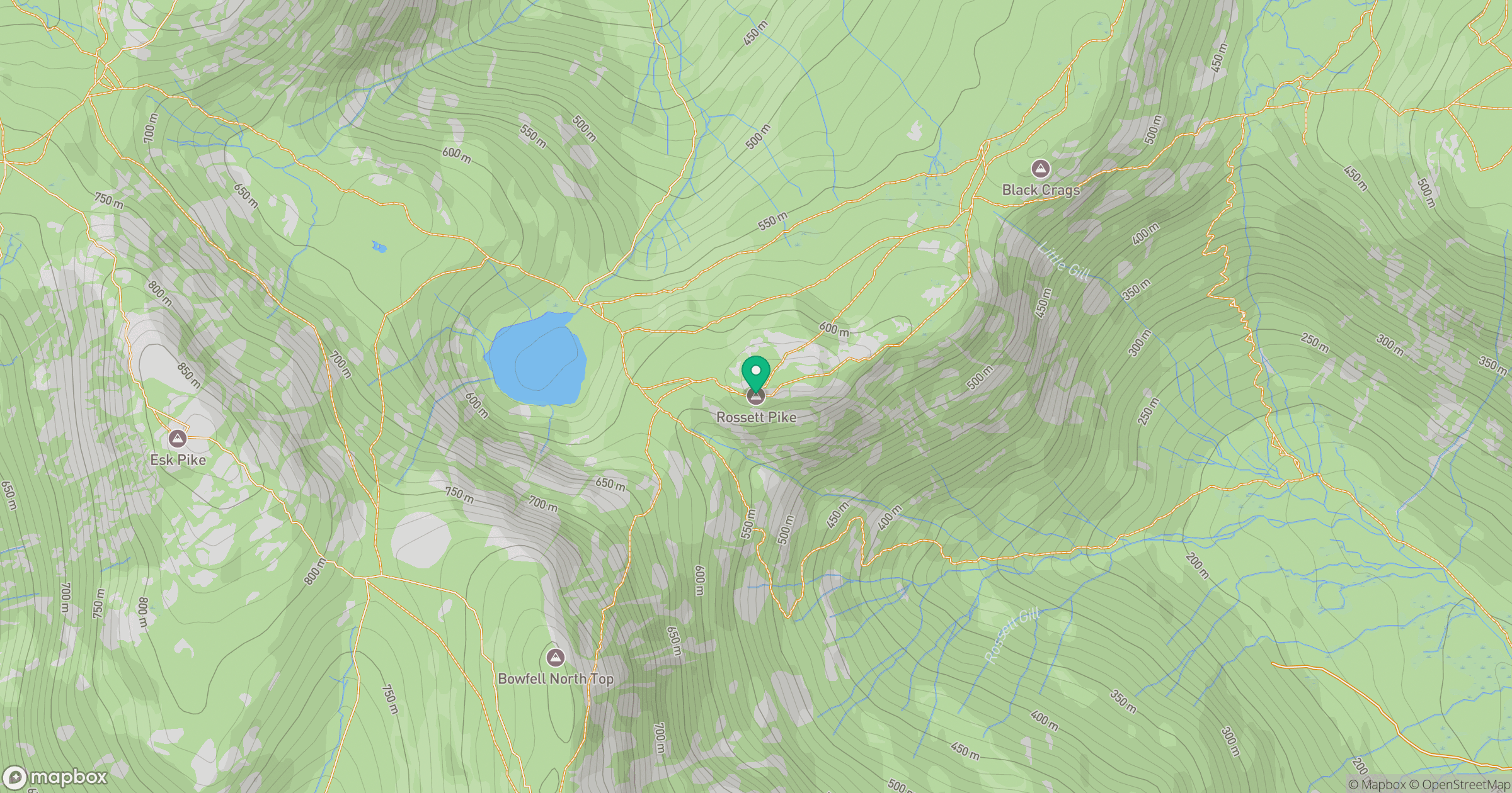
Grid reference: NY249075
View on OpenStreetMapOpens a map in a new tab, centred on the hill.
Nearby Hills
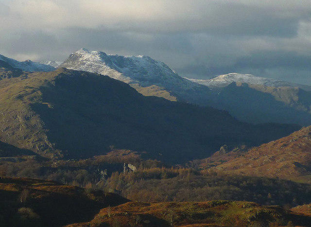
Bowfell
903m
Esk Pike
885m
Crinkle Crags - Long Top [Second Crinkle]
859m
Glaramara
783m
Pike of Blisco
703m
No comments yet. Be the first.