

Rhinog Fach
Good walks are even better shared.
SH6626 : Llyn Anghysbell
Peter S Photo source
Overview
Rhinog Fach
Rhinog Fach is a gem in the Snowdonia National Park, standing proudly at an elevation of 720 meters. Often overshadowed by its bigger neighbour, Rhinog Fawr, this Marilyn offers its own unique charm and breathtaking views.
Geology
The mountain is a patchwork of ancient volcanic rocks, primarily formed from granite and sandstone. The unique geological formation provides a rugged terrain that tells tales of the Earth's history.
Route Options
Two popular routes lead to the summit of Rhinog Fach:
Rhinog Fach via the Roman Steps - A moderate 6.5 km trek starting from the Roman Steps car park. Ascend through lovely woodlands before reaching the mountain's rocky paths. Expect to spend around 3.5 hours experiencing the tranquil beauty of the area.
Rhinog Fach from Cwm Bychan - For those feeling adventurous, this steep 5 km route offers a challenging climb, rewarding your effort with stunning views. Plan for about 3 hours of hiking, and don't forget your sense of humour—and maybe a snack!
Summit Features
The summit is home to a substantial stone cairn, making it an ideal picnic spot (or a place for deep contemplation about your life choices). Take a moment to enjoy the picturesque vistas.
Terrain and Hazards
Expect rocky trails that can be tricky, so sturdy footwear is a must. The terrain varies from rocky to grassy patches interspersed with boggy dips, so tread carefully. Always be mindful of rapidly changing weather conditions, a notorious feature of the Welsh mountains.
Views and Best Seasons
From the top, revel in the awe-inspiring sight of Snowdon to the north and the stunning coastline of Cardigan Bay to the south. Late spring and early autumn are the golden times for views, thanks to clearer skies.
Access and Facilities
The Roman Steps car park offers the closest parking, providing a handy launching point for your hike. Public transport options are available from Dolgellau, the nearest town, which is around 10 miles south. Make sure to fuel up at one of its towns' cafes before or after your trek!
History and Name Meaning
'Rhinog Fach' literally means 'Little Rhinog'. Despite its stature, the mountain holds historical significance in local folklore, believed to be the dwelling of ancient creatures, adding a sprinkle of legend to your hiking experience.
So come prepared, enjoy the great outdoors, and let's hope the weather plays nice!
Explore routes near Rhinog Fach
Walks starting near this hill. Open a route to check its map, distance and full itinerary.
Northern Rhinogydd guided mountain walk
View route
Coed y Brenin: Pont Ty'n-y-groes and Mawddach Forest Trail
View route
Mawddach Trail: Penmaenpool to Arthog Estuary Return
View route
Mawddach Trail: Penmaenpool to Dolgellau Riverside Return
View route
Route planning notes
These notes describe possible approaches. Check a route's map and access information when planning your walk.
Rhinog Fach via the Roman Steps
This scenic route starts at the Roman Steps car park, taking you through beautiful woodlands and up into the rugged terrain of the Rhinogs.
Rhinog Fach from Cwm Bychan
Starting from Cwm Bychan, this route offers a steep ascent and rewards hikers with stunning views across the valleys.
Make a day of it, together
Find someone to share the walk with, or organise a day out along a route you like.
Photo Gallery
View all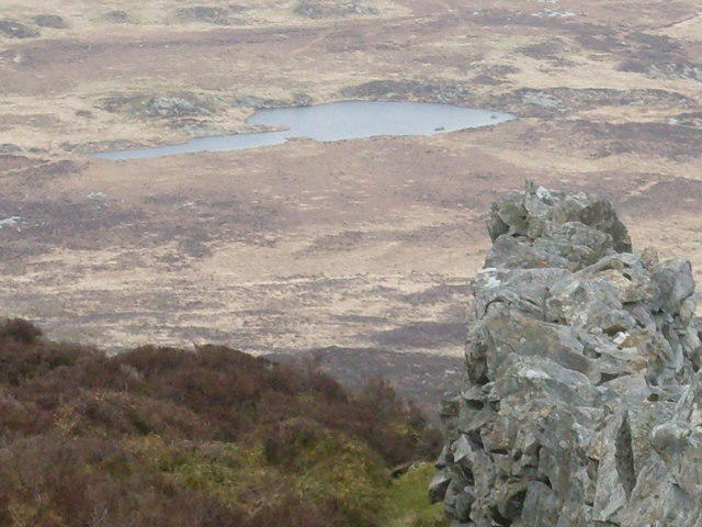 Photo could not load
SH6626 : Llyn Anghysbell
Peter S
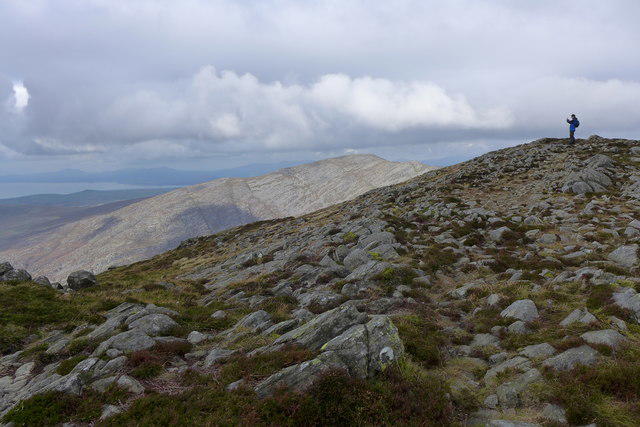 Photo could not load
SH6627 : Path on Rhinog Fach
Hansjoerg Lipp
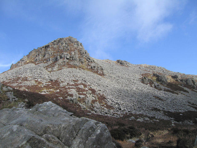 Photo could not load
SH6626 : A foreshortened view of Rhinog Fach
Dave Croker
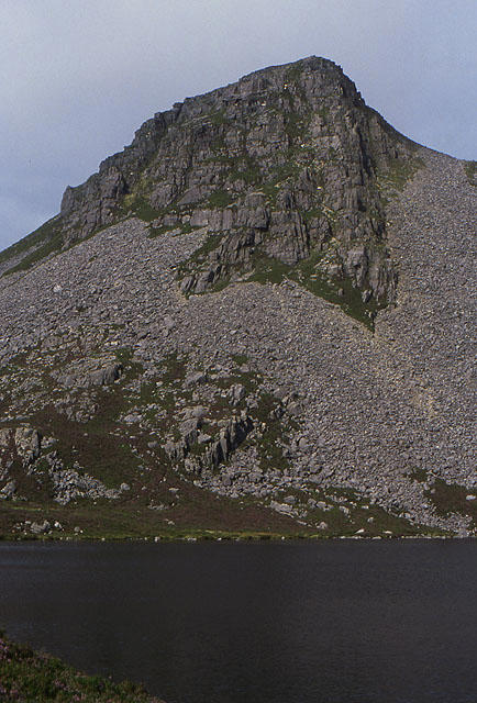 Photo could not load
SH6626 : Rhinog Fach from Llyn Hywel
Nigel Brown
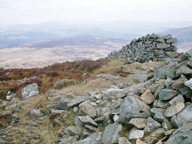 Photo could not load
SH6627 : View in one direction from Rhinog Fach
Peter S
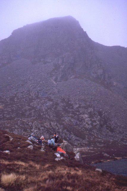 Photo could not load
SH6626 : Llyn Hywel and Rhinog Fach, 1971
Jim Barton
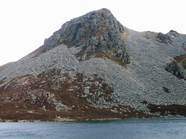 Photo could not load
SH6626 : Rhinog Fach
Peter S
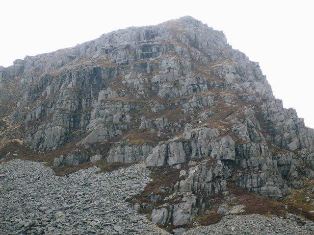 Photo could not load
SH6626 : Rhinog Fach
Peter S
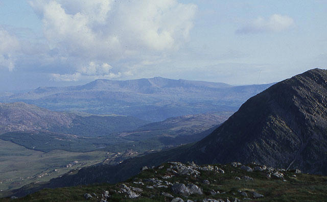 Photo could not load
SH6626 : View towards a distant Cadair Idris from Rhinog Fach
Nigel Brown
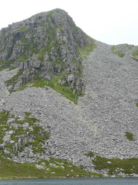
SH6626 : Rhinog Fach from Llyn Hywel
John Dyason
Hill facts and local notes
Classifications
Elevation
712m
2,335 ft
Prominence
151m
Coordinates
52.8242, -3.9830
SH664270
OS Map
124
Explorer: OL18W
At the Summit
The summit features a stone cairn, which provides a great spot for a rest and some selfies. On a clear day, it's a perfect vantage point for panoramic views.
Terrain & Geology
Rhinog Fach is primarily composed of ancient volcanic rocks, with a fascinating mixture of granite and sandstone. The rugged landscape is a testament to the area's dynamic geological history.
Views & Scenery
From the summit, you can see the majestic peaks of Snowdon to the north and the beautiful coastline of Cardigan Bay to the south.
History & Heritage
Name Origin
The name 'Rhinog Fach' translates to 'Little Rhinog', highlighting its stature among the more prominent Rhinog peaks.
Historical Significance
Historically, the Rhinogs are tied to local folklore and are said to be the home of ancient creatures, adding a hint of mystique to your trek.
Getting There & Facilities
Parking
The nearest parking is at the Roman Steps car park, which has space for several vehicles and starts the adventure.
Public Transport
Buses run from nearby villages like Dolgellau to the car park, though check the local timetable for accuracy.
Nearby Facilities
There are limited facilities at the base; however, Dolgellau offers cafes, restaurants, and public toilets.
Safety Information
Known Hazards
- Rocky terrain requires sturdy footwear. Be cautious of sudden weather changes common in mountainous regions.
General Safety Tips
- Check weather conditions before setting out
- Carry appropriate clothing and equipment
- Let someone know your planned route
- Take a map, compass, and GPS device
- Carry emergency supplies: food, water, first aid kit, torch
Hills
Some common questions about the hills answered
Are there group walks up Rhinog Fach?
Many walkers use Walkmates to join or organise walks with others. You can check for group walks around Rhinog Fach through the maps
Are there other walkers around Rhinog Fach?
Activity varies by location and time, but Walkmates lets you see whether others have shared walks or shown interest in this area. Find other people through the walking friends search walking friends for Rhinog Fach search or of course create your own walk for Rhinog Fach
Can I organise a walk to Rhinog Fach?
Yes. If there aren’t any walks listed already, you can create a walk and make it available for others to join.
If you're signed up to Walkmates, you can create a walk to Rhinog Fach.
How do I find a walk up this hill?
There are often multiple ways to walk this hill, depending on experience and route preference. Walkmates helps you explore walks and routes that others have shared.
Can I suggest a new route up Rhinog Fach?
Yes. You can suggest or create routes to share with others. Walkmates focuses on the social side of walking, so routes are used to help people organise walks and explore areas together, rather than as detailed navigation tools or route libraries.
Other uses really appreciate knowledgeable walkers sharing their routes. Share your favourite route to Rhinog Fach here
The is an error or something incorrect about this hill. How do I let you know?
We always strive to keep the information on Walkmates as accurate as possible. If you find an error, please let us know through the contact form and we'll aim to correct it as quickly as possible
Community Discussion
Comments
Location
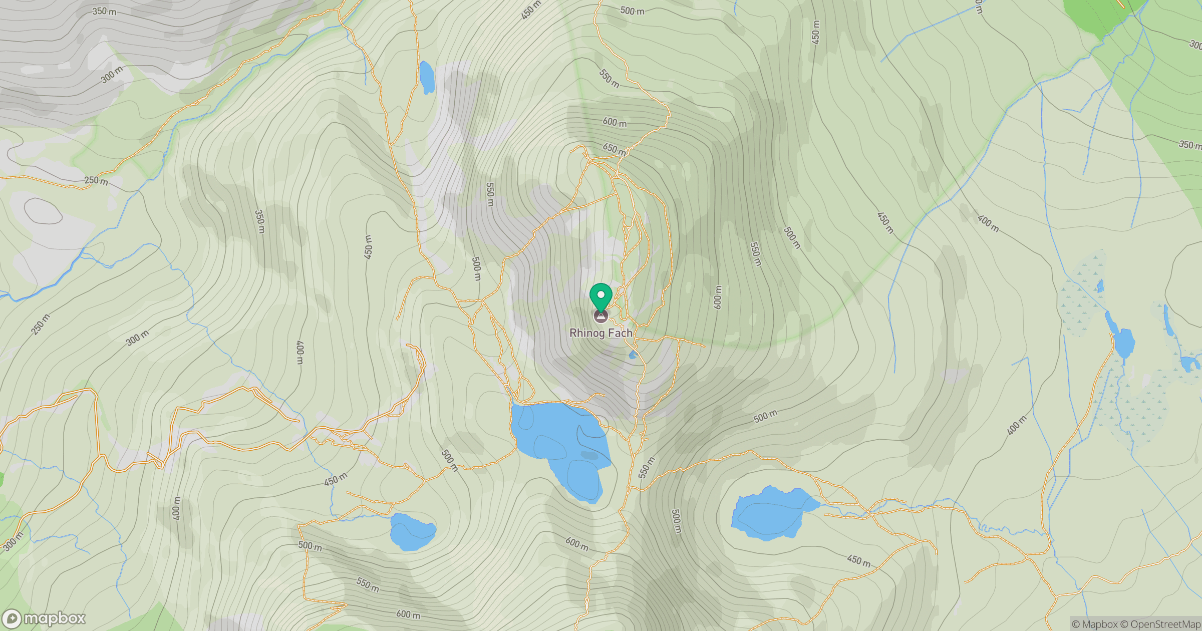
Grid reference: SH664270
View on OpenStreetMapOpens a map in a new tab, centred on the hill.
No comments yet. Be the first.