

Raven Crag
Good walks are even better shared.
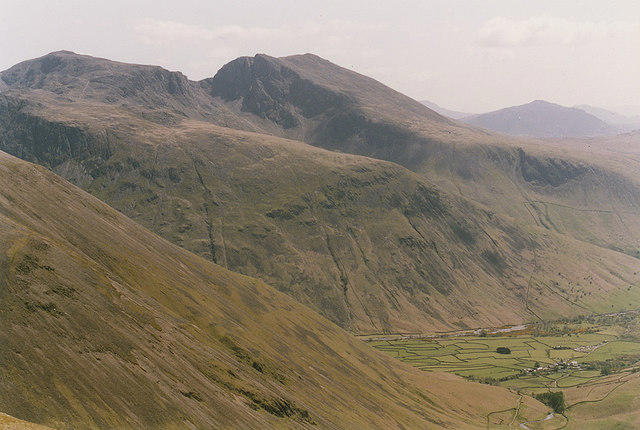
SD1396 : Looking across to Raven Crag
William Bartlett Photo source
Overview
Raven Crag
Overview
Raven Crag, standing proudly at 431 metres, offers an engaging hike that rewards adventurers with breathtaking views and a sense of accomplishment. This Wainwright favourite is located in the idyllic Lake District, where the landscape is as dramatic as the weather.
Geology
Nestled amidst the Skiddaw slate, Raven Crag presents an intriguing geological profile. The age-old processes of erosion are evident here, with dramatic crags and smooth grassy patches co-existing in harmony. If you’re into geology, you'll find it’s a wonderful spot for a bit of rock appreciation... just make sure you don’t trip over one!
Route Information
The Kirkstone Pass Circuit is a popular choice for accessing Raven Crag. The journey starts at Kirkstone Pass, which itself is a stunning drive and a great place to stretch those legs before the ascent. The route is moderately challenging, weaving through lush landscapes, offering a mix of rocky trails and grassy meadows that make for a delightful hike. And let’s be honest, who doesn’t fancy a bit of a workout followed by a fabulous view?
Summit Features
On reaching the summit, you'll find a quaint stone cairn, the perfect little marker of your achievement. Sit back, relax, and absorb the vistas of Ullswater and the Helvellyn range. Don’t forget to snap a few photos—after all, nothing beats bragging rights!
Terrain and Views
The terrain is rocky, with plenty of opportunities to stop for a picnic amongst grassy patches. From the top, the views are truly spectacular, particularly in late spring or early autumn when the scenery is at its most colourful. As you take in the sights, keep an eye out for the iconic “lake” that makes the Lake District famous—Ullswater will be out there gleaming in all its glory.
Hazards
While Raven Crag is a rewarding trek, it’s not without risks. Be aware of loose rocks along the trail and sudden changes in weather, typical of the Lake District. Those crag edges can be a bit precarious, so take care not to slip while showing off your best mountain pose!
Access and Facilities
Accessing Raven Crag is fairly straightforward, with the nearest parking available at Kirkstone Pass. If you're relying on public transport, buses from Windermere and Ambleside will get you fairly close, but you might have to walk a bit to get to the starting point. Facilities can be found in the nearby towns of Windermere and Ambleside—with a hot cup of coffee waiting for you after your descent, or even a slice of cake if you're lucky!
Conclusion
Raven Crag is not just a mountain; it’s an experience that combines nature, history, and a good dose of fresh air. So grab your walking boots, and take a trip to this stunning locale—you won't regret it!
Happy hiking!
Explore routes near Raven Crag
Walks starting near this hill. Open a route to check its map, distance and full itinerary.
Scafell Pike via Brown Tongue and Hollow Stones
View route
Great Carrs Halifax Wreckage from Wrynose Pass
View route
Bow Fell from Langdale
View route
Scafell Pike from Seathwaite via the Corridor Route
View route
Route planning notes
These notes describe possible approaches. Check a route's map and access information when planning your walk.
Kirkstone Pass Circuit
A picturesque climb starting from Kirkstone Pass with a steep ascent that meanders through the rugged terrain towards the summit of Raven Crag, providing stunning views along the way.
Make a day of it, together
Find someone to share the walk with, or organise a day out along a route you like.
Photo Gallery
View all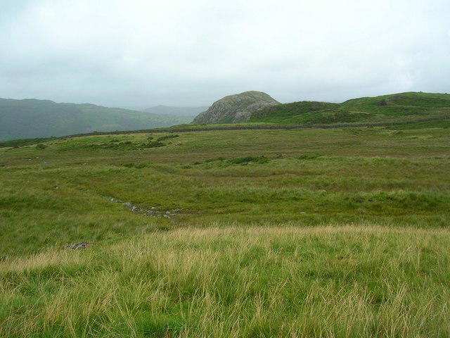 Photo could not load
SD1396 : Looking across to Raven Crag
William Bartlett
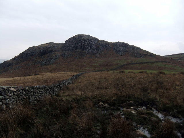 Photo could not load
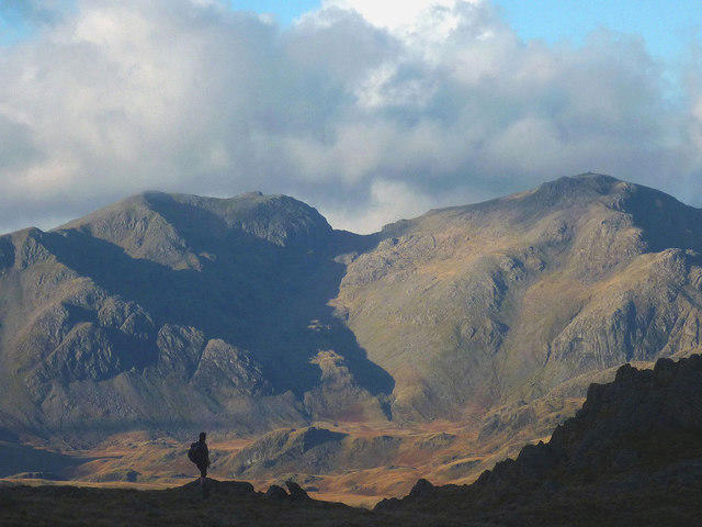
SD1396 : Raven Crag
David Brown
Hill facts and local notes
Classifications
Elevation
199m
653 ft
Prominence
36m
Coordinates
54.3604, -3.3352
SD133969
OS Map
96
Explorer: OL6N
At the Summit
The summit features a small stone cairn and spectacular views of the surrounding valleys and peaks. An ideal spot for a breather and to catch your breath while soaking in the scenery.
Terrain & Geology
Raven Crag is primarily composed of Skiddaw slate, a metamorphosed sedimentary rock known for its durability and scenic strata. The steep crags and rocky outcrops offer a geological marvel, showcasing the ancient forces that shaped this natural landscape.
Views & Scenery
From the summit, you can enjoy sweeping vistas of Ullswater, the Helvellyn range, and the picturesque hills of the Lake District.
History & Heritage
Name Origin
Raven Crag's name is believed to derive from the Old Norse word ‘hræfn’, meaning raven, reflecting the rich folklore associated with this majestic bird in British culture.
Historical Significance
The area boasts a history rich in agriculture and sheep farming, and has been frequented by walkers for centuries, making it a cherished spot in the Lake District.
Getting There & Facilities
Parking
The nearest parking is at Kirkstone Pass, which features a small car park accommodating around 20 vehicles.
Public Transport
Bus services operate from nearby towns like Windermere and Ambleside, with the nearest stop approximately 2 km from the start point.
Nearby Facilities
There are no facilities directly at Raven Crag; however, several cafes and pubs can be found in nearby Windermere and Ambleside, perfect for post-hike refreshments.
Safety Information
Known Hazards
- Loose rocks on paths, sudden weather changes in the Lakeland, and steep drops near the crag edges.
General Safety Tips
- Check weather conditions before setting out
- Carry appropriate clothing and equipment
- Let someone know your planned route
- Take a map, compass, and GPS device
- Carry emergency supplies: food, water, first aid kit, torch
Hills
Some common questions about the hills answered
Are there group walks up Raven Crag?
Many walkers use Walkmates to join or organise walks with others. You can check for group walks around Raven Crag through the maps
Are there other walkers around Raven Crag?
Activity varies by location and time, but Walkmates lets you see whether others have shared walks or shown interest in this area. Find other people through the walking friends search walking friends for Raven Crag search or of course create your own walk for Raven Crag
Can I organise a walk to Raven Crag?
Yes. If there aren’t any walks listed already, you can create a walk and make it available for others to join.
If you're signed up to Walkmates, you can create a walk to Raven Crag.
How do I find a walk up this hill?
There are often multiple ways to walk this hill, depending on experience and route preference. Walkmates helps you explore walks and routes that others have shared.
Can I suggest a new route up Raven Crag?
Yes. You can suggest or create routes to share with others. Walkmates focuses on the social side of walking, so routes are used to help people organise walks and explore areas together, rather than as detailed navigation tools or route libraries.
Other uses really appreciate knowledgeable walkers sharing their routes. Share your favourite route to Raven Crag here
The is an error or something incorrect about this hill. How do I let you know?
We always strive to keep the information on Walkmates as accurate as possible. If you find an error, please let us know through the contact form and we'll aim to correct it as quickly as possible
Community Discussion
Comments
Location
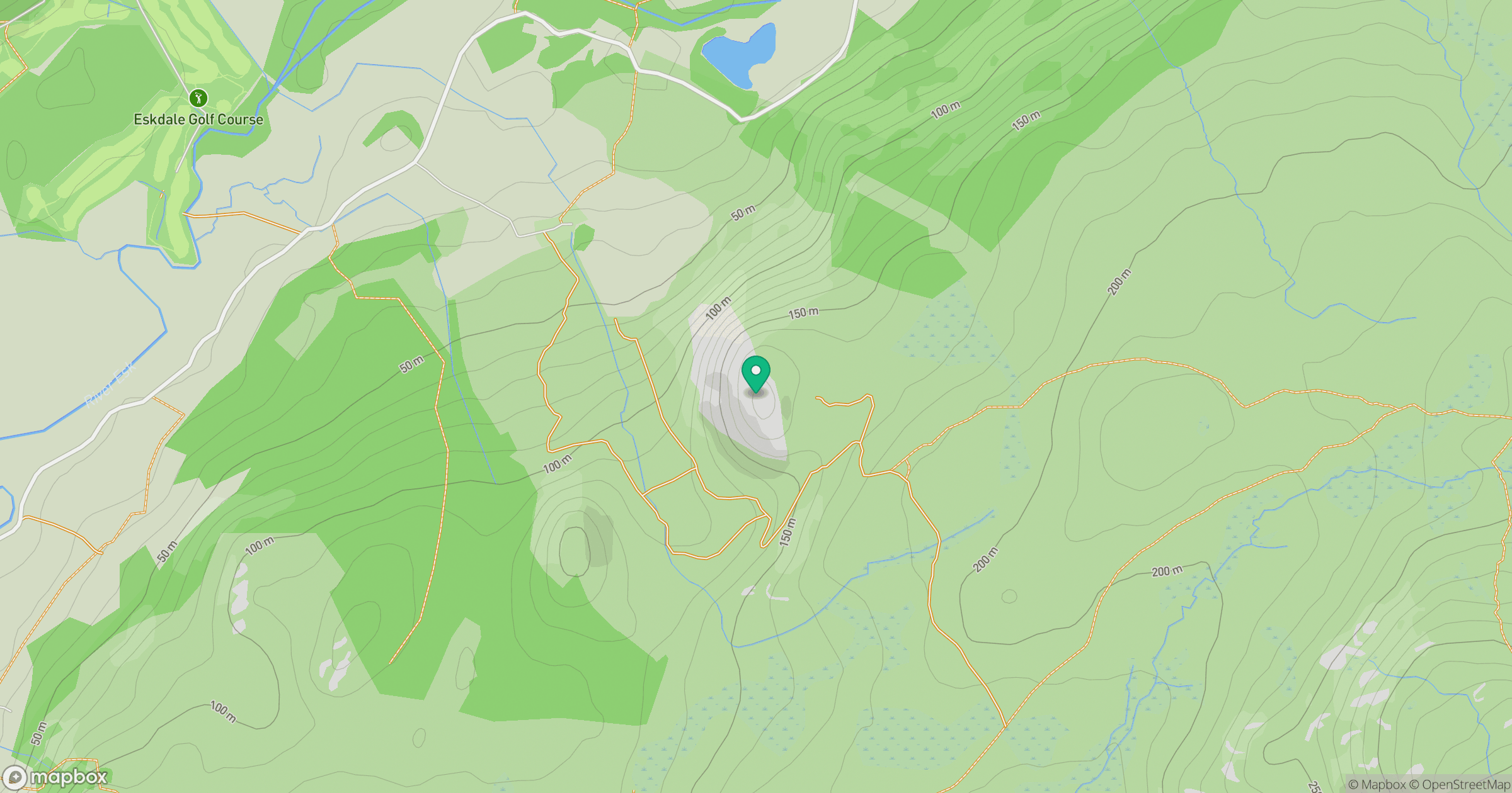
Grid reference: SD133969
View on OpenStreetMapOpens a map in a new tab, centred on the hill.
No comments yet. Be the first.