

Quiraing North Peak
Good walks are even better shared.
NG4469 : Gap in the Quiraing Cliffs
Sandy Gerrard Photo source
Overview
Quiraing North Peak: A Hiker's Paradise
Introduction
Nestled in the stunning Isle of Skye, Quiraing North Peak stands tall at 543 meters, offering hikers a journey through both remarkable geology and breathtaking scenery. With its rugged formations and captivating views, this Marilyn is a must-visit for outdoor enthusiasts.
Geology
The Quiraing is not just a pretty face—it’s a geomorphological marvel! This area is shaped by the processes of landslips that have occurred over millennia. The result? A complex tapestry of cliffs, slopes, and unique rock formations that leave geology buffs in awe. Just remember, it's not just the peaks that are wobbly; the rocks occasionally may share their thoughts on the matter, particularly during rainy spells!
Route Description
- Route Name: Quiraing Circuit
- Distance: 7.5 km loop
- Time: Approximately 2.5 hours
- Difficulty: Moderate
Starting from the car park, this well-trodden path meanders through beautiful landscapes and provides ample opportunities for photography. Expect some rocky sections that might make you question your hiking boots' loyalty, but it's all part of the fun!
Summit Features
Upon reaching the summit, you will be greeted by a striking rocky outcrop, the perfect spot for selfies—just don't get too close to the edge unless you want to be in a new 'most scenic fall' Instagram post!
Terrain Type
The terrain is distinctly rocky, with patches of grassy heath. As you navigate the route, a bit of scrambling may be required. Bring your sense of adventure and perhaps a walking stick for good measure.
Views
From the summit, the views are nothing short of spectacular. You can see the iconic Old Man of Storr and the expansive Trotternish Ridge. Just be sure to keep your camera ready, as the light changes quicker than you can say, 'highland fling!'
Best Seasons
Spring and autumn yield the clearest views. Early mornings are particularly magical, as the mist often wraps around the peaks like a soft blanket.
Hazards
Navigating Quiraing North Peak does come with its share of risks—be cautious on wet or slippery rocks! The uneven terrain requires attention and proper footwear. Losing your footing is one thing, but trying to juggle that sandwich while doing so—now that's a tricky situation!
Nearby Summits
- Ben Dearg: 569 meters
- Table Mountain: 317 meters
Both nearby summits are worthy companions to your hiking adventure, offering additional routes and stunning views.
Access
Nearest Parking
Located at NG455689, the main car park has enough space for most visitors, but in peak season, it may resemble a game of Tetris. Arrive early!
Public Transport
Buses operate from Portree, but they’re not exactly frequent. Plan accordingly—there’s nothing worse than being stranded with nothing but your sandwich and a longing for a cuppa.
Nearest Town
Portree is your go-to base, just a short drive away, with cafes and shops to stock up on essentials.
Facilities
Facilities are sparse near the Quiraing itself, but Portree is rich with options, including cafes where you can enjoy local treats. Public toilets are also available in town—make use of them!
History
Name Meaning
The name 'Quiraing' is derived from the Old Norse, meaning 'church'. This denotes its historical significance to the local community.
Significance
Rich in history, the Quiraing has sheltered Clans during tumultuous times. It’s not just a hike; it’s a journey through time and legends.
Conclusion
Quiraing North Peak beckons with its towering cliffs, sweeping views, and fascinating history. Whether you’re a hiking aficionado or a casual walker, this peak promises an unforgettable outdoor experience. Pack your rucksack, lather on some sunscreen, and embark on this enchanting adventure!
Explore routes near Quiraing North Peak
Walks starting near this hill. Open a route to check its map, distance and full itinerary.
Fairy Lochs Liberator Wreckage Circuit
View route
Beinn Eighe Lancaster Wreckage at Coire Mhic Fhearchair
View route
Berneray Community Hall to the beautiful beach
View route
Beautiful private beach walk Isle of Harris
View route
Route planning notes
These notes describe possible approaches. Check a route's map and access information when planning your walk.
Quiraing Circuit
This classic circular route starts and ends at the Quiraing car park. The trail ascends through the dramatic Trotternish landslip, passing iconic features such as The Needle, The Prison, and The Table. After reaching Quiraing North Peak, the route loops back along the ridge with stunning views of Staffin Bay and the surrounding landscape.
Quiraing North Peak Direct Ascent
This shorter, direct route begins at the Quiraing car park and follows a well-trodden path that ascends steeply towards Quiraing North Peak. The route focuses on reaching the summit quickly, offering panoramic views of the Isle of Skye and the Outer Hebrides.
Quiraing and Flodigarry Traverse
This linear route starts at the Quiraing car park and traverses the Trotternish Ridge to Flodigarry. After visiting Quiraing North Peak, the trail continues along the ridge with expansive views, eventually descending near Flodigarry. A return to the start point requires arranging transport in advance.
Quiraing Sunrise Walk
A scenic early-morning route designed to catch the sunrise over the Quiraing. Starting from the car park, this route ascends to Quiraing North Peak, offering incredible light and shadow contrasts across the landscape. It's a shorter route but can be challenging in low-light conditions.
Extended Quiraing Exploration
This extended circular route starts at the Quiraing car park and combines the Quiraing Circuit with additional exploration of lesser-trodden paths around the landslip. It includes a visit to Quiraing North Peak and other unique geological features, making it ideal for those who want a longer day out.
Make a day of it, together
Find someone to share the walk with, or organise a day out along a route you like.
Photo Gallery
View all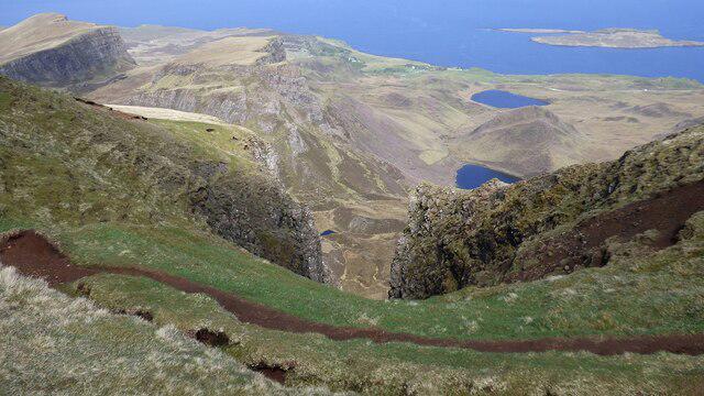 Photo could not load
NG4469 : Gap in the Quiraing Cliffs
Sandy Gerrard
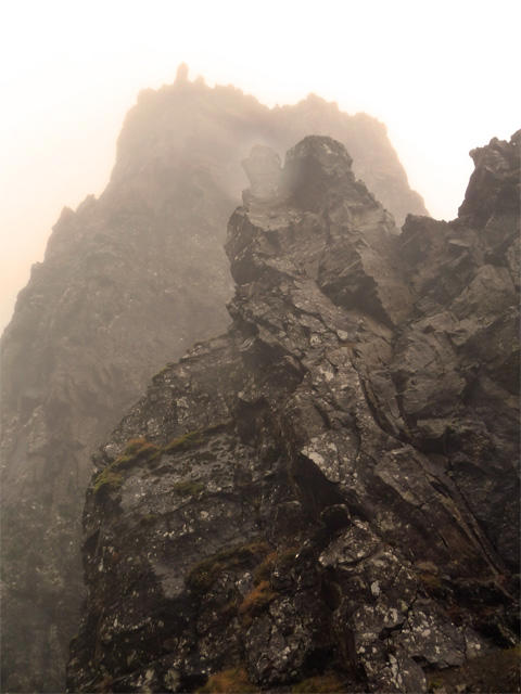 Photo could not load
NG4569 : Rock towers in the Quiraing
John Allan
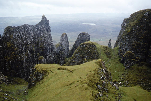 Photo could not load
NG4569 : Quiraing - view from the Table
Ian Taylor
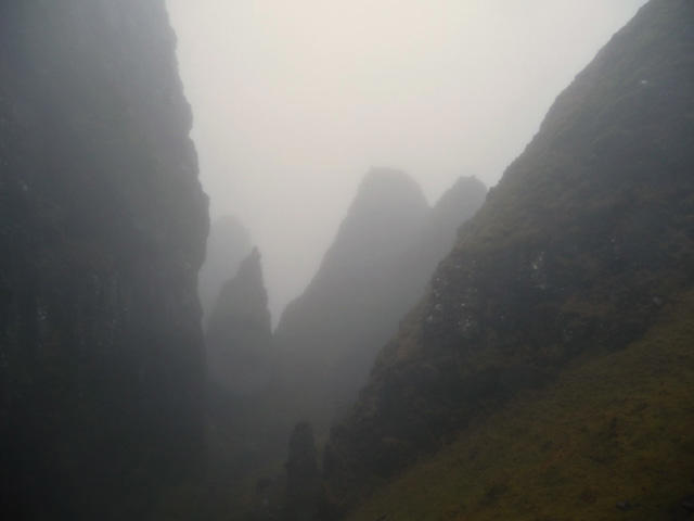 Photo could not load
NG4569 : Inside the Quiraing
John Allan
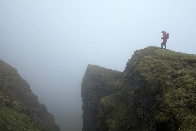 Photo could not load
NG4469 : Chasm above The Table
Trevor Littlewood
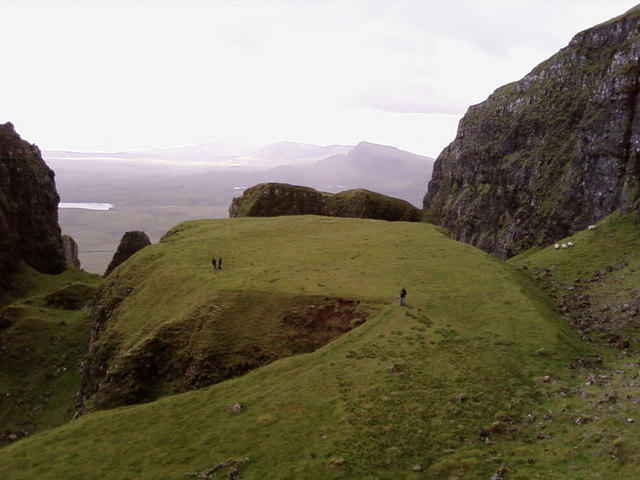 Photo could not load
NG4569 : The Table
Colin Wilson
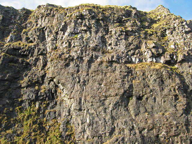 Photo could not load
NG4469 : East face of Meall na Suiramach
John Allan
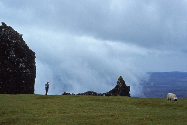 Photo could not load
NG4569 : Quiraing - on the Table
Ian Taylor
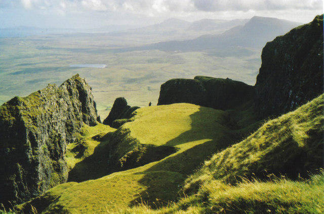 Photo could not load
NG4569 : The Table
Carol Walker
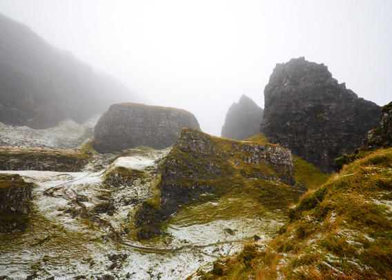
NG4569 : Rock formations in the upper Quiraing
John Allan
Hill facts and local notes
Classifications
Elevation
492m
1,614 ft
Prominence
33m
Coordinates
57.6417, -6.2739
NG450693
OS Map
23
Explorer: 408
At the Summit
The summit is marked by a prominent rocky outcrop, offering panoramic views of the surrounding landscape, including the Old Man of Storr and the distant vistas of the mainland.
Terrain & Geology
The Quiraing is a fascinating example of landslip geology, with impressive cliffs, rocky outcrops, and a landscape formed by ancient volcanic activity. The unique formations are a result of massive slippage of the land.
Views & Scenery
Visible landmarks from the summit include the Old Man of Storr, the Trotternish Ridge, and the dramatic cliffs of the Quiraing itself.
History & Heritage
Name Origin
The name 'Quiraing' comes from the Old Norse word 'Kirkja', meaning 'church', reflecting the area's spiritual significance.
Historical Significance
The Quiraing has a rich history, once serving as a refuge for the MacLeods during clan feuds, and is steeped in local legends.
Getting There & Facilities
Parking
The main car park is located just off the A855, at NG455689. It can accommodate a good number of cars but tends to fill up quickly, especially in tourist season.
Public Transport
Buses from Portree run to the Quiraing area, but services may be infrequent. Plan accordingly or consider a taxi for convenience.
Nearby Facilities
There are limited facilities near the Quiraing, but Portree offers various cafes, visitor centres, and public toilets. Don't forget to refuel before tackling the trails!
Safety Information
Known Hazards
- Beware of slippery rocks, particularly after rain. The terrain can be uneven, so appropriate footwear is essential.
General Safety Tips
- Check weather conditions before setting out
- Carry appropriate clothing and equipment
- Let someone know your planned route
- Take a map, compass, and GPS device
- Carry emergency supplies: food, water, first aid kit, torch
Hills
Some common questions about the hills answered
Are there group walks up Quiraing North Peak?
Many walkers use Walkmates to join or organise walks with others. You can check for group walks around Quiraing North Peak through the maps
Are there other walkers around Quiraing North Peak?
Activity varies by location and time, but Walkmates lets you see whether others have shared walks or shown interest in this area. Find other people through the walking friends search walking friends for Quiraing North Peak search or of course create your own walk for Quiraing North Peak
Can I organise a walk to Quiraing North Peak?
Yes. If there aren’t any walks listed already, you can create a walk and make it available for others to join.
If you're signed up to Walkmates, you can create a walk to Quiraing North Peak.
How do I find a walk up this hill?
There are often multiple ways to walk this hill, depending on experience and route preference. Walkmates helps you explore walks and routes that others have shared.
Can I suggest a new route up Quiraing North Peak?
Yes. You can suggest or create routes to share with others. Walkmates focuses on the social side of walking, so routes are used to help people organise walks and explore areas together, rather than as detailed navigation tools or route libraries.
Other uses really appreciate knowledgeable walkers sharing their routes. Share your favourite route to Quiraing North Peak here
The is an error or something incorrect about this hill. How do I let you know?
We always strive to keep the information on Walkmates as accurate as possible. If you find an error, please let us know through the contact form and we'll aim to correct it as quickly as possible
Community Discussion
Comments
Location
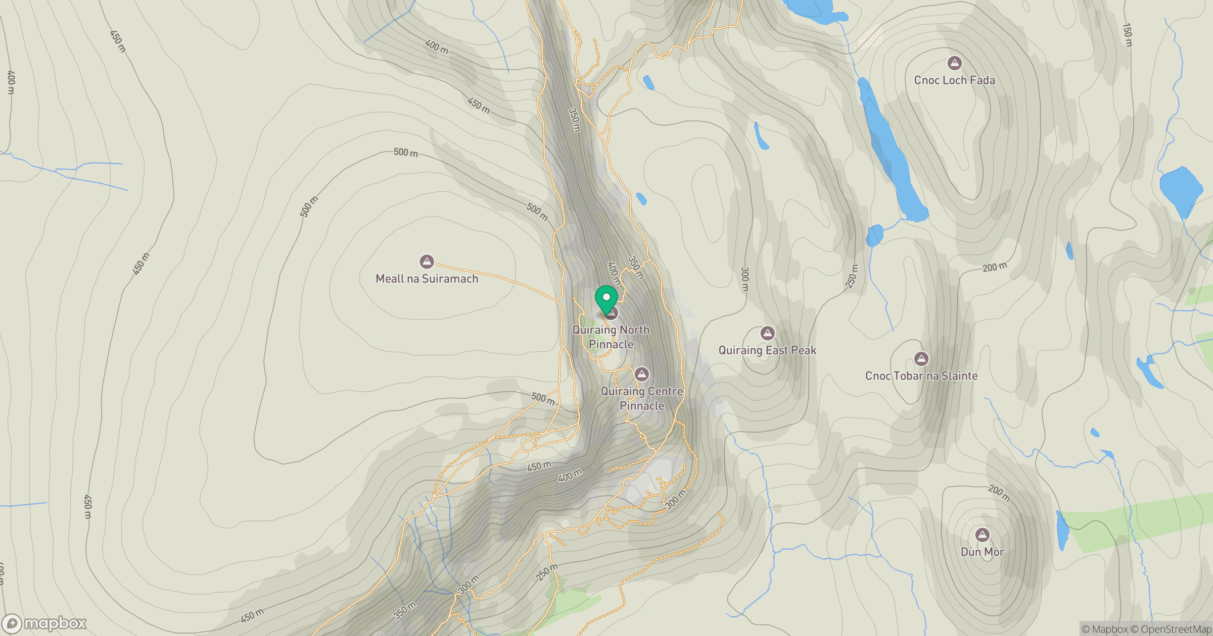
Grid reference: NG450693
View on OpenStreetMapOpens a map in a new tab, centred on the hill.
No comments yet. Be the first.