
Pen y Foel
Good walks are even better shared.
Overview
Pen y Foel: A Guide to Hiking the Hill of the Hill
Nestled in the heart of Snowdonia National Park, Pen y Foel offers an accessible yet enchanting hiking experience for those keen to explore the Welsh mountains.
Geology
Primarily formed from volcanic rock, the geology of Pen y Foel presents hikers with intriguing features along the route. With its rugged terrain, it is a perfect location to observe varied geological formations that tell the story of the earth’s history in this area.
Routes
Several routes lead to the summit, each offering its unique charm:
Penyfoel from SH661395
A moderate trek of approximately 5.0 km starting at SH661395. This route provides hikers with a pleasant pathway and gorgeous views.
Cwm Pen y Foel Route
For those seeking a bit more challenge, the 8.0 km loop around Cwm Pen y Foel offers a more strenuous experience while showcasing the dramatic scenery Swnodonia has to offer.
Terrain
The terrain varies, ranging from rocky patches to grassy slopes, with a sprinkle of boggy areas that can test your balance. Good hiking shoes are a must – unless you fancy a splash!
Summit Features
The summit stands at 447 meters above sea level and features a picturesque cairn that marks your achievement. Enjoy a well-deserved rest here amidst stunning panoramic views!
Views
From the top, you can enjoy sweeping vistas that include:
- Cadair Idris and its surrounding peaks
- The rolling hills leading down to Cardigan Bay
For the best views, consider hiking in spring or autumn when the visibility is at its peak and the nature around you doesn’t skimp on colours.
Hazards
Be mindful of your surroundings; the terrain can turn slippery in wet weather, and it’s wise to keep an eye on changing weather conditions to ensure a safe outing.
Nearby Summits
While Pen y Foel may not be the highest, it stands proud amongst a selection of nearby summits:
- Moel Gornach (496 meters)
- Cader Idris (893 meters)
Access
The nearest parking is conveniently located at SH661395, with enough space for about 5-6 vehicles. If you’re opting for public transport, there are bus services from Bala to Dolgellau.
Facilities
Be sure to stock up on your supplies in Bala, where numerous cafes, pubs, and toilet facilities can be found before you head into the wild!
History
The name Pen y Foel translates to 'Hill of the Hill', aptly describing its prominent position. The region is steeped in history, with ancient legends of battles between local tribes and tales that would make even the bravest warrior pause.
So lace up those boots, pack a snack or two, and embrace the adventure that awaits atop Pen y Foel – just be careful where you step, or you might find yourself taking an unexpected detour into a puddle!
Explore routes near Pen y Foel
Walks starting near this hill. Open a route to check its map, distance and full itinerary.
Northern Rhinogydd guided mountain walk
View route
Beddgelert Forest: Derwen Circuit and Llyn Llywelyn
View route
Beddgelert Forest: Llyn Llywelyn Woodland Circuit
View route
Coed y Brenin: Pont Ty'n-y-groes and Mawddach Forest Trail
View route
Route planning notes
These notes describe possible approaches. Check a route's map and access information when planning your walk.
Penyfoel from SH661395
A delightful walk from the trailhead at SH661395, winding through beautiful heathland and up to the summit.
Cwm Pen y Foel Route
A scenic loop taking in the dramatic scenery of Cwm Pen y Foel, suitable for those looking for some adventure.
Make a day of it, together
Find someone to share the walk with, or organise a day out along a route you like.
Hill facts and local notes
Classifications
Elevation
214m
701 ft
Prominence
31m
Coordinates
52.9371, -3.9929
SH661395
OS Map
124
Explorer: OL18W
At the Summit
The summit features a small rocky outcrop with a cairn marking the highest point and stunning panoramic views.
Terrain & Geology
Primarily composed of volcanic rock, providing a mix of rugged terrain and interesting geological features.
Views & Scenery
Views include the expansive landscapes of Snowdonia, with notable sights like Cadair Idris and the distant coast of Cardigan Bay.
History & Heritage
Name Origin
The name 'Pen y Foel' translates from Welsh to 'Hill of the Hill', aptly describing its location amidst higher ground.
Historical Significance
Historically, this region was significant for its local legends, including tales of ancient tribes and their battles.
Getting There & Facilities
Parking
There is adequate parking at the trailhead located at SH661395, suitable for about 5-6 vehicles.
Public Transport
The nearest bus services run from Bala to Dolgellau, with further connections towards Tregaron.
Nearby Facilities
The nearest facilities are found in Bala, including cafes, pubs, and toilet facilities.
Safety Information
Known Hazards
- Uneven terrain that can be slippery, particularly in wet weather; be cautious of changing weather conditions.
General Safety Tips
- Check weather conditions before setting out
- Carry appropriate clothing and equipment
- Let someone know your planned route
- Take a map, compass, and GPS device
- Carry emergency supplies: food, water, first aid kit, torch
Hills
Some common questions about the hills answered
Are there group walks up Pen y Foel?
Many walkers use Walkmates to join or organise walks with others. You can check for group walks around Pen y Foel through the maps
Are there other walkers around Pen y Foel?
Activity varies by location and time, but Walkmates lets you see whether others have shared walks or shown interest in this area. Find other people through the walking friends search walking friends for Pen y Foel search or of course create your own walk for Pen y Foel
Can I organise a walk to Pen y Foel?
Yes. If there aren’t any walks listed already, you can create a walk and make it available for others to join.
If you're signed up to Walkmates, you can create a walk to Pen y Foel.
How do I find a walk up this hill?
There are often multiple ways to walk this hill, depending on experience and route preference. Walkmates helps you explore walks and routes that others have shared.
Can I suggest a new route up Pen y Foel?
Yes. You can suggest or create routes to share with others. Walkmates focuses on the social side of walking, so routes are used to help people organise walks and explore areas together, rather than as detailed navigation tools or route libraries.
Other uses really appreciate knowledgeable walkers sharing their routes. Share your favourite route to Pen y Foel here
The is an error or something incorrect about this hill. How do I let you know?
We always strive to keep the information on Walkmates as accurate as possible. If you find an error, please let us know through the contact form and we'll aim to correct it as quickly as possible
Community Discussion
Comments
Location
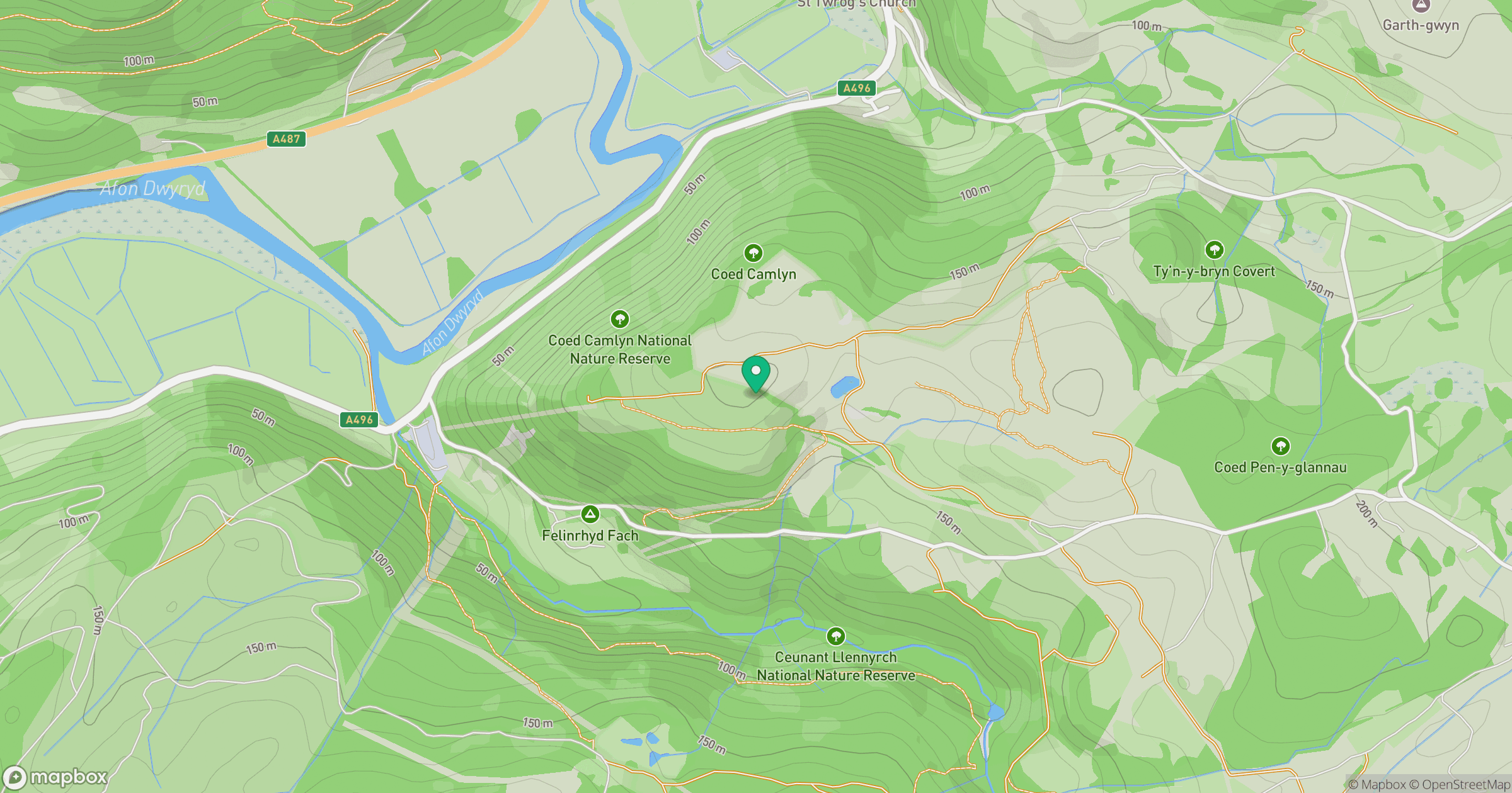
Grid reference: SH661395
View on OpenStreetMapOpens a map in a new tab, centred on the hill.
No comments yet. Be the first.