

Parys Mountain
Good walks are even better shared.
SH4490 : Old Windmill on Parys Mountain
Chris Heaton Photo source
Overview
Parys Mountain
Parys Mountain is a unique and striking destination nestled in Anglesey, Wales. With its rich mineral history and rugged terrain, it offers not only a fantastic hike but also a glimpse into the industrial past of the area.
Geology
The mountain is home to one of the most significant copper mining sites in the world, dating back to the 18th century. The vibrant colours of the landscape, caused by oxidation of copper and other minerals, are a sight to behold. Don't forget your camera as you hike through the colourful hues that make this place memorable.
Route Information
Parys Mountain Circuit
- Distance: 5.5 km
- Time: Approximately 2 hours
- Difficulty: Moderate
This route will take you through the heart of the mining district, showcasing the remnants of old mines and machinery. It’s a loop that promises both physical challenge and historical insight, making it a great afternoon walk.
Terrain
The terrain is rocky and sometimes loose, typical of old mining regions. Ensure you wear sturdy footwear and keep an eye out for your footing. The paths are well-trodden but can be uneven in certain spots.
Summit Features
At the summit, you will find a trig point and various mining relics. The view from the top is worth the climb, offering panoramic vistas in every direction.
Views
- Highlights: When standing atop Parys Mountain, your eyes will feast upon breathtaking views of the Snowdonia range, the Menai Strait, and, if you’re lucky, even the Llyn Peninsula. Just remember, your jaw may hit the floor in awe!
- Best Seasons: Spring and autumn are the crème de la crème for views, offering clearer skies and vibrant scenery.
Hazards
As enchanting as the landscape is, do be mindful of your surroundings. Loose rocks are prevalent, so watch your step! Also, the weather can be rather moody, so bring a decent jacket, just in case it decides to rain when you least expect it.
Access
The nearest parking spot is at SH446910, which gives you easy access to the main trailhead. For those relying on public transport, buses frequently run from Holyhead and Amlwch, making it accessible for day-trippers. And don’t forget, the closest town is Amlwch, perfect for grabbing a bite before or after your adventure.
Facilities
Amlwch provides a few cafes and public toilets. Make sure to indulge in some local snacks before you tackle the mountain – you’ll need the energy, after all!
History
The name 'Parys' suggests a deep-rooted connection to its mining past, with roots meaning 'copper'. The mountain's significance in the development of the local economy and its mining heritage makes it a must-visit site for history buffs.
In summary, Parys Mountain is a charming trek filled with natural beauty, historical intrigue, and perhaps a few surprises along the way. So lace up your boots, grab your walking stick, and set off on an adventure that is sure to be a memorable one!
Explore routes near Parys Mountain
Walks starting near this hill. Open a route to check its map, distance and full itinerary.
Snowdon Pyg Track returning by Miner's Track
View route
Beddgelert Forest: Llyn Llywelyn Woodland Circuit
View route
Beddgelert Forest: Derwen Circuit and Llyn Llywelyn
View route
Llyn Crafnant: Lakeside Circuit from the NRW Car Park
View route
Route planning notes
These notes describe possible approaches. Check a route's map and access information when planning your walk.
Parys Mountain Circuit
A scenic loop that showcases the mining history and stunning vistas of the surrounding landscape.
Make a day of it, together
Find someone to share the walk with, or organise a day out along a route you like.
Photo Gallery
View all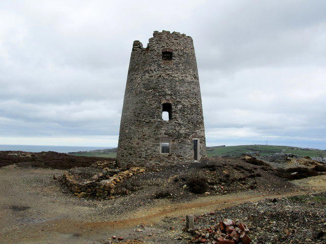 Photo could not load
SH4490 : Old Windmill on Parys Mountain
Chris Heaton
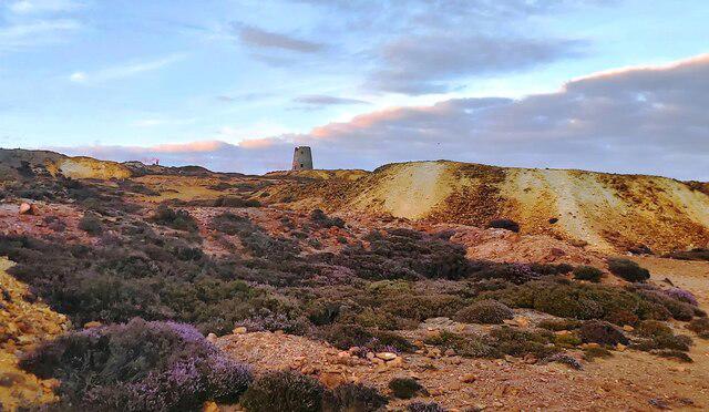 Photo could not load
SH4490 : Parys Mountain Copper Mine at Sunset
Anthony Parkes
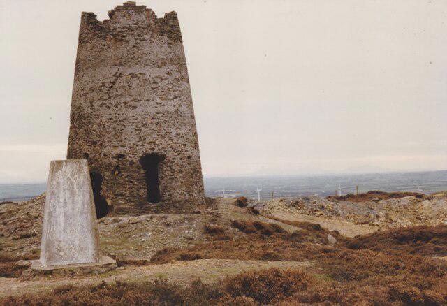 Photo could not load
SH4490 : Windmill and Trig Point on the summit of Mynydd Parys
Eric Jones
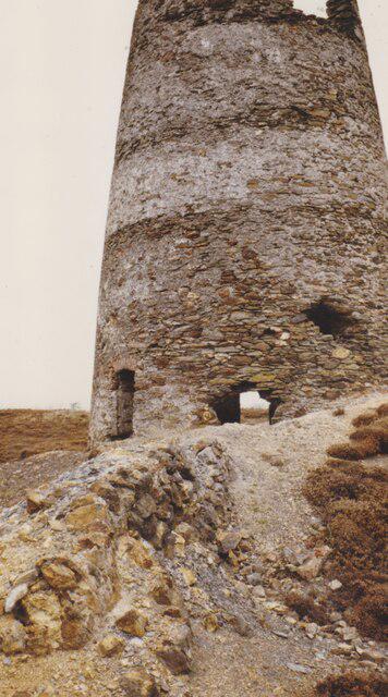 Photo could not load
SH4490 : Melin Wynt Mynydd Parys Windmill
Eric Jones
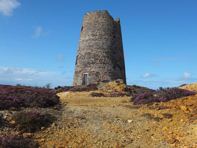 Photo could not load
SH4490 : Five sailed windmill Parys Mountain
Richard Hoare
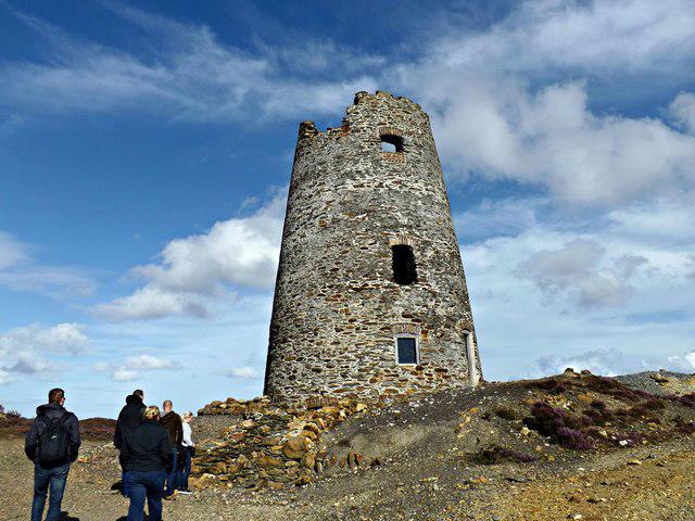 Photo could not load
SH4490 : Five Sailed Windmill Located at Parys Mountain
Meg Hoare
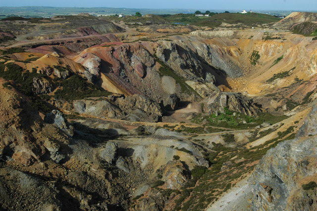 Photo could not load
SH4490 : Lunar Landscape
Anonymous
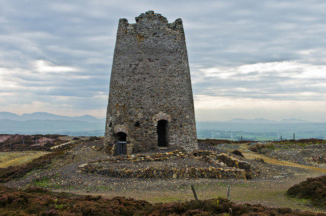 Photo could not load
SH4490 : Parys Mountain Windmill
Ian Capper
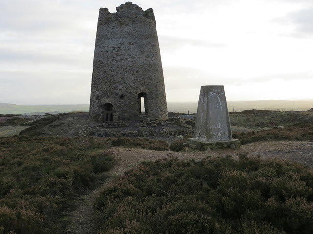 Photo could not load
SH4490 : The ruined windmill and triangulation pillar on Parys Mountain
Peter Wood
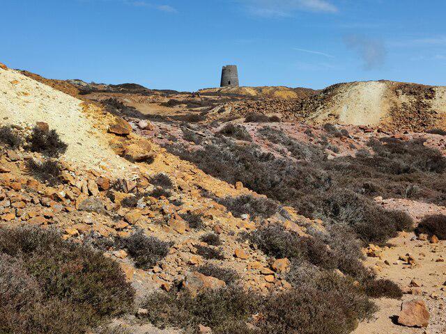
SH4490 : Parys Mountain Windmill
Mat Fascione
Hill facts and local notes
Classifications
Elevation
147m
482 ft
Prominence
66m
Coordinates
53.3887, -4.3432
SH442905
OS Map
114
Explorer: 263N
At the Summit
The summit features a prominent trig point and remnants of old mining equipment, offering a glimpse into the mountain's industrious past.
Terrain & Geology
Parys Mountain is known for its rich mineral deposits and distinctive copper mines, which have left a vivid mark on the landscape. The area features an array of colours due to the presence of various minerals, including blues, greens, and browns.
Views & Scenery
From the summit, hikers can enjoy views of Snowdonia, the Menai Strait, and even the distant peaks of the Llyn Peninsula on a clear day.
History & Heritage
Name Origin
The name 'Parys' is believed to have come from 'paris' in Welsh, meaning 'the place of the copper'.
Historical Significance
Parys Mountain was once one of the largest copper mines in the world, heavily influencing the local economy and industry during the 18th and 19th centuries.
Getting There & Facilities
Parking
There is a small parking area at SH446910, providing easy access to the mountain trails.
Public Transport
Buses run from Holyhead and Amlwch with a short walk to the parking area.
Nearby Facilities
Amlwch offers several cafes and public toilets, ideal for a pre-hike coffee or post-hike snack.
Safety Information
Known Hazards
- Loose rocks are common; watch your footing. The weather can change rapidly, leading to sudden fog or rain.
General Safety Tips
- Check weather conditions before setting out
- Carry appropriate clothing and equipment
- Let someone know your planned route
- Take a map, compass, and GPS device
- Carry emergency supplies: food, water, first aid kit, torch
Hills
Some common questions about the hills answered
Are there group walks up Parys Mountain?
Many walkers use Walkmates to join or organise walks with others. You can check for group walks around Parys Mountain through the maps
Are there other walkers around Parys Mountain?
Activity varies by location and time, but Walkmates lets you see whether others have shared walks or shown interest in this area. Find other people through the walking friends search walking friends for Parys Mountain search or of course create your own walk for Parys Mountain
Can I organise a walk to Parys Mountain?
Yes. If there aren’t any walks listed already, you can create a walk and make it available for others to join.
If you're signed up to Walkmates, you can create a walk to Parys Mountain.
How do I find a walk up this hill?
There are often multiple ways to walk this hill, depending on experience and route preference. Walkmates helps you explore walks and routes that others have shared.
Can I suggest a new route up Parys Mountain?
Yes. You can suggest or create routes to share with others. Walkmates focuses on the social side of walking, so routes are used to help people organise walks and explore areas together, rather than as detailed navigation tools or route libraries.
Other uses really appreciate knowledgeable walkers sharing their routes. Share your favourite route to Parys Mountain here
The is an error or something incorrect about this hill. How do I let you know?
We always strive to keep the information on Walkmates as accurate as possible. If you find an error, please let us know through the contact form and we'll aim to correct it as quickly as possible
Community Discussion
Comments
Location
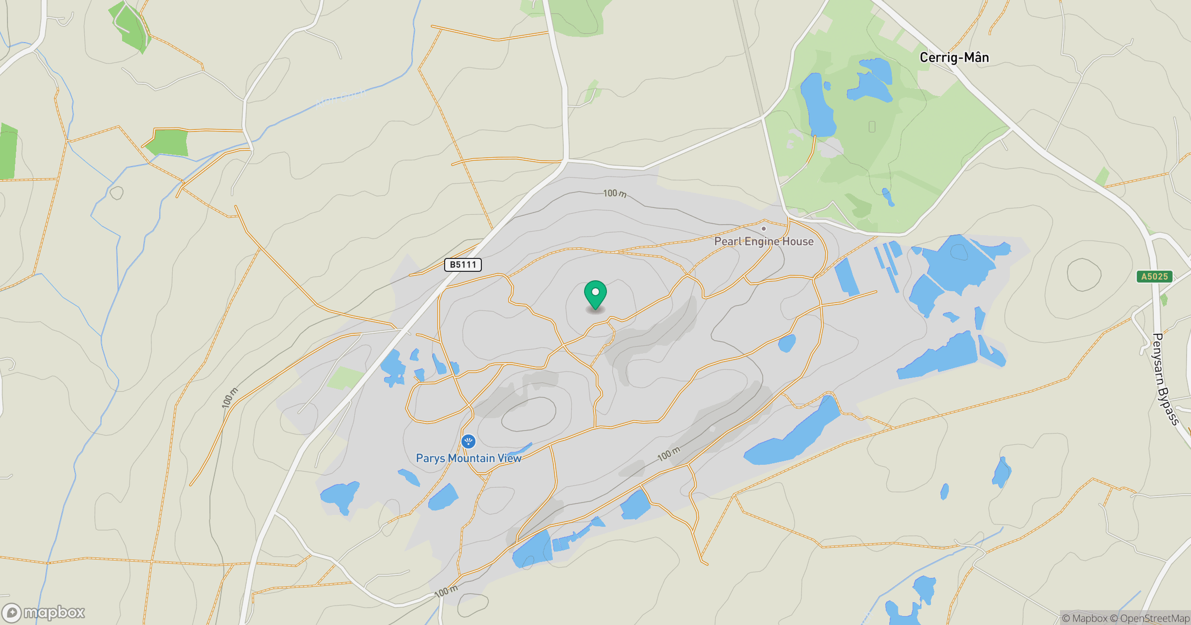
Grid reference: SH442905
View on OpenStreetMapOpens a map in a new tab, centred on the hill.
No comments yet. Be the first.