

Mynydd y Garn
Good walks are even better shared.
Overview
Mynydd y Garn
Mynydd y Garn, standing at 554 meters, offers hikers a splendid experience whether you’re an enthusiastic newcomer or a seasoned hillwalker. Nestled in the heart of Snowdonia National Park, it’s a Marilyn, which means it boasts a significant prominence and is a worthy addition to any hiker’s to-do list.
Geology
The mountain's rugged good looks come courtesy of volcanic rock formed millions of years ago, with fascinating lava flows weaving an intricate tale of geological history. Be sure to look down as you walk; you might just spot some interesting rock formations!
Routes
A popular route begins in the picturesque Llanberis village. Known as the Llanberis Path, it meanders through beautiful woodlands and past meandering streams, leading you to the broad, grassy expanse of the summit. This route covers about 8 km and is classified as moderate, making it a tad challenging but not overly strenuous—perfect for a Sunday walk!
Terrain
Expect a delightful mix of rocky and grassy terrain, reminding you why sturdy hiking boots are your best buddy on the mountain! As you approach the summit, you’ll encounter loose stones that might attempt to trip you up—stay alert, and avoid the ballet of slips!
Summit Features
At the top, you'll find a spectacular stone cairn and a trig point, both offering ample photo opportunities. Don’t forget to capture the view; it’s a sight to behold!
Views
The views from Mynydd y Garn are nothing short of breathtaking. You can gaze upon the majestic Snowdon, glistening Llyn Padarn, and if you squint hard enough and the weather’s right, Anglesey makes a cheeky appearance on the horizon. Late spring and autumn tend to offer the best views, so plan your hike around these seasons for the clearest images.
Hazards
Weather in the mountains can be as fickle as a cat in the rain, so prepare for sudden changes that can obscure visibility. Also, tread carefully on loose stones; they might have a mind of their own!
Nearby Summits
For those keen on a bit of mountain-hopping, Mynydd Mawr, standing at 600 meters, is a delightful neighbour worth visiting.
Access
Reaching Mynydd y Garn is straightforward. The nearest parking facilities can be found in Llanberis, where various options are ready to accommodate your car while you stretch your legs. Public transport is also a breeze, with the nearest train station in Bangor and reliable bus services to Llanberis.
Facilities
After your hike, reward yourself at one of the local cafes or pubs in Llanberis. Who doesn’t love a well-earned slice of cake?
History
The mountain’s name means 'Hill of the Cairn' in Welsh, a fitting title for such a prominent feature. The area’s historical importance is underlined by its slate mining heritage, with remains of these activities scattered throughout the landscape, giving a glimpse into the past.
In conclusion, Mynydd y Garn is a gem waiting to be explored. Whether you're there for a hearty walk, to absorb the beautiful scenery, or to hunt for some historical treasures, it’s a spot that offers something for everyone. So, lace up those boots and head out for an adventure!
Explore routes near Mynydd y Garn
Public walks starting within 80 km of this hill. Nearby does not mean a route reaches the summit; check its map and access before setting out.
Yr Eifl and the Gyrns guided mountain walk
View route
Beddgelert Forest: Llyn Llywelyn Woodland Circuit
View route
Beddgelert Forest: Derwen Circuit and Llyn Llywelyn
View route
Snowdon Pyg Track returning by Miner's Track
View route
Route planning notes
These notes describe possible approaches, not verified navigable routes or permission to cross land. Check current paths, local access rules and conditions before setting out.
Llanberis Path
A well-marked path that starts from the charming village of Llanberis, gradually ascending through lush woodlands before reaching the rugged summit.
Make a day of it, together
Find someone to share the walk with, or organise a day out along a route you like.
Photo Gallery
View all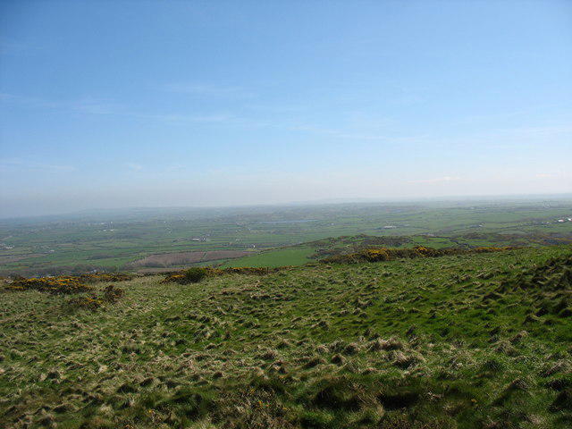 Photo could not load
SH3190 : Rough grazing on the National Trust-owned summit of Mynydd y Garn
Eric Jones
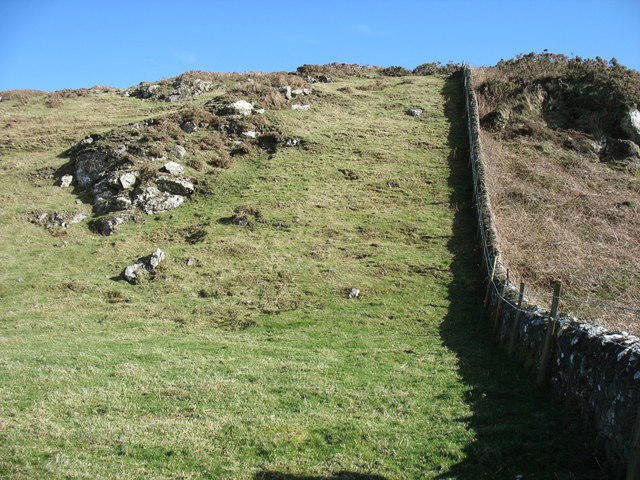 Photo could not load
SH3190 : Mynydd y Garn
David Purchase
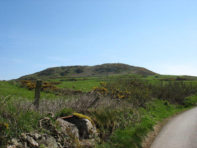 Photo could not load
SH3190 : The summit of Mynydd y Garn from the stile near Waen-lydan
Eric Jones
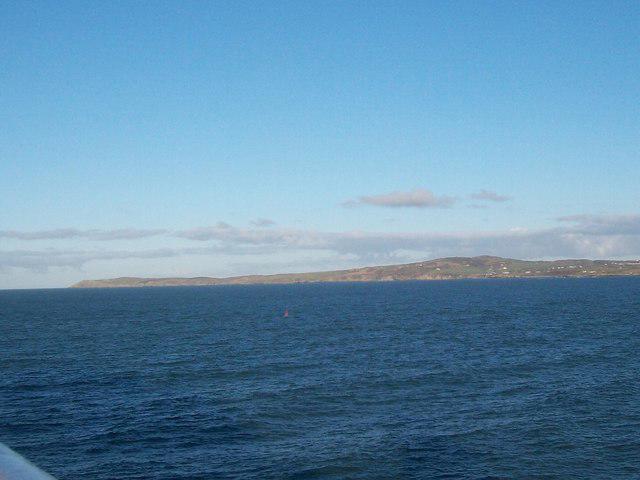 Photo could not load
SH3190 : Mynydd y Garn and Carmel Head from Holyhead Bay
Eric Jones
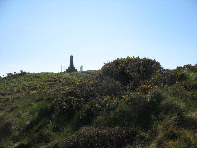 Photo could not load
SH3190 : Monument on the summit of Mynydd y Garn
Eric Jones
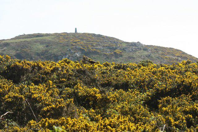 Photo could not load
SH3190 : The summit of Mynydd y Garn seen through a sea of gorse
Eric Jones
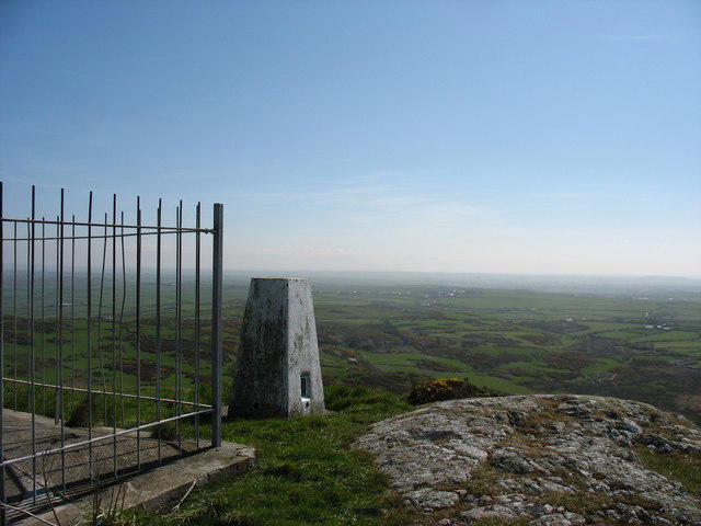 Photo could not load
SH3190 : Triangulation pillar on Mynydd y Garn
Eric Jones
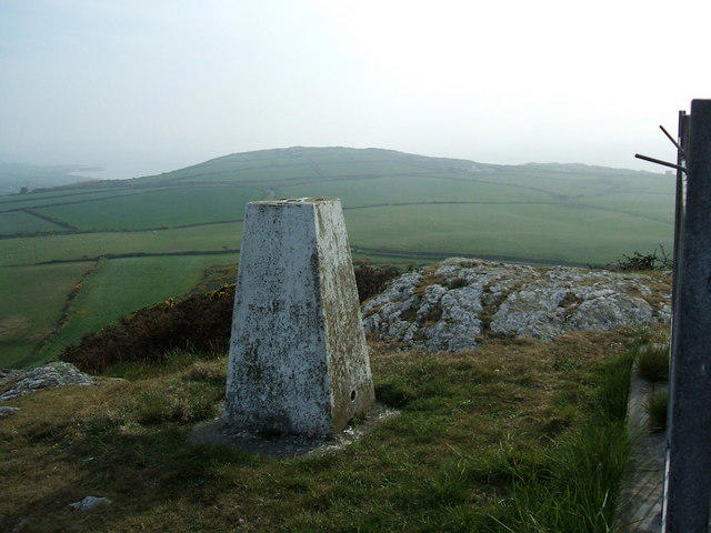 Photo could not load
SH3190 : Trig pillar Mynydd y Garn
David Brown
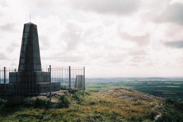 Photo could not load
SH3190 : Llanfairynghornwy: view across Anglesey
Chris Downer
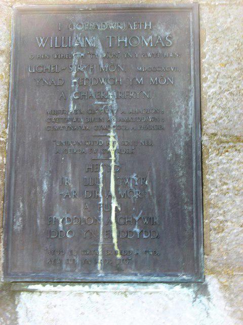
SH3190 : William Thomas Memorial plaque
David Purchase
Hill facts and local notes
Classifications
Elevation
170m
558 ft
Prominence
106m
Coordinates
53.3860, -4.5352
SH314906
OS Map
114
Explorer: 262
At the Summit
The summit has a large stone cairn and a trig point offering stunning panoramic views. It's a great spot for those who fancy a cheeky selfie with a view!
Terrain & Geology
Mynydd y Garn is primarily composed of volcanic rock, typical of the Snowdonia region. The terrain features ancient lava flows and attractive scree slopes.
Views & Scenery
From the summit, hikers can enjoy views of Snowdon, Llyn Padarn, and the surrounding valleys. On a clear day, you might even spot Anglesey in the distance.
History & Heritage
Name Origin
The name 'Mynydd y Garn' translates to 'Hill of the Cairn' in Welsh, reflecting the prominent cairn at its summit.
Historical Significance
Historically, the area has been significant for slate mining, and archaeological finds suggest Bronze Age activity in the region.
Getting There & Facilities
Check current local access restrictions, parking rules and transport timetables before travelling. These notes do not confirm public access to the summit.
Parking
There is parking available in the village of Llanberis, with several pay-and-display options.
Public Transport
The nearest train station is in Bangor, with bus services connecting to Llanberis.
Nearby Facilities
Llanberis offers various facilities, including cafes, a pub, and public toilets, a good pit stop before or after your hike.
Safety Information
Known Hazards
- Weather can change unexpectedly, leading to reduced visibility. Loose stones make footing tricky in places.
General Safety Tips
- Check weather conditions before setting out
- Carry appropriate clothing and equipment
- Let someone know your planned route
- Take a map, compass, and GPS device
- Carry emergency supplies: food, water, first aid kit, torch
Hills
Some common questions about the hills answered
Are there group walks up Mynydd y Garn?
Many walkers use Walkmates to join or organise walks with others. You can check for group walks around Mynydd y Garn through the maps
Are there other walkers around Mynydd y Garn?
Activity varies by location and time, but Walkmates lets you see whether others have shared walks or shown interest in this area. Find other people through the walking friends search walking friends for Mynydd y Garn search or of course create your own walk for Mynydd y Garn
Can I organise a walk to Mynydd y Garn?
Yes. If there aren’t any walks listed already, you can create a walk and make it available for others to join.
If you're signed up to Walkmates, you can create a walk to Mynydd y Garn.
How do I find a walk up this hill?
There are often multiple ways to walk this hill, depending on experience and route preference. Walkmates helps you explore walks and routes that others have shared.
Can I suggest a new route up Mynydd y Garn?
Yes. You can suggest or create routes to share with others. Walkmates focuses on the social side of walking, so routes are used to help people organise walks and explore areas together, rather than as detailed navigation tools or route libraries.
Other uses really appreciate knowledgeable walkers sharing their routes. Share your favourite route to Mynydd y Garn here
The is an error or something incorrect about this hill. How do I let you know?
We always strive to keep the information on Walkmates as accurate as possible. If you find an error, please let us know through the contact form and we'll aim to correct it as quickly as possible
Community Discussion
Comments
Location
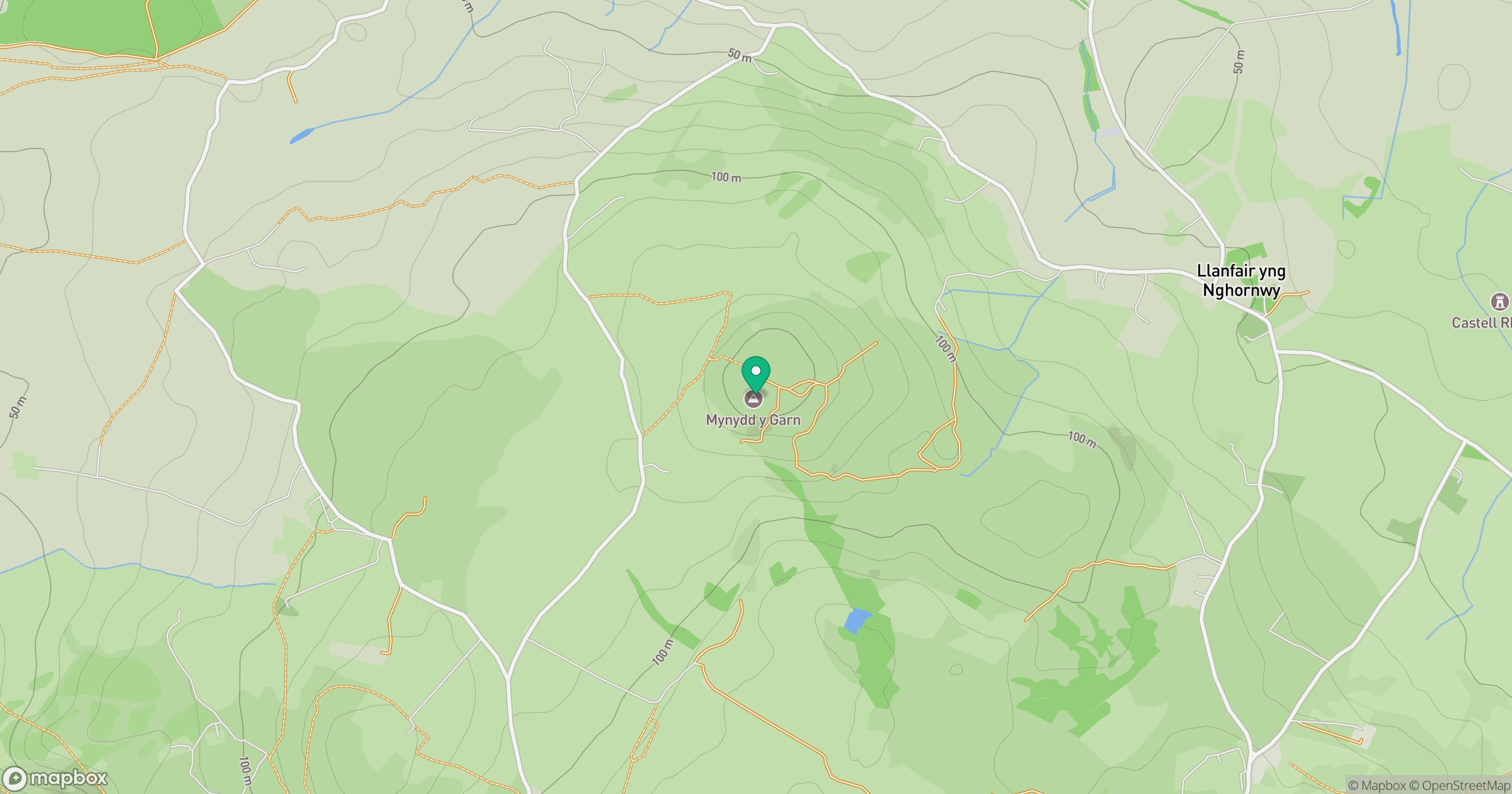
Grid reference: SH314906
View on OpenStreetMapOpens a map in a new tab, centred on the hill.
Hills within 30 km
Straight-line distance, not a walking route or confirmation of access.
No comments yet. Be the first.