

Mynydd Eilian
Good walks are even better shared.
Overview
Mynydd Eilian: A Welsh Gem
Mynydd Eilian, perched at an elevation of 368 meters, is a prominent Marilyn in Gwynedd, North Wales. With a splendid mix of geological features and stunning views, this mountain is a favourite amongst hikers of all abilities.
Geology
The geology of Mynydd Eilian is fascinating for geology buffs. It consists mainly of volcanic rock, showcasing features from long-forgotten eruptions. As you stroll through its landscapes, keep an eye out for unique rock formations that hint at its volcanic past.
Routes
Two popular routes are available for aspiring hikers. The Coastal Path Route is approximately 7.5 km and takes about 3.5 hours, suitable for those looking for a moderate challenge with exceptional coastal views. Alternatively, the Direct Ascent from Llanbadrig offers a more challenging ascent over 3.5 km in about 2 hours, catering to those who fancy a swift climb.
Summit Features
Upon reaching the summit, you’ll be greeted by a trig point—a perfect spot to snap a shot or ponder life’s great mysteries while overlooking the fantastic landscapes below.
Terrain Type
The terrain varies from grassy slopes to rocky outcrops, making for a diverse hiking experience. It's advisable to wear sturdy footwear; you'll feel more like a mountain goat and less like a Bambi on ice!
Views
On a clear day, the views from Mynydd Eilian are nothing short of spectacular. Notable sights include the breathtaking coastline of Anglesey and the magnificent peaks of Snowdonia. The best seasons for indulging in these views are spring and early summer, especially during sunset when the sky paints a canvas of colours.
Hazards
As with any adventure, safety is key. The terrain can be slippery, especially when wet, and watch out for sudden weather changes that can catch even the most seasoned hikers by surprise.
Access
Access to Mynydd Eilian is quite convenient. The nearest parking is in Cemaes Bay, about 15 minutes from the Coastal Path Route. If you’re relying on the bus, services are available to Cemaes Bay from nearby towns, ensuring you're not left high and dry.
Facilities
Post-hike, Cemaes Bay has quaint cafes and necessary amenities to refuel after your adventure. Make sure to grab a pasty or ice cream, depending on the season!
History
The name Mynydd Eilian holds its own history and potential tales tied to local culture. With Eilian possibly being linked to an ancient figure, the mountain stands as a reminder of the folklore that enriches the region.
So, lace up those hiking boots and pack a snack or two; Mynydd Eilian is waiting to share its treasure trove of experiences with you!
Explore routes near Mynydd Eilian
Public walks starting within 80 km of this hill. Nearby does not mean a route reaches the summit; check its map and access before setting out.
Conwy Quay to Llanfairfechan: the upland coast-path alternative
View route
Snowdon Pyg Track returning by Miner's Track
View route
Llyn Crafnant: Lakeside Circuit from the NRW Car Park
View route
Beddgelert Forest: Llyn Llywelyn Woodland Circuit
View route
Route planning notes
These notes describe possible approaches, not verified navigable routes or permission to cross land. Check current paths, local access rules and conditions before setting out.
Coastal Path Route
A popular route that begins at the nearby village of Cemaes Bay. This scenic path meanders along the coast before ascending to the summit of Mynydd Eilian.
Direct Ascent from Llanbadrig
This direct ascent from Llanbadrig Church offers a shorter but steeper path leading straight up the mountain, perfect for those eager to gain altitude quickly.
Make a day of it, together
Find someone to share the walk with, or organise a day out along a route you like.
Photo Gallery
View all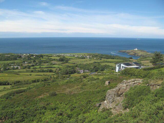 Photo could not load
SH4791 : Hillside, Mynydd Eilian
Jonathan Wilkins
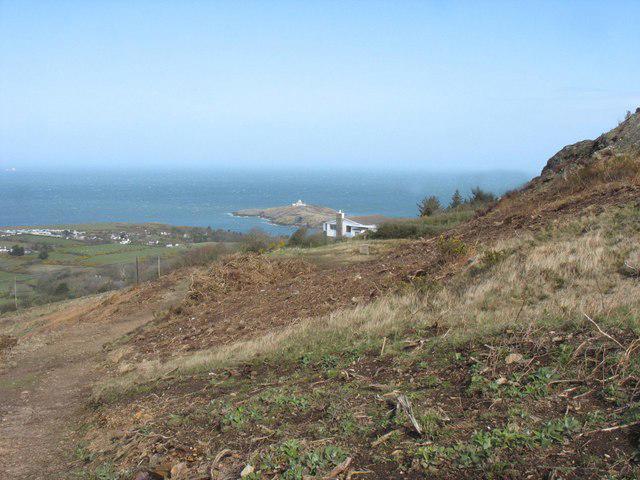 Photo could not load
SH4791 : Approaching Pant-y-clociau bungalow with Lynas Point in the background
Eric Jones
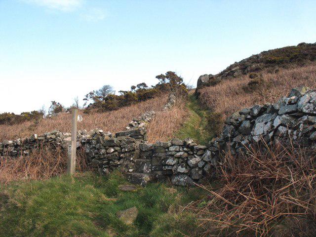 Photo could not load
SH4791 : The start of the path to the summit of Mynydd Eilian
Eric Jones
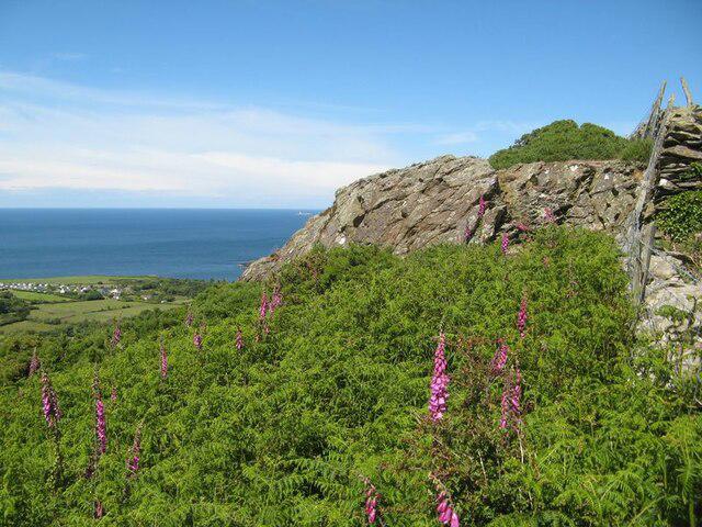 Photo could not load
SH4791 : Foxglove, bracken, rock
Jonathan Wilkins
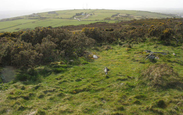 Photo could not load
SH4791 : View from the summit of Mynydd Eilian south to Mynydd Nebo
Eric Jones
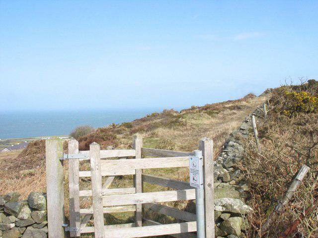 Photo could not load
SH4791 : Kissing gate at the path junction where the summit path is joined by a path from the north
Eric Jones
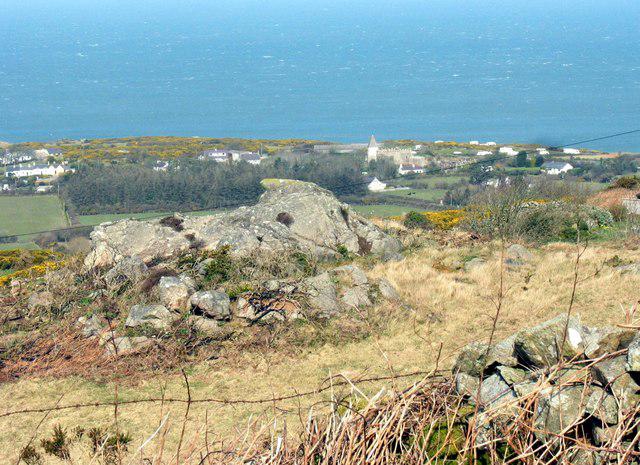 Photo could not load
SH4791 : Rock outcrop on the north-western slope of Mynydd Eilian
Eric Jones
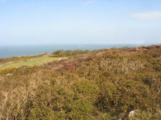 Photo could not load
SH4791 : Gorse-clad hillside with extensive sea views
Eric Jones
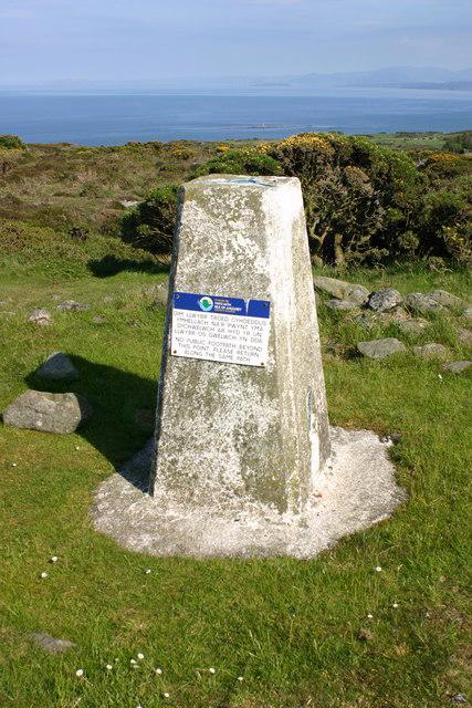 Photo could not load
SH4791 : Llaneilian trig
Iain Macaulay
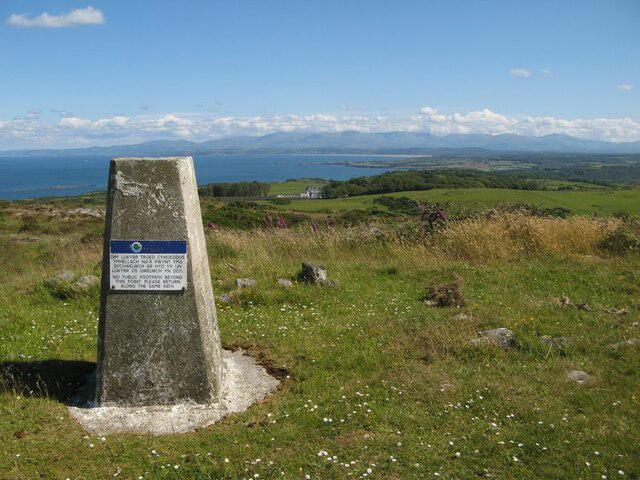
SH4791 : Mynydd Eilian trig point
Jonathan Wilkins
Hill facts and local notes
Classifications
Elevation
177m
581 ft
Prominence
124m
Coordinates
53.4002, -4.2985
SH472917
OS Map
114
Explorer: 263N
At the Summit
The summit features a prominent trig point, providing a firm foundation for not only measurements but also for the occasional picnicker (who presumably forgot their sandwiches).
Terrain & Geology
Predominantly formed from volcanic rocks, Mynydd Eilian showcases various geological features, including old basalt flows and weathered formations that tell the story of past volcanic activity in the region.
Views & Scenery
From the summit, hikers are treated to breathtaking views of Anglesey, the Snowdonia mountains, and on clear days, even as far as the Llyn Peninsula.
History & Heritage
Name Origin
The name 'Mynydd Eilian' roughly translates to 'Mount Eilian', where 'Eilian' may be linked to an ancient local figure or deity.
Historical Significance
Mynydd Eilian is not just a peak; it has historical significance tied to local folklore and has served as a beacon for sailors navigating along the coast.
Getting There & Facilities
Check current local access restrictions, parking rules and transport timetables before travelling. These notes do not confirm public access to the summit.
Parking
There is limited parking available in Cemaes Bay, approximately 15 minutes from the start of the Coastal Path Route.
Public Transport
Buses operate to the village of Cemaes Bay from larger towns such as Llangefni and Holyhead.
Nearby Facilities
Cemaes Bay has several small cafes and shops, as well as public toilets which are a welcomed sight for the weary hiker.
Safety Information
Known Hazards
- Occasional steep sections can be slippery, especially when wet. Be cautious of sudden weather changes common in the area.
General Safety Tips
- Check weather conditions before setting out
- Carry appropriate clothing and equipment
- Let someone know your planned route
- Take a map, compass, and GPS device
- Carry emergency supplies: food, water, first aid kit, torch
Hills
Some common questions about the hills answered
Are there group walks up Mynydd Eilian?
Many walkers use Walkmates to join or organise walks with others. You can check for group walks around Mynydd Eilian through the maps
Are there other walkers around Mynydd Eilian?
Activity varies by location and time, but Walkmates lets you see whether others have shared walks or shown interest in this area. Find other people through the walking friends search walking friends for Mynydd Eilian search or of course create your own walk for Mynydd Eilian
Can I organise a walk to Mynydd Eilian?
Yes. If there aren’t any walks listed already, you can create a walk and make it available for others to join.
If you're signed up to Walkmates, you can create a walk to Mynydd Eilian.
How do I find a walk up this hill?
There are often multiple ways to walk this hill, depending on experience and route preference. Walkmates helps you explore walks and routes that others have shared.
Can I suggest a new route up Mynydd Eilian?
Yes. You can suggest or create routes to share with others. Walkmates focuses on the social side of walking, so routes are used to help people organise walks and explore areas together, rather than as detailed navigation tools or route libraries.
Other uses really appreciate knowledgeable walkers sharing their routes. Share your favourite route to Mynydd Eilian here
The is an error or something incorrect about this hill. How do I let you know?
We always strive to keep the information on Walkmates as accurate as possible. If you find an error, please let us know through the contact form and we'll aim to correct it as quickly as possible
Community Discussion
Comments
Location
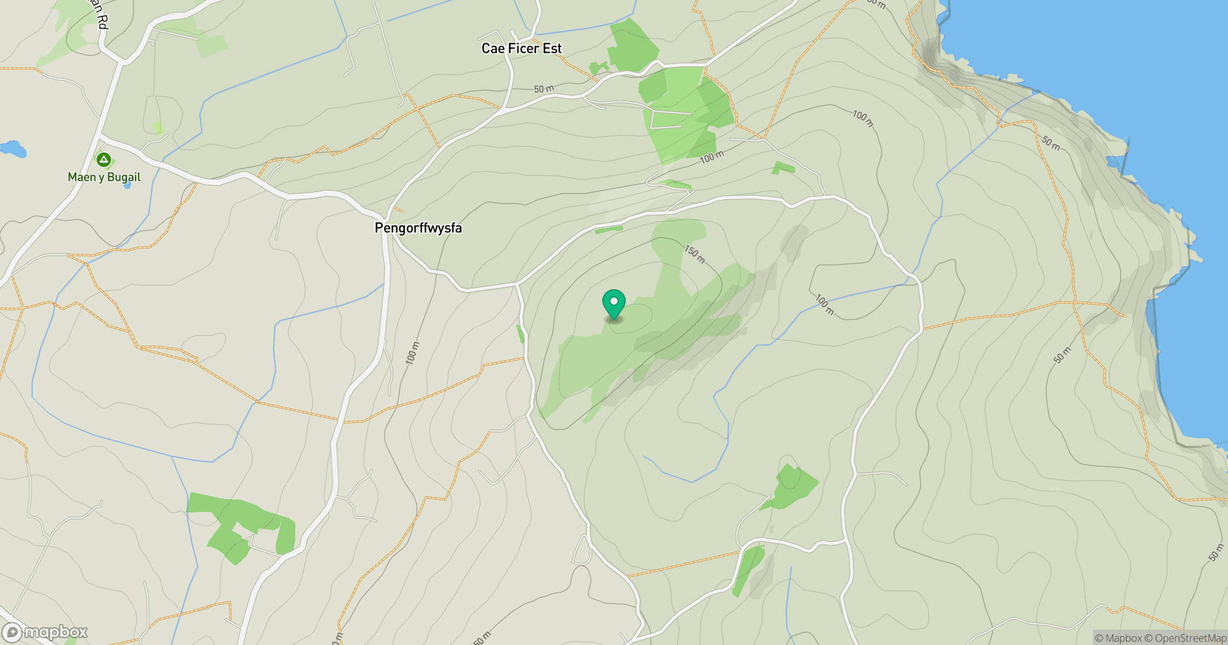
Grid reference: SH472917
View on OpenStreetMapOpens a map in a new tab, centred on the hill.
Hills within 30 km
Straight-line distance, not a walking route or confirmation of access.
No comments yet. Be the first.