

Nicky Nook
Good walks are even better shared.
SD5248 : Surveyor's Column, Nicky Nook
Peter Bond Photo source
Overview
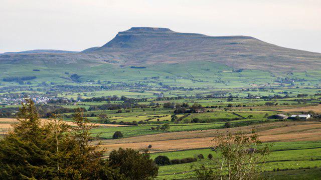
Nicky Nook is a 214.9 m fell beside Scorton on the western edge of the Forest of Bowland. Its open summit overlooks the Lancashire coastal plain and Morecambe Bay, with the Lake District visible in clear weather. Stepped paths climb from the village side, while longer walks combine the summit with farmland or the wooded Grizedale valley.
Nicky Nook
Nicky Nook rises to 214.9 m above the countryside east of Scorton, on the western edge of the Forest of Bowland. Its summit is marked by a trig point; the highest ground is 5 m south of it. Views extend across the Lancashire coastal plain and Morecambe Bay, towards the Lake District and inland to the Bowland fells when visibility allows.
Choosing a walk
The Forest of Bowland’s published farmland circuit is a full 6.83 km return to Scorton via Wyresdale Lake, Clifton’s Farm, Sykes Farm and the summit area. Its summit waypoint does not separately identify the precise high ground 5 m south of the trig, so the distance remains the publisher’s circuit figure. Use the footbridge beside the ford and, at the later bridge junction, take the right-hand kissing gate without crossing the bridge. The western descent returns to Scorton over the M6. The document was published and last modified on 12 February 2019; follow current farm waymarks and access notices.
For a direct outing, climb the signed, stepped path from the fell access near the Snowhill Lane/Higher Lane junction to the summit and return by the same path to the same gate. Add the approach from wherever you parked or arrived by bus. A separate circuit crosses the summit, descends towards Grizedale Reservoir and follows the brook and woodland back to Higher Lane. Do not combine these different route scopes when planning distance or return time.
Terrain and access
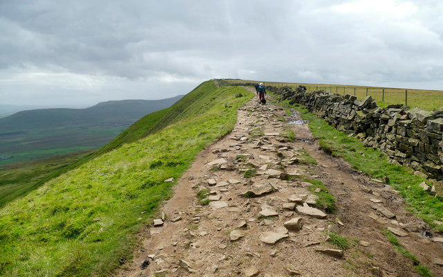
Steep steps, uneven paths, muddy fields and lanes without pavements require care. This is working sheep-farming country; use signed rights of way, leave gates as found and keep dogs on a short lead around livestock. Follow any woodland-work diversions and nesting-season notices. Race routes may include permission-only land, so do not use a race descent as evidence of ordinary public access.
Landscape and heritage
BGS describes Nicky Nook as a Pendle Grit sandstone promontory on an anticline, shaped by folding and later ice erosion. The Victoria Jubilee Cairn dates from 1887, while separate stone towers relate to the Thirlmere Aqueduct. These are different from the summit trig point.
Arrival and refreshments
Scorton and the Applestore Café provide refreshments and shops nearby. Café parking is advertised for visitors; check its posted terms before leaving a vehicle for a hill walk. The A6 bus stop at Cabus, Station Lane has a walking approach into Scorton, which must be added to the hill route. Check current timetables and return travel arrangements.
Explore routes near Nicky Nook
Walks starting near this hill. Open a route to check its map, distance and full itinerary.
Brockholes Reserve Tour
View route
Brockholes Wildflower Year guided walk
View route
Brockholes Reserve Tour
View route
History of Christmas guided walk
View route
Route planning notes
These notes describe possible approaches. Check a route's map and access information when planning your walk.
Scorton and Nicky Nook farmland circuit
A full circuit from and back to Scorton. Follow Snowhill Lane over the M6, then the route by Wyresdale Lake and through Clifton’s Farm and Sykes Farm. Join the lane and use the footbridge beside the ford; continue onto the bridleway. At the later bridge junction, do not cross: take the kissing gate on the right and climb towards the summit, keeping left where the path divides. Descend the western track, skirt right of the wall and exit through the kissing gate. Turn left then immediately right on the road; bear left at the Wyresdale Park/Applestore signs and cross the M6 back to Scorton. The published 6.83 km covers this farmland loop via the summit area; it does not separately verify a visit to the precise high ground 5 m south of the trig. Expect mud, gates, stiles, livestock and lanes without pavements. The February 2019 route is distinct from the Grizedale Reservoir circuit; follow current farm waymarks and access notices.
Make a day of it, together
Find someone to share the walk with, or organise a day out along a route you like.
Photo Gallery
View all Photo could not load
SD5248 : Surveyor's Column, Nicky Nook
Peter Bond
 Photo could not load
SD5148 : Nicky nook
Antony McCann
 Photo could not load
SD5148 : Nicky Nook
Anita Greene
 Photo could not load
SD5148 : The trig point on Nicky Nook
Raymond Knapman
 Photo could not load
SD5148 : Trig point on Nicky Nook
Bryan Pready
 Photo could not load
SD5148 : Nickey Nook Trig Point Flush Bracket S4697
thejackrustles
 Photo could not load
SD5148 : Trig Point on Nicky Nook
David Robinson
 Photo could not load
SD5148 : Trig Pillar, Nicky Nook
Michael Graham
 Photo could not load
SD5148 : Nicky Nook
Rude Health
Hill facts and local notes
Classifications
Elevation
215m
705 ft
Prominence
90m
Coordinates
53.9309, -2.7330
SD519485
OS Map
102
Explorer: OL41W
At the Summit
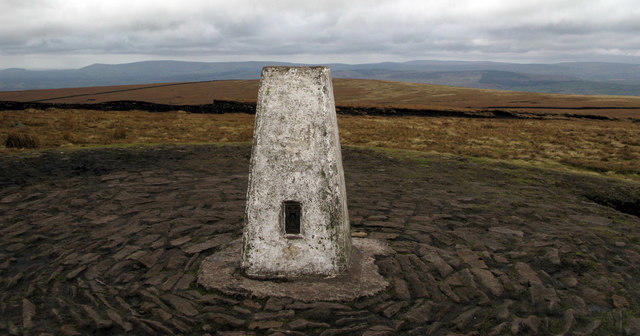
A trig point is the main summit landmark. The recorded highest ground is 5 m south of it, at SD519485. The Jubilee cairn and the stone waterworks towers elsewhere on the fell are separate features.
Terrain & Geology
Nicky Nook is a promontory of Carboniferous Pendle Grit sandstone, folded into the Nicky Nook Anticline. Ice erosion truncated this western spur of the Bowland fells. Patches of weathered material and glacial debris occupy some hollows; the hill is not simply a mound of glacial deposits.
Views & Scenery
The summit looks across the Lancashire coastal plain and Morecambe Bay towards the Lake District, and inland to the Bowland fells. Blackpool Tower is a recognisable coastal landmark. The Isle of Man and the Great Orme may be visible in exceptionally clear conditions.
History & Heritage
Historical Significance
The Victoria Jubilee Cairn commemorates Queen Victoria’s Golden Jubilee in 1887. Other stone towers on and beside the fell relate to the Thirlmere Aqueduct, which carries water towards Manchester. Neither the cairn nor the waterworks towers should be confused with the summit trig point.
Getting There & Facilities
Parking
The Applestore Café at Wyresdale Park advertises free parking for its visitors, with access from the Snowhill Lane side. Check the signs and ask the café before leaving a car there solely for a hill walk. Use marked parking and keep farm entrances and narrow lanes clear. Scorton starts add the walk along Snowhill Lane to the fell access.
Public Transport
Lancashire County Council lists service 41 between Preston and Morecambe via Lancaster at Cabus, Station Lane on the A6. From there, walk along Station Lane into Scorton and then to the chosen hill start; this approach is additional to the route distance. Check the current timetable and return service before travel. Scorton has no operating railway station.
Nearby Facilities
The Applestore Café at Wyresdale Park offers refreshments, with cafés, places to eat and shops in Scorton, including The Barn and The Priory. Check opening times before relying on them and carry food and water for the walk.
Safety Information
Known Hazards
- Steep stone steps and uneven paths can be slippery when wet or icy; descend carefully and use footwear with good grip.
- Longer circuits cross muddy fields, gates and stiles, with traffic on narrow lanes that have no pavement in places.
- This is working farmland with sheep and potentially other livestock. Keep dogs on a short lead near animals, give livestock space and leave gates as found.
- Use signed rights of way through farmyards and follow any woodland-work diversions. Do not treat the permission-only final fell-race descent as a public walking route.
- The open summit is exposed to wind and poor visibility. Carry a map and allow time to return to your actual starting point.
Seasonal Hazards
Wet weather makes farmland and woodland sections muddy, while ice can make the summit steps hazardous. In spring and summer avoid disturbing ground-nesting birds; keep dogs controlled and follow local restrictions, particularly around sheep and lambs. Check posted access and road-closure notices before starting.
General Safety Tips
- Check weather conditions before setting out
- Carry appropriate clothing and equipment
- Let someone know your planned route
- Take a map, compass, and GPS device
- Carry emergency supplies: food, water, first aid kit, torch
Hills
Some common questions about the hills answered
Are there group walks up Nicky Nook?
Many walkers use Walkmates to join or organise walks with others. You can check for group walks around Nicky Nook through the maps
Are there other walkers around Nicky Nook?
Activity varies by location and time, but Walkmates lets you see whether others have shared walks or shown interest in this area. Find other people through the walking friends search walking friends for Nicky Nook search or of course create your own walk for Nicky Nook
Can I organise a walk to Nicky Nook?
Yes. If there aren’t any walks listed already, you can create a walk and make it available for others to join.
If you're signed up to Walkmates, you can create a walk to Nicky Nook.
How do I find a walk up this hill?
There are often multiple ways to walk this hill, depending on experience and route preference. Walkmates helps you explore walks and routes that others have shared.
Can I suggest a new route up Nicky Nook?
Yes. You can suggest or create routes to share with others. Walkmates focuses on the social side of walking, so routes are used to help people organise walks and explore areas together, rather than as detailed navigation tools or route libraries.
Other uses really appreciate knowledgeable walkers sharing their routes. Share your favourite route to Nicky Nook here
The is an error or something incorrect about this hill. How do I let you know?
We always strive to keep the information on Walkmates as accurate as possible. If you find an error, please let us know through the contact form and we'll aim to correct it as quickly as possible
Community Discussion
Comments
Location
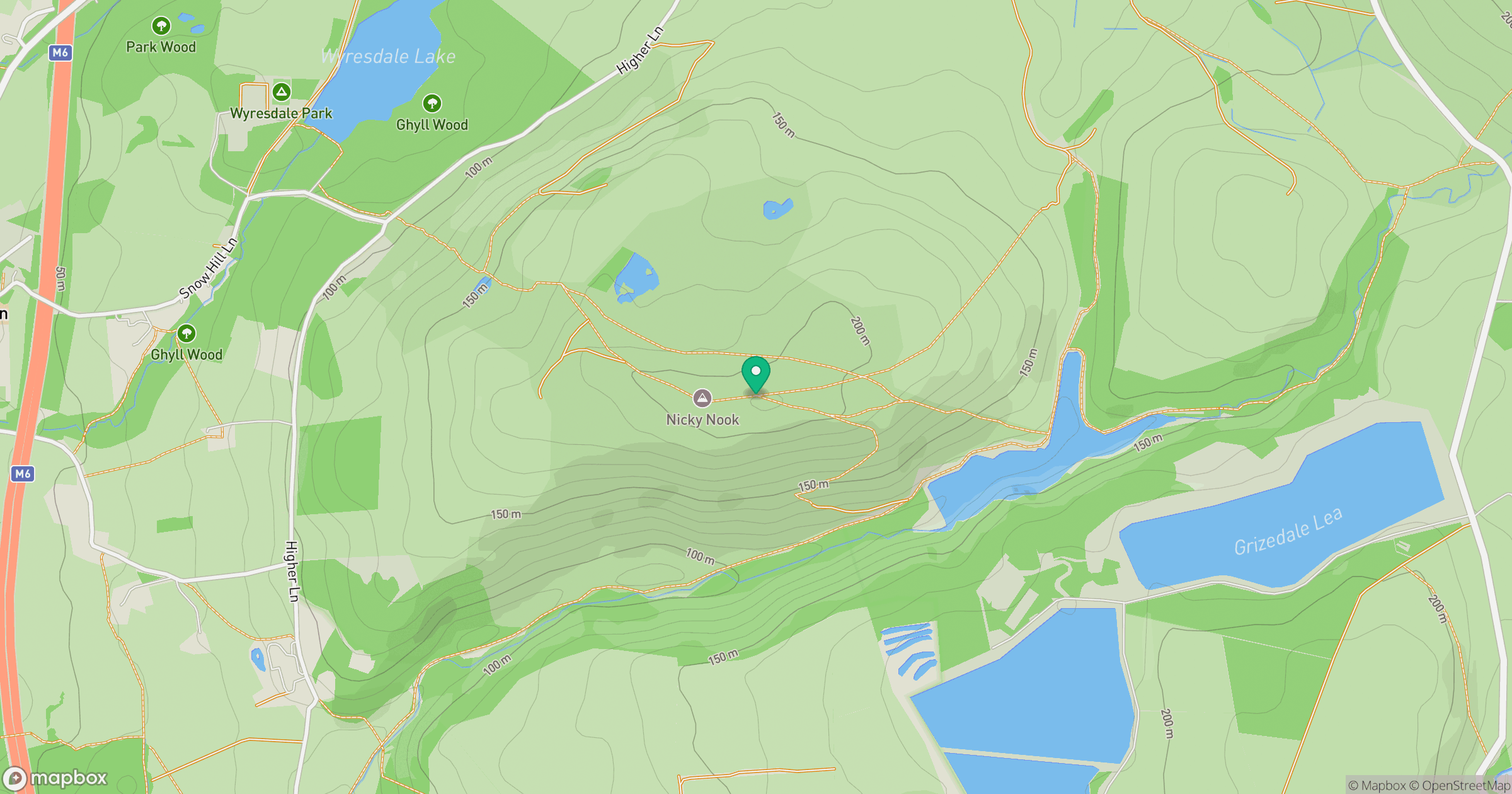
Grid reference: SD519485
View on OpenStreetMapOpens a map in a new tab, centred on the hill.
No comments yet. Be the first.